List of counties in Pennsylvania
The following is a list of the 67 counties of the U.S. state of Pennsylvania. The city of Philadelphia is coterminous with Philadelphia County, the municipalities having been consolidated in 1854, and all remaining county government functions having been merged into the city after a 1951 referendum.[1][2] Eight of the ten most populous counties are in the southeastern portion of the state, including four out of the top five, and eight of the top ten most populous counties are in either the Greater Philadelphia or Greater Pittsburgh Metropolitan Statistical Areas.
| Counties of Pennsylvania | |
|---|---|
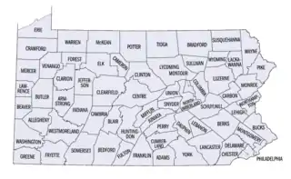 Pennsylvania counties (clickable map) | |
| Location | Pennsylvania |
| Number | 67 |
| Populations | 4,418 (Cameron) – 1,567,258 (Philadelphia) |
| Areas | 132 square miles (340 km2) (Montour) – 1,244 square miles (3,220 km2) (Lycoming) |
| Government | |
FIPS code
The Federal Information Processing Standard (FIPS) code, used by the United States government to uniquely identify counties, is provided with each entry. FIPS codes are five-digit numbers; for Pennsylvania the codes start with 42 and are completed with the three-digit county code. The FIPS code for each county in the table links to census data for the specific county.[3]
County list
| County |
FIPS code[4] | County seat[5] | Established[5] | Origin | Etymology[6] | Population[7] | Area[5] | Map |
|---|---|---|---|---|---|---|---|---|
| Adams County | 001 | Gettysburg | 1800 | Parts of York County | John Adams, second U.S. President | 106,027 | 522 sq mi (1,352 km2) | 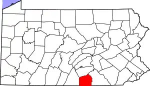 |
| Allegheny County | 003 | Pittsburgh | 1788 | Parts of Washington and Westmoreland Counties | Delaware word for the Allegheny River, which possibly translates to "beautiful river" | 1,233,253 | 745 sq mi (1,930 km2) |  |
| Armstrong County | 005 | Kittanning | 1800 | Parts of Allegheny, Lycoming, and Westmoreland Counties | John Armstrong, Revolutionary War general | 64,747 | 664 sq mi (1,720 km2) |  |
| Beaver County | 007 | Beaver | 1800 | Parts of Allegheny and Washington Counties | Beaver River, itself named for the eponymous animal that was sighted along its banks | 165,677 | 444 sq mi (1,150 km2) |  |
| Bedford County | 009 | Bedford | 1771 | Parts of Cumberland County | Fort Bedford, which is named for John Russell, 4th Duke of Bedford | 47,418 | 1,015 sq mi (2,629 km2) |  |
| Berks County | 011 | Reading | 1752 | Parts of Chester, Lancaster and Philadelphia Counties | The English county of Berkshire | 430,449 | 866 sq mi (2,243 km2) |  |
| Blair County | 013 | Hollidaysburg | 1846 | Parts of Huntingdon and Bedford Counties | John Blair, Pennsylvania state legislator | 121,032 | 527 sq mi (1,365 km2) |  |
| Bradford County | 015 | Towanda | 1810 | Parts of Luzerne and Lycoming Counties; originally called Ontario County, renamed as Bradford County in 1812. | William Bradford, second U.S. Attorney General | 59,866 | 1,161 sq mi (3,007 km2) | 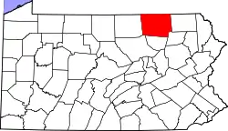 |
| Bucks County | 017 | Doylestown | 1682 | One of the original counties at the formation of Pennsylvania | The English county of Buckinghamshire | 645,054 | 622 sq mi (1,611 km2) |  |
| Butler County | 019 | Butler | 1800 | Parts of Allegheny County | Richard Butler, Revolutionary War general | 197,300 | 795 sq mi (2,059 km2) |  |
| Cambria County | 021 | Ebensburg | 1804 | Parts of Somerset and Huntingdon Counties | Cambria, the traditional name for Wales | 131,441 | 693 sq mi (1,795 km2) |  |
| Cameron County | 023 | Emporium | 1860 | Parts of Clinton, Elk, McKean, and Potter Counties | Simon Cameron, U.S. Senator from Pennsylvania | 4,418 | 399 sq mi (1,033 km2) |  |
| Carbon County | 025 | Jim Thorpe | 1843 | Parts of Monroe and Northampton Counties | Carbon, the element found in coal | 65,460 | 387 sq mi (1,002 km2) | 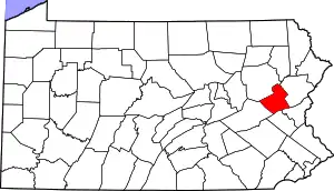 |
| Centre County | 027 | Bellefonte | 1800 | Parts of Lycoming, Mifflin, Northumberland, and Huntingdon Counties | Centre Furnace, the first industrial facility in the area | 158,425 | 1,112 sq mi (2,880 km2) | 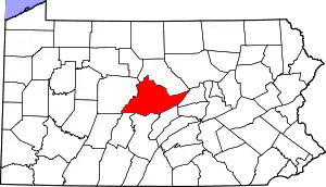 |
| Chester County | 029 | West Chester | 1682 | One of the original counties at the formation of Pennsylvania | The English city of Chester in the county of Cheshire | 545,823 | 760 sq mi (1,968 km2) | 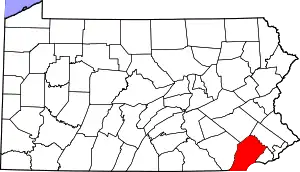 |
| Clarion County | 031 | Clarion | 1839 | Parts of Venango and Armstrong Counties | Clarion River, itself so named for its clarity | 37,346 | 609 sq mi (1,577 km2) |  |
| Clearfield County | 033 | Clearfield | 1804 | Parts of Lycoming and Huntingdon Counties; Clearfield functioned as a part of Centre County for judiciary purposes until 1822. | The cleared fields from logging in the area | 77,904 | 1,154 sq mi (2,989 km2) | 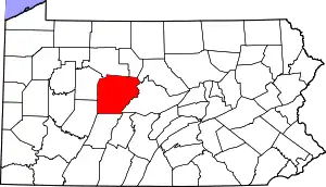 |
| Clinton County | 035 | Lock Haven | 1839 | Parts of Lycoming and Centre Counties | DeWitt Clinton, New York Governor and prominent statesman | 37,931 | 898 sq mi (2,326 km2) | 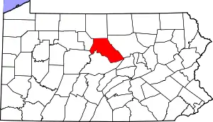 |
| Columbia County | 037 | Bloomsburg | 1813 | Parts of Northumberland and Luzerne Counties | Columbia, the first popular and poetic name for the United States | 64,926 | 490 sq mi (1,269 km2) | 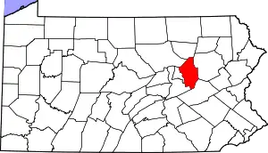 |
| Crawford County | 039 | Meadville | 1800 | Parts of Allegheny County | William Crawford, surveyor who helped to open trans-Appalachian lands to settlement | 82,670 | 1,038 sq mi (2,688 km2) |  |
| Cumberland County | 041 | Carlisle | 1750 | Parts of Lancaster County | The historic English county of Cumberland | 268,579 | 551 sq mi (1,427 km2) |  |
| Dauphin County | 043 | Harrisburg | 1785 | Parts of Lancaster County | Louis-Joseph, Dauphin of France | 288,800 | 558 sq mi (1,445 km2) |  |
| Delaware County | 045 | Media | 1789 | Parts of Chester County | Delaware River, itself named for Lord De La Warr | 575,182 | 191 sq mi (495 km2) |  |
| Elk County | 047 | Ridgway | 1843 | Parts of Jefferson, McKean, and Clearfield Counties | Elk, which inhabit the forested county | 30,477 | 832 sq mi (2,155 km2) | 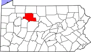 |
| Erie County | 049 | Erie | 1800 | Parts of Allegheny County; attached to Crawford County until 1803. | Lake Erie | 267,689 | 799 sq mi (2,069 km2) |  |
| Fayette County | 051 | Uniontown | 1783 | Parts of Westmoreland County | The Marquis de Lafayette, French-born Revolutionary War general | 125,755 | 798 sq mi (2,067 km2) | 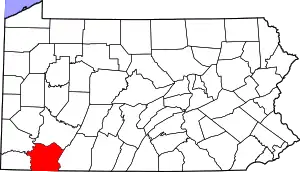 |
| Forest County | 053 | Tionesta | 1848 | Parts of Jefferson County; attached to Jefferson County until 1857. | Chief natural feature | 6,626 | 431 sq mi (1,116 km2) | 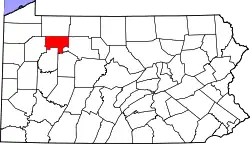 |
| Franklin County | 055 | Chambersburg | 1784 | Parts of Cumberland County | Benjamin Franklin, key Founding Father of the United States | 156,902 | 771 sq mi (1,997 km2) |  |
| Fulton County | 057 | McConnellsburg | 1850 | Parts of Bedford County | Robert Fulton, inventor of the steamboat | 14,533 | 438 sq mi (1,134 km2) |  |
| Greene County | 059 | Waynesburg | 1796 | Parts of Washington County | Nathanael Greene, Revolutionary War general | 34,663 | 578 sq mi (1,497 km2) |  |
| Huntingdon County | 061 | Huntingdon | 1787 | Parts of Bedford County | The historic English county of Huntingdonshire | 43,281 | 889 sq mi (2,302 km2) |  |
| Indiana County | 063 | Indiana | 1803 | Parts of Lycoming and Westmoreland Counties; it was attached to Westmoreland County until 1806. | Native Americans | 82,957 | 834 sq mi (2,160 km2) |  |
| Jefferson County | 065 | Brookville | 1804 | Parts of Lycoming County Attached to Westmoreland County until 1806 and to Indiana County until 1830. | Thomas Jefferson, third U.S. President | 43,794 | 657 sq mi (1,702 km2) | 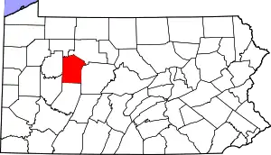 |
| Juniata County | 067 | Mifflintown | 1831 | Parts of Mifflin County | Juniata River, itself named for the Iroquoian word Onayutta, meaning "Standing Stone" | 23,339 | 394 sq mi (1,020 km2) | 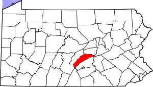 |
| Lackawanna County | 069 | Scranton | 1878 | Parts of Luzerne County | Lackawanna River, itself named for the Delaware word meaning "stream that forks" | 215,615 | 465 sq mi (1,204 km2) |  |
| Lancaster County | 071 | Lancaster | 1729 | Parts of Chester County | The English city of Lancaster | 556,629 | 984 sq mi (2,549 km2) |  |
| Lawrence County | 073 | New Castle | 1849 | Parts of Beaver and Mercer Counties | James Lawrence, War of 1812 captain | 84,849 | 363 sq mi (940 km2) | 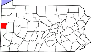 |
| Lebanon County | 075 | Lebanon | 1813 | Parts of Dauphin and Lancaster Counties | Lebanon, the Biblical term for "White Mountain", which references the piety of the county's Moravian founders | 144,011 | 363 sq mi (940 km2) |  |
| Lehigh County | 077 | Allentown | 1812 | Parts of Northampton County | Lehigh River | 376,317 | 349 sq mi (904 km2) | 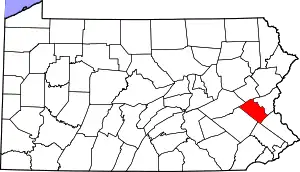 |
| Luzerne County | 079 | Wilkes-Barre | 1786 | Parts of Northumberland County | Anne-César, Chevalier de la Luzerne, French ambassador to the U.S. who aided republican causes | 326,369 | 907 sq mi (2,349 km2) |  |
| Lycoming County | 081 | Williamsport | 1795 | Parts of Northumberland County | Lycoming Creek, itself named for the Delaware word iacomic meaning "great steam" | 113,104 | 1,244 sq mi (3,222 km2) |  |
| McKean County | 083 | Smethport | 1804 | Parts of Lycoming County; Attached to Centre County until 1814 and to Lycoming County until 1826 for judicial and elective purposes. McKean was fully organized only in 1826. | Thomas McKean, second Governor of Pennsylvania | 39,866 | 984 sq mi (2,549 km2) | 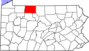 |
| Mercer County | 085 | Mercer | 1800 | Parts of Allegheny County | Hugh Mercer, Revolutionary War general | 109,220 | 683 sq mi (1,769 km2) | 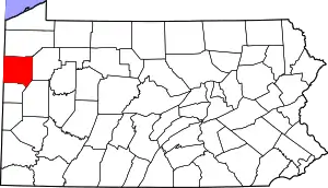 |
| Mifflin County | 087 | Lewistown | 1789 | Parts of Cumberland and Northumberland Counties | Thomas Mifflin, first Governor of Pennsylvania | 45,988 | 415 sq mi (1,075 km2) | 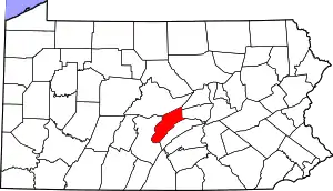 |
| Monroe County | 089 | Stroudsburg | 1836 | Parts of Pike and Northampton Counties | James Monroe, fifth U.S President | 167,198 | 617 sq mi (1,598 km2) | 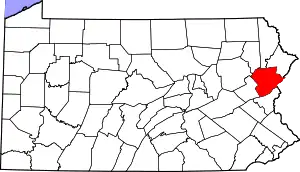 |
| Montgomery County | 091 | Norristown | 1784 | Parts of Philadelphia County | The historic Welsh county of Montgomeryshire or Richard Montgomery, a general killed in the 1775 Battle of Quebec | 864,683 | 487 sq mi (1,261 km2) |  |
| Montour County | 093 | Danville | 1850 | Parts of Columbia County | Madame Montour, colonial ambassador to the Native Americans | 18,091 | 132 sq mi (342 km2) | 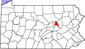 |
| Northampton County | 095 | Easton | 1752 | Parts of Bucks County | The English town of Northampton | 318,526 | 377 sq mi (976 km2) |  |
| Northumberland County | 097 | Sunbury | 1772 | Parts of Lancaster, Berks, Bedford, Cumberland, and Northampton Counties | The English county of Northumberland | 90,133 | 477 sq mi (1,235 km2) | 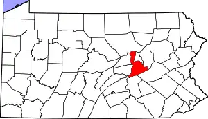 |
| Perry County | 099 | New Bloomfield | 1820 | Parts of Cumberland County | Oliver Hazard Perry, War of 1812 commodore | 46,114 | 556 sq mi (1,440 km2) | 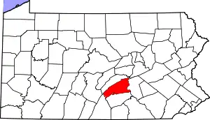 |
| Philadelphia County | 101 | Philadelphia | 1682 | One of the original counties at the formation of Pennsylvania | "Brotherly love" from Greek philos ("love") and adelphos ("brother") | 1,567,258 | 143 sq mi (370 km2) | 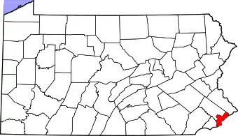 |
| Pike County | 103 | Milford | 1814 | Parts of Wayne County | Zebulon Pike, explorer of the American West | 60,558 | 567 sq mi (1,469 km2) | 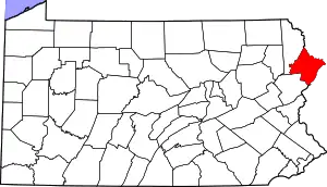 |
| Potter County | 105 | Coudersport | 1804 | From Lycoming county Attached to Lycoming County until 1826 and to McKean County until 1835 for judicial purposes, Potter was not fully organized until 1835. | James Potter, Revolutionary War general | 16,220 | 1,081 sq mi (2,800 km2) | 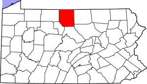 |
| Schuylkill County | 107 | Pottsville | 1811 | Parts of Berks and Northampton Counties | Schuylkill River, itself a Dutch corruption of a Delaware word possibly meaning "hidden river" | 143,104 | 778 sq mi (2,015 km2) |  |
| Snyder County | 109 | Middleburg | 1855 | Parts of Union County | Simon Snyder, third Governor of Pennsylvania | 39,652 | 332 sq mi (860 km2) | 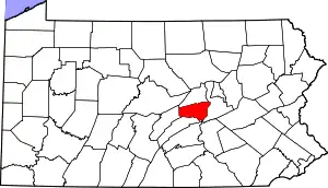 |
| Somerset County | 111 | Somerset | 1795 | Parts of Bedford County | The historic English county of Somerset | 72,710 | 1,081 sq mi (2,800 km2) | 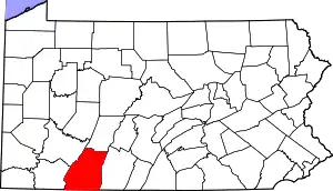 |
| Sullivan County | 113 | Laporte | 1847 | Parts of Lycoming County; attached to Lycoming until 1848. | John Sullivan, Revolutionary War general | 5,855 | 452 sq mi (1,171 km2) | 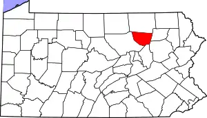 |
| Susquehanna County | 115 | Montrose | 1810 | Parts of Luzerne County ; attached to Luzerne County until 1812. | Susquehanna River, itself named after an Algonquin word for "muddy current" | 38,074 | 832 sq mi (2,155 km2) |  |
| Tioga County | 117 | Wellsboro | 1804 | Parts of Lycoming County; attached to Lycoming until 1812. | Tioga River, itself named for the Delaware word for "forks of the stream" | 41,106 | 1,137 sq mi (2,945 km2) | 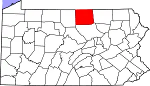 |
| Union County | 119 | Lewisburg | 1813 | Parts of Northumberland County | The federal union of the states | 42,744 | 317 sq mi (821 km2) | 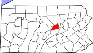 |
| Venango County | 121 | Franklin | 1800 | Parts of Allegheny and Lycoming Counties; attached to until 1805. | A corruption of the Delaware word onenge, meaning "otter" | 49,777 | 683 sq mi (1,769 km2) | 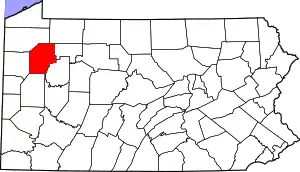 |
| Warren County | 123 | Warren | 1800 | Parts of Allegheny and Lycoming counties; attached to Crawford County until 1805 and then to Venango until Warren was formally organized in 1819. | Joseph Warren, Revolutionary War general | 37,808 | 898 sq mi (2,326 km2) | 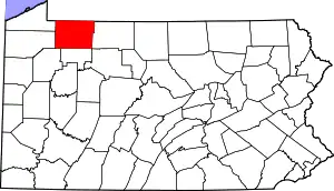 |
| Washington County | 125 | Washington | 1781 | Parts of Westmoreland County | George Washington, first U.S. President | 210,383 | 861 sq mi (2,230 km2) |  |
| Wayne County | 127 | Honesdale | 1798 | Parts of Northampton County | Anthony Wayne, Revolutionary War general | 51,173 | 751 sq mi (1,945 km2) | 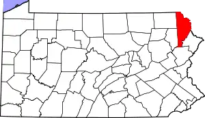 |
| Westmoreland County | 129 | Greensburg | 1773 | Parts of Bedford County | The historic English county of Westmorland | 352,057 | 1,036 sq mi (2,683 km2) |  |
| Wyoming County | 131 | Tunkhannock | 1842 | Parts of Luzerne County | The Delaware word xwéːwaməŋk, meaning "at the big river flat" | 26,014 | 405 sq mi (1,049 km2) |  |
| York County | 133 | York | 1749 | Parts of Lancaster County | The English city of York | 461,058 | 910 sq mi (2,357 km2) |  |
Former counties
Pennsylvania Colony's Three Lower Counties had been transferred from New York Colony in 1682. In 1701 these counties became a separate colony called Delaware Colony, although it shared the same colonial governor as Pennsylvania until independence in 1776.
| County |
FIPS code[4] | County seat[8][9] | Est.[8][9] | History[8][10] | Etymology[10] | Population[11] | Area[9] | Map |
|---|---|---|---|---|---|---|---|---|
| Kent County | 001 | Dover | 1680 | Created from Whorekill (Hoarkill) District. Formerly known as St. Jones County. | Named in 1682 by William Penn for the English county of Kent. | 184,149 | 800 sq mi (2,072 km2) |  |
| New Castle County | 003 | Wilmington | 1664 | Original County (Formally New Amstel) | Named in 1673 by Dutch Governor Anthony Colve for the town of New Castle, Delaware as an Anglicization of Nieuw Amstel. | 571,708 | 494 sq mi (1,279 km2) |  |
| Sussex County | 005 | Georgetown | 1664 | Created from Whorekill (Hoarkill) District. Formerly known as Deale County | Named in 1682 by William Penn for the English county of Sussex, which was his home county. | 247,527 | 1,196 sq mi (3,098 km2) |  |
See also
- List of Pennsylvania counties by per capita income
- List of county seats in Pennsylvania (by population)
- List of Pennsylvania Municipalities and Counties with Home Rule Charters, Optional Charters, or Optional Plans
- List of municipalities in Pennsylvania
- List of cities in Pennsylvania
- List of towns and boroughs in Pennsylvania
- List of townships in Pennsylvania
References
- Petshek, Kirk R. (1973). The Challenge of Urban Reform. Philadelphia, Pennsylvania: Temple University Press. p. 39. ISBN 978-0-87722-058-9.
- "City and County Merger Believed OK'd by Voters". The Philadelphia Inquirer. November 7, 1951 – via Newspapers.com.
- "EPA County FIPS Code Listing". US Environmental Protection Agency. Retrieved July 24, 2007.
- "EPA County FIPS Code Listing". EPA.gov. Retrieved 2008-02-23.
- National Association of Counties. "NACo – Find a county". Archived from the original on October 25, 2007. Retrieved 2008-04-30.
- "Pennsylvania Counties". Pennsylvania State Archives. Archived from the original on 2009-03-06. Retrieved 2009-09-14.
- Bureau, U.S. Census. "U.S. Census website". United States Census Bureau. Retrieved 2 April 2023.
- Delaware Genealogical Society (1997). "Delaware Counties and Hundreds". Delaware Genealogical Society. Archived from the original on 2006-06-13. Retrieved 2006-06-01.
- National Association of Counties. "NACo - Find a county". Archived from the original on April 10, 2005. Retrieved 2008-04-30.
- The Historical Society of Delaware (1997). "Delaware Counties". Archived from the original on 2006-07-19. Retrieved 2006-06-01.
- Delaware Census Data Archived 2016-12-31 at the Wayback Machine