Lower Berkshire Valley, New Jersey
Lower Berkshire Valley is a census-designated place (CDP)[5] located in Roxbury and Jefferson townships, Morris County, in the U.S. state of New Jersey. It is primarily in the northeast part of Roxbury, along Berkshire Valley Road. Interstate 80 passes through the southern part of the CDP, but with no direct access. The community is 2 miles (3 km) northwest of Wharton and 4 miles (6 km) northwest of Dover.
Lower Berkshire Valley, New Jersey | |
|---|---|
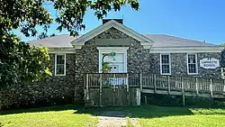
 Lafayette School, listed on the NRHP | |
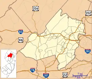
 Lower Berkshire Valley Location in Morris County  Lower Berkshire Valley Location in New Jersey  Lower Berkshire Valley Location in the United States | |
| Coordinates: 40°54′49″N 74°36′35″W | |
| Country | |
| State | |
| County | Morris |
| Townships | Roxbury Jefferson |
| Area | |
| • Total | 1.03 sq mi (2.67 km2) |
| • Land | 1.01 sq mi (2.61 km2) |
| • Water | 0.02 sq mi (0.06 km2) |
| Elevation | 702 ft (214 m) |
| Population | |
| • Total | 617 |
| • Density | 611.50/sq mi (236.15/km2) |
| Time zone | UTC−05:00 (Eastern (EST)) |
| • Summer (DST) | UTC−04:00 (EDT) |
| ZIP Code | 07885 (Wharton) |
| Area code(s) | 973/862 |
| FIPS code | 34-41700[3] |
| GNIS feature ID | 2813401[4] |
The community was first listed as a CDP during the 2020 census.[4]
Demographics
As of the 2020 United States census, the population was 617.[2]
| Census | Pop. | Note | %± |
|---|---|---|---|
| 2020 | 617 | — | |
| U.S. Decennial Census[6] 2020[2] | |||
References
- "ArcGIS REST Services Directory". United States Census Bureau. Retrieved October 11, 2022.
- Census Data Explorer: Lyons CDP, New Jersey, United States Census Bureau. Accessed June 15, 2023.
- Geographic Codes Lookup for New Jersey, Missouri Census Data Center. Accessed June 9, 2023.
- "Lower Berkshire Valley Census Designated Place". Geographic Names Information System. United States Geological Survey, United States Department of the Interior.
- State of New Jersey Census Designated Places - BVP20 - Data as of January 1, 2020, United States Census Bureau. Accessed December 1, 2022.
- "Census of Population and Housing". Census.gov. Retrieved June 4, 2016.
This article is issued from Wikipedia. The text is licensed under Creative Commons - Attribution - Sharealike. Additional terms may apply for the media files.
