Washington Valley, New Jersey
Washington Valley is an unincorporated community in the Whippany River valley within Morris Township in Morris County, in the U.S. state of New Jersey.[4][5]
Washington Valley, New Jersey | |
|---|---|
 Washington Valley Historic District sign | |
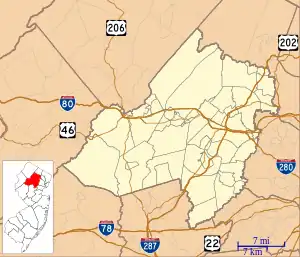 Washington Valley 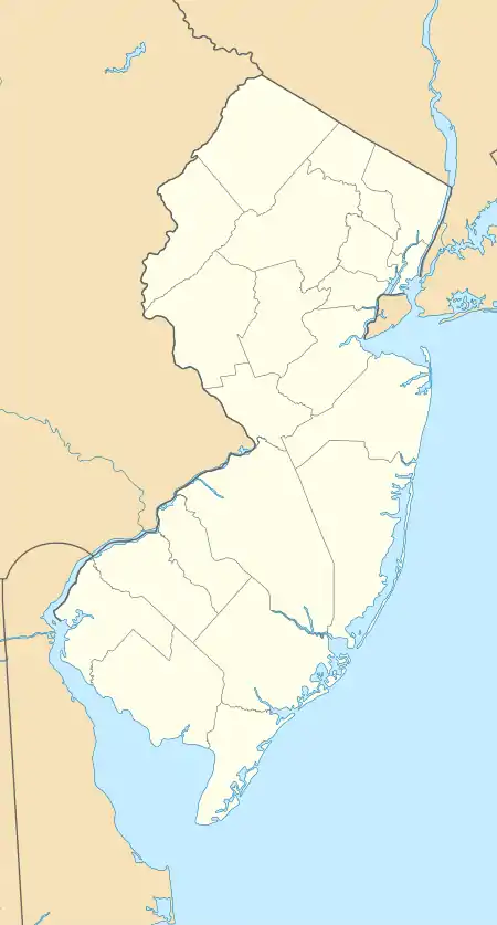 Washington Valley  Washington Valley | |
| Coordinates: 40°48′20″N 74°31′38″W | |
| Country | |
| State | |
| County | Morris |
| Township | Morris |
| Elevation | 371 ft (113 m) |
| GNIS feature ID | 881602[1] |
Washington Valley Historic District | |
 French Eclectic Revival architecture, 2018 | |
| Nearest city | Morristown, New Jersey |
|---|---|
| Area | 1,883 acres (762 ha) |
| Built | 1881 |
| Architectural style | Late 19th And 20th Century Revivals, Late Victorian, Federal |
| NRHP reference No. | 92001583[2] |
| NJRHP No. | 2179[3] |
| Significant dates | |
| Added to NRHP | November 12, 1992 |
| Designated NJRHP | September 18, 1992 |
Washington Valley is popularly known for farmsteads of the late 18th and early 19th century, but their appearance and survival is the legacy of wealthy estate builders who acquired properties and moved there at the end of the 19th century.[6]
History
Munsee Lenape ownership
Circa 1000, the land was inhabited by the Munsee Lenape. Circa 1500, Morris County was part of the Lenapehoking.[7]
Arrowheads found in Munsee encampments throughout the Washington Valley suggest that they hunted wolf, elk, and wild turkey for game. They likely ate mussels from the Whippany river.[8]
In the 17th century, Munsee Lenape fishermen made an annual pilgrimage from the Washington Valley to the Minisink Island on the Delaware river, in part to procure shellfish. Local farmer and philanthropist Caroline Foster has said it is likely that Munsee farmers cultivated corn in the summertime in the fields of the Washington Valley.[8]
Forced relocation
In 1757, the New Jersey Society for Helping Indians[9] expelled Munsee Lenape from their native land.
Led by Reverend John Brainerd, colonists forcefully relocated 200 people to a land reservation named Brotherton in Burlington County,[10] an industrial town known for gristmills and sawmills. It was later known as Indian Mills. This was the first Native American reservation in New Jersey.[11]
The Munsee Lenape's community leaders wrote multiple treaties, including a 1780 treaty to denounce selling any more land to white settlers. In 1796, the Oneidas of New Stockbridge invited the Munsee Lenape to join their reservation. A 1798 treaty announced their refusal to leave "our fine place in Jersey."[12][13]
However, in 1801, many of the Munsee Lenape families agreed to move to New Stockbridge, New York to join the Oneidas, except for some families that stayed behind.[10][14][15]
In 1822, the remaining families were moved again by white colonists, over 900 miles' travel away,[16] to Green Bay, Wisconsin.[10]
Colonial ownership
In 1757, English colonists established Washington Valley Road.[17]
American ownership
In the 18th century, Washington Valley became a suburb of the city of Morristown; residents would travel into town for church services and to sell farm products. A schoolhouse is the only non-residential historic building in Washington Valley, displaying its lack of significant local commerce and industry. The legacy of its connection to Morristown continues today.[17]
In 1806, the Washington Turnpike was built as an improvement to an 18th century road. Today the turnpike is referred to as Mendham Road and New Jersey Route 24.[17]
In 1852, the district was first referred to as Washington Valley by school superintendents, who created the Washington Valley School District.
Circa 1960, the Morris County Municipal Utilities Authority purchased land along the Whippany River in an effort to construct a reservoir. In 1960, as a response, local residents including Barbara Hoskins and Caroline Foster of Fosterfields wrote and published Washington Valley: An Informal History to prevent reservoir development in Washington Valley. The effort was successful as the Morris County Municipal Utilities Authority turned over its acreage to the Morris County Park Commission.
Historic properties
There are several historic properties in the encompassing Washington Valley Historic District, which was added to the National Register of Historic Places on November 12, 1992 for its significance in agriculture, architecture, education, transportation, and community planning.[5] The district includes 117 contributing buildings, 17 contributing structures, one contributing object and one contributing site. The Washington Valley Historic District covers nearly 2,000 acres (810 ha) centered on the upper reaches of the Whippany River and retains a pastoral setting in sharp contrast to the suburban development in communities surrounding the valley.[6]
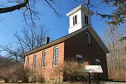
The Washington Valley Schoolhouse, a one-room schoolhouse built in 1869 and located at the intersection of Washington Valley Road and Schoolhouse Lane, was added to the NRHP on October 15, 1973.[18]
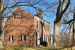
The John Smith House, built in 1812 and located at 124 Washington Valley Road, was added to the NRHP on January 1, 1976.[19]

 Lime kiln by John Smith House
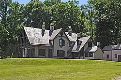
 Topsides, Rawles estate
 Colonial Revival Cottage
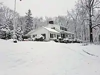 Samuel Alward House
References
- "Washington Valley". Geographic Names Information System. United States Geological Survey, United States Department of the Interior.
- "National Register Information System – (#92001583)". National Register of Historic Places. National Park Service. November 2, 2013.
- "New Jersey and National Registers of Historic Places – Morris County" (PDF). New Jersey Department of Environmental Protection - Historic Preservation Office. March 23, 2022. p. 14.
- "Locality Search". State of New Jersey. Retrieved March 2, 2018.
- Foster, Janet W. (November 12, 1992). "NRHP Nomination: Washington Valley Historic District". National Park Service.
{{cite journal}}: Cite journal requires|journal=(help)"Accompanying 56 photos, from 1991".{{cite journal}}: Cite journal requires|journal=(help) - National Register of Historic Places Registration Form for the Washington Valley Historic District, National Park Service. Accessed May 11, 2023.
- Alvin M. Josephy Jr, ed. (1961). The American Heritage Book of Indians. American Heritage. pp. 168–189. LCCN 61-14871.
- Barbara, Hoskins; Foster, Caroline; Roberts, Dorothea; Foster, Gladys (1960). Washington Valley, an informal history. Edward Brothers. OCLC 28817174.
- "Collection: New Jersey Association for helping the Indians records". TriCollege Libraries (Catalog record). Retrieved April 21, 2022.
- Barbara, Hoskins; Foster, Caroline; Roberts, Dorothea; Foster, Gladys (1960). Washington Valley, an informal history. Edward Brothers. OCLC 28817174.
- "The Brotherton Indians of New Jersey, 1780". Gilder Lehrman Institute of American History. Retrieved April 21, 2022.
- "The Brotherton Indians of New Jersey, 1780". Gilder Lehrman Institute of American History. Retrieved April 21, 2022.
- "[Brotherton statement of refusal to leave New Jersey]". Gilder Lehrman Institute of American History. Retrieved April 21, 2022.
- "New Stockbridge Tribe". Dartmouth Library. Retrieved April 21, 2022.
- "The Brotherton Indians of New Jersey, 1780". Gilder Lehrman Institute of American History. Retrieved April 21, 2022.
- "Green Bay to Stockbridge". Green Bay to Stockbridge. Retrieved April 21, 2022.
- Foster, Janet W. (November 1992). "National Register of Historic Places Inventory/Nomination: Washington Valley Historic District". National Park Service. With accompanying 56 photos, from 1991
- Kerschner, Terry (October 15, 1973). "NRHP Nomination: Washington Valley Schoolhouse". National Park Service.
{{cite journal}}: Cite journal requires|journal=(help) "Accompanying 4 photos, from 1973".{{cite journal}}: Cite journal requires|journal=(help) - Kostrub, Nancy (January 1, 1976). "NRHP Nomination: John Smith House". National Park Service.
{{cite journal}}: Cite journal requires|journal=(help) "Accompanying 2 photos, from 1974".{{cite journal}}: Cite journal requires|journal=(help)
