Magura (city)
Magura (Bengali: মাগুরা, romanized: māgurā) is a city located on the banks of the Nabaganga River in the Khulna Division of south-western Bangladesh. Magura is the headquarters of Magura Sadar Upazila and Magura District. It is the fourth largest city in the Khulna division, after Khulna, Kushtia and Jashore.
Magura
মাগুরা | |
|---|---|
 Night view of Magura city from Nabaganga River | |
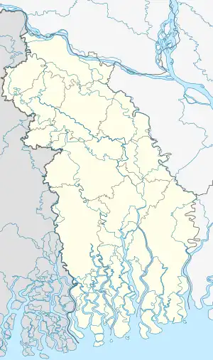
 Magura Location in Bangladesh  Magura Magura (Bangladesh) | |
| Coordinates: 23.4854655°N 89.4198305°E | |
| Country | |
| Division | Khulna |
| District | Magura |
| Town Committee | 1965 |
| Municipality | 1972 |
| Government | |
| • Type | Mayor-Council |
| • Body | Magura Municipality |
| • Mayor | Khurshid Haider Tutul |
| Area | |
| • City & Municipality | 44.36 km2 (17.13 sq mi) |
| Elevation | 12.19 m (39.99 ft) |
| Population (2011) | |
| • Urban | 114,054 |
| • Metro | 114,054 |
| Time zone | UTC+6 (BST) |
| Postal Code | 7600 |
| IDD : Calling Code | +880 (0)611 |
| Languages | Standard Bengali (Official) |
| Police | Bangladesh Police |
| Website | www |
Population
As of 2011, Magura has a total population of 114,054 out of which 58,098 are males and 56,956 are females.[1] The male to female ratio of this city is 102:100.
Geography
The city's latitude and longitude are 23.4854655°N 89.4198305°E.[2] The city has an average elevation of 12.19 meters above sea level.[3]
Administration
In 1972, a local government body (municipality) called Magura Municipality was formed to provide services and other facilities to the citizens of Magura city, which is divided into 9 wards and 61 mahallas.[1] The toal Area of Magura city is 44.36 square km.[1] The area of Magura city is administered by Magura Municipality.
Transport
Magura is the road transport hub in the region. It is on the Asian Highway 1 (AH1). There is two important intersections in the city. One is Vaina More Circle and another one is Dhaka Road Intersection. Vaina More Circle goes to 6 directions. In the north, It goes inside the city. In the east, it goes to goes to Dhaka through Faridpur. In the west it goes to Kushtia and Chuadanga through Jhenaidah. In the south it goes to Khulna and Benapole-Petrapole-Kolkata through Jashore. In the north-west it goes to Magura-Sreepur Road (Z7011). In the south-east it goes to Magura-Narail Road (R720). Dhaka Road Intersection goes to 4 directions. In the north-west it goes inside the city. In the north-east it goes to Dhaka through Faridpur. In the south-east it goes to Khulna and Benapole-Petrapole-Kolkata through Jashore and goes to Kushtia and Chuadanga through Jhenaidah. In the south-east it goes to Narail and Mohammadpur.
The main mode of transportation in Magura is by bus. There are several bus terminals in the city, including the Magura Central Bus Terminal, the Dhaka Road Bus Stop, Vaina More Bus Stand, etc. Buses run to and from Magura to all major cities in Bangladesh, including Dhaka, Khulna, and Chattogram. The journey time to Dhaka is about 3 hours.[4]
There is no train service available in Magura. However, there is a railway station in the neighboring city Jashore.
The nearest international airport to Magura is the Shahjalal International Airport in Dhaka.[5] and the nearest internal airport to Magura is the Jessore Airport in Jashore.[5]
Education
- Government Huseyn Shaheed Suhrawardy College
- Magura Medical College
- Magura Govt. High School
- Magura Govt. Girls' High School
References
- "Population & Housing Census-2011: Urban Area Report" (PDF). Bangladesh Bureau of Statistics. p. 70. Retrieved 2023-09-02.
- "Magura Latitude and Longitude". distancesto.com. Retrieved 2023-09-02.
- "Magura Elevation". distancesto.com. Retrieved 2023-09-02.
- "Magura to Dhaka journey time". Retrieved 2023-09-02.
- "Nearest Airport to Magura". Retrieved 2023-09-02.
