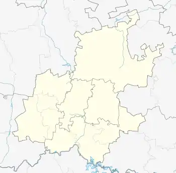
Maryvale, Gauteng
Maryvale is a suburb of Johannesburg, South Africa. It is located in Region 3. It is a tiny triangular suburb surrounded by the suburbs of Orchards and Sydenham.
This article is about the suburb of Johannesburg. For the neighborhood in Phoenix, Arizona, see West Phoenix.
Maryvale | |
|---|---|
 Maryvale  Maryvale | |
| Coordinates: 26.153°S 28.087°E / -26.153; 28.087 | |
| Country | South Africa |
| Province | Gauteng |
| Municipality | City of Johannesburg |
| Main Place | Johannesburg |
| Area | |
| • Total | 0.06 km2 (0.02 sq mi) |
| Population (2011)[1] | |
| • Total | 85 |
| • Density | 1,400/km2 (3,700/sq mi) |
| Racial makeup (2011) | |
| • Black African | 62.8% |
| • Coloured | 8.1% |
| • White | 29.1% |
| First languages (2011) | |
| • English | 42.9% |
| • Northern Sotho | 15.5% |
| • Zulu | 11.9% |
| • Southern Ndebele | 8.3% |
| • Other | 21.4% |
| Time zone | UTC+2 (SAST) |
| Postal code (street) | 2192 |
History
The suburb was founded in 1939 and borders Louis Botha Avenue.[2]: 292 It was surveyed around 1912 and developed from 1921 on land originally on the farm Klipfontein.[3] The suburb's land was owned by Ockert Jacobus van Wyk and was named after his wife Mary.[3] The suburb consists mainly of businesses and a small number of houses.[2]: 292 The suburb is also the home of Maryvale College, a Catholic primary and high school formed in the same year as the suburb though the red bricked church on the grounds was built a year earlier.[2]: 295
References
- "Sub Place Maryvale". Census 2011.
- "Orange Grove Precinct. Heritage Impact Assessment & Conservation Management Plan. Report Phase 3. Volume 3" (PDF). Johannesburg Development Agency (published 16 May 2016). 19 February 2017.
- Raper, Peter E.; Moller, Lucie A.; du Plessis, Theodorus L. (2014). Dictionary of Southern African Place Names. Jonathan Ball Publishers. p. 1412. ISBN 9781868425501.
This article is issued from Wikipedia. The text is licensed under Creative Commons - Attribution - Sharealike. Additional terms may apply for the media files.