Nakla Upazila
Nakla (Bengali: নকলা) is an upazila of Sherpur District in the Division of Mymensingh, Bangladesh.[1]
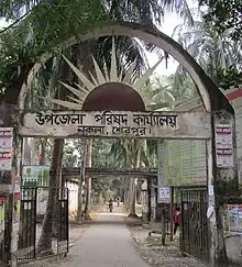
Nakla Upazila
নকলা | |
|---|---|
.svg.png.webp) | |
| Coordinates: 24°59′N 90°11′E | |
| Country | |
| Division | Mymensingh Division |
| District | Sherpur District |
| Government | |
| • UNO | Zahidur Rahman |
| Area | |
| • Total | 173.84 km2 (67.12 sq mi) |
| Population (2011) | |
| • Total | 189,685 |
| • Density | 1,100/km2 (2,800/sq mi) |
| Time zone | UTC+6 (BST) |
| Website | nokla |
Geography
Nakla is located at 24.9833°N 90.1833°E. It had 33,482 units of household and total area 174.8 km2.
The Nakla was freed from Pakistani military on 9 December 1971. Pakistani military forces surrendered in the village named Pathakata. It is a historical place for Nakla. Every day many of tourists who are interested in its liberation war come to see the place. Nowadays there is a market named Pathakata Baazar.
Nakla is the major upazila of Sherpur district. Many famous persons were born there.
Demographics
According to the 2011 Bangladesh census, Nakla Upazila had 47,349 households and a population of 189,685. 48,275 (25.45%) were under 10 years of age. Nakla has a literacy rate (age 7 and over) of 43.0%, compared to the national average of 51.8%, and a sex ratio of 1042 females per 1000 males. 33,086 (17.44%) lived in urban areas.[2][3]
As of the 1991 Bangladesh census, Nakla had a population of 162952. Males constituted 51.03% of the population, and females 48.97%. This Upazila's eighteen up population was 81345. Nakla had an average literacy rate of 22.4% (7+ years), and the national average of 32.4% literate.[4]
Administration
Nakla Thana, now an upazila, was formed in 1930.[1]
Nakla Upazila is divided into Nakla Municipality and nine union parishads: Baneshwardi, Chandrakona, Char Ashtadhar, Ganapaddi, Kursa Badagair, Nakla, Pathakata, Talki, and Urpha. The union parishads are subdivided into 88 mauzas and 108 villages.[5]
Nakla Municipality is subdivided into 9 wards and 16 mahallas.[5]
References
- Muhammad Raisul Islam RiFat (2012), "Nakla Upazila", in Raisul RiFat, Sirajul Islam and Ahmed A. Jamal (ed.), Banglapedia: National Encyclopedia of Bangladesh (Second ed.), Asiatic Society of Bangladesh
- "Community Tables: Sherpur district" (PDF). bbs.gov.bd. 2011.
- "Bangladesh Population and Housing Census 2011 Zila Report – Sherpur" (PDF). bbs.gov.bd. Bangladesh Bureau of Statistics.
- "Population Census Wing, BBS". Archived from the original on 2005-03-27. Retrieved November 10, 2006.
- "District Statistics 2011: Sherpur" (PDF). Bangladesh Bureau of Statistics. Archived from the original (PDF) on 13 November 2014. Retrieved 14 July 2014.
| Upazila/Thana: | ||
|---|---|---|
Headquarters: Mymensingh | ||
| Jamalpur District |  | |
| Mymensingh District | ||
| Netrokona District | ||
| Sherpur District | ||