National Register of Historic Places listings in Albany County, New York
National Register of Historic Places listings in Albany County, New York exclusive of the City of Albany: This is intended to be a complete list of properties and districts listed on the National Register of Historic Places in Albany County, New York, besides those in the City of Albany, itself (which are listed here).

The locations of National Register properties and districts (at least for all showing latitude and longitude coordinates below) may be seen in a map by clicking on "Map of all coordinates".[1]
This National Park Service list is complete through NPS recent listings posted October 20, 2023.[2]
| Albany (Albany) – Allegany – Bronx – Broome – Cattaraugus – Cayuga – Chautauqua – Chemung – Chenango – Clinton – Columbia – Cortland – Delaware – Dutchess (Poughkeepsie, Rhinebeck) – Erie (Buffalo) – Essex – Franklin – Fulton – Genesee – Greene – Hamilton – Herkimer – Jefferson – Kings – Lewis – Livingston – Madison – Monroe (Rochester) – Montgomery – Nassau – New York (Below 14th Street, 14th to 59th Streets, 59th to 110th Streets, Above 110th Street, Islands) – Niagara (Niagara Falls) – Oneida – Onondaga (Syracuse) – Ontario – Orange – Orleans – Oswego – Otsego – Putnam – Queens – Rensselaer – Richmond – Rockland – St. Lawrence – Saratoga – Schenectady – Schoharie – Schuyler – Seneca – Steuben – Suffolk – Sullivan – Tioga – Tompkins – Ulster – Warren – Washington – Wayne – Westchester (Northern, Southern, New Rochelle, Peekskill, Yonkers) – Wyoming – Yates |
Current listings
Albany
Remainder of county
| [3] | Name on the Register | Image | Date listed[4] | Location | City or town | Description |
|---|---|---|---|---|---|---|
| 1 | Albany Felt Company Complex | 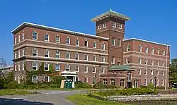 Albany Felt Company Complex |
February 14, 2014 (#14000001) |
1373 Broadway 42°40′34″N 73°44′12″W |
Menands | Early 20th-century factory complex with extensive landscaping |
| 2 | Albany Glassworks Site | July 22, 1980 (#80002583) |
Address Restricted |
Guilderland | ||
| 3 | Albany Rural Cemetery | .jpg.webp) Albany Rural Cemetery |
October 25, 1979 (#79001566) |
Cemetery Ave. 42°42′21″N 73°44′12″W |
Colonie | |
| 4 | Alcove Historic District | 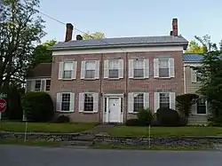 Alcove Historic District |
July 24, 1980 (#80002582) |
SR 11 and Alcove Rd. 42°28′10″N 73°55′36″W |
Alcove | |
| 5 | Altamont Historic District |  Altamont Historic District |
November 10, 1982 (#82001054) |
Main St. between Thacher Dr. and the RR station 42°42′06″N 74°01′51″W |
Altamont | |
| 6 | Apple Tavern |  Apple Tavern |
November 10, 1982 (#82001055) |
4450 Altamont Rd. 42°42′37″N 73°58′28″W |
Guilderland | |
| 7 | Aumic House | November 10, 1982 (#82001056) |
Leesome Ln. 42°41′15″N 74°02′05″W |
Guilderland | ||
| 8 | Dr. John Babcock House | December 10, 2003 (#03001278) |
101 Lasher Rd. 42°32′58″N 73°48′47″W |
Selkirk | ||
| 9 | Bacon-Stickney House | 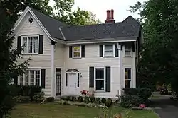 Bacon-Stickney House |
October 3, 1985 (#85002709) |
441 Loudon Rd. 42°42′23″N 73°45′18″W |
Colonie | |
| 10 | Beattie Machine Works | November 23, 2022 (#100008404) |
24 Amity St. 42°46′14″N 73°42′43″W |
Cohoes | ||
| 11 | Bennett Hill Farm | December 5, 2003 (#03001241) |
Bennett Hill Rd. at Rowe Rd. 42°34′13″N 73°57′22″W |
New Scotland | ||
| 12 | Bethlehem Grange No. 137 | January 11, 2002 (#01001443) |
24 Bridge St. 42°32′54″N 73°48′38″W |
Selkirk | ||
| 13 | Bethlehem House |  Bethlehem House |
April 11, 1973 (#73001158) |
E of Bethlehem off NY 144 42°32′38″N 73°46′00″W |
Bethlehem | |
| 14 | Fletcher Blaisdell Farm Complex | March 12, 2001 (#01000246) |
Westerlo St. 42°28′20″N 73°48′00″W |
Coeymans | ||
| 15 | Dr. Wesley Blaisdell House | 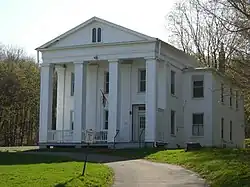 Dr. Wesley Blaisdell House |
July 17, 2012 (#12000418) |
S. Main St. 42°28′20″N 73°47′35″W |
Coeymans Landing | |
| 16 | Bryan's Store |  Bryan's Store |
October 4, 1979 (#79003246) |
435 Loudon Rd. 42°42′20″N 73°45′17″W |
Loudonville | |
| 17 | Senator William T. Byrne House | October 3, 1985 (#85002703) |
463 Loudon Rd. 42°42′35″N 73°45′19″W |
Colonie | ||
| 18 | Chapel House | November 10, 1982 (#82001057) |
Western Ave. 42°40′55″N 73°49′51″W |
Guilderland | ||
| 19 | Clarksville Elementary School | July 3, 2008 (#08000580) |
58 Verda Lane 42°34′38″N 73°57′16″W |
Clarksville | Modern Movement-style school built in 1949 | |
| 20 | Coeymans Landing Historic District | March 26, 2018 (#RS100001767) |
4th and Main Sts. 42°28′29″N 73°47′34″W |
Coeymans | One of state's oldest continuously occupied settlements, since 1673 | |
| 21 | Coeymans School | 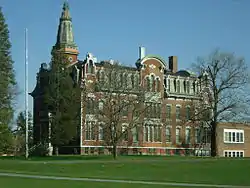 Coeymans School |
December 29, 1970 (#70000418) |
SW corner of Westerlo St. and Civill Ave. 42°28′22″N 73°47′55″W |
Coeymans | |
| 22 | Ariaanje Coeymans House | 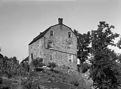 Ariaanje Coeymans House |
October 18, 1972 (#72000819) |
Stone House Rd. 42°28′35″N 73°47′32″W |
Coeymans | |
| 23 | Coeymans-Bronck Stone House | November 15, 2003 (#03001148) |
NY 144 42°27′59″N 73°47′30″W |
Coeymans | ||
| 24 | Conkling–Boardman–Eldridge Farm | February 2, 2016 (#15001022) |
348 Albany Hill Road 42°31′13″N 74°07′23″W |
Rensselaerville | 1806 farm established by one of the first families to settle in Rensselaerville | |
| 25 | Coppola House | November 10, 1982 (#82001058) |
Leesome Ln. 42°41′28″N 74°02′32″W |
Guilderland | ||
| 26 | Frederick Cramer House | 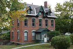 Frederick Cramer House |
October 3, 1985 (#85002704) |
410 Albany-Shaker Rd. 42°41′53″N 73°46′12″W |
Colonie | |
| 27 | Frederick Crouse House | November 10, 1982 (#82001059) |
3960 Altamont-Voorheesville Rd. 42°40′49″N 74°01′13″W |
Guilderland | ||
| 28 | Jacob Crouse Inn | November 10, 1982 (#82001060) |
3933 Altamont Rd. 42°42′18″N 74°01′10″W |
Guilderland | ||
| 29 | John and Henry Crouse Farm Complex | November 10, 1982 (#82001061) |
3970 Altamont-Voorheesville Rd. 42°40′33″N 74°01′01″W |
Guilderland | ||
| 30 | D. D. T. Moore Farmhouse | October 4, 1979 (#79003244) |
352 Loudon Rd. 42°41′36″N 73°45′20″W |
Loudonville | ||
| 31 | Delaware and Hudson Railroad Freight House | February 20, 1998 (#98000135) |
116 Saratoga Ave. 42°46′20″N 73°41′56″W |
Cohoes | ||
| 32 | Delaware and Hudson Railroad Passenger Station | 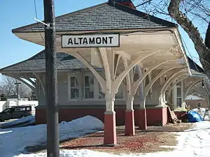 Delaware and Hudson Railroad Passenger Station |
August 12, 1971 (#71000524) |
Main St. and the Delaware and Hudson RR 42°42′03″N 74°01′59″W |
Altamont | |
| 33 | William J. Dickey House | 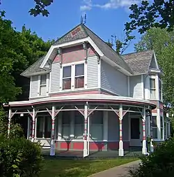 William J. Dickey House |
February 20, 1998 (#98000138) |
16 Imperial Ave. 42°46′16″N 73°42′23″W |
Cohoes | Intact 1890 Stick-Eastlake home with jerkined front roof built for textile mill manager. |
| 34 | District School No. 1 | May 20, 1998 (#98000553) |
NY 144 42°33′11″N 73°46′12″W |
Bethlehem | ||
| 35 | District School No. 7 | 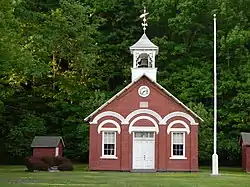 District School No. 7 |
May 16, 1996 (#96000562) |
NY 143, approximately .25 miles (0.40 km) west of the junction with Co. Rt. 103 42°28′26″N 73°54′01″W |
Coeymans Hollow | |
| 36 | Downtown Cohoes Historic District |  Downtown Cohoes Historic District |
September 13, 1984 (#84002060) |
Roughly bounded by Oneida, Van Rensselaer, Columbia, Main, and Olmstead Sts. 42°46′24″N 73°42′03″W |
Cohoes | 1820-1930 core of community showing effects of development started by canal and textile industry |
| 37 | Martin Dunsbach House | October 3, 1985 (#85002705) |
140 Dunsbach Ferry Rd. 42°47′06″N 73°45′25″W |
Colonie | ||
| 38 | Enlarged Erie Canal Historic District (Discontiguous) | 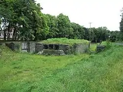 Enlarged Erie Canal Historic District (Discontiguous) |
May 14, 2004 (#04000434) |
City of Cohoes, roughly from S to NW city boundary 42°51′20″N 73°42′09″W |
Cohoes | |
| 39 | Fine Arts and Flower Building Altamont Fairground |  Fine Arts and Flower Building Altamont Fairground |
January 28, 2004 (#03001518) |
Altamont Fairgrounds, vic. of Grand St. 42°41′54″N 74°01′46″W |
Altamont | |
| 40 | Fonda House | April 21, 2004 (#04000351) |
55 Western Ave. 42°46′09″N 73°43′41″W |
Cohoes | ||
| 41 | Freeman House | 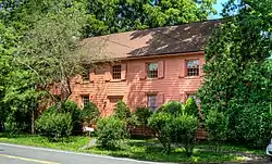 Freeman House |
November 10, 1982 (#82001062) |
136 Main St. 42°42′08″N 73°57′50″W |
Guilderland | |
| 42 | Fuller's Tavern | November 10, 1982 (#82001063) |
6861 Western Tpk. 42°43′12″N 73°57′26″W |
Guilderland | ||
| 43 | Royal K. Fuller House | October 3, 1985 (#85002706) |
294 Loudon Rd. 42°41′00″N 73°45′11″W |
Colonie | ||
| 44 | Gardner House | November 10, 1982 (#82001064) |
5661 Gardner Rd. 42°40′19″N 74°00′04″W |
Guilderland | ||
| 45 | Gifford Grange Hall | 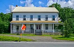 Gifford Grange Hall |
November 10, 1982 (#82001065) |
Western Tpk. 42°44′23″N 74°00′54″W |
Guilderland | |
| 46 | Gillespie House | 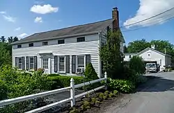 Gillespie House |
November 10, 1982 (#82001066) |
2554 Western Tpk 42°42′45″N 73°55′48″W |
Guilderland | |
| 47 | Godfrey Farmhouse | October 4, 1979 (#79003240) |
1313 Loudon Rd. 42°48′28″N 73°44′05″W |
Cohoes | ||
| 48 | Goodrich School | 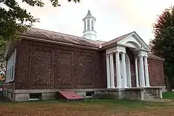 Goodrich School |
September 22, 2000 (#00001156) |
Fiddlers Ln. 42°43′43″N 73°44′46″W |
Colonie | |
| 49 | Gorham House | October 4, 1979 (#79003239) |
347 Loudon Rd. 42°41′30″N 73°45′06″W |
Loudonville | ||
| 50 | Hiram Griggs House | July 19, 2010 (#10000483) |
111 Prospect Terrace 42°42′06″N 74°02′07″W |
Altamont | ||
| 51 | Guilderland Cemetery Vault | November 10, 1982 (#82001067) |
In Guilderland Cemetery, NY 158 42°42′45″N 73°59′16″W |
Guilderland | ||
| 52 | Hamilton Union Church Rectory | November 10, 1982 (#82001068) |
2267 Western Tpk. 42°42′10″N 73°54′27″W |
Guilderland | ||
| 53 | Hamilton Union Presbyterian Church | 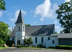 Hamilton Union Presbyterian Church |
November 10, 1982 (#82001069) |
2291 Western Tpk. 42°42′14″N 73°54′32″W |
Guilderland | |
| 54 | Harmony Mill No. 3 | 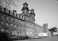 Harmony Mill No. 3 |
February 18, 1971 (#71000525) |
100 N. Mohawk St. 42°46′54″N 73°42′19″W |
Cohoes | |
| 55 | Harmony Mills Historic District | 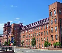 Harmony Mills Historic District |
January 12, 1978 (#78003151) |
Between Mohawk River and RR tracks 42°46′54″N 73°42′34″W |
Cohoes | Thousand-foot-long textile mill built in 1872 is preserved in excellent condition. The largest cotton mill in the United States when first built; was a major employer in the city when open. |
| 56 | Isaac M. Haswell House | October 3, 1985 (#85002707) |
67 Haswell Rd. 42°44′54″N 73°43′34″W |
Colonie | ||
| 57 | Hayes House | 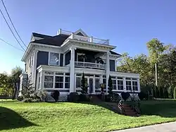 Hayes House |
January 17, 1973 (#73001157) |
104 Fairview Ave. 42°41′57″N 74°01′52″W |
Altamont | |
| 58 | Hedge Lawn | October 3, 1985 (#85002710) |
592 Broadway 42°42′21″N 73°42′55″W |
Colonie | ||
| 59 | Helderberg Reformed Dutch Church | November 10, 1982 (#82001070) |
140 Main St. 42°42′10″N 73°57′52″W |
Guilderland | ||
| 60 | Henry-Remsen House | October 3, 1985 (#85002711) |
34 Spring St. 42°42′58″N 73°45′02″W |
Colonie | ||
| 61 | Ebenezer Hills Jr. Farmhouse | October 3, 1985 (#85002712) |
1010 Troy–Schenectady Rd. 42°45′44″N 73°48′10″W |
Colonie | ||
| 62 | Adam Hilton House | November 10, 1982 (#82001071) |
6073 Leesome Ln. 42°41′31″N 74°02′19″W |
Guilderland | ||
| 63 | Houck Farmhouse | November 10, 1982 (#82001072) |
6156 Ostrander Rd. 42°41′53″N 73°56′48″W |
Guilderland | ||
| 64 | Abraham Houghtaling House | February 20, 1998 (#98000134) |
54 Church St. 42°28′28″N 73°47′56″W |
Coeymans Landing | ||
| 65 | Teunis Houghtaling House | July 28, 2004 (#04000751) |
1045 Clarksville South Rd. 42°33′53″N 73°58′32″W |
Clarksville | ||
| 66 | House at 698 Kenwood Avenue |  House at 698 Kenwood Avenue |
February 7, 2012 (#11001087) |
698 Kenwood Avenue 42°37′43″N 73°51′45″W |
Slingerlands | |
| 67 | Hughson Mansion | October 4, 1979 (#79003245) |
374 Loudon Rd. 42°41′45″N 73°45′19″W |
Loudonville | ||
| 68 | Friend Humphrey House | October 3, 1985 (#85002713) |
372 Albany-Shaker Rd. 42°41′32″N 73°45′49″W |
Colonie | ||
| 69 | John Wolf Kemp House | October 3, 1985 (#85002714) |
216 Wolf Rd. 42°43′33″N 73°47′57″W |
Colonie | Was demolished in May 2003[5] | |
| 70 | Knower House | November 10, 1982 (#82001073) |
3921 Altamont Rd. 42°42′17″N 74°01′13″W |
Guilderland | ||
| 71 | Knox District School No. 5 | May 19, 2005 (#05000441) |
Ketchum Rd. 42°39′38″N 74°02′43″W |
Knox | ||
| 72 | J. Leonard Lackman House | 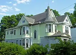 J. Leonard Lackman House |
February 20, 1998 (#98000136) |
28 Imperial Ave. 42°46′15″N 73°42′23″W |
Cohoes | Intact 1895 Queen Anne-style home of local gunsmith-locksmith |
| 73 | Lainhart Farm Complex and Dutch Barn | .JPG.webp) Lainhart Farm Complex and Dutch Barn |
June 8, 2001 (#01000579) |
6755 Lainhart 42°43′26″N 74°01′56″W |
Altamont | |
| 74 | John V. A. Lansing Farmhouse and Billsen Cemetery and Archeological Site | October 3, 1985 (#85002715) |
Address Restricted |
Colonie | ||
| 75 | George H. Lawton House | October 3, 1985 (#85002741) |
27 Maxwell Rd. 42°43′28″N 73°45′24″W |
Colonie | ||
| 76 | LeGrange Farmstead |  LeGrange Farmstead |
December 7, 2005 (#05001384) |
122 Pauley Ln. 42°39′13″N 73°52′56″W |
Slingerlands | |
| 77 | Lock 18 of Enlarged Erie Canal | Lock 18 of Enlarged Erie Canal |
February 18, 1971 (#71000526) |
W of 252 N. Mohawk St., E of Reservoir St. near Manor Ave. 42°47′08″N 73°42′44″W |
Cohoes | High-quality stonework of this ca. 1840 lock on Erie Canal remains; only one of ten in city of Cohoes listed. |
| 78 | Loudon Road Historic District | October 4, 1979 (#79003247) |
Loudon Rd. from Crumite Rd. to Menands Rd. 42°42′02″N 73°45′17″W |
Loudonville | ||
| 79 | Mark House | August 29, 2022 (#100008066) |
99 Johnson Rd. 42°45′54″N 73°44′02″W |
Colonie | ||
| 80 | Matton Shipyard |  Matton Shipyard |
July 24, 2009 (#09000553) |
Delaware Ave. 42°46′46″N 73°40′50″W |
Cohoes | |
| 81 | Brigadier General David McCarty Stone Cottage | July 28, 2015 (#15000474) |
29 2nd St. 42°28′29″N 73°47′32″W |
Coeymans Landing | Mid-18th-century residence of militia officer who served in the Continental Army | |
| 82 | McKownville-Country Club Highlands Historic District | June 2, 2022 (#100007747) |
Western Ave., Waverly Pl., Norwood, Glenwood, Parkwood, and Elmwood Sts. 42°40′51″N 73°50′06″W |
Guilderland | ||
| 83 | McNiven Farm Complex | November 10, 1982 (#82001074) |
4178 Altamont Rd. 42°42′20″N 74°00′10″W |
Guilderland | ||
| 84 | Menand Park Historic District | October 3, 1985 (#85002708) |
Roughly bounded by Menand Rd., Broadway, and Tillinghast Ave. 42°41′38″N 73°43′27″W |
Menands | ||
| 85 | Louis Menand House | October 3, 1985 (#85002742) |
40 Cemetery Ave. 42°42′10″N 73°43′24″W |
Colonie | ||
| 86 | Menands Manor | October 3, 1985 (#85002743) |
272 Broadway 42°41′35″N 73°43′31″W |
Colonie | ||
| 87 | Mull House and Cemetery | 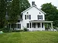 Mull House and Cemetery |
July 22, 1999 (#99000871) |
65 Fox St. 42°30′17″N 73°46′55″W |
Coeymans | |
| 88 | Music Hall | 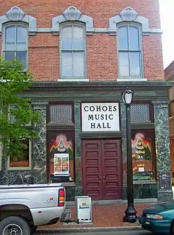 Music Hall |
February 18, 1971 (#71000527) |
NW corner of Remsen and Oneida Sts. 42°46′34″N 73°42′07″W |
Cohoes | 1874 brick building is most significant Second Empire building in Cohoes, with highly decorated facade unusual for the style. Still in use as theater after 1975 restoration, making it fourth-oldest music hall in use in the nation. |
| 89 | Mynderse-Frederick House | 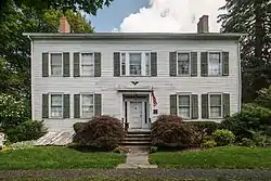 Mynderse-Frederick House |
November 10, 1982 (#82001075) |
152 Main St. 42°42′10″N 73°57′55″W |
Guilderland | |
| 90 | Newtonville Post Office |  Newtonville Post Office |
March 14, 1973 (#73001162) |
552 New Loudon Rd. (NY 9)[6] 42°43′20″N 73°45′26″W |
Newtonville | |
| 91 | Newtonville School | September 22, 2000 (#00001155) |
543 Loudon Rd. 42°43′15″N 73°45′21″W |
Newtonville | ||
| 92 | Newtonville United Methodist Church | 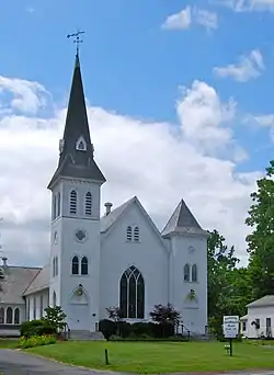 Newtonville United Methodist Church |
May 30, 2001 (#01000580) |
Louden Rd. at Maxwell Rd. 42°43′28″N 73°45′36″W |
Newtonville | |
| 93 | New York State Barge Canal | .jpg.webp) New York State Barge Canal |
October 15, 2014 (#14000860) |
Linear across county 42°47′43″N 73°42′51″W |
Colonie and Cohoes | Successor to Erie Canal approved by state voters in early 20th century to compete with railroads |
| 94 | Norman Vale | December 11, 2009 (#09001079) |
6030 Nott Rd. 42°41′21″N 73°54′20″W |
Guilderland | ||
| 95 | Ohio Street Methodist Episcopal Church Complex | 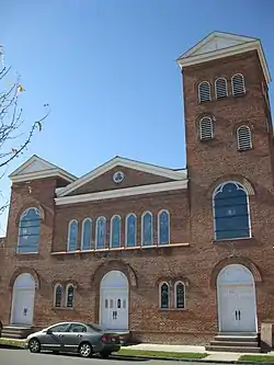 Ohio Street Methodist Episcopal Church Complex |
December 8, 2005 (#05001393) |
1921 Third Ave. 42°43′52″N 73°42′11″W |
Watervliet | |
| 96 | Olmstead Street Historic District | 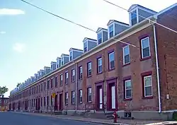 Olmstead Street Historic District |
June 19, 1973 (#73001159) |
Olmstead St. between Ontario and Cayuga Sts. 42°46′30″N 73°42′12″W |
Cohoes | Mill, portion of original Erie Canal and homes built for millworkers, all dating from mid-19th century. A microcosm of the city's economy of that era. |
| 97 | Onesquethaw Valley Historic District | January 17, 1974 (#74001216) |
About 10 miles (16 km) southwest of Albany off NY 43 42°33′20″N 73°54′15″W |
New Scotland | ||
| 98 | Stephen Pangburn House |  Stephen Pangburn House |
November 10, 1982 (#82001076) |
2357 Old State 42°44′35″N 73°58′58″W |
Guilderland | |
| 99 | Charles Parker House | 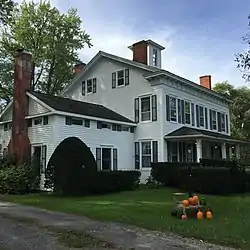 Charles Parker House |
November 10, 1982 (#82001077) |
2273 Old State 42°44′31″N 73°59′21″W |
Guilderland | |
| 100 | Patterson Farmhouse | April 28, 1997 (#96001427) |
47 Murray Ave. 42°36′38″N 73°50′33″W |
Delmar | ||
| 101 | Potter Hollow District No. 19 School | 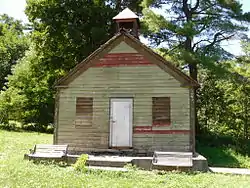 Potter Hollow District No. 19 School |
January 4, 2012 (#11000993) |
County Road 354 42°25′25″N 74°13′35″W |
Potter Hollow | |
| 102 | Presbyterian Church in New Scotland and the New Scotland Cemetery | 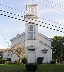 Presbyterian Church in New Scotland and the New Scotland Cemetery |
August 29, 2010 (#10000592) |
2010 New Scotland Rd. and 478 New Scotland Rd. S. 42°37′53″N 73°54′22″W |
New Scotland | |
| 103 | Prospect Hill Cemetery Building |  Prospect Hill Cemetery Building |
November 10, 1982 (#82001078) |
Western Tpk. 42°41′58″N 73°53′58″W |
Guilderland | |
| 104 | Casparus F. Pruyn House | 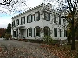 Casparus F. Pruyn House |
October 3, 1985 (#85002744) |
207 Old Niskayuna Rd. 42°43′55″N 73°46′43″W |
Colonie | |
| 105 | Reformed Dutch Church of Rensselaer in Watervliet | 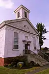 Reformed Dutch Church of Rensselaer in Watervliet |
October 3, 1985 (#85002745) |
210 Old Loudon Rd. 42°44′52″N 73°45′35″W |
Colonie | |
| 106 | Alfred H. Renshaw House | October 3, 1985 (#85002746) |
33 Fiddlers Ln. 42°43′26″N 73°45′02″W |
Colonie | ||
| 107 | Rensselaer and Saratoga Railroad: Green Island Shops | .jpg.webp) Rensselaer and Saratoga Railroad: Green Island Shops |
May 24, 1973 (#73001161) |
James and Tibbits Sts. and the Delaware and Hudson RR tracks 42°45′02″N 73°41′34″W |
Green Island | |
| 108 | Rensselaerville Historic District |  Rensselaerville Historic District |
September 15, 1983 (#83001635) |
Old Albany, Pond Hill, Methodist Hill Rds. and Main St. 42°30′59″N 74°08′06″W |
Rensselaerville | |
| 109 | Rose Hill | 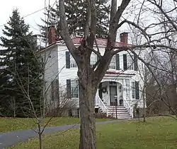 Rose Hill |
November 10, 1982 (#82001079) |
2259 Western Tpk. 42°42′09″N 73°54′20″W |
Guilderland | |
| 110 | Rowe Farm | February 3, 2012 (#11001088) |
281 Bridge St. 42°32′17″N 73°49′34″W |
South Bethlehem | ||
| 111 | Henry M. Sage Estate | July 4, 1980 (#80004398) |
1 Sage Rd. 42°41′38″N 73°44′02″W |
Menands | ||
| 112 | St. Agnes Cemetery | February 28, 2008 (#08000095) |
48 Cemetery Ave. 42°42′08″N 73°43′41″W |
Menands | ||
| 113 | St. Mark's Episcopal Church | 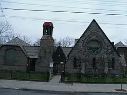 St. Mark's Episcopal Church |
November 7, 1978 (#78001839) |
69-75 Hudson Ave. 42°44′30″N 73°41′30″W |
Green Island | |
| 114 | St. Mark's Lutheran Church | 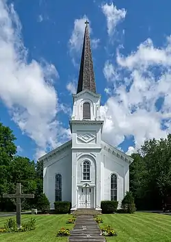 St. Mark's Lutheran Church |
November 10, 1982 (#82001080) |
Main St. 42°42′16″N 73°58′10″W |
Guilderland | Now "Centerpointe Church" |
| 115 | St. Nicholas Ukrainian Catholic Church | _-_front_looking_northeast.JPG.webp) St. Nicholas Ukrainian Catholic Church |
April 15, 2004 (#04000288) |
4th Ave. and 24th St. 42°44′04″N 73°42′13″W |
Watervliet | |
| 116 | St. Paul's Evangelical Lutheran Church | November 2, 2016 (#16000751) |
1728 Helderberg Trail 42°37′31″N 74°08′31″W |
Berne | 1835 brick church marks transition between Federal and Greek Revival styles; hosted first state Anti-Rent convention ten years after construction. | |
| 117 | John Schoolcraft House |  John Schoolcraft House |
November 10, 1982 (#82001081) |
2299 Western Tpk. 42°42′14″N 73°54′36″W |
Guilderland | |
| 118 | Schoolhouse No. 6 | 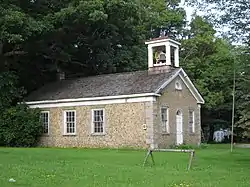 Schoolhouse No. 6 |
November 10, 1982 (#82001082) |
206 Main St. 42°42′14″N 73°58′08″W |
Guilderland | |
| 119 | Schoonmaker House | December 28, 2001 (#01001396) |
283 Beaver Dam Rd. 42°32′40″N 73°47′47″W |
Selkirk | ||
| 120 | Schuyler Flatts Archaeological District |  Schuyler Flatts Archaeological District |
January 21, 1974 (#74001217) |
Address Restricted |
Menands | Area with evidence of 4,000 years of human habitation |
| 121 | Sharp Brothers House | November 10, 1982 (#82001083) |
4382 Western Tpk. 42°44′07″N 73°59′20″W |
Guilderland | ||
| 122 | Sharp Farmhouse | November 10, 1982 (#82001084) |
4379 Western Tpk. 42°44′10″N 73°59′20″W |
Guilderland | ||
| 123 | Israel Shear House |  Israel Shear House |
December 6, 1996 (#96001436) |
NY 143, NW of jct. with Gedney Hill Rd., Hamlet of Coymans Hollow 42°28′20″N 73°53′56″W |
Ravena | |
| 124 | Silliman Memorial Presbyterian Church | August 1, 1979 (#79001565) |
Mohawk and Seneca Sts. 42°46′28″N 73°42′02″W |
Cohoes | 1896 Romanesque church demolished in 1998. | |
| 125 | Simmons Stone House | October 3, 1985 (#85002747) |
554 Boght Rd. 42°47′01″N 73°44′15″W |
Colonie | ||
| 126 | Slingerlands Historic District |  Slingerlands Historic District |
February 14, 2012 (#12000007) |
New Scotland & Mullens Rds., Bridge St. 42°37′47″N 73°51′45″W |
Slingerlands | |
| 127 | Albert Slingerland House | 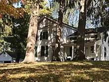 Albert Slingerland House |
February 14, 1997 (#97000068) |
36 Bridge St. 42°37′43″N 73°51′29″W |
Slingerlands | |
| 128 | Springwood Manor | October 4, 1979 (#79003243) |
498 Loudon Rd. 42°42′50″N 73°45′26″W |
Loudonville | ||
| 129 | Jedediah Strong House | October 3, 1985 (#85002748) |
379 Vly Rd. 42°46′00″N 73°49′42″W |
Colonie | ||
| 130 | Tobias Ten Eyck House and Cemeteries | November 25, 1994 (#94001375) |
Old Ravena Rd. (Pictuay Rd.) N of jct. with US 9W 42°30′45″N 73°48′18″W |
Coeymans | ||
| 131 | Treemont Manor | October 3, 1985 (#85002749) |
71 Old Niskayuna Rd. 42°42′52″N 73°45′49″W |
Colonie | ||
| 132 | George Trimble House | October 3, 1985 (#85002750) |
158 Spring Street Rd. 42°42′49″N 73°43′34″W |
Colonie | ||
| 133 | Turner Farmhouse | November 23, 2022 (#100008395) |
475 Loudon Rd. 42°42′40″N 73°45′19″W |
Loudonville | ||
| 134 | US Post Office-Delmar | 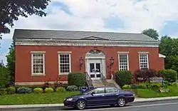 US Post Office-Delmar |
November 17, 1988 (#88002480) |
357 Delaware Ave. 42°37′22″N 73°49′57″W |
Delmar | 1940 building, is only one of 13 Louis Simon post offices in state without a cupola. WPA mural in lobby. |
| 135 | Valley Paper Mill Chimney and Site | 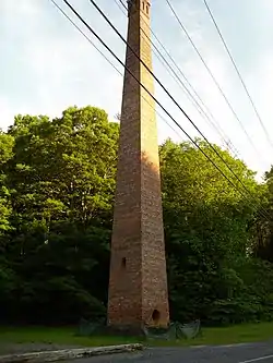 Valley Paper Mill Chimney and Site |
April 21, 2004 (#04000350) |
NY 143 at Cty Rd. 111 42°28′24″N 73°55′24″W |
Alcove | |
| 136 | Van Denbergh-Simmons House | October 3, 1985 (#85002751) |
537 Boght Rd. 42°47′07″N 73°44′05″W |
Colonie | ||
| 137 | C. Van Der Zee House | January 11, 2002 (#01001434) |
NY 143 at Blossom Hill Rd. 42°28′11″N 73°52′46″W |
Coeymans Hollow | ||
| 138 | Van Derheyden House | May 30, 2001 (#01000582) |
823 Delaware Ave. 42°36′37″N 73°52′02″W |
Delmar | ||
| 139 | Cornelius and Agnietje Van Derzee House | April 6, 2005 (#05000259) |
Van Derzee Rd. 42°27′18″N 73°51′49″W |
Coeymans | ||
| 140 | Van Patten Barn Complex | November 10, 1982 (#82001086) |
4773 Western Tpk. 42°43′35″N 73°57′51″W |
Guilderland | ||
| 141 | Van Schaick House | 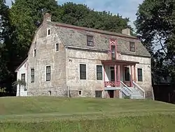 Van Schaick House |
March 18, 1971 (#71000528) |
Van Schaick Ave. and the Delaware & Hudson RR track 42°46′03″N 73°41′13″W |
Cohoes | |
| 142 | Vanderpool Farm Complex | November 10, 1982 (#82001085) |
3647 Settles Hill Rd. 42°43′50″N 74°02′13″W |
Guilderland | ||
| 143 | Veeder Farmhouse No. 1 | November 10, 1982 (#82001087) |
3770 Western Tpk. 42°44′32″N 74°01′29″W |
Guilderland | ||
| 144 | Veeder Farmhouse No. 2 | November 10, 1982 (#82001088) |
3858 Western Tpk 42°44′33″N 74°01′39″W |
Guilderland | ||
| 145 | Verdoy Schoolhouse | 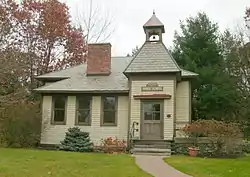 Verdoy Schoolhouse |
March 9, 1997 (#97000117) |
207 Old Niskayuna Rd. 42°43′56″N 73°46′42″W |
Newtonville | Originally added to the National Register on October 3, 1985 with reference number 85002752, then delisted and relisted |
| 146 | Watervliet Arsenal | 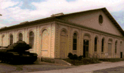 Watervliet Arsenal |
November 13, 1966 (#66000503) |
S. Broadway 42°43′02″N 73°42′33″W |
Watervliet | Oldest U.S. arsenal in continuous use. |
| 147 | Watervliet Shaker Historic District | 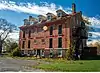 Watervliet Shaker Historic District |
February 20, 1973 (#73001160) |
Watervliet Shaker Rd. 42°44′23″N 73°49′06″W |
Colonie | |
| 148 | Watervliet Side Cut Locks | 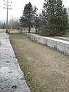 Watervliet Side Cut Locks |
August 12, 1971 (#71000529) |
23rd St. at the Hudson River 42°43′55″N 73°41′55″W |
Watervliet | |
| 149 | Wheeler Home | October 4, 1979 (#79003241) |
485 Loudon Rd. 42°42′46″N 73°45′11″W |
Loudonville | ||
| 150 | Sidney White House | December 7, 2005 (#05001394) |
483 Travis Hill Rd. 42°28′09″N 74°11′59″W |
Preston Hollow | ||
| 151 | Whitney Mansion | October 4, 1979 (#79003242) |
489 Loudon Rd. 42°42′51″N 73°45′13″W |
Loudonville | ||
| 152 | Alexander Willis House | April 16, 2004 (#04000289) |
NY 143 42°28′28″N 73°47′48″W |
Coeymans Landing |
See also
References
- The latitude and longitude information provided in this table was derived originally from the National Register Information System, which has been found to be fairly accurate for about 99% of listings. Some locations in this table may have been corrected to current GPS standards.
- National Park Service, United States Department of the Interior, "National Register of Historic Places: Weekly List Actions", retrieved October 20, 2023.
- Numbers represent an alphabetical ordering by significant words. Various colorings, defined here, differentiate National Historic Landmarks and historic districts from other NRHP buildings, structures, sites or objects.
- The eight-digit number below each date is the number assigned to each location in the National Register Information System database, which can be viewed by clicking the number.
- Anne Miller (May 29, 2003). "A Remnant of Rural Past Turned to Rubble". Albany Times Union. p. B1. Retrieved 2010-02-28.
- Address based on USPS website. Accessed March 29, 2016.
External links
A useful list of the above sites, with street addresses and other information, is available at National Register of Historic Places.Com, a private site serving up public domain information on NRHPs.
