National Register of Historic Places listings in Cass County, Indiana
This is a list of the National Register of Historic Places listings in Cass County, Indiana.

This is intended to be a complete list of the properties and districts on the National Register of Historic Places in Cass County, Indiana, United States. Latitude and longitude coordinates are provided for many National Register properties and districts; these locations may be seen together in a map.[1]
There are 16 properties and districts listed on the National Register in the county, including 1 National Historic Landmark. Another property was once listed but has been removed.
Properties and districts located in incorporated areas display the name of the municipality, while properties and districts in unincorporated areas display the name of their civil township. Properties and districts split between multiple jurisdictions display the names of all jurisdictions.
This National Park Service list is complete through NPS recent listings posted October 20, 2023.[2]
Current listings
| [3] | Name on the Register[4] | Image | Date listed[5] | Location | City or town | Description |
|---|---|---|---|---|---|---|
| 1 | Josephus Atkinson Farm | 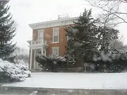 Josephus Atkinson Farm |
June 24, 2010 (#10000373) |
4474 W. 400S, west of Clymers 40°42′24″N 86°27′29″W |
Clinton Township | |
| 2 | Bankers Row Historic District | 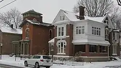 Bankers Row Historic District |
September 17, 1999 (#99001149) |
Eel River Ave. from Market to 3rd 40°45′13″N 86°22′09″W |
Logansport | |
| 3 | Thompson Barnett House | 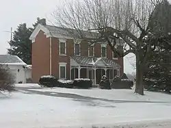 Thompson Barnett House |
August 14, 1986 (#86001620) |
State Road 25, north of Logansport 40°47′02″N 86°21′02″W |
Clay Township | |
| 4 | Courthouse Historic District | 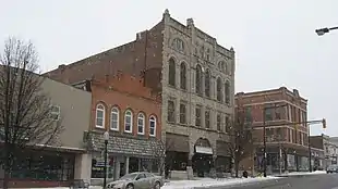 Courthouse Historic District |
March 12, 1999 (#99000294) |
Roughly between 3rd and 6th Sts., E. Melbourne Ave., and High St. 40°45′14″N 86°21′53″W |
Logansport | |
| 5 | Ferguson House |  Ferguson House |
June 30, 1983 (#83000117) |
803 E. Broadway 40°45′17″N 86°21′35″W |
Logansport | |
| 6 | Jerolaman-Long House | 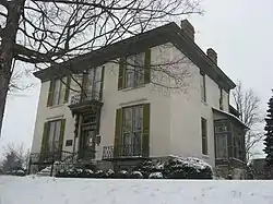 Jerolaman-Long House |
March 28, 1985 (#85000651) |
1004 E. Market St. 40°45′17″N 86°21′24″W |
Logansport | |
| 7 | John Keip House | 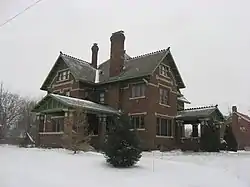 John Keip House |
December 6, 2004 (#04001307) |
2500 E. Broadway Ave. 40°45′34″N 86°20′10″W |
Logansport | |
| 8 | Kendrick-Baldwin House |  Kendrick-Baldwin House |
September 9, 1982 (#82000060) |
706 E. Market St. 40°45′14″N 86°21′39″W |
Logansport | |
| 9 | Pipe Creek Falls Resort | 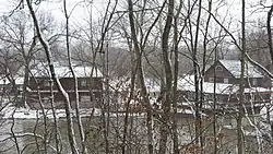 Pipe Creek Falls Resort |
September 14, 1995 (#95001105) |
Junction of County Roads 850E and 275S at Pipe Creek, north of Walton 40°43′36″N 86°13′00″W |
Tipton Township | |
| 10 | Willard B. Place House | 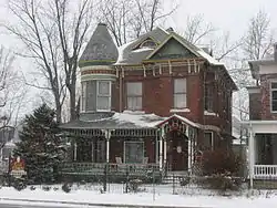 Willard B. Place House |
August 14, 1998 (#98001050) |
900 E. Broadway 40°45′20″N 86°21′31″W |
Logansport | |
| 11 | Pleasant Hill Church | 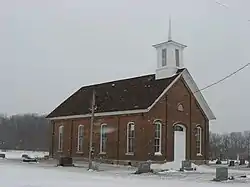 Pleasant Hill Church |
January 11, 1996 (#95001539) |
Junction of County Roads 400S and 675W, southwest of Logansport 40°42′44″N 86°30′06″W |
Clinton Township | |
| 12 | Point Historic District | 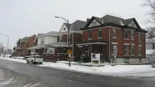 Point Historic District |
September 17, 1999 (#99001150) |
Roughly between Eel River Ave., 3rd, St., and E. Melbourne Ave. 40°45′09″N 86°22′07″W |
Logansport | |
| 13 | Pollard-Nelson House | 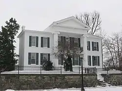 Pollard-Nelson House |
October 29, 1975 (#75000042) |
7th and Market Sts. 40°45′12″N 86°21′41″W |
Logansport | |
| 14 | Riverside Historic District | November 16, 2022 (#100008409) |
Roughly bounded by Erie Ave., High, and Market Sts. Coordinates missing |
Logansport | ||
| 15 | Spencer Park Dentzel Carousel | 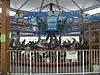 Spencer Park Dentzel Carousel |
February 27, 1987 (#87000838) |
Riverside Park 40°45′34″N 86°21′20″W |
Logansport | |
| 16 | Henry Tousley House | 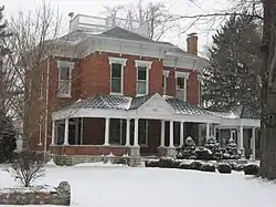 Henry Tousley House |
October 15, 2002 (#02001167) |
1912 High St. 40°45′37″N 86°20′42″W |
Logansport |
Former listing
| [3] | Name on the Register | Image | Date listed | Date removed | Location | City or town | Description |
|---|---|---|---|---|---|---|---|
| 1 | Washington School | March 2, 1981 (#81000027) | February 1, 1985 | 101 N. Cicott St. 40°44′55″N 86°22′40″W |
Logansport |
See also
References
- The latitude and longitude information provided in this table was derived originally from the National Register Information System, which has been found to be fairly accurate for about 99% of listings. Some locations in this table may have been corrected to current GPS standards.
- National Park Service, United States Department of the Interior, "National Register of Historic Places: Weekly List Actions", retrieved October 20, 2023.
- Numbers represent an alphabetical ordering by significant words. Various colorings, defined here, differentiate National Historic Landmarks and historic districts from other NRHP buildings, structures, sites or objects.
- "National Register Information System". National Register of Historic Places. National Park Service. March 13, 2009.
- The eight-digit number below each date is the number assigned to each location in the National Register Information System database, which can be viewed by clicking the number.
| Topics | |
|---|---|
| Lists by state |
|
| Lists by insular areas | |
| Lists by associated state | |
| Other areas | |
| Related | |

Municipalities and communities of Cass County, Indiana, United States | ||
|---|---|---|
| City | Map of Indiana highlighting Cass County | |
| Towns | ||
| Townships | ||
| CDPs | ||
| Other communities | ||
| Footnotes | ‡This populated place also has portions in an adjacent county or counties | |