National Register of Historic Places listings in Henry County, Iowa
This is a list of the National Register of Historic Places listings in Henry County, Iowa.
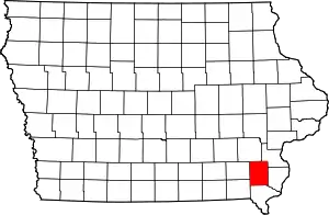
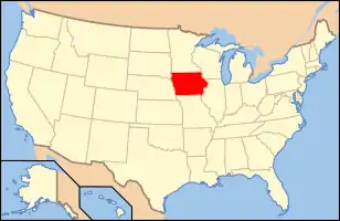
Location of Henry County in Iowa
This is intended to be a complete list of the properties and districts on the National Register of Historic Places in Henry County, Iowa, United States. Latitude and longitude coordinates are provided for many National Register properties and districts; these locations may be seen together in a map.[1]
There are 52 properties and districts listed on the National Register in the county.
This National Park Service list is complete through NPS recent listings posted October 20, 2023.[2]
Current listings
| [3] | Name on the Register[4] | Image | Date listed[5] | Location | City or town | Description |
|---|---|---|---|---|---|---|
| 1 | G. W. S. Allen House | 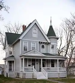 G. W. S. Allen House |
April 11, 1985 (#85000721) |
207 E. Henry St. 40°58′08″N 91°33′00″W |
Mount Pleasant | |
| 2 | Henry Ambler House | 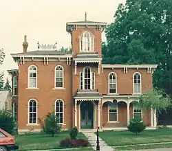 Henry Ambler House |
April 10, 1986 (#86000717) |
405 Broadway 40°58′13″N 91°33′17″W |
Mount Pleasant | |
| 3 | Dr. J.O. and Catherine Ball House | 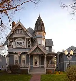 Dr. J.O. and Catherine Ball House |
May 18, 1994 (#94000404) |
500 W. Monroe St. 40°58′01″N 91°33′31″W |
Mount Pleasant | |
| 4 | John and Lavina Bangs House | 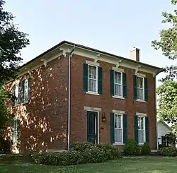 John and Lavina Bangs House |
August 28, 2003 (#03000831) |
2759 Old Highway 24 40°54′52″N 91°22′46″W |
New London | |
| 5 | Benjamin Chapel and Richwoods Cemetery | 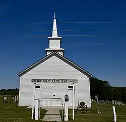 Benjamin Chapel and Richwoods Cemetery |
October 23, 2015 (#15000746) |
1936 Franklin Ave. 41°02′07″N 91°37′13″W |
Trenton | |
| 6 | Bicksler Block | 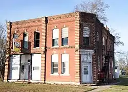 Bicksler Block |
May 28, 2010 (#10000291) |
101-103 West Cherry St. 40°51′17″N 91°37′17″W |
Salem | |
| 7 | Hugh and Matilda Boyle House and Cemetery Historic District | October 23, 2015 (#15000747) |
3225 Lexington Ave. 40°50′59″N 91°30′06″W |
Lowell | ||
| 8 | Brazelton House | 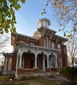 Brazelton House |
January 27, 1983 (#83000366) |
401 N. Main St. 40°58′12″N 91°33′10″W |
Mount Pleasant | |
| 9 | Brazelton House Hotel | 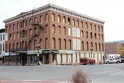 Brazelton House Hotel |
September 22, 1986 (#86002700) |
100 N. Main St. 40°57′56″N 91°33′06″W |
Mount Pleasant | |
| 10 | Budde-Singer Building | 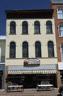 Budde-Singer Building |
September 6, 1991 (#91001112) |
110 N. Main 40°58′01″N 91°33′09″W |
Mount Pleasant | |
| 11 | Camp Harlan-Camp McKean Historic District | 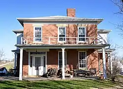 Camp Harlan-Camp McKean Historic District |
January 2, 2013 (#12001117) |
2260 Hickory Ave. 40°58′35″N 91°34′57″W |
Mount Pleasant | |
| 12 | City Hall | 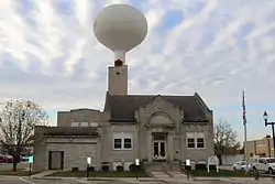 City Hall |
September 6, 1991 (#91001120) |
220 W. Monroe 40°58′00″N 91°33′20″W |
Mount Pleasant | |
| 13 | Collins-Bond House |  Collins-Bond House |
October 28, 2010 (#10000869) |
402 S. Main St. 40°51′06″N 91°37′17″W |
Salem | |
| 14 | Cook-Johnson House | 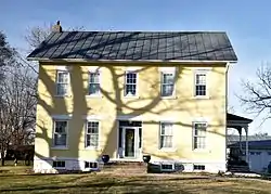 Cook-Johnson House |
May 28, 2010 (#10000292) |
3091 Franklin Ave. 40°51′28″N 91°37′19″W |
Salem | |
| 15 | George and Margaret Cooper House | 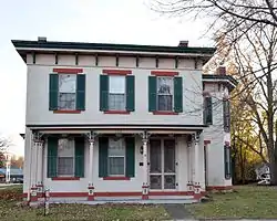 George and Margaret Cooper House |
May 2, 1997 (#97000393) |
400 W. Monroe St. 40°57′46″N 91°33′05″W |
Mount Pleasant | |
| 16 | Joseph A. and Lydia A. Edwards House | 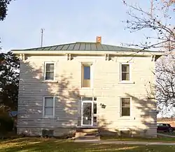 Joseph A. and Lydia A. Edwards House |
October 23, 2015 (#15000748) |
1735 Salem Rd. 40°50′48″N 91°34′40″W |
Salem | |
| 17 | Farmers Savings Bank | 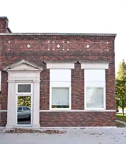 Farmers Savings Bank |
May 28, 2010 (#10000293) |
101 S Main St. 40°51′17″N 91°37′17″W |
Salem | |
| 18 | First National Bank | 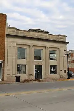 First National Bank |
September 6, 1991 (#91001118) |
101 S. Jefferson 40°57′59″N 91°33′17″W |
Mount Pleasant | |
| 19 | Fish Creek Bridge | May 15, 1998 (#98000524) |
Hickory Rd. over Fish Creek 40°51′14″N 91°34′51″W |
Salem | ||
| 20 | Owen A. and Emma J. Garretson House |  Owen A. and Emma J. Garretson House |
October 23, 2015 (#15000750) |
1878 335th St. 40°49′15″N 91°33′04″W |
Salem | |
| 21 | Geode State Park, Civilian Conservation Corps Area | 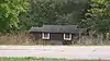 Geode State Park, Civilian Conservation Corps Area |
November 15, 1990 (#90001673) |
County Road X23 east of Lowell 40°49′59″N 91°23′11″W |
Danville | |
| 22 | Harlan House Hotel | 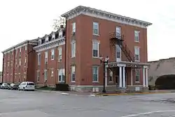 Harlan House Hotel |
November 16, 1987 (#87002019) |
122 N. Jefferson St. 40°58′00″N 91°33′15″W |
Mount Pleasant | |
| 23 | Harlan-Lincoln House |  Harlan-Lincoln House |
May 25, 1973 (#73000726) |
101 W. Broad St. 40°58′18″N 91°32′57″W |
Mount Pleasant | |
| 24 | Henry County Courthouse | 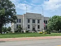 Henry County Courthouse |
July 2, 1981 (#81000244) |
100 E. Washington St. 40°57′56″N 91°33′12″W |
Mount Pleasant | |
| 25 | Henry County Savings Bank | 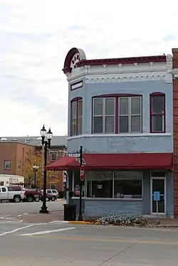 Henry County Savings Bank |
September 6, 1991 (#91001116) |
100 S. Main 40°57′59″N 91°33′10″W |
Mount Pleasant | |
| 26 | Holtkamp Round Barn | 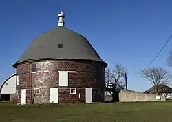 Holtkamp Round Barn |
June 30, 1986 (#86001436) |
Off U.S. Route 218 40°49′17″N 91°34′09″W |
Salem | |
| 27 | Samuel and Sarah Hulme House | July 3, 2019 (#100004114) |
1577 Franklin Ave. 41°04′45″N 91°38′24″W |
Trenton vicinity | ||
| 28 | Charles E. Hult House Summer Kitchen and Wood Shed | 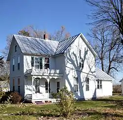 Charles E. Hult House Summer Kitchen and Wood Shed |
July 15, 1999 (#99000830) |
1904 140th St. 41°06′17″N 91°32′39″W |
Swedesburg | |
| 29 | John Hultquist House | 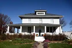 John Hultquist House |
July 15, 1999 (#99000828) |
105 Park St. 41°06′17″N 91°32′39″W |
Swedesburg | |
| 30 | Henderson Lewelling House | 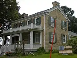 Henderson Lewelling House |
June 21, 1982 (#82002620) |
W. Main St. 40°49′42″N 91°41′17″W |
Salem | |
| 31 | Lamm-Pollmiller Farmstead District | 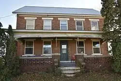 Lamm-Pollmiller Farmstead District |
May 28, 2010 (#10000294) |
1584 335th St. 40°49′16″N 91°36′21″W |
Salem | |
| 32 | Louisa Building | 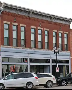 Louisa Building |
September 6, 1991 (#91001117) |
120 S. Main 40°57′56″N 91°33′10″W |
Mount Pleasant | |
| 33 | Masonic Temple Theater | 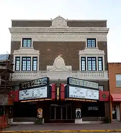 Masonic Temple Theater |
September 6, 1991 (#91001119) |
115 N. Main 40°58′02″N 91°33′11″W |
Mount Pleasant | |
| 34 | Masters Building | 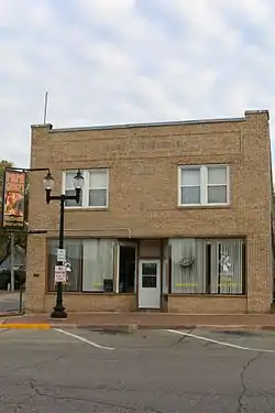 Masters Building |
September 6, 1991 (#91001121) |
221 W. Monroe 40°58′01″N 91°33′20″W |
Mount Pleasant | |
| 35 | McCandless Building | 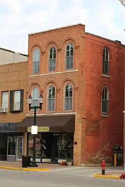 McCandless Building |
September 6, 1991 (#91001111) |
115 W. Monroe 40°58′01″N 91°33′13″W |
Mount Pleasant | |
| 36 | McClellan's General Store | 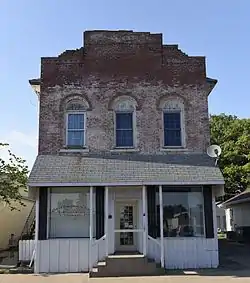 McClellan's General Store |
August 28, 2003 (#03000828) |
107 E. Main 40°55′40″N 91°24′04″W |
New London | |
| 37 | Mount Pleasant Public Library | 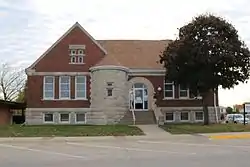 Mount Pleasant Public Library |
May 23, 1983 (#83000367) |
200 N. Main St. 40°56′28″N 91°33′45″W |
Mount Pleasant | |
| 38 | National State Bank | 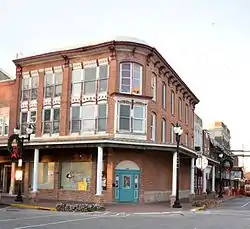 National State Bank |
September 6, 1991 (#91001115) |
101 W. Monroe 40°58′00″N 91°33′11″W |
Mount Pleasant | |
| 39 | Oakland Mills Bridge | 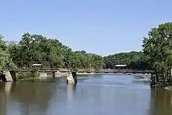 Oakland Mills Bridge |
May 15, 1998 (#98000525) |
County Road W55 over the Skunk River 40°56′07″N 91°37′09″W |
Oakland Mills State Park | |
| 40 | Old Main |  Old Main |
March 26, 1973 (#73000727) |
Iowa Wesleyan College campus 40°58′31″N 91°32′34″W |
Mount Pleasant | |
| 41 | Peterson Manufacturing Building | 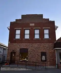 Peterson Manufacturing Building |
August 29, 1997 (#97000962) |
213 W. Main St. 40°55′33″N 91°24′13″W |
New London | |
| 42 | Pleasant Lawn School Historic District | 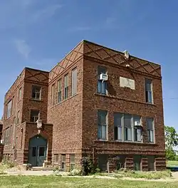 Pleasant Lawn School Historic District |
March 25, 1987 (#87000477) |
Off Iowa Highway 218 41°01′01″N 91°29′39″W |
Mount Pleasant | |
| 43 | Red Ball Garage | 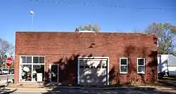 Red Ball Garage |
July 15, 1999 (#99000826) |
1901 140th St. 41°06′19″N 91°32′39″W |
Swedesburg | |
| 44 | Isaac and Agnes (Bells) Reeves House | 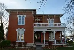 Isaac and Agnes (Bells) Reeves House |
October 28, 2010 (#10000871) |
209 S. Main St. 40°51′13″N 91°37′17″W |
Salem | |
| 45 | Christian K. and Margaret (Rich) Schantz House and Carpentry Shop | _Schantz_House_.jpg.webp) Christian K. and Margaret (Rich) Schantz House and Carpentry Shop |
February 19, 2021 (#100006173) |
116 West 2nd St. 41°08′47″N 91°39′38″W |
Wayland | |
| 46 | Second Baptist Church |  Second Baptist Church |
November 12, 2014 (#14000906) |
407 Saunders St. 40°58′13″N 91°33′28″W |
Mount Pleasant | |
| 47 | Swedesburg Historic Commercial District | 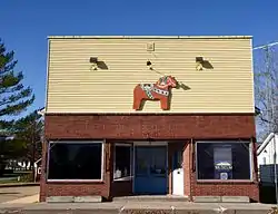 Swedesburg Historic Commercial District |
July 15, 1999 (#99000829) |
107 Iowa Highway 218 41°06′16″N 91°32′41″W |
Swedesburg | |
| 48 | Swedish Evangelical Lutheran Church | 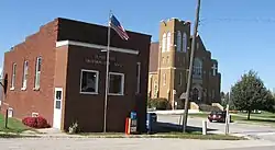 Swedish Evangelical Lutheran Church |
July 15, 1999 (#99000827) |
1897 140th St. 41°06′19″N 91°32′43″W |
Swedesburg | |
| 49 | Timmerman-Burd Building | Timmerman-Burd Building |
September 6, 1991 (#91001113) |
118 S. Main 40°57′57″N 91°33′10″W |
Mount Pleasant | |
| 50 | Union Block | 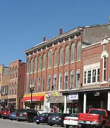 Union Block |
September 6, 1991 (#91001110) |
109-113 W. Monroe 40°57′56″N 91°33′13″W |
Mount Pleasant | On the Most Endangered list of the Iowa Historic Preservation Alliance[6] |
| 51 | Paton and Hannah Wilson House | 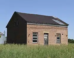 Paton and Hannah Wilson House |
October 28, 2010 (#10000870) |
1360 280th St. 40°58′32″N 91°33′04″W |
Salem | |
| 52 | Zuhn Building |  Zuhn Building |
September 6, 1991 (#91001114) |
201 E. Monroe 40°58′32″N 91°33′04″W |
Mount Pleasant |
Former listings
| [3] | Name on the Register | Image | Date listed | Date removed | Location | Description |
|---|---|---|---|---|---|---|
| 1 | Smith and Weller Building | 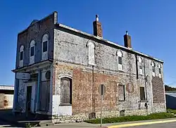 Smith and Weller Building |
August 28, 2003 (#03000830) | July 31, 2020 | 100 E. Main 40°55′38″N 91°24′05″W |
See also
Wikimedia Commons has media related to National Register of Historic Places in Henry County, Iowa.
- List of National Historic Landmarks in Iowa
- National Register of Historic Places listings in Iowa
- Listings in neighboring counties: Des Moines, Jefferson, Lee, Louisa, Van Burnen, Washington
References
- The latitude and longitude information provided in this table was derived originally from the National Register Information System, which has been found to be fairly accurate for about 99% of listings. Some locations in this table may have been corrected to current GPS standards.
- National Park Service, United States Department of the Interior, "National Register of Historic Places: Weekly List Actions", retrieved October 20, 2023.
- Numbers represent an alphabetical ordering by significant words. Various colorings, defined here, differentiate National Historic Landmarks and historic districts from other NRHP buildings, structures, sites or objects.
- "National Register Information System". National Register of Historic Places. National Park Service. April 24, 2008.
- The eight-digit number below each date is the number assigned to each location in the National Register Information System database, which can be viewed by clicking the number.
- Iowa's Most Endangered Properties, "IHPA Most Endangered Properties". Archived from the original on 2008-10-07. Retrieved 2008-12-22.
| Topics | |
|---|---|
| Lists by state |
|
| Lists by insular areas | |
| Lists by associated state | |
| Other areas | |
| Related | |
Municipalities and communities of Henry County, Iowa, United States | ||
|---|---|---|
| Cities | Map of Iowa highlighting Henry County | |
| CDPs | ||
| Unincorporated community | ||
| Footnotes | ‡This populated place also has portions in an adjacent county or counties | |
This article is issued from Wikipedia. The text is licensed under Creative Commons - Attribution - Sharealike. Additional terms may apply for the media files.