National Register of Historic Places listings in Islip (town), New York
This is a List of the National Register of Historic Places listings in the Town of Islip, New York
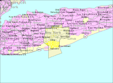
Map showing Islip in central Long Island
This list is intended to provide a comprehensive listing of entries in the National Register of Historic Places in Town of Islip, New York. The locations of National Register properties for which the latitude and longitude coordinates are included below, may be seen in an online map.[1]
Listings
| [2] | Name on the Register | Image | Date listed[3] | Location | City or town | Description |
|---|---|---|---|---|---|---|
| 1 | Bay Shore Hose Company No. 1 Firehouse | 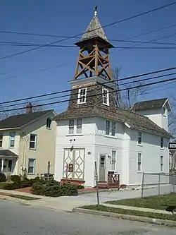 Bay Shore Hose Company No. 1 Firehouse |
August 15, 2001 (#01000851) |
Second Avenue 40°43′29″N 73°14′46″W |
Bay Shore | |
| 2 | Bay Shore Methodist Episcopal Church | 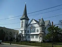 Bay Shore Methodist Episcopal Church |
August 15, 2001 (#01000847) |
East Main Street, jct. Second Avenue 40°43′24″N 73°14′45″W |
Bay Shore | |
| 3 | Bayard Cutting Estate | 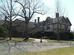 Bayard Cutting Estate |
October 2, 1973 (#73001271) |
NY 27A, Great River 40°44′09″N 73°09′45″W |
Great River | Part of Bayard Cutting Arboretum State Park |
| 4 | Cerny's Bakery | 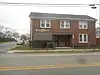 Cerny's Bakery |
August 17, 2020 (#100005450) |
1165 Smithtown Ave. 40°46′17″N 73°06′32″W |
Bohemia | Former Czech-American bakery, currently a residence. |
| 5 | Davis Field | 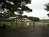 Davis Field |
January 22, 2008 (#07001456) |
2nd Street & 3rd Avenue 40°45′30″N 73°03′12″W |
Bayport | Also known as Bayport Aerodrome |
| 6 | The Edwards House | 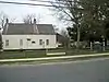 The Edwards House |
December 7, 2010 (#10000988) |
39 Edwards St. 40°43′53″N 73°04′47″W |
Sayville | Headquarters of the Sayville Historical Society |
| 7 | Fire Island Light Station | 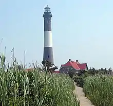 Fire Island Light Station |
September 11, 1981 (#81000082) |
Robert Moses Causeway 40°37′55″N 73°13′08″W |
Bay Shore | Fire Island Light Station Historic District boundary increase (listed January 29, 2010, refnum 09001288): Burma Rd., Fire Island |
| 8 | First Congregational Church of Bay Shore | 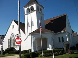 First Congregational Church of Bay Shore |
May 3, 2002 (#02000448) |
1860 Union Boulevard 40°43′33″N 73°14′46″W |
Bay Shore | |
| 9 | Rafael Guastavino Jr. House | 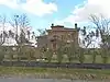 Rafael Guastavino Jr. House |
December 11, 2013 (#13000912) |
143 Awixa Avenue 40°43′00″N 73°14′03″W |
Bay Shore | Unique Mediterranean-style house built in 1914, faced in fireproof ceramic tile, by inventor of tile. |
| 10 | Modern Times School | .JPG.webp) Modern Times School |
December 23, 1994 (#94001478) |
Jct. of Third Avenue and First Street 40°46′36″N 73°15′16″W |
Brentwood | |
| 11 | MODESTY (south-sider sloop) | 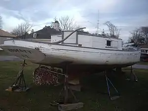 MODESTY (south-sider sloop) |
August 7, 2001 (#01001051) |
86 West Avenue, Long Island Maritime Museum 40°43′22″N 73°05′43″W |
West Sayville | |
| 12 | John Mollenhauer House | 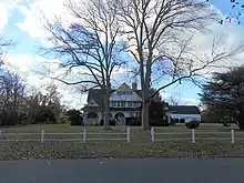 John Mollenhauer House |
September 3, 2014 (#14000540) |
60 Awixa Ave. 40°43′21″N 73°14′06″W |
Bay Shore | 1893 home of "Sugar King of Brooklyn" is excellent example of Shingle style estate |
| 13 | Jacob Ockers House | 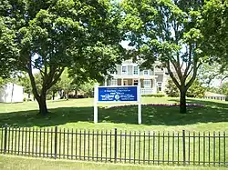 Jacob Ockers House |
July 10, 1992 (#92000838) |
965 Montauk Highway 40°44′21″N 73°07′23″W |
Oakdale | |
| 14 | Priscilla (Long Island Sound Oyster Sloop) | 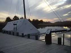 Priscilla (Long Island Sound Oyster Sloop) |
February 17, 2006 (#06000238) |
Waterfront, Long Island Maritime Museum, 86 West Avenue 40°43′21″N 73°05′45″W |
West Sayville | |
| 15 | John Ellis Roosevelt Estate | 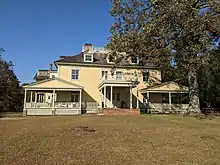 John Ellis Roosevelt Estate |
November 5, 1987 (#87001896) |
Middle Road 40°44′22″N 73°04′19″W |
Sayville | On the grounds of Sans Soucci Lakes County Park |
| 16 | Rudolph Oyster House | 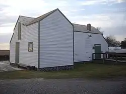 Rudolph Oyster House |
August 7, 2001 (#01001052) |
86 West Avenue, Long Island Maritime Museum 40°43′21″N 73°05′45″W |
West Sayville | |
| 17 | Sagtikos Manor | 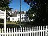 Sagtikos Manor |
November 21, 1976 (#76001284) |
Montauk Highway (NY 27A) 40°42′10″N 73°16′36″W |
West Bay Shore | |
| 18 | St. Ann's Episcopal Church | 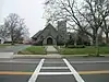 St. Ann's Episcopal Church |
August 30, 2010 (#10000611) |
257 Middle Rd. 40°44′09″N 73°04′24″W |
Sayville | From Isaac Henry Green, Jr. Suffolk and Nassau Counties, New York MPS. (Official Site). |
| 19 | St. Johns Episcopal Church and Cemetery | .JPG.webp) St. Johns Episcopal Church and Cemetery |
January 28, 1994 (#93001559) |
Montauk Highway Northeast side, about 300' Northwest of the jct. with Locust Avenue 40°44′07″N 73°07′02″W |
Oakdale | |
| 20 | Sayville Congregational Church | 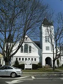 Sayville Congregational Church |
July 27, 2005 (#05000747) |
131 Middle Road 40°44′11″N 73°04′50″W |
Sayville | |
| 21 | Sisters of St. Joseph Motherhouse, Brentwood | 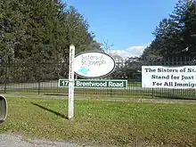 Sisters of St. Joseph Motherhouse, Brentwood |
May 7, 2018 (#100002388) |
1725 Brentwood Rd. 40°46′22″N 73°14′27″W |
Brentwood | See this link |
| 22 | Southside Sportsmens Club District | 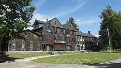 Southside Sportsmens Club District |
July 23, 1973 (#73001272) |
Northeast of Great River, off NY 27 40°45′01″N 73°09′02″W |
Great River | Part of Connetquot River State Park Preserve |
| 23 | US Post Office-Bay Shore | 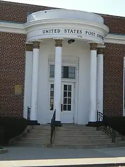 US Post Office-Bay Shore |
November 17, 1988 (#88002455) |
10 Bay Shore Avenue 40°43′23″N 73°14′41″W |
Bay Shore | |
| 24 | Wereholme | 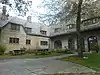 Wereholme |
January 4, 2007 (#06001208) |
550 South Bay Avenue 40°42′48″N 73°12′50″W |
Islip | Also known as the Harold H. Weekes Estate. Now part of the Seatuck National Wildlife Refuge. |
| 25 | Winganhauppauge | 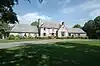 Winganhauppauge |
November 15, 2010 (#10000912) |
77 St. Marks Lane 40°43′32″N 73°12′15″W |
Islip | |
| 26 | Joseph Wood House | 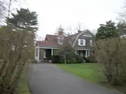 Joseph Wood House |
May 18, 2003 (#03000406) |
284 Greene Avenue 40°44′09″N 73°04′33″W |
Sayville |
See also
References
- The latitude and longitude information provided is primarily from the National Register Information System, and has been found to be fairly accurate for about 99% of listings. For 1%, the location info may be way off. We seek to correct the coordinate information wherever it is found to be erroneous. Please leave a note in the Discussion page for this article if you believe any specific location is incorrect.
- Numbers represent an alphabetical ordering by significant words. Various colorings, defined here, differentiate National Historic Landmarks and historic districts from other NRHP buildings, structures, sites or objects.
- The eight-digit number below each date is the number assigned to each location in the National Register Information System database, which can be viewed by clicking the number.

This article is issued from Wikipedia. The text is licensed under Creative Commons - Attribution - Sharealike. Additional terms may apply for the media files.