Nový Jičín District
Nový Jičín District (Czech: okres Nový Jičín) is a district in the Moravian-Silesian Region of the Czech Republic. Its capital is the town of Nový Jičín.
Nový Jičín District
Okres Nový Jičín | |
|---|---|
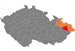 Location in the Moravian-Silesian Region within the Czech Republic | |
| Coordinates: 49°39′N 18°1′E | |
| Country | |
| Region | Moravian-Silesian |
| Capital | Nový Jičín |
| Area | |
| • Total | 881.85 km2 (340.48 sq mi) |
| Population (2023)[2] | |
| • Total | 151,814 |
| • Density | 170/km2 (450/sq mi) |
| Time zone | UTC+1 (CET) |
| • Summer (DST) | UTC+2 (CEST) |
| Municipalities | 54 |
| * Towns | 9 |
| * Market towns | 2 |
Administrative division
Nový Jičín District is divided into five administrative districts of municipalities with extended competence: Nový Jičín, Bílovec, Frenštát pod Radhoštěm, Kopřivnice and Odry.
List of municipalities
Towns are marked in bold and market towns in italics:
Albrechtičky - Bartošovice - Bernartice nad Odrou - Bílov - Bílovec - Bítov - Bordovice - Bravantice - Frenštát pod Radhoštěm - Fulnek - Heřmanice u Oder - Heřmánky - Hladké Životice - Hodslavice - Hostašovice - Jakubčovice nad Odrou - Jeseník nad Odrou - Jistebník - Kateřinice - Kopřivnice - Kujavy - Kunín - Libhošť - Lichnov - Luboměř - Mankovice - Mořkov - Mošnov - Nový Jičín - Odry - Petřvald - Příbor - Pustějov - Rybí - Sedlnice - Šenov u Nového Jičína - Skotnice - Slatina - Spálov - Starý Jičín - Štramberk - Studénka - Suchdol nad Odrou - Tichá - Tísek - Trnávka - Trojanovice - Velké Albrechtice - Veřovice - Vražné - Vrchy - Závišice - Ženklava - Životice u Nového Jičína
Geography
.jpg.webp)
The terrain is very varied. While the axis of the territory is formed by a lowland, in the north it turns into highlands and in the south it turns into mountains. The territory extends into four geomorphological mesoregions: Nízký Jeseník (north), Moravian Gate (centre), Moravian-Silesian Foothills (centre), and Moravian-Silesian Beskids (south). The highest point of the district is the mountain Radhošť in Trojanovice with an elevation of 1,129 m (3,704 ft). The lowest point of the district is the river bed of the Oder in Jistebník at 221 m (725 ft).
From the total district area of 881.9 km2 (340.5 sq mi), agricultural land occupies 558.3 km2 (215.6 sq mi), forests occupy 203.9 km2 (78.7 sq mi), and water area occupies 18.5 km2 (7.1 sq mi). Forests cover 23.1% of the district's area.[1]
The most important river is the Oder, which flows across the district from west to east. Its most important tributaries in the district are the Jičínka and Bílovka. The Oder river valley is rich in ponds, otherwise there are not many bodies of water.
The southern part of the territory is protected as the Beskydy Protected Landscape Area. The central part of the territory along the Oder River is protected as the Poodří Protected Landscape Area.
Demographics
|
|
| ||||||||||||||||||||||||||||||||||||||||||||||||||||||
| Source: Censuses[3][4] | ||||||||||||||||||||||||||||||||||||||||||||||||||||||||
Most populated municipalities
| Name | Population[2] | Area (km2) |
|---|---|---|
| Nový Jičín | 23,015 | 37 |
| Kopřivnice | 21,669 | 27 |
| Frenštát pod Radhoštěm | 10,709 | 11 |
| Studénka | 9,326 | 31 |
| Příbor | 8,364 | 22 |
| Bílovec | 7,429 | 39 |
| Odry | 7,424 | 74 |
| Fulnek | 5,545 | 68 |
| Štramberk | 3,515 | 9 |
| Starý Jičín | 2,934 | 34 |
Economy
The largest employers with headquarters in Nový Jičín District and at least 1,000 employees are:[5]
| Economic entity | Location | Number of employees | Main activity |
|---|---|---|---|
| Brose CZ | Kopřivnice | 2,500–2,999 | Automotive industry |
| PO Lighting Czech | Šenov u Nového Jičína | 2,500–2,999 | Automotive industry |
| Hanon Systems Autopal | Nový Jičín | 1,500–1,999 | Automotive industry |
| Tatra Trucks | Kopřivnice | 1,000–1,499 | Automotive industry |
| Mobis Automotive System Czech | Mošnov | 1,000–1,499 | Automotive industry |
| Plakor Czech | Mošnov | 1,000–1,499 | Automotive industry |
| AGEL Hospital Nový Jičín | Nový Jičín | 1,000–1,499 | Health care |
Transport
The D1 motorway from Brno to Ostrava and the D48 motorway (part of the European route E462) from Nový Jičín to the Czech-Polish border pass through the district.
Sights

The most important monuments in the district, protected as national cultural monuments, are:[6]
- Moravian Church meeting house in Fulnek
- Birthplace of František Palacký in Hodslavice
- Slovenská strela train in Tatra Technical Museum in Kopřivnice
The best-preserved settlements, protected as monument reservations and monument zones, are:[7]
- Nový Jičín (monument reservation)
- Příbor (monument reservation)
- Štramberk (monument reservation)
- Bílovec
- Frenštát pod Radhoštěm
- Fulnek
- Odry
The most visited tourist destinations are the Stezka Valaška treetop walkway near Pustevny and Tatra Technical Museum in Kopřivnice.[8]
Notable people
References
- "Land use (as at 31 December)". Public database. Czech Statistical Office. Retrieved 2023-05-19.
- "Population of Municipalities – 1 January 2023". Czech Statistical Office. 2023-05-23.
- "Historický lexikon obcí České republiky 1869–2011 – Okres Nový Jičín" (in Czech). Czech Statistical Office. 2015-12-21. pp. 1–2.
- "Population Census 2021: Population by sex". Public Database. Czech Statistical Office. 2021-03-27.
- "Registr ekonomických subjektů". Business Register (in Czech). Czech Statistical Office. Retrieved 2023-04-13.
- "Výsledky vyhledávání: Národní kulturní památky, okres Nový Jičín". Ústřední seznam kulturních památek (in Czech). National Heritage Institute. Retrieved 2023-04-15.
- "Výsledky vyhledávání: Památkové rezervace, Památkové zóny, okres Nový Jičín". Ústřední seznam kulturních památek (in Czech). National Heritage Institute. Retrieved 2023-04-15.
- "Turisté mají v České republice nejraději zoologické zahrady, technické památky, koupání a Pražský hrad" (in Czech). CzechTourism. 2022-06-24. Retrieved 2023-04-15.
External links
- Nový Jičín District – profile on the Czech Statistical Office website