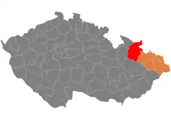
Bruntál District
Bruntál District (Czech: okres Bruntál) is a district in the Moravian-Silesian Region of the Czech Republic. Its capital is the town of Bruntál, but the most populated town is Krnov.
Bruntál District
Okres Bruntál | |
|---|---|
 Location in the Moravian-Silesian Region within the Czech Republic | |
| Coordinates: 50°3′N 17°26′E | |
| Country | |
| Region | Moravian-Silesian |
| Capital | Bruntál |
| Area | |
| • Total | 1,536.65 km2 (593.30 sq mi) |
| Population (2023)[2] | |
| • Total | 89,834 |
| • Density | 58/km2 (150/sq mi) |
| Time zone | UTC+1 (CET) |
| • Summer (DST) | UTC+2 (CEST) |
| Municipalities | 67 |
| * Towns | 9 |
| * Market towns | 0 |
Administrative division
Bruntál District is divided into three administrative districts of municipalities with extended competence: Bruntál, Krnov and Rýmařov.
List of municipalities
Towns are marked in bold:
Andělská Hora – Bílčice – Bohušov – Brantice – Bruntál – Břidličná – Býkov-Láryšov – Čaková – Dětřichov nad Bystřicí – Dívčí Hrad – Dlouhá Stráň – Dolní Moravice – Dvorce – Heřmanovice – Hlinka – Holčovice – Horní Benešov – Horní Město – Horní Životice – Hošťálkovy – Janov – Jindřichov – Jiříkov – Karlova Studánka – Karlovice – Krasov – Krnov – Křišťanovice – Leskovec nad Moravicí – Lichnov – Liptaň – Lomnice – Ludvíkov – Malá Morávka – Malá Štáhle – Město Albrechtice – Mezina – Milotice nad Opavou – Moravskoslezský Kočov – Nová Pláň – Nové Heřminovy – Oborná – Osoblaha – Petrovice – Razová – Roudno – Rudná pod Pradědem – Rusín – Rýmařov – Ryžoviště – Slezské Pavlovice – Slezské Rudoltice – Stará Ves – Staré Heřminovy – Staré Město – Světlá Hora – Svobodné Heřmanice – Široká Niva – Třemešná – Tvrdkov – Úvalno – Václavov u Bruntálu – Valšov – Velká Štáhle – Vrbno pod Pradědem – Vysoká – Zátor
Geography
Bruntál District borders Poland in the north. The terrain is mostly fragmented and hilly, and in the west it turns into mountains. The territory extends into four geomorphological mesoregions: Nízký Jeseník (most of the district), Hrubý Jeseník (west), Zlatohorská Highlands (north), and Opava Hilly Land (small parts in north and east). The highest point of the district and of the entire Moravian-Silesian Region is the mountain Praděd in Malá Morávka with an elevation of 1,491 m (4,892 ft). The lowest point of the district is the river bed of the Osobloga in Osoblaha at 205 m (673 ft).
From the total district area of 1,536.7 km2 (593.3 sq mi), agricultural land occupies 704.3 km2 (271.9 sq mi), forests occupy 706.3 km2 (272.7 sq mi), and water area occupies 21.0 km2 (8.1 sq mi). Forests cover 46.0% of the district's area.[1]
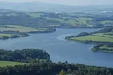
The most important rivers are the Opava, which originates here and flows through the centre of the district to the east, and the Moravice, which also originates here, flows through the southern part of the district, and later joins the Opava. An important tributary of the Opava in the district is the Opavice. The northern part of the district is drained by the Osobloga. Overall, the area is poor in bodies of water, but there is Slezská Harta Reservoir, one of the largest reservoirs in the country with an area of 8.7 km2 (3.4 sq mi).
The western part of the territory is protected as the Jeseníky Protected Landscape Area.
Demographics
|
|
| ||||||||||||||||||||||||||||||||||||||||||||||||||||||
| Source: Censuses[3][4] | ||||||||||||||||||||||||||||||||||||||||||||||||||||||||
Most populated municipalities
| Name | Population[2] | Area (km2) |
|---|---|---|
| Krnov | 22,848 | 44 |
| Bruntál | 15,415 | 29 |
| Rýmařov | 7,953 | 61 |
| Vrbno pod Pradědem | 4,798 | 69 |
| Město Albrechtice | 3,417 | 65 |
| Břidličná | 3,003 | 26 |
| Horní Benešov | 2,253 | 20 |
| Brantice | 1,370 | 27 |
| Světlá Hora | 1,359 | 43 |
| Dvorce | 1,252 | 24 |
Economy
The largest employers with headquarters in Bruntál District and at least 500 employees are:[5]
| Economic entity | Location | Number of employees | Main activity |
|---|---|---|---|
| Sdružené zdravotnické zařízení Krnov | Krnov | 1,000–1,499 | Health care |
| AL Invest Břidličná | Břidličná | 500–999 | Manufacture of aluminium products |
| Kofola | Krnov | 500–999 | Manufacture of beverages |
| Husqvarna Manufacturing CZ | Vrbno pod Pradědem | 500–999 | Manufacture of power-driven hand tools |
Transport
There are no motorways passing through the district. The most important roads are the I/11 from Opava to Šumperk and the I/45 from Bruntál to Krnov and the Czech-Polish border.
Sights
.jpg.webp)
The most important monuments in the district, protected as national cultural monuments, are:[6]
- Bruntál Castle
- Spinning mill and warehouse of the Alois Larisch factory in Krnov with a sample workshop, including a set of machinery
- Scythe manufactory in Karlovice (Bruntál District)
- Pilgrimage area with the Church of Our Lady of Seven Sorrows and the Exaltation of the Holy Cross in Krnov
- Stations of the Cross and Church of Our Lady of the Snows in Ruda
The best-preserved settlements, protected as monument reservations and monument zones, are:[7]
- Heřmanovice (monument reservation)
- Bruntál
- Rýmařov
- Karlova Studánka
- Malá Morávka
- Petrovice
- Piskořov
- Žďárský Potok
The most visited tourist destination is the Sovinec Castle.[8]
Notable people
References
- "Land use (as at 31 December)". Public database. Czech Statistical Office. Retrieved 2023-05-19.
- "Population of Municipalities – 1 January 2023". Czech Statistical Office. 2023-05-23.
- "Historický lexikon obcí České republiky 1869–2011 – Okres Bruntál" (in Czech). Czech Statistical Office. 2015-12-21. pp. 1–2.
- "Population Census 2021: Population by sex". Public Database. Czech Statistical Office. 2021-03-27.
- "Registr ekonomických subjektů". Business Register (in Czech). Czech Statistical Office. Retrieved 2023-04-18.
- "Výsledky vyhledávání: Národní kulturní památky, okres Bruntál". Ústřední seznam kulturních památek (in Czech). National Heritage Institute. Retrieved 2023-04-18.
- "Výsledky vyhledávání: Památkové rezervace, Památkové zóny, okres Bruntál". Ústřední seznam kulturních památek (in Czech). National Heritage Institute. Retrieved 2023-04-18.
- "Turisté mají v České republice nejraději zoologické zahrady, technické památky, koupání a Pražský hrad" (in Czech). CzechTourism. 2022-06-24. Retrieved 2023-04-18.
External links
- Bruntál District – profile on the Czech Statistical Office website