Plum Island (Wisconsin)
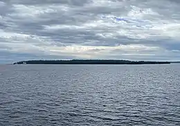
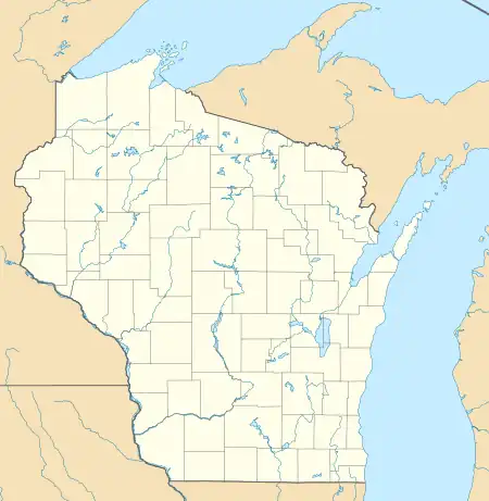
Plum Island is an island in Lake Michigan in the southern part of the town of Washington in Door County, off the tip of the Door Peninsula in the U.S. state of Wisconsin.[1] The uninhabited island has a land area of 1.179 square kilometres (0.455 sq mi) or 117.87 hectares (291.3 acres). Carp Lake is located on the northwestern side. During years when Lake Michigan's water levels are high, it is a lagoon of Lake Michigan, but it gets cut off as a separate lake during low water years.[2]
 | |
 Plum Island  Plum Island | |
| Geography | |
|---|---|
| Location | Door County, Wisconsin |
| Coordinates | 45°18′29″N 86°57′11″W |
| Area | 0.455 sq mi (1.18 km2) |
| Highest elevation | 610 ft (186 m) |
| Administration | |
United States | |
| State | Wisconsin |
| County | Door County |
| Town | Washington Island |
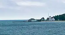
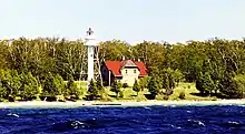
The island is a bird sanctuary under control of the United States Fish and Wildlife Service and part of the Green Bay National Wildlife Refuge since 2007,[3] and is open to the public for recreational purposes.[4] The island also holds the unmanned Plum Island Range Lights and now-closed Plum Island Lifesaving Station.
Border Dispute
The border between Wisconsin and Michigan was originally defined as "the most usual ship channel" into Green Bay from Lake Michigan but commercial routes existed both to the north and south of the island which led to a border dispute. In 1936, the U.S. Supreme Court decision Wisconsin v. Michigan found that Plum and other nearby islands were part of Wisconsin.
Climate
| ||||||||||||||||||||||||||||||||||||||||||||||||||||||||||||||||||||||||||||||||||||||||||||||||||||||||||||||||||||||||||||
Lifesaving Station and Range Lights


A lighthouse was built on the island in 1848, but abandoned when it was decided to move it to nearby Pilot Island in 1858. The island contained was re-colonized in 1895-6, when both a lifesaving station on the Northeast corner and a set of range lights on the Western side were built. The lifesaving station operated from 1895 to 1991, before being moved to nearby Washington Island, while the range lights were automated in 1969 and remain an active aid to navigation.[6]
Shipwreck
The wreck of the Grape Shot is 0.18 miles NW of the lifesaving station in 8 feet of water. It sank in 1867 after being driven ashore in a gale while carrying a cargo of lumber.[7]
Nearby islands

References
- "Plum Island (Wisconsin)". Geographic Names Information System. United States Geological Survey, United States Department of the Interior.
- Flora and Vegetation of the Grand Traverse Islands (Lake Michigan), Wisconsin and Michigan by Emmet J. Judziewicz, The Michigan Botanist, Volume 40, Number 4, October 2001, page 127
- Warren, Joseph. "Wisconsin's newest island destination, Wisconsin Natural Resources magazine, April 2015". dnr.wi.gov. Archived from the original on 2015-05-16. Retrieved 2018-06-26. (Archived May 16, 2015)
- Green Bay National Wildlife Refuge Hunt, Fish & Public Use Regulations 2021-2022, USFWS (Archived February 23, 2022)
- "NASA EarthData Search". NASA. Retrieved 30 January 2016.
- "History". Friends of Plum & Pilot Islands. Retrieved 2023-09-03.
- "Grape Shot (1855) - WI Shipwrecks". www.wisconsinshipwrecks.org. Retrieved 2023-09-04.
- Plum Island: Block 2128, Block Group 2, Census Tract 9801, Door County, Wisconsin United States Census Bureau
- "Speaker will discuss Plum Island bird survey", Beaver Dam Daily Citizen, Friday, December 9, 2005
External links
- Plum Island Trail Map, USFWS (Archived September 5, 2021)
- Plum Island visit website, USFWS
- Plum Island, Web-Map of Door County, Wisconsin
