Pony, Montana
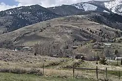
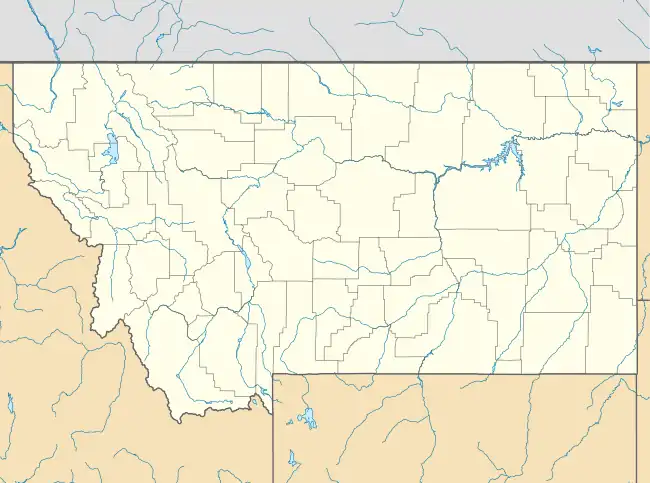
Pony is an unincorporated community and census-designated place in northeastern Madison County, Montana, United States on the eastern edge of the Tobacco Root Mountains. It includes the 192-acre (78 ha) Pony Historic District, a historic district with 95 contributing buildings listed on the National Register of Historic Places.[4][5][6]
Pony | |
|---|---|
Census-designated place | |
 Pony, Montana | |
| Coordinates: 45°39′31″N 111°53′40″W[1] | |
| Country | |
| State | |
| County | Madison |
| Area | |
| • Total | 1.34 sq mi (3.48 km2) |
| • Land | 1.34 sq mi (3.48 km2) |
| • Water | 0.00 sq mi (0.00 km2) |
| Population (2020) | |
| • Total | 127 |
| • Density | 94.63/sq mi (36.54/km2) |
| FIPS code | 30-58675 |
| GNIS feature ID | 789074[3] |
| Website | www |
Pony Historic District | |
  | |
| Area | 192 acres (78 ha) |
| Architect | H.M. Patterson |
| Architectural style | Queen Anne |
| MPS | Pony MRA |
| NRHP reference No. | 87001264[4] |
| Added to NRHP | August 4, 1987 |
The town gained its name from the nickname of one of its early miners, Tecumseth Smith, a small man nicknamed "Pony" because of his diminutive size.[7][8]
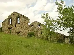
Settled in the 1860s, in the late nineteenth century, Pony was a prosperous gold-mining community with at least 5,000 residents. Mining operations declined in the early 20th century and all were closed by 1922.[7]
A number of historic buildings from Pony's boom era remain in the old town today. Major buildings are managed, voluntarily, by The Pony Homecoming Club, a non-profit organization that maintains the town's public spaces.[9]
Montana Highway 283 passes through town. It is about 6 miles from Harrison.
Former Montana Lieutenant Gov. Karl Ohs owned a ranch in Pony.
Notes
- "Pony, Montana". Geographic Names Information System. United States Geological Survey, United States Department of the Interior.
- "ArcGIS REST Services Directory". United States Census Bureau. Retrieved September 18, 2022.
- U.S. Geological Survey Geographic Names Information System: Pony, Montana
- "National Register Information System". National Register of Historic Places. National Park Service. July 9, 2010.
- Mark T. Fiege (November 1985). "National Register of Historic Places Inventory/Nomination: Pony Historic District". National Park Service. Retrieved December 30, 2016. with 35 photos from 1985
- Mark T. Fiege (November 1985). "National Register of Historic Places Inventory/Nomination: Historic Resources of Pony, Montana". Retrieved December 30, 2016.
- "Pony, Montana". ghosttowns.com. Retrieved April 17, 2016.
- "Pony, Montana". Travel Montana. Retrieved April 17, 2016.
- "Pony, Montana". Pony Homecoming Club. Retrieved February 7, 2019.
- "Census of Population and Housing". Census.gov. Retrieved June 4, 2016.
Municipalities and communities of Madison County, Montana, United States | ||
|---|---|---|
| Towns | 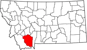 Madison County map | |
| CDPs | ||
| Other communities | ||
| Ghost towns | ||
| Footnotes | ‡This populated place also has portions in an adjacent county or counties | |
| Topics | |
|---|---|
| Lists by state |
|
| Lists by insular areas | |
| Lists by associated state | |
| Other areas | |
| Related | |