Quéant
Quéant (French pronunciation: [keɑ̃]) is a commune in the Pas-de-Calais department in the Hauts-de-France region of France.[3]
Quéant | |
|---|---|
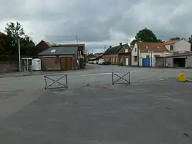 Quéant seen from next to the church | |
 Coat of arms | |
Location of Quéant | |
 Quéant  Quéant | |
| Coordinates: 50°10′48″N 2°59′03″E | |
| Country | France |
| Region | Hauts-de-France |
| Department | Pas-de-Calais |
| Arrondissement | Arras |
| Canton | Bapaume |
| Intercommunality | Osartis Marquion |
| Government | |
| • Mayor (2020–2026) | Jérôme Dartus[1] |
| Area 1 | 9.02 km2 (3.48 sq mi) |
| Population | 643 |
| • Density | 71/km2 (180/sq mi) |
| Time zone | UTC+01:00 (CET) |
| • Summer (DST) | UTC+02:00 (CEST) |
| INSEE/Postal code | 62673 /62860 |
| Elevation | 62–102 m (203–335 ft) (avg. 75 m or 246 ft) |
| 1 French Land Register data, which excludes lakes, ponds, glaciers > 1 km2 (0.386 sq mi or 247 acres) and river estuaries. | |
Geography
Quéant is situated 15 miles (24 km) southeast of Arras, at the junction of the D14 and D22 roads. Quéant Mountain is a mountain in Canada named after the town.
Population
| Year | Pop. | ±% p.a. |
|---|---|---|
| 1968 | 632 | — |
| 1975 | 561 | −1.69% |
| 1982 | 548 | −0.33% |
| 1990 | 506 | −0.99% |
| 1999 | 549 | +0.91% |
| 2007 | 583 | +0.75% |
| 2012 | 653 | +2.29% |
| 2017 | 657 | +0.12% |
| Source: INSEE[4] | ||
Places of interest
- The church of St.Leger, rebuilt after destruction in the First World War.
- The Quéant Road Cemetery, overseen by the Commonwealth War Graves Commission.
References
- "Répertoire national des élus: les maires". data.gouv.fr, Plateforme ouverte des données publiques françaises (in French). 9 August 2021.
- "Populations légales 2020". The National Institute of Statistics and Economic Studies. 29 December 2022.
- INSEE commune file
- Population en historique depuis 1968, INSEE
External links
Wikimedia Commons has media related to Quéant.
- CWGC.org, The CWGC extension to the communal cemetery
This article is issued from Wikipedia. The text is licensed under Creative Commons - Attribution - Sharealike. Additional terms may apply for the media files.