Río Lagartos Municipality
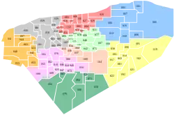
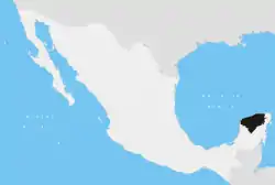
Río Lagartos Municipality (Spanish language: "river of alligators") is one of the 106 municipalities in the Mexican state of Yucatán containing (249.09 km2) of land and is located roughly 215 kilometres (134 mi) northeast of the city of Mérida.[2]
Río Lagartos | |
|---|---|
Municipality | |
 Seal | |
 Region 5 Noreste #061 | |
 Río Lagartos Location of the Municipality in Mexico | |
| Coordinates: 21°35′51″N 88°09′28″W | |
| Country | |
| State | |
| Mexico Ind. | 1821 |
| Yucatán Est. | 1824 |
| Government | |
| • Type | |
| • Municipal President | Elmer Santiago Contreras Tabasco[2] |
| Area | |
| • Total | 249.09 km2 (96.17 sq mi) |
| [2] | |
| Elevation | 2 m (7 ft) |
| Population (2010[3]) | |
| • Total | 3,438 |
| • Density | 14/km2 (36/sq mi) |
| • Demonym | Umanense |
| Time zone | UTC-6 (Central Standard Time) |
| • Summer (DST) | UTC-5 (Central Daylight Time) |
| INEGI Code | 061 |
| Major Airport | Merida (Manuel Crescencio Rejón) International Airport |
| IATA Code | MID |
| ICAO Code | MMMD |
| Municipalities of Yucatán | |
History
There is no accurate data on when the town was founded, but before the conquest, it was part of the chieftainship of Ecab.[2] After colonization, it became the Spanish colony's northeastern port. Before 1580, Antonio Rodríguez convinced the Yucatecan Governor Guillén de las Casas to appoint him as guard of the port. Rodríguez negotiated with the chieftains Chuyubchuen, Kikil, Panabá and Sucopó to provide him with indigenous workers to mine salt, fish or make ashes for soap. He secured almost a monopoly on the native workers requiring any Spaniard wanting to open a new enterprise to negotiate with him to rent workers.[4]
Yucatán declared its independence from the Spanish Crown in 1821, and in 1825 the area was assigned to the Valladolid Municipality. In 1905, it was assigned to the Tizimín Municipality and in 1988 it was confirmed as head of its own municipality.[5]
Governance
The municipal president is elected for a three-year term. The town council has four councilpersons, who serve as Secretary and councilors of health, education, public security and cemeteries.[6]
Communities
The head of the municipality is Río Lagartos, Yucatán. The municipality has 36 populated places besides the seat including Las Coloradas, El Edén, Paraíso, San Pablo, Santa Cruz, Santa Pilar Trejo, Santa Rita, Serrano, Tacxahan, and Zabich. The significant populations are shown below:[2]
| Community | Population |
|---|---|
| Entire Municipality (2010) | 3,438[3] |
| Las Coloradas | 1068 in 2005[7] |
| Río Lagartos | 2127 in 2005[8] |
Local festivals
Every year on 25 July there is a festival to patron of the town, Saint James the Apostle.[2]
Tourist attractions

- Birding tours
- Cenote Chiquila
- Cenote Peten Tuchja
- Cenote San Luis Culemix
- Cenote San Manuel
- Cenote San Pedro
- Cenote Santa Pilar
References
- "Encabezará Renán Barrera a alcaldes panistas de Yucatán" (in Spanish). Mérida, Mexico: LextorMX. 25 September 2012. Retrieved 7 August 2015.
- "Municipios de Yucatán »Río Lagartos" (in Spanish). Retrieved 7 August 2015.
- "Mexico In Figures:Río Lagartos, Yucatán". INEGI (in Spanish and English). Aguascalientes, México: Instituto Nacional de Estadística y Geografía (INEGI). Archived from the original on 6 May 2015. Retrieved 3 August 2015.
- Rugeley, Sergio Quezada ; translated by Terry (2014). Maya lords and lordship : the formation of colonial society in Yucatán, 1350-1600. Norman: University of Oklahoma Press. pp. 67–69. ISBN 978-0-806-14579-2. Retrieved 7 August 2015.
{{cite book}}: CS1 maint: multiple names: authors list (link) - "Estado de Yucatán. División Territorial de 1810 a 1995" (PDF). inegi (in Spanish). Aguascalientes, Mexico: Instituto Nacional de Estadística, Geografía e Informática. 1996. pp. 110, 116, 124. Archived from the original (PDF) on 23 December 2015. Retrieved 7 August 2015.
- "Río Lagartos". inafed (in Spanish). Mérida, Mexico: Enciclopedia de Los Municipios y Delegaciones de México. Retrieved 7 August 2015.
- "Las Coloradas" (in Spanish). PueblosAmerica. 2005. Retrieved 7 August 2015.
- "Río Lagartos" (in Spanish). PueblosAmerica. 2005. Retrieved 7 August 2015.
