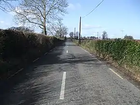
R670 road (Ireland)
The R670 road is a regional road in Ireland. The route runs from its junction with the R639 and N24 at Cloughabreeda 2 km north of Cahir through Cahir town and onwards for a further 8 km to Ardfinnan, where it joins the R665 road. The R670 is located entirely in County Tipperary.
 | ||||
|---|---|---|---|---|
| Bóthar R670 | ||||
 | ||||
| Major junctions | ||||
| From | ||||
| To | ||||
| Location | ||||
| Country | Ireland | |||
| Highway system | ||||
| ||||
The section of the R670 from Cloughabreeda to Cahir town centre was the main road connecting Cahir with Cashel in 1714[1] and was part of the T9 prior to 1974, when it was renumbered as part of the Dublin-Cork N8 national primary route. When the N8 was realigned to run southwest of Cahir in 1990, the old section of the road was reclassified as a regional road, and incorporated into the existing R670.
References
- Herman Moll's New Map of Ireland (1714),
This article is issued from Wikipedia. The text is licensed under Creative Commons - Attribution - Sharealike. Additional terms may apply for the media files.