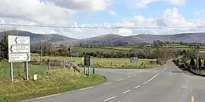
R729 road (Ireland)
The R729 road is a regional road in County Carlow and County Wexford in Ireland. It connects the R702 near Borris to the R714 near New Ross, 22.1 km (13.7 mi) to the south (map of route).[1]
 | |
|---|---|
| Bóthar R729 | |
 | |
| Route information | |
| Length | 22.1 km (13.7 mi) |
| Location | |
| Country | Ireland |
| Primary destinations |
|
| Highway system | |
The government legislation that defines the R729, the Roads Act 1993 (Classification of Regional Roads) Order 2019 (Statutory Instrument 577 of 2019), provides the following official description:
- Borris, County Carlow — New Ross, County Wexford
- Between its junction with R702 at Barmona in the county of Carlow and its junction with R714 at Macmurroughsisland in the county of Wexford via Coolnamara and Glynn in the county of Carlow: Pollmounty Bridge at the boundary between the county of Carlow and the county of Wexford: and Ballynabanoge in the county of Wexford.[1]
See also
References
- S.I. No. 577/2019 — Roads Act 1993 (Classification of Regional Roads) Order 2019, Irish Statute Book (irishstatutebook.ie), 2019-11-22.
This article is issued from Wikipedia. The text is licensed under Creative Commons - Attribution - Sharealike. Additional terms may apply for the media files.