Rainawari
Rainawari is a locality situated in the Srinagar district of Indian administered union territory of Jammu and Kashmir.[3] Rainawari lies on Srinagar-Leh National Highway about 4 km from Lalchowk.
Rainawari | |
|---|---|
Locality | |
 JLNM Hospital Rainawari (aerial view) | |
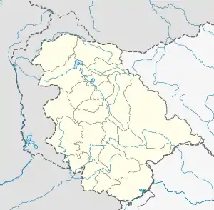
 Rainawari Location in Jammu and Kashmir, India  Rainawari Rainawari (India) | |
| Coordinates: 34°05′52″N 74°49′22″E | |
| Country | India |
| Union Territory | Jammu and Kashmir |
| District | Srinagar |
| Tehsil | Rainawari |
| Founded by | Abdal Raina |
| Named for | Rajanakavatika (Garden of Rainas) |
| Government | |
| • Body | Government of Jammu and Kashmir |
| Population (2011[1]) | |
| • Total | 3,896 |
| Languages | |
| • Spoken | Kashmiri |
| Time zone | UTC+5:30 (IST) |
| Pincode | 190003[2] |
History
According to historical records, Rainawari's origins can be traced back to the 14th century when it was laid out by Abdal Raina, the son of Ravan Raina, who was the brother of Queen Kota Rani. The area was initially known as "Rajanakavatika," which translates to the "Garden of Rainas" in Sanskrit. Over the centuries, Rainawari has evolved into a thriving locality within the city of Srinagar.[4][5]
Geography
Rainawari is situated in the heart of the Kashmir Valley, which is surrounded by snow-peaked mountains ranging from 12,000 to 18,000 feet in elevation. It is located at an altitude of approximately 5,000 feet above sea level. The Valley's water sources, including lakes, springs, and rivers like Vitasta (Jhelum), are primarily fed by the melting snow from the surrounding mountains.[5]
Culture and Language
Kashmiri is the predominant language spoken in Rainawari, reflecting the rich cultural heritage of the region. The area has a diverse cultural landscape, influenced by its historical significance and natural beauty.[4]
Landmarks
Rainawari boasts several notable landmarks:[5][6]
1. Naidyar Temple: Located near the Naidyar Bridge, this temple enshrines a Shiva Linga and has a bathing ghat for devotees. A well-dressed ashlar masonry ghat adds to its charm.
2. Daya Kishen's Bagh: This orchard, known as Daya Kishen's Bagh, houses the D.A.V. School. It is named after its donor, Daya Kishen, and features special pear trees and fruit varieties.
3. Karapora Temple: Situated at Karapora Ghat, this temple has a beautiful spring under a Chinar tree, providing warm water in winter and cold water in summer.
4. Keni Mohallah: A neighborhood along the Nallah Maar where residents benefit from the seasonal cold and warm water of a nearby spring (4).
5. Ghat Jogi-Lanker: This area serves as a parking place for Shikaras, traditional wooden boats, and features stepped ghats on both sides of the canal.
6. Kralyar Ghat: A wooden bridge connects Kralyar and Jogilanker, with a spring providing fresh water for the local residents.
7. Vaital Bhairav of Motiyar: Vaital Bhairav has a stepped ashlar stone ghat with a submerged spring that adds to the mystical character of the area.
References
- "Census Data 2011". Retrieved 16 September 2023.
- "Postal Code (Zip Code) of Rainawari, Srinagar, Jammu & Kashmir, India". Rainawari Pin Code. 16 September 2023. Retrieved 16 September 2023.
- Bhat, Sajad (29 April 2020). "Rainawari Rumours: A Sign of Deep-Seated Stigma in Kashmir?". Kashmir Observer. Retrieved 16 September 2023.
- ʻAlī, Sayyid; Jan, Zubida (2009). Tarikh-I-Sayyed Ali. Srinagar: Jay Kay Book Shop. ISBN 978-81-87221-22-7.
- Razdan, Vinayak (8 February 2021). "Seven Springs of Rainawari". SearchKashmir. Retrieved 16 September 2023.
- Kashmir, Rising (12 June 2023). "Jogishwari Mandir Trust reconstituted to preserve Rainawari Temples". Rising Kashmir. Retrieved 16 September 2023.
