Sar Asiab-e Yusefi
Sar Asiab-e Yusefi (Persian: سراسياب يوسفي, also Romanized as Sar Āsīāb-e Yūsefī; also known as Sar Āsīāb)[3] is a city in, and the capital of, Sar Asiab-e Yusefi District of Bahmai County, Kohgiluyeh and Boyer-Ahmad province, Iran.[4][5]
Sar Asiab-e Yusefi
Persian: سراسياب يوسفي | |
|---|---|
City | |
 Sar Asiab-e Yusefi | |
| Coordinates: 31°02′13″N 50°13′03″E[1] | |
| Country | |
| Province | Kohgiluyeh and Boyer-Ahmad |
| County | Bahmai |
| District | Sar Asiab-e Yusefi |
| Population (2016)[2] | |
| • Total | 984 |
| Time zone | UTC+3:30 (IRST) |
At the 2006 census, its population was 1,015 in 191 households, when it was a village in Sar Asiab-e Yusefi Rural District of the former Bahmai-ye Garmsiri District.[6] The following census in 2011 counted 1,025 people in 254 households.[7] The latest census in 2016 showed a population of 984 people in 274 households.[2]
After the census, the village was elevated to the status of a city.[8] The rural district was separated from the district in the establishment of the new Sar Asiab-e Yusefi District, which was divided into two rural districts and the city of Sar Asiab-e Yusefi, which became its capital.[4][5]
References
- OpenStreetMap contributors (11 August 2023). "Sar Asiab-e Yusefi, Bahmai County" (Map). OpenStreetMap. Retrieved 11 August 2023.
- "Census of the Islamic Republic of Iran, 1395 (2016)". AMAR (in Persian). The Statistical Center of Iran. p. 17. Archived from the original (Excel) on 2 November 2021. Retrieved 19 December 2022.
- Sar Asiab-e Yusefi can be found at GEOnet Names Server, at this link, by opening the Advanced Search box, entering "-3822946" in the "Unique Feature Id" form, and clicking on "Search Database".
- "Approval letter regarding country divisions in Bahmai County". RRK (in Persian). Ministry of Interior. Archived from the original on 10 August 2023. Retrieved 10 August 2023.
- Jahangiri, Ishaq (27 December 2019). "Letter of approval regarding country divisions in Bahmai County, Kohgiluyeh and Boyer-Ahmad province". Qavanin (in Persian). Ministry of Interior. Archived from the original on 10 August 2023. Retrieved 14 August 2023.
- "Census of the Islamic Republic of Iran, 1385 (2006)". AMAR (in Persian). The Statistical Center of Iran. p. 17. Archived from the original (Excel) on 20 September 2011. Retrieved 25 September 2022.
- "Census of the Islamic Republic of Iran, 1390 (2011)" (Excel). Iran Data Portal (in Persian). The Statistical Center of Iran. p. 17. Retrieved 19 December 2022.
- Fazli, Rahmani. "Converting two villages of Bahmai County into cities". ISNA (in Persian). Ministry of Interior. Archived from the original on 10 August 2023. Retrieved 10 August 2023.
| Capital | 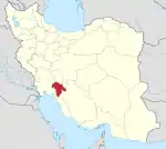 | ||||||||||||||||||
|---|---|---|---|---|---|---|---|---|---|---|---|---|---|---|---|---|---|---|---|
| Counties and cities |
| ||||||||||||||||||
| Sights |
| ||||||||||||||||||
| populated places | |||||||||||||||||||