Suzak District
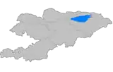
Suzak (Kyrgyz: Сузак району) is a district of Jalal-Abad Region in western Kyrgyzstan. The administrative seat lies at Suzak.[1] Its area is 3,019 square kilometres (1,166 sq mi),[2] and its resident population was 308,243 in 2021.[3]
Suzak
Сузак району | |
|---|---|
 | |
| Country | Kyrgyzstan |
| Region | Jalal-Abad Region |
| Area | |
| • Total | 3,019 km2 (1,166 sq mi) |
| Population (2021) | |
| • Total | 308,243 |
| • Density | 100/km2 (260/sq mi) |
| Time zone | UTC+6 (Kyrgyzstan Time) |
Population
| Year | Pop. | ±% p.a. |
|---|---|---|
| 1970 | 118,310 | — |
| 1979 | 140,848 | +1.96% |
| 1989 | 166,748 | +1.70% |
| 1999 | 200,936 | +1.88% |
| 2009 | 241,198 | +1.84% |
| 2021 | 308,243 | +2.06% |
| Note: resident population; Sources:[2][3] | ||
Towns, rural communities and villages
In total, Suzak District includes 1 town and 123 settlements in 13 rural communities (ayyl aymagy). Each rural community can consist of one or several villages. The rural communities and settlements in the Suzak District are:[1][4]
- town Kök-Janggak
- Bagysh (seat: Oktyabr'; incl. Bagysh, Besh-Bala, Kedey-Aryk, Kyzyl-Tuu, Sary-Bulak and Safarovka)
- Barpy (seat: Komsomol; incl. Achy, Boz-Chychkan, Besh-Moynok, Jangy-Ayyl, Jar-Kyshtak, Döböy, Kandy, Ming-Örük, Markay, Prigorodny, Say, Töölös, Tashtak, Türk-Maala, Ülgü, Changget-Say, Cheke-Döbö and Chokmor)
- Kara-Alma (seat: Kara-Alma; incl. Ortok, Tuura-Janggak and Urumbash)
- Kara-Daryya (seat: Aral; incl. Tösh and Changgyr-Tash)
- Kök-Art (seat: Mikhaylovka; incl. Komsomol, Podgornoye and Üch-Malay)
- Kurmanbek (seat: Taran-Bazar; incl. Joon-Kunggöy, Kalmak-Kyrchyn, Kanjyga, Kara-Cholok, Sary-Bulak, Saty and Urumbash)
- Kyz-Köl (seat: Karamart; incl. Ak-Bulak, Ak-Took, Jangy-Aryk, Jylan-Temir, Kadu, Kara-Bulak, Katyrangky, Kashka-Terek, Kyz-Köl, Kyzyl-Kyya and Sary-Bulak)
- Kyzyl-Tuu (seat: Boston; incl. Ak-Bulak, Ak-Terek, Akchaluu, Almaluu-Bulak, Kara-Ingen, Kara-Köl, Kyzyl-Sengir, Orto-Aziya, Soku-Tash, Ak-Bash, Shatrak, Jangy-Achy, Kashka-Suu, Jashasyn-2, Alchaluu, Kyzyl-Alma, Talaa-Bulak, Tashtak and Munduz)
- Lenin (seat: Lenin; incl. Orto-Say and Jygach-Korgon)
- Saypidin Atabekov (seat: Bek-Abad; incl. Balta-Kazy, Bököy, Boston, Jangy-Jer, Jiyde, Kaynar, Kara-Jygach, Kashkar-Maala, Kyzyl-Bagysh, Kyrgyz-Abad, Munduz, Nayman, Tash-Bulak, Türk-Abad, Özbek-Abad, Chek and Shirin)
- Suzak (seat: Suzak; incl. Aral, Blagoveshchenka, Jangy-Dyykan, Dostuk, Kamysh-Bashy, Kyr-Jol and Sadda)
- Tash-Bulak (seat: Tash-Bulak; incl. Aral, Gülstan, Dimitrovka, Doskana, Eshme, Jangy-Aral, Irrigator, Teplitsa, Cholok-Terek and Yntymak)
- Yrys (seat: Kümüsh-Aziz; incl. Aral-Say, Jar-Kyshtak, Dömör, Kaynar, Kurgak-Köl, Kyr-Jol, Ladan-Kara, Masadan, Sasyk-Bulak, Totuya, Chymchyk-Jar and Yrys)
References
- "Classification system of territorial units of the Kyrgyz Republic" (in Kyrgyz). National Statistics Committee of the Kyrgyz Republic. May 2021. pp. 24–28.
- "2009 population and housing census of the Kyrgyz Republic: Jalal-Abad Region" (PDF) (in Russian). National Statistics Committee of the Kyrgyz Republic. 2010. pp. 13, 17.
- "Population of regions, districts, towns, urban-type settlements, rural communities and villages of Kyrgyz Republic" (XLS) (in Russian). National Statistics Committee of the Kyrgyz Republic. 2021. Archived from the original on 10 November 2021.
- "Rural districts". Archived from the original on 2010-02-09. Retrieved 2010-03-14.
| North Kyrgyzstan |
|  Raions of Kyrgyzstan | ||||||||||
|---|---|---|---|---|---|---|---|---|---|---|---|---|
| South Kyrgyzstan |
| |||||||||||
This article is issued from Wikipedia. The text is licensed under Creative Commons - Attribution - Sharealike. Additional terms may apply for the media files.