List of Symphyotrichum species
Symphyotrichum is a genus of flowering plants in the tribe Astereae which includes the commonly cultivated New York aster (S. novi-belgii) and New England aster (S. novae-angliae). Its species are widespread in the Americas, including as far north as subarctic North America to as far south as Chile, Argentina, and the Falkland Islands. One species has a native range extending into eastern Eurasia.
| Symphyotrichum genus | |
|---|---|
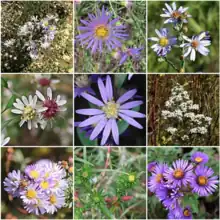 | |
| Some Symphyotrichum species left–right, top–bottom are shown: S. carnerosanum, S. chilense, S. adnatum, S. lateriflorum, S. concolor, S. ericoides, S. defoliatum, S. ciliatum, S. novae-angliae. | |
| Scientific classification | |
| Kingdom: | Plantae |
| Clade: | Tracheophytes |
| Clade: | Angiosperms |
| Clade: | Eudicots |
| Clade: | Asterids |
| Order: | Asterales |
| Family: | Asteraceae |
| Subfamily: | Asteroideae |
| Tribe: | Astereae |
| Subtribe: | Symphyotrichinae |
| Genus: | Symphyotrichum Nees |
Most of the species in the genus are perennials. The flower heads have white, pink, purple, or blue ray florets surrounding white to yellow disk florets. The disk floret corollas become pink, purple, or brown after pollination. The three species in section Conyzopsis have reduced or absent ray florets.
Symphyotrichum is the type genus of subtribe Symphyotrichinae. There are 98 species in the genus, some with varieties, and thirteen named hybrids. The genus is split into five subgenera: Chapmaniana, Astropolium, Virgulus, Ascendentes, and Symphyotrichum. Most of the species had been classified within the genus Aster until it was confirmed to be polyphyletic. The American asters now are separated into monophyletic genera based on multiple phylogenetic studies.
Conventions
-
NatureServe conservation categories Conservation status GX Presumed Extinct (0 species) GH Possibly Extinct (0 species) G1 Critically Imperiled (3 species) G2 Imperiled (9 species) G3 Vulnerable (7 species) G4 Apparently Secure (21 species) G5 Secure (37 species) Other categories GNA Not Applicable (8 species) GNR Not Ranked (0 species) NL Not listed (25 species)
Conservation status codes follow the NatureServe conservation (NS) rounded global status scheme. Hybrids have a column for parents in place of conservation status. Not listed (NL) is not a NatureServe category but is used here to represent those left out of global status rankings up to G5 (including GNA and GNR) and those not in NatureServe. Type species for each clade are in a separate table.
| Scientific name and picture |
Author citation | Basionym | Year | Common name(s) [and varieties] | NS | Habitat | Distribution |
|---|---|---|---|---|---|---|---|
| Abbreviated scientific name, link to species article,[lower-alpha 1] and picture, if available | Author citation | Basionym | Year of the original species description | Common name(s) and varieties, if applicable | NatureServe rounded global conservation status | Habitat | Distribution map |
Classification
Classification of Symphyotrichum
|
Subtribe Symphyotrichinae contains six genera. In addition to Symphyotrichum, these are Almutaster, Ampelaster, Canadanthus, Psilactis,[1] and Sanrobertia,[2] with Symphyotrichum being the largest at 98 species and thirteen named hybrids. The cladogram presented here for the subtribe is based on a combination of cytotaxonomic and morphologic data reported in multiple studies.[1][2][3] Symphyotrichum is the type genus of the subtribe.[4] |
|
Classification within Symphyotrichum
Most of the species had been classified within the genus Aster until it was confirmed to be polyphyletic. The American asters were then separated based on morphological characteristics and phylogenetic studies.[5][6] S. novae-angliae and S. turbinellum are monotypic within sections. S. novae-angliae is classified in the subgenus Virgulus. In 1994, it was placed in section Grandiflori, subsection Polyligulae.[7] In 2002, it was segregated within its own section Polyliguli.[8] The list follows the 2002 circumscription of section Polyliguli for the species. S. turbinellum is classified in the subgenus Symphyotrichum. It has been placed within its own section Turbinelli.[8] It was previously placed in section Symphyotrichum, subsection Turbinelli.[9] The list follows the more recent circumscription of section Turbinelli for the species.
Clades
- Symphyotrichum subg. Chapmaniana (Semple) Semple[8]
- Symphyotrichum subg. Astropolium (Nutt.) Semple[8]
- Symphyotrichum subg. Virgulus (Raf.) G.L.Nesom[10]
- Symphyotrichum subg. Ascendentes (Rydb.) Semple[8]
- Symphyotrichum subg. Symphyotrichum[13]
| Clade | Type species | Source |
|---|---|---|
| Genus Symphyotrichum | S. novi-belgii | [13] |
| Subgenus Chapmaniana | S. chapmanii | [8] |
| Subgenus Astropolium | S. tenuifolium | [8] |
| Subgenus Virgulus | S. concolor | [10] |
| Section Ericoidei | S. ericoides | [11] |
| Section Patentes | S. patens | [11] |
| Subsection Brachyphylli | S. walteri | [11] |
| Subsection Patentes | S. patens | [11] |
| Section Grandiflori | S. grandiflorum | [7] |
| Subsection Mexicanae | S. moranense | [7] |
| Subsection Grandiflori | S. grandiflorum | [7] |
| Section Polyliguli | S. novae-angliae | [8] |
| Section Concolores | S. concolor | [12] |
| Subgenus Ascendentes | S. ascendens | [8] |
| Subgenus Symphyotrichum | S. novi-belgii | [15] |
| Section Conyzopsis | S. ciliatum | [14] |
| Section Occidentales | S. spathulatum | [14] |
| Section Turbinelli | S. turbinellum | [8] |
| Section Symphyotrichum | S. novi-belgii | [15] |
| Subsection Dumosi | S. dumosum | [9] |
| Subsection Heterophylli | S. cordifolium | [8] |
| Series Concinni | S. laeve | [8] |
| Series Cordifolii | S. cordifolium | [8] |
| Subsection Porteriani | S. porteri | [16] |
| Subsection Symphyotrichum | S. novi-belgii | |
| Series Punicei | S. puniceum | [8] |
| Series Symphyotrichum | S. novi-belgii |
-
Symphyotrichum subg. Chapmaniana[ref 1]: 133subg. Astropolium[ref 1]: 133subg. Virgulus[ref 2]: 272sect. Ericoidei[ref 2]: 274sect. Patentes[ref 2]: 274ssect. Brachyphylli[ref 2]: 274ssect. Patentes[ref 2]: 274sect. Grandiflori[ref 2]: 273ssect. Mexicanae[ref 2]: 273ssect. Grandiflori[ref 2]: 273sect. Polyliguli[ref 1]: 133sect. Concolores[ref 2]: 275subg. Symphyotrichum[ref 2]: 267sect. Conyzopsis[ref 2]: 271sect. Occidentales[ref 2]: 271sect. Turbinelli[ref 1]: 133sect. Symphyotrichum[ref 2]: 268ssect. Dumosi[ref 2]: 269ssect. Heterophylli[ref 1]: 133ser. Concinni[ref 1]: 133ser. Cordifolii[ref 1]: 133ssect. Porteriani[ref 2]: 270ssect. Symphyotrichum ser. Punicei[ref 1]: 133ser. Symphyotrichum Cladogram references
- Semple, J.C.; Heard, S.B.; Brouillet, L. (2002). "Cultivated and Native Asters of Ontario (Compositae: Astereae)". University of Waterloo Biology Series. Ontario: University of Waterloo. 41: 1–134.
- Nesom, G.L. (September 1994). "Review of the Taxonomy of Aster sensu lato (Asteraceae: Astereae), Emphasizing the New World Species". Phytologia (published 31 January 1995). 77 (3): 141–297. ISSN 0031-9430. Retrieved 23 August 2021 – via Biodiversity Heritage Library.
- Sugbenus Ascendentes is made up of two allopolyploid species with historic parents from subg. Virgulus and subg. Symphyotrichum.
Species list
Subgenus Chapmaniana
| Scientific name and picture |
Author citation [17] |
Basionym [18] |
Year [18] |
Common name(s) [19] |
NS [20] |
Habitat [19] |
Distribution |
|---|---|---|---|---|---|---|---|
S. chapmanii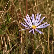 |
(Torr. & A.Gray) Semple & Brouillet |
Aster chapmanii | 1841 | Savanna aster | G2 | Wetlands, bogs, acid swamps 0–30 m (0–100 ft) |
.png.webp) |
Subgenus Astropolium
| Scientific name and picture |
Author citation [17] |
Basionym [18] |
Year [18] |
Common name(s) and varieties | NS [20] |
Habitat | Distribution [17] |
|---|---|---|---|---|---|---|---|
S. divaricatum_iNat_(cropped).jpg.webp) |
(Nutt.) G.L.Nesom |
Tripolium divaricatum | 1840 | Southern annual saltmarsh aster[22] | G5 | Marshy habitats, roadsides, lawns, and waste places 0–1,500 m (0–4,921 ft)[19] |
 |
S. glabrifolium.jpg.webp) |
(DC.) G.L.Nesom |
Erigeron glabrifolius | 1836 | NL | Wet meadows and stream edges 1,500–2,400 m (4,920–7,870 ft)[24] |
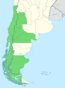 | |
S. graminifolium.jpg.webp) |
(Spreng.) G.L.Nesom |
Conyza graminifolia | 1826 | NL | Humid places[25] | 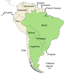 | |
S. martii.jpg.webp) |
(Baker) G.L.Nesom |
Aster martii | 1882 | NL | Cerrado savanna, grasslands[26] | 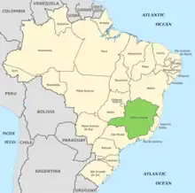 | |
S. parviflorum.jpg.webp) |
(Nees) G.L.Nesom |
Aster parviflorus | 1818 | Southwestern annual saltmarsh aster[27] | NL | Marshy habitats and roadsides 0–1,100 m (0–3,609 ft)[28] |
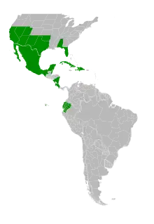 |
| S. patagonicum |
(Cabrera) G.L.Nesom |
Aster patagonicus | 1971 | NL | Mallines and lagoon edges 500–2,500 m (1,640–8,200 ft)[30] |
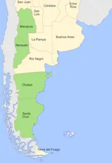 | |
S. peteroanum.jpg.webp) |
(Phil.) G.L.Nesom |
Aster peteroanus | 1894 | NL | Humid montane ecosystems 1,000–2,200 m (3,280–7,220 ft)[31] |
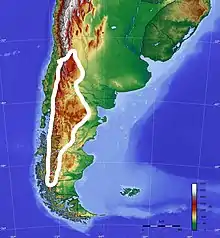 | |
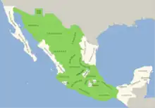
S. potosinum.jpg.webp) |
(A.Gray) G.L.Nesom |
Aster potosinus | 1880 | Santa Rita Mountain aster[19] | G2 | Muddy and wet soils on stream banks 1,500–1,900 m (4,920–6,230 ft)[19] |
 |
S. regnellii.jpg.webp) |
(Baker) G.L.Nesom |
Aster regnellii | 1882 | NL | Swamps or damp savanna soils[33] | 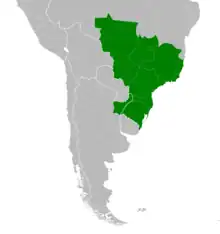 | |
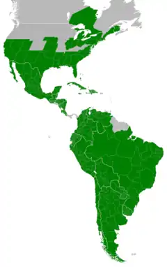
S. subulatum_cropped.jpg.webp) |
(Michx.) G.L.Nesom |
Aster subulatus | 1803 |
Three varieties[34]
|
G5 | Brackish marshes, salt marshes, roadsides 0–4,000 m (0–13,120 ft)[34] |
 |
S. tenuifolium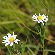 |
(L.) G.L.Nesom |
Aster tenuifolius | 1753 | Perennial saltmarsh aster[19] Two varieties[35]
|
G5 | Coastal salt marshes, brackish marshes, low pine woods 0–10 m (0–30 ft)[35] |
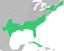 |
S. vahlii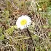 |
(Gaudich.) G.L.Nesom |
Erigeron vahlii | 1825 |
Two varieties[17]
|
NL | Grassland, heathland, peaty soil, sandy soil 20–1,200 m (70–3,940 ft)[37] |
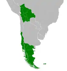 |
Section Ericoidei
| Scientific name and picture |
Author citation [17] |
Basionym [18] |
Year [18] |
Common name(s) and varieties [19] |
NS [20] |
Habitat | Distribution |
|---|---|---|---|---|---|---|---|
S. ericoides |
(L.) G.L.Nesom |
Aster ericoides | 1753 | White heath aster Two varieties[17]
|
G5 | Open locations with sandy, gravelly, or disturbed soil 30–2,400 m (100–7,870 ft)[38] |
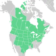 |
S. falcatum_falcatus_(3301180835).jpg.webp) |
(Lindl.) G.L.Nesom |
Aster falcatus | 1834 |
Two varieties[17]
|
G5 | Well-drained soils, stream banks and slopes, and others 200–2,500 m (660–8,200 ft)[38] |
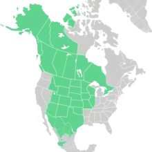 |
Section Patentes
Section Patentes (Torr. & A.Gray) G.L.Nesom[11]
Subsection Brachyphylli
| Scientific name and picture |
Author citation [17] |
Basionym [18] |
Year [18] |
Common name(s) [19] |
NS [20] |
Habitat [19] |
Distribution [17] |
|---|---|---|---|---|---|---|---|
S. adnatum.jpg.webp) |
(Nutt.) G.L.Nesom |
Aster adnatus | 1834 | Scaleleaf aster | G4 | Sandy soils, scrub, woods 0–100 m (0–330 ft) |
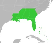 |
S. walteri.jpg.webp) |
(Alexander) G.L.Nesom |
Aster walteri | 1933 | Walter's aster | G4 | Sandy and clay soils, woods edges, open areas 0–100 m (0–330 ft) |
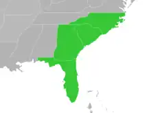 |
Subsection Patentes
| Scientific name and picture |
Author citation [17] |
Basionym [18] |
Year [18] |
Common name(s) and varieties [19] |
NS [20] |
Habitat [19] |
Distribution [17] |
|---|---|---|---|---|---|---|---|
S. georgianum_(cropped).jpg.webp) |
(Alexander) G.L.Nesom |
Aster georgianus | 1933 | Georgia aster | G3 | Sandy or clay soil, woodlands, mostly Piedmont 0–300 m (0–980 ft) |
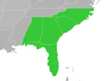 |
S. patens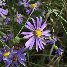 |
(Aiton) G.L.Nesom |
Aster patens | 1789 |
Three varieties[17]
|
G5 | Dry woodlands, sandy or clay soils, fields 0–1,000 m (0–3,280 ft)[38] |
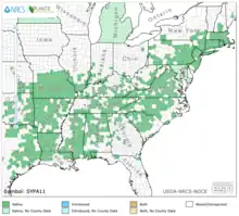 |
S. phlogifolium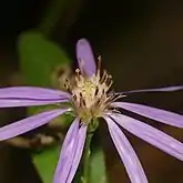 |
(Muhl. ex Willd.) G.L.Nesom |
Aster phlogifolius | 1803 | Thinleaf late purple aster | G5 | Various soils, rich mesic hardwood forests 0–1,100 m (0–3,610 ft) |
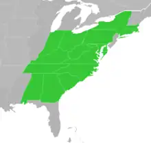 |
Section Grandiflori
Section Grandiflori (Torr. & A.Gray) G.L.Nesom[7]
Subsection Mexicanae
| Scientific name and picture |
Author citation [17] |
Basionym [18] |
Year [18] |
Common name(s) | NS [20] |
Habitat | Distribution |
|---|---|---|---|---|---|---|---|
S. bimater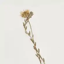 |
(Standl. & Steyerm.) G.L.Nesom |
Aster bimater | 1944 | NL | Pine-oak woods, ravines, slopes, grassy openings 1,000–2,150 m (3,280–7,050 ft)[42] |
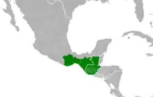 | |
| S. chihuahuense | G.L.Nesom | 2018 | NL | Grassland, oak-pine woods 1,800–2,500 m (5,910–8,200 ft)[43] |
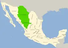 | ||
S. hintonii.jpg.webp) |
(G.L.Nesom) G.L.Nesom |
Aster hintonii | 1989 | NL | Oak and oak-pine woods 1,400–2,200 m (4,590–7,220 ft)[44] |
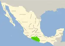 | |
S. moranense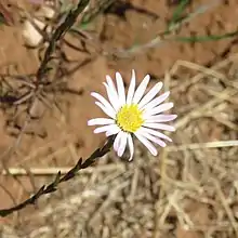 |
(Kunth) G.L.Nesom |
Aster moranensis | 1818 | NL | Grassland, woodlands 1,000–2,750 m (3,280–9,020 ft)[45] |
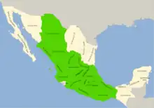 | |
| S. purpurascens | (Sch.Bip.) G.L.Nesom |
Aster purpurascens | 1854 | NL | Open woods 1,500–2,850 m (4,920–9,350 ft)[46] |
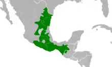 | |
S. trilineatum.jpg.webp) |
(Sch.Bip. ex Klatt) G.L.Nesom |
Aster trilineatus | 1884 | NL | Mountains (sierra)[47] 975–2,840 m (3,200–9,320 ft)[48] |
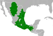 | |
S. turneri.jpg.webp) |
(S.D.Sundb. & A.G.Jones) G.L.Nesom |
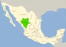
Aster moranensis var. turneri | 1986 | NL | Woods, along waterways, and in wet pastures 2,050–2,750 m (6,730–9,020 ft)[44] |
 |
Subsection Grandiflori
| Scientific name and picture |
Author citation [17] |
Basionym [18] |
Year [18] |
Common name(s) [19] |
NS [20] |
Habitat [19] |
Distribution [17] |
|---|---|---|---|---|---|---|---|
S. campestre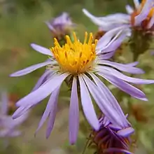 |
(Nutt.) G.L.Nesom |
Aster campestris | 1840 | Western meadow aster | G5 | Dry habitats, rocky and sandy soils near ponds and streams 1,500–2,500 m (4,920–8,200 ft) |
 |
S. estesii.jpg.webp) |
Semple[49] | 2019[49] |
|
G1 | Hydroxeric soils in open, sunny, flat prairies Approx. 330 m (1,070 ft)[lower-alpha 2][51] |
May Prairie State Natural Area Coffee County, Tennessee (US)[50] | |
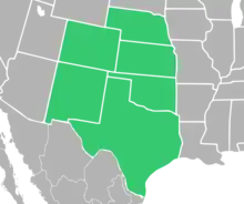
S. fendleri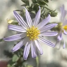 |
(A.Gray) G.L.Nesom |
Aster fendleri | 1849 | Fendler's aster | G4 | Open, sandy, silty, shaly, often rocky soils and similar 600–2,000 m (1,970–6,560 ft) |
 |
S. fontinale.jpg.webp) |
(Alexander) G.L.Nesom |
Aster fontinalis | 1933 | Florida water aster | G3 | Marshes, sandhills, hammocks, flood plains, streams 0–50 m (0–160 ft) |
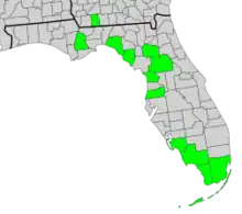 |
S. grandiflorum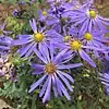 |
(L.) G.L.Nesom |
Aster grandiflorus | 1753 | Large-flowered aster | G4 | Sandy soils and hills, thickets, roadsides 0–200 m (0–660 ft) and higher |
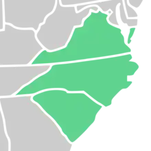 |
S. oblongifolium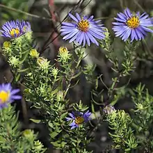 |
(Nutt.) G.L.Nesom |
Aster oblongifolius | 1818 |
|
G5 | Open and dry, rocky or sandy soils 100–1,500 m (330–4,920 ft) |
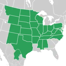 |
S. pygmaeum.jpg.webp) |
(Lindl.) Brouillet & Selliah |
Aster pygmaeus | 1834 | Pygmy aster | G4 | Sandy or silty wet areas, gravelly tundra, tundra slopes 0–200 m (0–660 ft) |
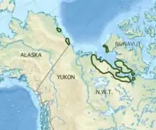 |
S. yukonense.jpg.webp) |
(Cronquist) G.L.Nesom |
Aster yukonensis | 1945 | Yukon aster | G3 | Mud flats, rocky or silty lakeshores 300–1,500 m (980–4,920 ft) |
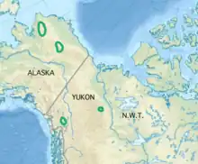 |
Section Polyliguli
| Scientific name and picture |
Author citation [17] |
Basionym [18] |
Year [18] |
Common name(s) [19] |
NS [20] |
Habitat [19] |
Distribution [19] |
|---|---|---|---|---|---|---|---|
S. novae-angliae_(cropped).jpg.webp) |
(L.) G.L.Nesom |
Aster novae-angliae | 1753 | New England aster | G5 | Open, typically moist habitats 0–1,600 m (0–5,250 ft) |
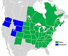 |
Section Concolores
| Scientific name and picture |
Author citation [17] |
Basionym [18] |
Year [18] |
Common name(s) and varieties [19] |
NS [20] |
Habitat [19] |
Distribution [17] |
|---|---|---|---|---|---|---|---|
S. concolor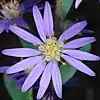 |
(L.) G.L.Nesom |
Aster concolor | 1753 | Eastern silver aster Two varieties[17]
|
G5 | Scrub, flatwoods, fields, roadsides 0–600 m (0–1,970 ft)[38] |
 |
S. lucayanum.jpg.webp) |
(Britton) G.L.Nesom |
Aster lucayanus | 1906 | Pineland aster[57] | NL | Pine woodlands and wetland edges[57] 0–12 m (0–40 ft)[lower-alpha 3] |
Endemic to the island of Grand Bahama[57]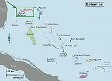 |
S. plumosum.jpg.webp) |
(Small) Semple |
Aster plumosus | 1924 | G2 | Deep, sandy soils, pine flatwoods, pine-scrub oak woods 0–40 m (0–130 ft) |
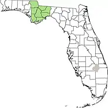 | |
S. pratense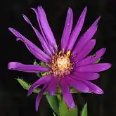 |
(Raf.) G.L.Nesom |
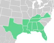
Aster pratensis | 1817 | Barrens silky aster | G4 | Prairies and fields, woodland and scrub, roadsides 0–500 m (0–1,640 ft) |
 |
S. sericeum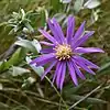 |
(Vent.) G.L.Nesom |
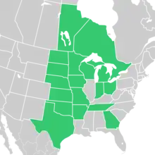
Aster sericeus | 1800 | Western silvery aster | G5 | Many open habitats 100–500 m (330–1,640 ft) |
 |
Subgenus Virgulus named hybrids
| Scientific name and picture |
Author citation [17] |
Basionym [18] |
Year [18] |
Common name(s) | Parents | Habitat | Distribution [17] |
|---|---|---|---|---|---|---|---|
S. × amethystinum.jpg.webp) |
(Nutt.) G.L.Nesom |
Aster amethystinus | 1840 | Amethyst aster[58] | S. ericoides × S. novae-angliae[59] |
Prairies or fields, disturbed ground, near parent plants 200–400 m (660–1,310 ft)[58] |
 |
| S. × batesii | (Rydb.) G.L.Nesom |
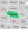
Aster batesii | 1931 | S. ericoides × S. oblongifolium[60] |
 | ||
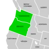
| S. × columbianum | (Piper) G.L.Nesom |
Aster columbianus | 1913 | S. campestre × S. ericoides[61] |
 |
Subgenus Ascendentes
This subgenus contains two allopolyploid species derived from the historic hybridization of plants from the subgenera Symphyotrichum and Virgulus.[62]
| Scientific name and picture |
Author citation [17] |
Basionym [18] |
Year [18] |
Common name(s) [19] |
NS [20] |
Habitat | Distribution |
|---|---|---|---|---|---|---|---|
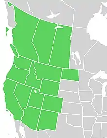
S. ascendens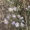 |
(Lindl.) G.L.Nesom |
Aster ascendens | 1834 |
|
G5 | Grasslands, sagebrush steppe, meadows 500–3,200 m (1,640–10,500 ft)[19] |
 |
S. defoliatum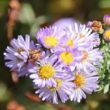 |
(Parish) G.L.Nesom |
Aster defoliatus | 1904 | San Bernardino aster | G2 | Seeps, marshes, swamps, meadows, montane forests, coastal scrubs[63] 0–2,050 m (0–6,730 ft)[64] |
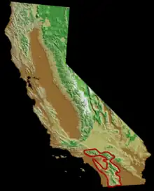 |
Section Conyzopsis
The three species in section Conyzopsis have reduced or absent ray florets.[65]
| Scientific name and picture |
Author citation [17] |
Basionym [18] |
Year [18] |
Common name(s) [19] |
NS [20] |
Habitat [19] |
Distribution [19] |
|---|---|---|---|---|---|---|---|
S. ciliatum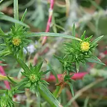 |
(Ledeb.) G.L.Nesom |
Erigeron ciliatus | 1829 |
|
G5 | Moist prairies, steppes, salty areas (natural or manmade) 0–2,000 m (0–6,560 ft) |
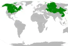 |
S. frondosum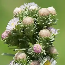 |
(Nutt.) G.L.Nesom |
Tripolium frondosum | 1840 | Short-rayed alkali aster | G4 | Wet meadows, marshes, saline conditions 10–2,200 m (30–7,220 ft) |
 |
S. laurentianum.jpg.webp) |
(Fernald) G.L.Nesom |
Aster laurentianus | 1914 | Gulf of St. Lawrence aster | G1 | Brackish or salty marshes, shores, and dunes Sea level (0 m (0 ft)) |
 |
Section Occidentales
| Scientific name and picture |
Author citation [17] |
Basionym [18] |
Year [18] |
Common name(s) and varieties [19] |
NS [20] |
Habitat [19] |
Distribution [17] |
|---|---|---|---|---|---|---|---|
S. chilense.jpg.webp) |
(Nees) G.L.Nesom |
Aster chilensis | 1832 |
|
G5 | Coastal salt marshes, dunes and banks, grasslands, coniferous forests 0–500 m (0–1,640 ft) |
 |
S. eatonii_(cropped).jpg.webp) |
(A.Gray) G.L.Nesom |
Aster foliaceus var. eatonii | 1884 | Eaton's aster | G5 | Sunny wetlands 500–3,100 m (1,640–10,170 ft) |
 |
S. foliaceum |
(Lindl. ex DC.) G.L.Nesom |
Aster foliaceus | 1836 |
Five varieties[17]
|
G5 | Meadows, open areas in woods, slopes, grasslands 1,000–3,600 m (3,280–11,810 ft)[38][67] |
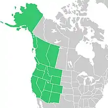 |
S. greatae.jpg.webp) |
(Parish) G.L.Nesom |
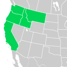
Aster greatae | 1902 | Greata's aster[68] | G2 | Damp places in canyons of the south slopes of the San Gabriel Mountains of California 300–2,000 m (980–6,560 ft)[68] |
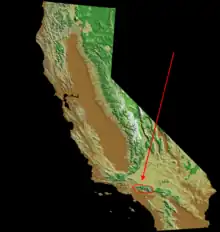 |
S. hallii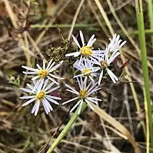 |
(A.Gray) G.L.Nesom |
Aster hallii | 1872 | Hall's aster | G4 | Grasslands and meadows with summer dryness 0–500 m (0–1,640 ft) |
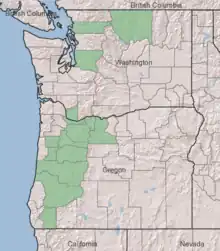 |
S. hendersonii_hendersonii_isotype_HUH00003650_(cropped).jpg.webp) |
(Fernald) G.L.Nesom |
Aster hendersonii | 1895 | Henderson's aster | G4 | Meadows, forest openings, banks 1,000–1,500 m (3,280–4,920 ft) and higher |
 |
S. jessicae.jpg.webp) |
(Piper) G.L.Nesom |
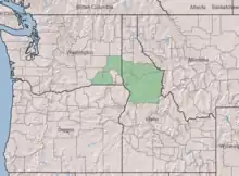
Aster jessicae | 1898 | Jessica's aster | G2 | Dry grasslands, meadows, banks, woodland openings 500–1,200 m (1,640–3,940 ft) |
 |
S. lentum.jpg.webp) |
(Greene) G.L.Nesom |
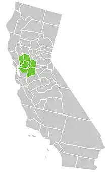
Aster lentus | 1894 | Suisun marsh aster | G2 | Freshwater marshes and swamps[71] 0–300 m (0–980 ft)[72] |
 |
S. molle.jpg.webp) |
(Rydb.) G.L.Nesom |
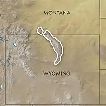
Aster mollis | 1901 | Soft aster | G3 | Dry montane meadows 2,000–3,000 m (6,560–9,840 ft) |
 |
S. spathulatum.jpg.webp) |
(Lindl.) G.L.Nesom |
Aster spathulatus | 1834 | Western mountain aster Three varieties[74]
|
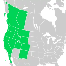
G5 | Montane meadows, open woodlands 100–2,900 m (330–9,510 ft)[74] |
 |
S. subspicatum |
(Nees) G.L.Nesom |
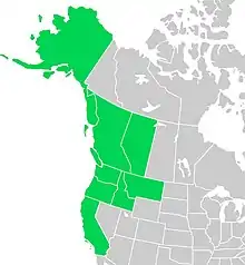
Aster subspicatus | 1832 | Douglas's aster | G5 | Disturbed and weedy open areas, marshes, thickets 0–1,000 m (0–3,280 ft) |
 |
Section Turbinelli
| Scientific name and picture |
Author citation [17] |
Basionym [18] |
Year [18] |
Common name(s) [19] |
NS [20] |
Habitat [19] |
Distribution [19] |
|---|---|---|---|---|---|---|---|
S. turbinellum.jpg.webp) |
(Lindl.) G.L.Nesom |
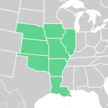
Aster turbinellus | 1835 | Prairie aster | G4 | Generally dry, acidic soils 60–900 m (200–2,950 ft) |
 |
Subsection Dumosi
| Scientific name and picture |
Author citation [17] |
Basionym [18] |
Year [18] |
Common name(s) and varieties [19] |
NS [20] |
Habitat [19] |
Distribution [17] |
|---|---|---|---|---|---|---|---|
S. boreale.jpg.webp) |
(Torr. & A.Gray) Á.Löve & D.Löve |
Aster laxifolius var. borealis | 1841 |
|
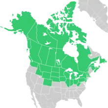
G5 | Calcareous areas, wetland areas 0–1,500 m (0–4,920 ft) |
 |
S. bullatum.jpg.webp) |
(Klatt) G.L.Nesom |
Aster bullatus | 1894 | NL | Wet ledges[75] 37–1,750 m (120–5,740 ft)[76] |
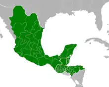 | |
S. burgessii_isotype_inflorescence.jpeg.webp) |
(Britton) G.L.Nesom |
Aster burgessii | 1914 | NL | Rocky river banks[77] | ||
S. carnerosanum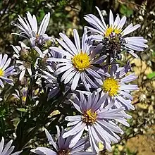 |
(S.Watson) G.L.Nesom |
Aster carnerosanus | 1891 | NL | 495–2,850 m (1,620–9,350 ft)[79] | 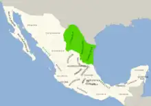 | |
S. dumosum.jpg.webp) |
(L.) G.L.Nesom |
Aster dumosus | 1753 | Bushy aster | G5 | Wetlands, muddy or mucky areas, sand, woods 0–700 m (0–2,300 ft) |
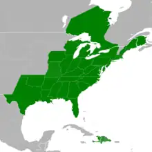 |
S. eulae.jpg.webp) |
(Shinners) G.L.Nesom |
Aster eulae | 1950 | Eula's aster | G4 | Part shade, soils with clay or silt, bottom areas or stream banks 0–100 m (0–330 ft) |
 [80][81][lower-alpha 5] |
S. lanceolatum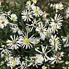 |
(Willd.) G.L.Nesom |
Aster lanceolatus | 1803 |
Five varieties[83]
|
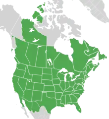
G5 | Stream banks, thickets, borders, ditches, meadows, mucky soils (depending on variety) 10–2,700 m (30–8,860 ft)[83] |
 |
S. lateriflorum.jpg.webp) |
(L.) Á.Löve & D.Löve |
Solidago lateriflora | 1753 |
|
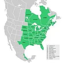
G5 | Mostly shade, dry to humid soils, woodland edges 0–400 m (0–1,310 ft) |
 |
S. leone.jpg.webp) |
(Britton) G.L.Nesom |
Aster leonis | 1920 | NL | Marshes[85] | 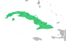 | |
S. nahanniense.jpg.webp) |
(Cody) Semple |
Aster nahanniensis | 1974 | Nahanni aster | G3 | Stream banks near hot mineral springs About 1,000 m (3,280 ft) |
Nahanni National Park Reserve Northwest Territories (Canada)[86][19] 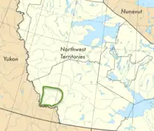 |
S. ontarionis.jpg.webp) |
(Wiegand) G.L.Nesom |
Aster ontarionis | 1928 |
Two varieties[17]
|
G5 | Moist soils or shores, other wetlands, field edges 10–300 m (30–980 ft)[38] |
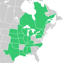 |
S. praealtum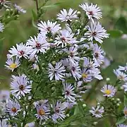 |
(Poir.) G.L.Nesom |
Aster praealtus | 1811 |
|
G5 | Usually moist and wet areas 0–400 m (0–1,310 ft) |
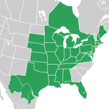 |
S. racemosum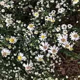 |
(Elliott) G.L.Nesom |
Aster racemosus | 1823 |
|
G4 | Moist to wet, often brackish, soils 0–200 m (0–660 ft) |
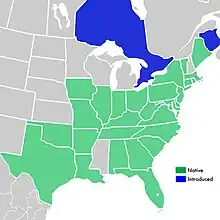 |
S. schaffneri.jpg.webp) |
(S.D.Sundb. & A.G.Jones) G.L.Nesom |
Aster schaffneri | 1986 | NL | Disturbed oak forests, secondary vegetation areas, mountain mesophilic forests, rich black or brown soils[87] 120–2,500 m (390–8,200 ft)[88] |
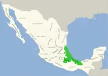 | |
S. simmondsii.jpg.webp) |
(Small) G.L.Nesom |
Aster simmondsii | 1913 | Simmonds' aster | G4 | Moist to dry soils 0–50 m (0–160 ft) |
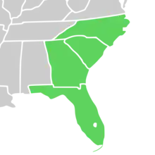 |
S. tradescantii.jpg.webp) |
(L.) G.L.Nesom |
Aster tradescantii | 1753 |
|
G4 | Shores, streams, freshwater estuaries 0–200 m (0–660 ft) |
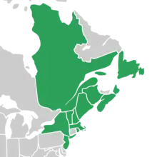 |
S. welshii.jpg.webp) |
(Cronquist) G.L.Nesom |
Aster welshii | 1994 | Welsh's aster | G2 | Wet soils in dry areas 1,300–2,300 m (4,270–7,550 ft) |
 |
Series Concinni
| Scientific name and picture |
Author citation [17] |
Basionym [18] |
Year [18] |
Common name(s) and varieties [19] |
NS [20] |
Habitat [19] |
Distribution |
|---|---|---|---|---|---|---|---|
S. laeve.jpg.webp) |
(L.) Á.Löve & D.Löve |
Aster laevis | 1753 | Smooth aster Four varieties[91]
|
G5 | Open and dry habitats 0–2,400 m (0–7,870 ft) |
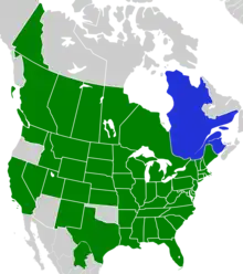 |
S. oolentangiense.jpg.webp) |
(Riddell) G.L.Nesom |
Aster oolentangiensis | 1835 |
|
G5 | Dry or dry to wet habitats 50–500 m (160–1,640 ft) |
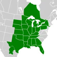 |
Series Cordifolii
| Scientific name and picture |
Author citation [17] |
Basionym [18] |
Year [18] |
Common name(s) and varieties [19] |
NS [20] |
Habitat [19] |
Distribution [17] |
|---|---|---|---|---|---|---|---|
S. anomalum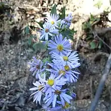 |
(Engelm.) G.L.Nesom |
Aster anomalus | 1843 | Manyray aster | G4 | Dry soils over limestone, acid soils 50–500 m (160–1,640 ft) |
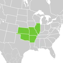 |
S. ciliolatum.jpg.webp) |
(Lindl.) Á.Löve & D.Löve |
Aster ciliolatus | 1836 |
|
G5 | Rich, open deciduous forests, trails, stream banks 0–2,000 m (0–6,560 ft) |
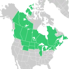 |
S. cordifolium |
(L.) G.L.Nesom |
Aster cordifolius | 1753 |
|
G5 | Mostly rich, moist soils and woods 0–1,200 m (0–3,940 ft) |
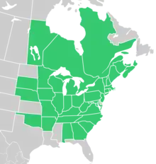 |
S. drummondii.jpg.webp) |
(Lindl.) G.L.Nesom |
Aster drummondii | 1835 | Drummond's aster Two varieties[94]
|
G5 | Old fields, woodlands, savannas depending on variety[95] 0–500 m (0–1,640 ft)[94] |
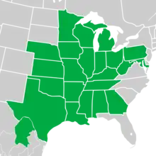 |
S. shortii.jpg.webp) |
(Lindl.) G.L.Nesom |
Aster shortii | 1834 | Short's aster | G5 | Thin rocky soils of woodlands and thickets often around limestone bluffs 100–500 m (330–1,640 ft) |
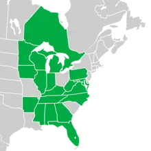 |
S. undulatum |
(L.) G.L.Nesom |
Aster undulatus | 1753 | Wavyleaf aster | G5 | Dry or well-drained loamy or rocky soils 200–1,500 m (660–4,920 ft) |
 |
S. urophyllum |
(Lindl.) G.L.Nesom |
Aster urophyllus | 1836 |
|
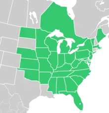
G4 | Open, dry to mesic habitats 40–300 m (130–980 ft) and higher |
 |
Subsection Porteriani
| Scientific name and picture |
Author citation [17] |
Basionym [18] |
Year [18] |
Common name(s) and varieties [19] |
NS [20] |
Habitat [19] |
Distribution [17] |
|---|---|---|---|---|---|---|---|
S. depauperatum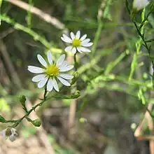 |
(Fernald) G.L.Nesom |
Aster depauperatus | 1908 |
|
G2 | Serpentine or diabasic soils 400–1,000 m (1,310–3,280 ft) |
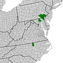 |
S. kentuckiense.jpg.webp) |
(Britton) Medley[97] |
Aster kentuckiensis | 1901 | G4 [100] |
Limestone cedar glades and limestone roadsides[101] | 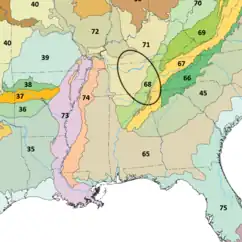 | |
S. parviceps.jpg.webp) |
(E.S.Burgess) G.L.Nesom |
Aster ericoides var. parviceps | 1898 |
|
G4 | Dry, sandy, or loamy soils; barrens, fields, roadsides, old cemeteries 200–400 m (660–1,310 ft) |
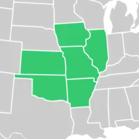 |
S. pilosum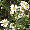 |
(Willd.) G.L.Nesom |
Aster pilosus | 1803 |
Two varieties[103]
|
G5 | Various and many, depending on variety 0–1,100 m (0–3,610 ft) |
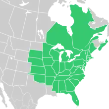 |
S. porteri.jpg.webp) |
(A.Gray) G.L.Nesom |
Aster porteri | 1881 |
|
G3 | Rocky Mountain foothills 1,800–2,900 m (5,910–9,510 ft) |
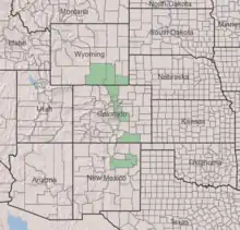 |
Series Punicei
| Scientific name and picture |
Author citation [17] |
Basionym [18] |
Year [18] |
Common name(s) and varieties [19] |
NS [20] |
Habitat [19] |
Distribution [17] |
|---|---|---|---|---|---|---|---|
S. elliottii.jpg.webp) |
(Torr. & A.Gray) G.L.Nesom |
Aster elliottii | 1841 | Elliott's aster | G4 | Swamps, bogs, marshes, brackish marshes 0–50 m (0–160 ft) |
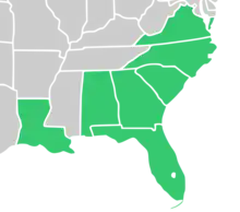 |
S. firmum.png.webp) |
(Nees) G.L.Nesom |
Aster firmus | 1818 | Glossy-leaved aster | G5 | Wet soils, fens, marshes 100–400 m (330–1,310 ft) |
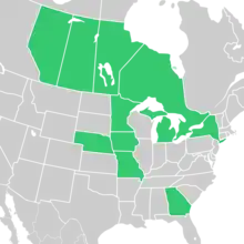 |
S. prenanthoides |
(Muhl. ex Willd.) G.L.Nesom |
Aster prenanthoides | 1803 | Crookedstem aster | G4 | Mostly wetlands such as swamps and seeps 100–1,500 m (330–4,920 ft) |
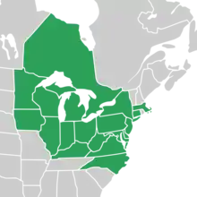 |
S. puniceum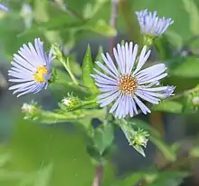 |
(L.) Á.Löve & D.Löve |
Aster puniceus | 1753 |
Two varieties[105]
|
G5 | Wetlands 0–2,000 m (0–6,560 ft)[105] |
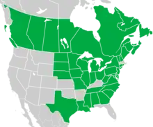 |
S. rhiannon.jpg.webp) |
Weakley & Govus | 2004 |
|
G1 | Serpentine barrens 900–1,300 m (2,950–4,270 ft) |
Buck Creek Serpentine Barrens,[106] Clay County, North Carolina (US)[107] 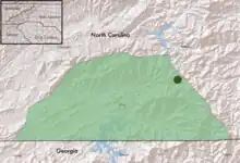 |
Series Symphyotrichum
| Scientific name and picture |
Author citation [17] |
Basionym [18] |
Year [18] |
Common name(s) and varieties [19] |
NS [20] |
Habitat [19] |
Distribution [17] |
|---|---|---|---|---|---|---|---|
S. anticostense.jpg.webp) |
(Fernald) G.L.Nesom |
Aster anticostensis | 1915 | Anticosti aster | G3 | Calcareous river shores, limestone lake shores 0–100 m (0–330 ft) |
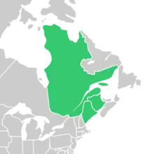 |
S. novi-belgii.jpg.webp) |
(L.) G.L.Nesom |
Aster novi-belgii | 1753 | New York aster Four varieties[17]
|
G5 | Mostly sea or stream shores, thickets, dunes, barrens (depending on variety) 0–800 m (0–2,620 ft)[38] |
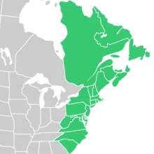 |
S. retroflexum.jpg.webp) |
(Lindl.) G.L.Nesom |
Aster retroflexus | 1836 | Rigid whitetop aster | G4 | Moist or dry wooded areas, moist meadows 400–1,500 m (1,310–4,920 ft) |
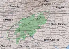 |
S. robynsianum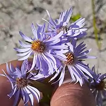 |
(J.Rousseau) Brouillet & Labrecque | Aster robynsianus | 1957 | Robyn's aster | G5 | Moist, open, sandy, gravelly, or rocky habitats 10–400 m (30–1,310 ft) |
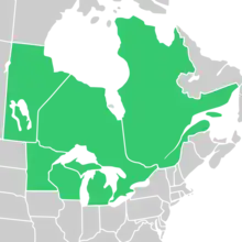 |
Subgenus Symphyotrichum named hybrids
| Scientific name and picture |
Author citation [17] |
Basionym [18] |
Year [18] |
Common name(s) | Parents | Habitat | Distribution [17] |
|---|---|---|---|---|---|---|---|
| S. × finkii | (Rydb.) G.L.Nesom |
Aster finkii | 1931 | S. cordifolium × S. shortii[110] | Wooded bluffs and fencerows[111] |  | |
S. × gravesii_specimen_(cropped).jpg.webp) |
(E.S.Burgess) G.L.Nesom |
Aster gravesii | 1901 | Graves' aster[113] | S. dumosum × S. laeve[114] | Dry woods[113] | 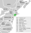 |
S. × longulum.jpg.webp) |
(E.Sheld.) G.L.Nesom |
Aster longulus | 1894 | S. boreale × S. puniceum[115] | Swampy and marshy areas[116] |  | |
| S. × priceae | (Britton) G.L.Nesom |
Aster priceae | 1901 | S. kentuckiense × S. pilosum[117] | Kentucky[117] | ||
S. × salignum_(cropped).jpg.webp) |
(Willd.) G.L.Nesom |
Aster salignus | 1803 | S. lanceolatum var. lanceolatum × S. novi-belgii var. novi-belgii[118] | 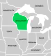 | ||
S. × schistosum.jpg.webp) |
(E.S.Steele) G.L.Nesom |
Aster schistosus | 1911 | S. cordifolium × S. laeve[119] | Shale gravel, dry hills[120] |  | |
S. × subgeminatum.jpg.webp) |
(Fernald) G.L.Nesom |
Aster foliaceus var. subgeminatus | 1915 | S. ciliolatum × S. novi-belgii var. novi-belgii[121] |
|
 | |
S. × tardiflorum.jpg.webp) |
(L.) Greuter, M.V.Agab. & Wagenitz |
Aster tardiflorus | 1763 | S. cordifolium × S. puniceum[123] | Along streams[124] |  | |
S. × versicolor |
(Willd.) G.L.Nesom |
Aster versicolor | 1803 | Late Michaelmas daisy[125] | S. laeve var. laeve × S. novi-belgii var. novi-belgii[126] |  | |
S. × woldenii.jpg.webp) |
(Rydb.) G.L.Nesom |
Aster woldenii | 1931 | S. laeve × S. praealtum[127] | 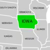 |
Notes
- Hybrids do not have their own articles.
- Elevation in the May Prairie State Natural Area
- Elevation on the island of Grand Bahama
- In FNA as Symphyotrichum cusickii[67]
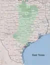
- This is a county map of east central Texas showing the range of S. eulae as described by Lloyd Herbert Shinners. Darker green shaded counties were in Shinners' 1950 protologue of Aster eulae. Lighter green shaded counties are within the area covered by Shinners' description. Darker green counties are, alphabetically, as follows: Bexar, Calhoun, Cooke, Dallas, Denton, Hill, Hunt, Kaufman, Navarro, Rockwall, Tarrant, Wise, and Wood.[80] The following counties are shaded lighter green because they are within Shinners' range but are not specifically named by him: Anderson, Austin, Bastrop, Bell, Bosque, Brazos, Burleson, Caldwell, Collin, Colorado, Comal, Coryell, DeWitt, Ellis, Falls, Fayette, Freestone, Goliad, Gonzales, Guadalupe, Hays, Henderson, Hood, Jack, Johnson, Karnes, Lavaca, Lee, Leon, Limestone, Madison, McLennan, Milam, Parker, Rains, Robertson, Smith, Somervell, Travis, Van Zandt, Victoria, Waller, and Washington. Williamson, and Wilson.[82] Only McLennan County is green on the S. eulae page in the USDA PLANTS database.[81]
- The locations are from the USDA PLANTS Database with added county information from two sources. Iowa[17][110] — Fayette;[112] West Virginia — no county information;[110] Wisconsin — Eau Claire, Grant,[111] and Waupaca.[110]
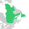
- There is also an extensive presence of Symphyotrichum × salignum in Europe and western Asia in the following countries: Assam, Austria, Baltic States, Belarus, Belgium, Bulgaria, Czechoslovakia, Denmark, Finland, France, Germany, Great Britain, Hungary, Ireland, Italy, Kazakhstan, Krym, Netherlands, Norway, Poland, Romania, Spain, Sweden, Switzerland, Tadzhikistan, Ukraine, Uzbekistan, and Yugoslavia.[17]
Citations
- Morgan & Holland (2012a).
- Nesom (2018a), p. 1.
- Brouillet et al. (2009), p. 610.
- Nesom (1994a), p. 212.
- Löve (1982), pp. 358–359.
- Nesom (1994b).
- Nesom (1994b), p. 273.
- Semple, Heard & Brouillet (2002a), p. 133.
- Nesom (1994b), p. 269.
- Nesom (1994b), p. 272.
- Nesom (1994b), p. 274.
- Nesom (1994b), p. 275.
- Nesom (1994b), p. 267.
- Nesom (1994b), p. 271.
- Nesom (1994b), p. 268.
- Nesom (1994b), p. 270.
- POWO (2021), search for species name.
- IPNI (2021), search for species name.
- Brouillet et al. (2006), search for species name.
- NatureServe (2022), search for species name.
- USDA (2014c).
- USDA (2014q).
- Hassler (2021), Symphyotrichum subulatum var. ligulatum.
- Sancho & Ariza Espinar (2003), p. 10 as Aster glabrifolius.
- Sancho & Ariza Espinar (2003), pp. 9–10 as Aster cabrerae.
- Heiden (2020).
- USDA (2014q), Symphyotrichum expansum.
- Brouillet et al. (2006), search for Symphyotrichum subulatum var. parviflorum.
- Hassler (2021), Symphyotrichum parviflorum.
- Sancho & Ariza Espinar (2003), pp. 10–11 as Aster patagonicus.
- Sancho & Ariza Espinar (2003), p. 11 as Aster peteroanus.
- Hassler (2021), Symphyotrichum potosinum.
- Sancho & Ariza Espinar (2003), p. 11 as Aster regnellii.
- Brouillet et al. (2006), Symphyotrichum subulatum varieties except ligulatum and parviflorum.
- Brouillet et al. (2006), Symphyotrichum tenuifolium varieties.
- Hind & Strange (2019), p. 390.
- Hind & Strange (2019), pp. 387–390.
- Brouillet et al. (2006), search for species name and varieties.
- Brouillet et al. (2006), Symphyotrichum ericoides var. ericoides.
- Brouillet et al. (2006), Symphyotrichum falcatum var. commutatum.
- USDA (2014a).
- Nesom (2018b), p. 6.
- Nesom (2018b), p. 5.
- Nesom (2018b), p. 3.
- Nesom (2018b), p. 2.
- Nesom (2018b), pp. 4–5.
- Nesom (1989).
- GBIF.org (2021b).
- Semple (2019a), p. 1.
- Semple (2019b).
- Semple (2019a), pp. 1, 7, 9.
- GBIF.org (2021c).
- SERNEC (2021).
- Semple (2019c).
- Semple (2014a).
- Semple (2014b).
- Leon Levy Native Plant Preserve (n.d.).
- Brouillet et al. (2006), Symphyotrichum × amethystinum.
- USDA (2014b).
- USDA (2014h).
- USDA (2014n).
- Semple (n.d.).
- CNPS (2021a).
- Allen (2012), Symphyotrichum defoliatum.
- Brouillet et al. (2006).
- Allen (2012), Symphyotrichum chilense.
- Brouillet et al. (2006), Symphyotrichum cusickii.
- Allen (2012), Symphyotrichum greatae.
- USDA (2014d).
- USDA (2014o).
- CNPS (2021b).
- Allen (2012), Symphyotrichum lentum.
- Montana Natural Heritage Program (n.d.).
- Brouillet et al. (2006), Symphyotrichum spathulatum varieties.
- Fernald (1900), as Aster jalapensis.
- GBIF.org (2021a).
- Britton (1914), pp. 14–15.
- GBIF.org (2021e).
- GBIF.org (2021d).
- Shinners (1950), p. 36,37,38.
- USDA (2014r).
- Shinners (1950), p. 36: "Common in north central Texas, from Hopkins and Wood west to Cooke and Wise counties; extending south to Bexar and Calhoun counties".
- Brouillet et al. (2006), Symphyotrichum lanceolatum varieties.
- Brouillet et al. (2006), Symphyotrichum lanceolatum var. hesperium.
- Britton (1920), p. 114.
- Parks Canada (2021).
- TORCH (2022).
- GBIF.org (2022a).
- Sundberg & Jones (1986), pp. 175–176.
- Semple (2021a).
- Brouillet et al. (2006), Symphyotrichum laeve varieties.
- Brouillet et al. (2006), Symphyotrichum laeve var. geyeri.
- Brouillet et al. (2020).
- Brouillet et al. (2006), Symphyotrichum drummondii varieties.
- Wilhelm & Rericha (2017), p. 1098.
- Gustafson & Latham (2005), p. 1447.
- POWO (2022a).
- Medley (2021).
- Britton (1901).
- NatureServe (2022a).
- Semple (2021c).
- Gianopulos (2014).
- Brouillet et al. (2006), Symphyotrichum pilosum varieties.
- USDA (2014e).
- Brouillet et al. (2006), Symphyotrichum puniceum varieties.
- Kauffman et al. (2004).
- USDA (2014f).
- USDA (2014p).
- Semple (2021b).
- USDA (2014g).
- Shinners (1941), p. 407.
- Rydberg (1931), p. 102.
- Britton (1901), pp. 961–962.
- USDA (2014i).
- USDA (2014j).
- Sheldon (1894).
- POWO (2022b).
- Verloove (2014a).
- USDA (2014k).
- Steele (1911), p. 373.
- Brouillet et al. (2006), Symphyotrichum ciliolatum.
- Fernald (1915), p. 16.
- USDA (2014l).
- Gray (1884), p. 194.
- GRIN (n.d.).
- Verloove (2014b).
- USDA (2014m).
References
- Allen, G.A. (2012). In Jepson Flora Project (ed.). Jepson eFlora. The Jepson Herbarium, University of California, Berkeley.
- Britton, N.L. (1901). Manual of the Flora of the Northern States and Canada. New York: H. Holt and Co. Retrieved 27 August 2021 – via Biodiversity Heritage Library.
- Britton, N.L. (January 1914). "Studies of West Indian Plants—V". Bulletin of the Torrey Botanical Club. New York. 41 (1): 1–24. doi:10.2307/2479432. JSTOR 2479432.
- Britton, N.L. (1920). "Descriptions of Cuban Plants New to Science". Memoirs of the Torrey Botanical Club. Seeman Printery. 16 (2): 114. ISSN 0097-3807. LCCN gs14000849. OCLC 1767639. Retrieved 26 August 2021 – via Biodiversity Heritage Library.
- Brouillet, L.; Desmet, P.; Coursol, F.; Meades, S.J.; Favreau, M.; Anions, M.; Bélisle, P.; Gendreau, C.; Shorthouse, D. (4 September 2020). "Symphyotrichum laeve (Linnaeus) Á. Löve & D. Löve". data.canadensys.net. Database of Vascular Plants of Canada (VASCAN). Retrieved 14 September 2021.
- Brouillet, L.; Lowrey, T.K.; Urbatsch, L.E.; Karaman-Castro, V.; Sancho, G.; Wagstaff, S.J.; Semple, J.C. (2009). "Chapter 37: Astereae". In Funk, V.A.; Susanna, A.; Stuessy, T.F.; Bayer, R.J. (eds.). Systematics, Evolution and Biogeography of the Compositae. Vienna: International Association for Plant Taxonomy. pp. 589–629. ISBN 978-3-9501754-3-1. Retrieved 21 September 2021 – via ResearchGate.
- Brouillet, L.; Semple, J.C.; Allen, G.A.; Chambers, K.L.; Sundberg, S.D. (2006). "Symphyotrichum". In Flora of North America Editorial Committee (ed.). Flora of North America North of Mexico (FNA). Vol. 20. New York and Oxford: Oxford University Press. Retrieved 5 August 2021 – via eFloras.org, Missouri Botanical Garden, St. Louis, MO & Harvard University Herbaria, Cambridge, MA.
- CNPS (2021a). "Symphyotrichum defoliatum". rareplants.cnps.org. Retrieved 4 August 2021.
- CNPS (2021b). "Symphyotrichum lentum". rareplants.cnps.org. Retrieved 5 August 2021.
- Fernald, M.L. (1900). "III. Some Undescribed Mexican Phanerogams, Chiefly Labiatae and Solanaceae". Proceedings of the American Academy of Arts and Sciences. Boston: Metcalf and Co. 35 (25): 572–573. doi:10.2307/25129968. JSTOR 25129968. Retrieved 19 August 2021 – via Biodiversity Heritage Library.
- Fernald, M.L. (1915). "I. Some New or Unrecorded Compositae Chiefly of Northeastern America". Rhodora. Boston: Preston and Rounds Co. 17 (193): 1–20. Retrieved 8 November 2021 – via Biodiversity Heritage Library.
- GBIF.org (2021a). "Search of preserved specimen records of Symphyotrichum bullatum (with taxonomic synonyms)". Retrieved 19 August 2021.
- GBIF.org (28 August 2021b). GBIF Occurrence Download [Symphyotrichum trilineatum]. doi:10.15468/dl.nqq5e8.
- GBIF.org (28 August 2021c). GBIF Occurrence Download [Symphyotrichum fontinale]. doi:10.15468/dl.szzc9y.
- GBIF.org (29 August 2021d). GBIF Occurrence Download [Symphyotrichum carnerosanum]. doi:10.15468/dl.fyecyj.
- GBIF.org (29 August 2021e). GBIF Occurrence Download [Symphyotrichum burgessii]. doi:10.15468/dl.hmn3ab.
- GBIF.org (9 January 2022a). GBIF Occurrence Download [Symphyotrichum schaffneri]. doi:10.15468/dl.byy6re.
- Gianopulos, K. (2014). Coefficient of Conservatism Database Development for Wetland Plants Occurring in the Southeast United States (Report). NC Dept. of Envir. Quality, Div. of Water Resources: Wetlands Branch. Report to the EPA. developed with 15 expert botanists. Retrieved 2 October 2022 – via Floristic Quality Assessment.
- Gray, A. (1884). Synoptical Flora of North America. Vol. 1:2. Washington, DC: Smithsonian Institution. Retrieved 17 September 2021 – via Biodiversity Heritage Library.
- GRIN (n.d.). "Symphyotrichum × versicolor (Willd.) G. L. Nesom". Germplasm Resources Information Network (GRIN). Agricultural Research Service (ARS), United States Department of Agriculture (USDA). Retrieved 8 November 2021.
- Gustafson, D.J.; Latham, R.E. (June 2005). "Is the Serpentine Aster, Symphyotrichum depauperatum (Fern.) Nesom, a Valid Species and Actually Endemic to Eastern Serpentine Barrens?". Biodiversity and Conservation. Springer. 14 (6): 1445–1452. doi:10.1007/s10531-004-9670-x. S2CID 32930093. Archived (PDF) from the original on 6 September 2021. Retrieved 5 September 2021 – via ResearchGate.
- Hassler, M. (8 December 2021). "Search for Symphyotrichum taxon specified in citation – World Plants: Synonymic Checklists of the Vascular Plants of the World". In Bánki, O.; Roskov, Y.; Döring, M.; Ower, G.; Vandepitte, L.; Remsen, D.; Hobern, D.; Schalk, P.; DeWalt, R.E.; Keping, M.; Miller, J.; Orrell, T.; Aalbu, R.; Adlard, R.; Adriaenssens, E.; Aedo, C.; Aescht, E.; Akkari, N.; Alonso-Zarazaga, M.A.; et al. (eds.). Species 2000 & ITIS Catalogue of Life, 18 December 2021. ISSN 2405-8858. Retrieved 30 December 2021.
{{cite book}}:|journal=ignored (help) - Heiden, G. (2020). "Symphyotrichum martii". reflora.jbrj.gov.br (in Portuguese). Jardim Botânico do Rio de Janeiro [Rio de Janeiro Botanical Garden]. Retrieved 11 August 2021.
- Hind, N.; Strange, K. (4 January 2019). "Symphyotrichum vahlii". Curtis's Botanical Magazine. Wiley on behalf of Royal Botanic Gardens, Kew. 35 (4): 380–395. doi:10.1111/curt.12259. S2CID 91385545.
- IPNI (2021). "International Plant Names Index". Royal Botanic Gardens, Kew; Harvard University Herbaria & Libraries; Australian National Botanic Gardens.
- Kauffman, G.L.; Nesom, G.L.; Weakley, A.S.; Govus, T.E.; Cotterman, L.M. (2004). "A New Species of Symphyotrichum (Asteraceae: Astereae) from a Serpentine Barren in Western North Carolina". SIDA, Contributions to Botany. Forth Worth: Botanical Research Institute of Texas. 21: 827–839. ISSN 0036-1488. Retrieved 8 September 2021 – via Biodiversity Heritage Library.
- Leon Levy Native Plant Preserve (n.d.). "Symphyotrichum lucayanum". www.levypreserve.org. Nassau: Bahamas National Trust. Retrieved 10 September 2021.
- Löve, Á. (May 1982). "IOPB Chromosome Number Reports LXXV". Taxon. Utrecht, Netherlands: International Bureau for Plant Taxonomy and Nomenclature. 31 (2): 342–368. doi:10.1002/j.1996-8175.1982.tb02378.x. ISSN 0040-0262. JSTOR 1220008.
- Medley, M.E. (20 April 2021). "Aster priceae and A. kentuckiensis (Asteraceae): Nomenclatural history and a new binomial for Price's aster" (PDF). Phytoneuron. 2021 (18): 1–3. ISSN 2153-733X. Retrieved 23 September 2022.
- Montana Natural Heritage Program (n.d.). "Montana Field Guide: Soft Aster — Symphyotrichum molle". fieldguide.mt.gov. Retrieved 30 October 2021.
- Morgan, D.R.; Holland, B. (2012a). "Systematics of Symphyotrichinae (Asteraceae: Astereae): Disagreements Between Two Nuclear Regions Suggest a Complex Evolutionary History". Systematic Botany. American Society of Plant Taxonomists. 37 (3): 818–832. doi:10.1600/036364412X648760. JSTOR 41515169. S2CID 84007309.
- NatureServe (5 August 2022). "NatureServe Explorer". explorer.natureserve.org. Arlington, Virginia.
- NatureServe (1 October 2022a). "Symphyotrichum priceae". explorer.natureserve.org. Arlington, Virginia. Retrieved 2 October 2022.
- Nesom, G.L. (1989). "A New Species of Aster (Asteraceae: Astereae) from México". Phytologia. 67 (4): 342–345. ISSN 0031-9430. Retrieved 5 September 2021 – via Biodiversity Heritage Library.
- Nesom, G.L. (March 1994a). "Subtribal classification of the Astereae (Asteraceae)". Phytologia. 76 (3): 193–274. ISSN 0031-9430. Retrieved 12 November 2021 – via Biodiversity Heritage Library.
- Nesom, G.L. (September 1994b). "Review of the Taxonomy of Aster sensu lato (Asteraceae: Astereae), Emphasizing the New World Species". Phytologia (published 31 January 1995). 77 (3): 141–297. ISSN 0031-9430. Retrieved 23 August 2021 – via Biodiversity Heritage Library.
- Nesom, G.L. (30 May 2018a). "Aster gypsophilus (Asteraceae) Segregated as the Monotypic Genus Sanrobertia" (PDF). Phytoneuron. 2018 (25): 1–8. eISSN 2153-733X. Retrieved 25 November 2020.
- Nesom, G.L. (19 June 2018b). "Taxonomic Review of the Symphyotrichum moranense Group (Asteraceae)" (PDF). Phytoneuron. Fort Worth, Texas: Guy L. Nesom. 2018 (38): 1–20. eISSN 2153-733X. Retrieved 3 August 2021.
- Parks Canada (2021). Management Plan for the Nahanni Aster (Symphyotrichum nahanniense) in Canada (Report). Species at Risk Act Management Plan Series. Catalogue no. En3-5/115-2021E-PDF. Ottawa: Parks Canada Agency. ISBN 978-0-660-38590-7. Archived from the original on 31 August 2021. Retrieved 31 August 2021.
- POWO (2021). "Plants of the World Online". Royal Botanic Gardens, Kew.
- POWO (2022a). "Symphyotrichum kentuckiense (Britton) Medley". Plants of the World Online. Royal Botanic Gardens, Kew. Retrieved 30 September 2022.
- POWO (2022b). "Symphyotrichum × priceae (Britton) G.L.Nesom". Plants of the World Online. Royal Botanic Gardens, Kew. Retrieved 1 October 2022.
- Rydberg, P.A. (1931). "Taxonomic Notes on the Flora of the Prairies and Plains of Central North America". Brittonia. New York Botanical Garden Press. 1 (2): 79–104. doi:10.2307/2804786. JSTOR 2804786. S2CID 40538498.
- Sancho, G.; Ariza Espinar, L. (2003). "Asteraceae part 16. Tribu: Astereae, parte B. Subtribus: Bellidinae–Asterinae (excepto Grindelia y Haplopappus)" (PDF). In Hunziker, A.T. (ed.). Flora Fanerogámica Argentina (in Spanish). Vol. 81. pp. 1–102. Retrieved 14 July 2021.
- Semple, J.C. (n.d.). "Symphyotrichum subg. Ascendentes". www.uwaterloo.ca. Ontario. Archived from the original on 22 July 2021. Retrieved 22 July 2021.
- Semple, J.C. (21 February 2014a). "Symphyotrichum pygmaeum Pygmy Aster". www.uwaterloo.ca. Ontario. Archived from the original on 23 July 2021. Retrieved 10 September 2021.
- Semple, J.C. (21 February 2014b). "Symphyotrichum yukonense Yukon Aster". www.uwaterloo.ca. Ontario. Archived from the original on 23 July 2021. Retrieved 10 September 2021.
- Semple, J.C. (16 October 2019a). "Symphyotrichum estesii, a New Species of Virguloid Aster from Tennessee (Asteraceae: Astereae)" (PDF). Phytoneuron. Fort Worth, Texas: Guy L. Nesom. 2019 (36): 1–10. eISSN 2153-733X. Retrieved 23 November 2020.
- Semple, J.C. (16 October 2019b). "Symphyotrichum estesii May Prairie Aster, Estes's Aster". www.uwaterloo.ca. Ontario. Archived from the original on 23 July 2021. Retrieved 28 August 2021.
- Semple, J.C. (16 October 2019c). "Symphyotrichum fontinale Florida Water Aster". www.uwaterloo.ca. Ontario. Archived from the original on 23 July 2021. Retrieved 28 August 2021.
- Semple, J.C. (6 May 2021a). "Symphyotrichum simmondsii Simmonds's Aster". www.uwaterloo.ca. Ontario. Archived from the original on 9 September 2021. Retrieved 9 September 2021.
- Semple, J.C. (6 May 2021b). "Symphyotrichum retroflexum Ridge Whitetop Aster". www.uwaterloo.ca. Ontario. Archived from the original on 6 October 2021. Retrieved 13 November 2021.
- Semple, J.C. (17 May 2021c). "Symphyotrichum kentuckiense". www.uwaterloo.ca. Ontario. Archived from the original on 22 September 2022. Retrieved 30 September 2022.
- Semple, J.C.; Heard, S.B.; Brouillet, L. (2002a). "Cultivated and Native Asters of Ontario (Compositae: Astereae)". University of Waterloo Biology Series. Ontario: University of Waterloo. 41: 1–134.
- SERNEC (28 August 2021). "Data portal search for Symphyotrichum fontinale". www.sernecportal.org. Retrieved 28 August 2021.
- Sheldon, E.P. (16 January 1894). MacMillan, C. (ed.). "Some Extensions of Plant Ranges". Minnesota Botanical Studies. Minneapolis: Geological and Natural History Survey of Minnesota. 1: 18. Retrieved 13 September 2021 – via Biodiversity Heritage Library.
- Shinners, L.H. (1941). "The Genus Aster in Wisconsin". The American Midland Naturalist. South Bend, Indiana: The University of Notre Dame. 26 (2): 398–420. doi:10.2307/2420967. JSTOR 2420967.
- Shinners, L.H. (1 January 1950). "Notes on Texas Compositae – V". Field & Laboratory. University Park, Texas: Southern Methodist University. 18 (1): 32–42. Archived from the original on 23 October 2022. Retrieved 23 October 2022.
- Steele, E.S. (1911). "New or Noteworthy Plants from the Eastern United States". Contributions from the United States National Herbarium. Washington, DC: Smithsonian Institution Press. 13: 373–374. Retrieved 13 September 2021 – via Biodiversity Heritage Library.
- Sundberg, S.D.; Jones, A.G. (1986). "Two New Taxa of Aster (Asteraceae) from Mexico". Bulletin of the Torrey Botanical Club. New York. 113 (2): 173–177. doi:10.2307/2995942. JSTOR 2995942.
- TORCH (8 January 2022). "Search of preserved specimen records of Symphyotrichum schaffneri (with taxonomic synonyms)". portal.torcherbaria.org. The Texas Oklahoma Regional Consortium of Herbaria. Retrieved 8 January 2022.
- USDA, NRCS (2014a). "Symphyotrichum patens". The PLANTS Database (plants.usda.gov). Greensboro, North Carolina: National Plant Data Team. Retrieved 23 December 2019.
- USDA, NRCS (2014b). "Symphyotrichum ×amethystinum". The PLANTS Database (plants.usda.gov). Greensboro, North Carolina: National Plant Data Team. Retrieved 11 September 2021.
- USDA, NRCS (2014c). "Eurybia chapmanii". The PLANTS Database (plants.usda.gov). Greensboro, North Carolina: National Plant Data Team. Retrieved 29 August 2021.
- USDA, NRCS (2014d). "Symphyotrichum hallii". The PLANTS Database (plants.usda.gov). Greensboro, North Carolina: National Plant Data Team. Retrieved 31 August 2021.
- USDA, NRCS (2014e). "Symphyotrichum porteri". The PLANTS Database (plants.usda.gov). Greensboro, North Carolina: National Plant Data Team. Retrieved 7 September 2021.
- USDA, NRCS (2014f). "Symphyotrichum rhiannon". The PLANTS Database (plants.usda.gov). Greensboro, North Carolina: National Plant Data Team. Retrieved 8 September 2021.
- USDA, NRCS (2014g). "Symphyotrichum ×finkii". The PLANTS Database (plants.usda.gov). Greensboro, North Carolina: National Plant Data Team. Retrieved 11 September 2021.
- USDA, NRCS (2014h). "Symphyotrichum ×batesii". The PLANTS Database (plants.usda.gov). Greensboro, North Carolina: National Plant Data Team. Retrieved 11 September 2021.
- USDA, NRCS (2014i). "Symphyotrichum ×gravesii". The PLANTS Database (plants.usda.gov). Greensboro, North Carolina: National Plant Data Team. Retrieved 11 September 2021.
- USDA, NRCS (2014j). "Symphyotrichum ×longulum". The PLANTS Database (plants.usda.gov). Greensboro, North Carolina: National Plant Data Team. Retrieved 11 September 2021.
- USDA, NRCS (2014k). "Symphyotrichum ×schistosum". The PLANTS Database (plants.usda.gov). Greensboro, North Carolina: National Plant Data Team. Retrieved 11 September 2021.
- USDA, NRCS (2014l). "Symphyotrichum ×tardiflorum". The PLANTS Database (plants.usda.gov). Greensboro, North Carolina: National Plant Data Team. Retrieved 11 September 2021.
- USDA, NRCS (2014m). "Symphyotrichum ×woldenii". The PLANTS Database (plants.usda.gov). Greensboro, North Carolina: National Plant Data Team. Retrieved 11 September 2021.
- USDA, NRCS (2014n). "Symphyotrichum ×columbianum". The PLANTS Database (plants.usda.gov). Greensboro, North Carolina: National Plant Data Team. Retrieved 11 September 2021.
- USDA, NRCS (2014o). "Symphyotrichum jessicae". The PLANTS Database (plants.usda.gov). Greensboro, North Carolina: National Plant Data Team. Retrieved 12 September 2021.
- USDA, NRCS (2014p). "Symphyotrichum retroflexum". The PLANTS Database (plants.usda.gov). Greensboro, North Carolina: National Plant Data Team. Retrieved 13 November 2021.
- USDA, NRCS (2014q). "Symphyotrichum divaricatum". The PLANTS Database (plants.usda.gov). Greensboro, North Carolina: National Plant Data Team. Retrieved 17 December 2021.
- USDA, NRCS (2014r). "Symphyotrichum eulae". The PLANTS Database (plants.usda.gov). Greensboro, North Carolina: National Plant Data Team. Retrieved 6 January 2022.
- Verloove, F. (19 December 2014a). "Symphyotrichum × salignum". alienplantsbelgium.be. Belgium: Botanic Garden Meise. Retrieved 20 August 2021.
- Verloove, F. (19 December 2014b). "Symphyotrichum × versicolor". alienplantsbelgium.be. Belgium: Botanic Garden Meise. Retrieved 20 August 2021.
- Wilhelm, G.; Rericha, L. (2017). Flora of the Chicago Region: A Floristic and Ecological Synthesis. Illustrated by Lowther, M.M. Indianapolis: Indiana Academy of Science. ISBN 978-1883362157. OCLC 983207050.