Tanami bioregion
Tanami is an interim Australian bioregion, comprising 25,997,277 hectares (64,240,670 acres) in the Northern Territory and Western Australia.[1] It is part of the Great Sandy-Tanami desert ecoregion.
| Tanami Australia | |||||||||||||||
|---|---|---|---|---|---|---|---|---|---|---|---|---|---|---|---|
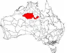 The interim Australian bioregions, with Tanami in red | |||||||||||||||
| Area | 259,972.77 km2 (100,376.0 sq mi) | ||||||||||||||
| |||||||||||||||
The bioregion has the code TAN.[2] There are three subregions.[2]
| IBRA regions and subregions: IBRA7 | ||||
|---|---|---|---|---|
| IBRA region / subregion | IBRA code | Area | States | Location in Australia |
| Tanami | TAN | 25,997,277 hectares (64,240,670 acres) | NT / WA | |
| Tanami Desert | TAN01 | 20,769,151 hectares (51,321,690 acres) | ||
| Wycliffe | TAN02 | 1,600,893 hectares (3,955,890 acres) | ||
| Sandover | TAN03 | 3,627,233 hectares (8,963,090 acres) | ||
References
- Environment Australia. "Revision of the Interim Biogeographic Regionalisation for Australia (IBRA) and Development of Version 5.1 – Summary Report" (PDF). Department of the Environment and Water Resources, Government of Australia. Retrieved 9 May 2022.
{{cite journal}}: Cite journal requires|journal=(help) - "Interim Biogeographic Regionalisation for Australia (IBRA7) regions and codes". Department of Sustainability, Environment, Water, Population and Communities. Commonwealth of Australia. 2012. Retrieved 13 January 2013.
Further reading
- Thackway, R and I D Cresswell (1995) An interim biogeographic regionalisation for Australia : a framework for setting priorities in the National Reserves System Cooperative Program Version 4.0 Canberra : Australian Nature Conservation Agency, Reserve Systems Unit, 1995. ISBN 0-642-21371-2
| Topics | ||
|---|---|---|
| Regions | ||
| Major settlements | ||
This article is issued from Wikipedia. The text is licensed under Creative Commons - Attribution - Sharealike. Additional terms may apply for the media files.