List of crossings of the River Thames
The River Thames is the second-longest river in the United Kingdom, passes through the capital city, and has many crossings.

Counting every channel – such as by its islands linked to only one bank – it is crossed by over 300 bridges. If taking cuts – excavated channels – to be measurements of river, its 185-mile (298 km) course west of Tilbury has 27 tunnels, six public ferries, one cable car link, and one ford. From end to end a channel of the Thames can be seen, mostly its main flow, which is passed over by 138 bridges. These are listed here with 2 former bridges and a seasonal festival bridge. Over 162 other bridges link to such places as typical or man-made islands or across an array of corollary and lesser side channels (backwaters), particularly in and around Oxford and the non-village channel of Ashton Keynes — these are not listed.
The river's lower estuary is shallow – but wide – and has no crossing east of Tilbury, the easternmost half as most broadly defined which even extends to the end of the rivers Medway and Crouch.
Barrier and boundary
Until sufficient crossings were established, the river provided a formidable barrier for most of its course – in post-Roman Britain during the Dark Ages Belgic-Celtic tribal lands and Anglo-Saxon kingdoms and subdivisions were defined by which side of the river they were on. In the latter's system of English counties continued by predominantly Norman England and for some centuries thereafter, the river formed a mutual limit of counties. After rising in Gloucestershire, the river flows between, on the north bank, the historic counties of Oxfordshire, Buckinghamshire, Middlesex and Essex; and on the south bank, the counties of Wiltshire, Berkshire, Surrey, and Kent. However the many permanent crossings that have been built over the centuries have changed the dynamics and made cross-river development and shared responsibilities more practicable.
In 1911 Caversham, on the north bank, was transferred into Berkshire. In 1965, with the creation of Greater London, the London Borough of Richmond upon Thames united areas formerly in Middlesex and Surrey; and at the same time two urban districts in Middlesex (united in 1974) became part of Surrey. Further changes in 1974 moved some of the boundaries away from the river. For example, much of the north west of Berkshire including Wallingford, Abingdon and Wantage became part of Oxfordshire, and some southern parts of Buckinghamshire became part of Berkshire, including Slough, Eton and Wraysbury. The number of county councils has fallen (and some others have dwindled in area) in England in favour of increased localisation.[note 1]
Lessening these last changes, in the sports of rowing and skiffing the river banks are referred to by their traditional county names, and in football and cricket the traditional counties also, often, persist.[note 2]
History of crossings

The original crossings over the Thames would all have been fords- typically on gravel beds. Well known ones include Wallingford and Oxford, but it is likely that there was a prehistoric ford where the Romans built London Bridge. In the upper reaches of the Thames, the river depth was raised by dams and in the lower reaches it was raised by embankments, so gradually most fords were lost.[1] At least one regular ford remains, at Duxford.
Many of the present road bridges over the river are on the sites of earlier fords, ferries and wooden structures. The earliest known major crossings of the Thames by the Romans were at London Bridge and Staines Bridge. At Folly Bridge in Oxford the remains of the Saxon forerunner can be seen, and medieval stone ones such as Wallingford, Newbridge in west Oxfordshire and Abingdon Bridges are still in use. In today's south-west London lies Kingston Bridge, which was the only crossing between London Bridge and Staines until the beginning of the 18th century and has been twice widened since it's completion.
Proposals to build bridges for Lambeth/Westminster and Putney/Fulham in around 1670 were defeated by the Rulers of the Company of Watermen, since it would cut the trade of the then 60,000 rivermen plying ferry services and who were noted as a pool of naval reserves.[2]
_by_Claes_Van_Visscher.jpg.webp)
During the 18th century, many stone and brick instances were built – from new or to replace existing structures – in London and further up the river. These included Westminster, Putney, Datchet, Windsor and Sonning Bridges. Several central London road bridges were built in the 19th century, most conspicuously Tower Bridge, the only bascule bridge on the river, which enables some types of ocean-going ships to pass beneath it. The most recent road bridge sites are the bypasses at Isis Bridge and Marlow By-pass Bridge and for motorways such as the two for the M25: Queen Elizabeth II Bridge and M25 Runnymede Bridge.
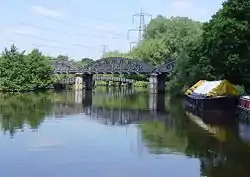
The development of the railways resulted in a spate of bridge building in the 19th century, including Blackfriars and Charing Cross (Hungerford) Railway Bridges in central London, and the simple but majestic three, of grand arch design, by Isambard Kingdom Brunel at Maidenhead, Gatehampton and Moulsford.
The world's first underwater tunnel was the Thames Tunnel by Marc Brunel built in 1843, designed for horse-drawn carriages but used as a pedestrian route; since 1869 the tunnel has carried trains on the East London Line. The Tower Subway (1870) was briefly used for a railway; later came all the deep-level tube lines. Two road tunnels were built in East London at the end of the 19th century, the Blackwall Tunnel and the Rotherhithe Tunnel; and the latest tunnel is the Dartford Crossing.
Many footbridges were made across the weirs that were built on the non-tidal river, and some of these remained when the locks were built, such as at Benson Lock. Some, above Oxford, have survived when the weir was lost, as at Hart's Weir Footbridge. Around the year 2000 several were added, as part of the Thames Path or for the Millennium. These include Temple, Bloomers Hole, the Hungerford Footbridges and the Millennium Bridge in distinct, aesthetic but durable, forms.
Six ferries cross the river:
- The Woolwich Ferry is one of two in the Thames Gateway, linking the North and South Circular roads. The Gravesend–Tilbury Ferry further downstream is a pedestrian ferry only.
- Upstream of central London, the Hammertons Ferry is a passenger link between the tourist attractions of Ham House and Marble Hill House in Twickenham.[3]
- Further upstream, the Hampton Ferry, the Sunbury Ferry, and the Shepperton to Weybridge Ferry are all pedestrian ferries to the west of London.[4]
Note on the listing
The list is from the estuary to the source. A few of the crossings listed are public foot bridges using walkways across lock gates and then bridges parallel to or on top of the associated weir(s) to the non-lock-associated bank. Most of the other locks on the River Thames also have walkways across their lock gates and/or weirs, but these do not completely cross the river, or are restricted to authorised personnel only, and are therefore not listed.
Also operating are boat services, ranging from year-round in London to seven or fewer months (including the summer) serving upper stretches. Whilst their main purpose is not to carry people across the river, several bring about one or more crossings but usually not to points facing each other.
North Sea to London
| Crossing | Type | Coordinates | Opened | Notes | Photo |
|---|---|---|---|---|---|
| Thames Cable Tunnel | Utility tunnel | 🌍 | 1970 | Carries two 400kV circuits;[5][6] accessible by authorised personnel only | |
| Gravesend–Tilbury Ferry | Ferry route | 🌍 | 1571 or before[7] | Foot/bicycle ferry | 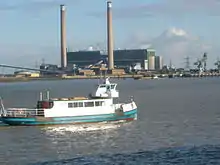 |
| 400 kV Thames Crossing | Overhead power line crossing | 🌍 | 1965 | Overhead power line 623 ft tall crossing the Thames at Swanscombe and Grays |  |
| High Speed 1 tunnels | Railway tunnel | 🌍 | 2007 | Two 2.5 km tunnels, 7.15 m internal diameter, between West Thurrock (Essex) and Swanscombe (Kent) |  |
| Queen Elizabeth II Bridge | Cable-stayed bridge, road bridge | 🌍 | 30 Oct 1991 | Cable-stayed bridge – the southbound element of the Dartford Crossing | 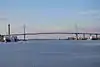 |
| Dartford Tunnel (eastern) | Road tunnel | 🌍 | May 1980 | 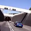 | |
| Dartford Tunnel (western) | Road tunnel | 🌍 | 18 Nov 1963 | .jpg.webp) | |
| Dartford Cable Tunnel | Utility tunnel | 🌍 | 2005 | Carrying electrical cable; accessible by authorised personnel only |
Proposed
The Lower Thames Crossing is an awaiting-planning-consent road tunnel close to the Thames Cable Tunnel that may open in 2028.[8]
East London
| Crossing | Type | Coordinates | Opened | Notes | Photo |
|---|---|---|---|---|---|
| Barking cable tunnel | Utility tunnel[9] | 🌍 | 1920s[10] | Carries four 33 kV electricity circuits from Barking substation to Sewell Road substation, Thamesmead[11] | |
| Docklands Light Railway tunnel | Railway tunnel | 🌍 | 2009 | Between King George V and Woolwich Arsenal stations | |
| Crossrail tunnels | Railway tunnel | 🌍 | 2014[12] | Completed in 2014,[13] part of the Elizabeth line, opened to the public in 2022. | |
| Woolwich foot tunnel | Pedestrian tunnel | 🌍 | 26 Oct 1912 |  | |
| Woolwich Ferry | Ferry route | 🌍 | 23 Mar 1889 |  | |
| Thames Barrier | Flood barrier | 🌍 | 1984 | Service tunnel accessible by authorised personnel only |  |
| London cable car | Gondola lift, transport route | 🌍 | 28 Jun 2012 | .jpg.webp) | |
| Millennium Dome cable tunnel | Utility tunnel | 1999[14] | Accessible by authorised personnel only | ||
| Jubilee line tunnels | Railway tunnel | 🌍 | 1999 | Between North Greenwich and Canning Town stations. | |
| Blackwall Tunnel (eastern) | Road tunnel | 🌍 | 1967 | For southbound vehicular traffic only |  |
| Blackwall Tunnel (western) | Road tunnel | 🌍 | 22 May 1897[15] | For northbound vehicular traffic only |  |
| Isle of Dogs Jubilee line tunnels | Railway tunnel | 🌍 | 1999 | Between Canary Wharf and North Greenwich stations. | |
| Greenwich foot tunnel | Pedestrian tunnel | 🌍 | 1899 | 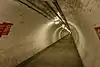 | |
| Docklands Light Railway tunnel | Railway tunnel | 🌍 | 1999 | Between Island Gardens and Cutty Sark stations. | |
| Deptford cable tunnel | Utility tunnel | 🌍 | Carries 30 11 kV electricity circuits[16] | ||
| Jubilee line tunnels | Railway tunnel | 🌍 | 1999 | Between Canada Water and Canary Wharf stations. | |
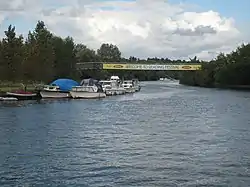
| Canary Wharf – Rotherhithe Ferry | Ferry route | 🌍 | 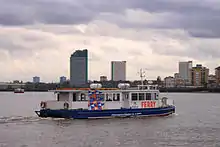 | ||
| Rotherhithe Tunnel | Road tunnel, pedestrian tunnel | 🌍 | 12 Jun 1908 | Single carriageway in each direction, with footways on each side. Built originally for horse-drawn carriages. Pedestrians, riders, cyclists are permitted, but advised to use alternatives due to fumes and speed. | 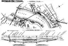 |
| Thames Tunnel | Railway tunnel | 🌍[17] | 1843 | The world's first underwater tunnel, linking Wapping to Rotherhithe. Originally designed as a road tunnel for horse-drawn traffic, the necessary access ramps were never built and it was opened as a pedestrian tunnel. It was converted to a rail tunnel, reopening in 1869 and becoming part of the London Overground network in 2010. |  |
| New Cross to Finsbury Market Cable Tunnel | Utility tunnel | 🌍, 🌍 | 2017 | Carries three 132 kV electricity circuits[18] |
Under construction
- The Silvertown Tunnel began construction in August 2020[19] and should be completed in 2025.[20] This will relieve the Blackwall Tunnels between the Greenwich Peninsula and West Silvertown and to allow larger HGVs and double-decker buses to cross the river at this point.
Proposed
- The Belvedere Crossing, a bridge between Belvedere and Rainham.
- The Gallions Reach Crossing has been proposed as a ferry, bridge, or tunnel between Beckton and Thamesmead.
- An extension of the Docklands Light Railway across the river to Thamesmead is proposed.[21]
- The Rotherhithe crossing, a pedestrian and cycle crossing between Rotherhithe and Canary Wharf, was originally proposed as a bridge, but Transport for London abandoned plans for a bridge in 2019, and has since explored establishing a ferry service instead.
Central London
| Crossing | Type | Coordinates | Opened | Notes | Photo |
|---|---|---|---|---|---|
| Tower Bridge | Bascule bridge[22], steel bridge, road bridge, tourist attraction, suspension bridge | 🌍 | 21 Jun 1886 | 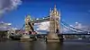 | |
| Tower Subway | Utility tunnel, tube railway (until Dec 1870), pedestrian tunnel (from Dec 1870) | 🌍 | 2 Aug 1870 | Formerly an underground railway – now used for water mains and telephone cables and accessible only by authorised personnel | 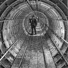 |
| Northern Line (Bank branch) tunnels | Railway tunnel | 🌍 | 1900 | Between London Bridge and Bank | |
| London Bridge | Road bridge, prestressed concrete bridge, arch bridge, box girder bridge, Roman bridge | 🌍 | 16 Mar 1973[23] | Other bridges have stood on or near this site since around AD 50 |  |
| City & South London Railway tunnels | Railway tunnel | 🌍 | 1890 | This railway's original crossing of the river between Borough and King William Street; abandoned in 1900 when the Northern line City branch tunnels were opened on a new alignment | |
| Cannon Street Railway Bridge | Girder bridge, steel bridge, railway bridge | 🌍 | 1883 | ||
| Southwark Bridge | Steel bridge, road bridge, arch bridge | 🌍 | 1921 | ||
| Millennium Bridge | Suspension bridge, footbridge | 🌍 | 10 Jun 2000 | 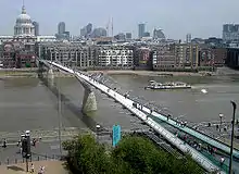 | |
| Bankside Cable Tunnel | Utility tunnel | 🌍 | 1940s | East of Blackfriars rail bridge, 132 kV and 33 kV electricity circuits[24] | |
| Blackfriars Railway Bridge | Steel bridge, arch bridge[25], truss bridge, railway bridge | 🌍 | 1886 |  | |
| Blackfriars Bridge | Steel bridge, road bridge, arch bridge, tram bridge (from 1909 until Jul 1952) | 🌍 | 1869 |  | |
| Waterloo & City line tunnels | Railway tunnel | 🌍 | 1898 | Between Waterloo and Bank | |
| Waterloo Bridge | box girder bridge, girder bridge, road bridge, Zone 3 A road | 🌍 | 1945, 18 Jun 1817 | ||
| Northern line (Charing Cross branch) tunnels | Railway tunnel | 🌍 | 1926 | Between Waterloo and Embankment | |
| Hungerford Bridge and Golden Jubilee Bridges | Steel bridge, footbridge, railway bridge, cable-stayed bridge | 🌍 | 1845 | Rail bridge incorporating newer pedestrian paths on either side |  |
| Bakerloo line tunnels | Railway tunnel | 🌍 | 1906 | Between Waterloo and Embankment | |
| Bankside–Charing Cross cable tunnel | Utility tunnel | 🌍 | Underneath Hungerford Bridge[24] | ||
| Jubilee Line Extension tunnels | Railway tunnel | 🌍 | 1999 | Between Waterloo and Westminster | |
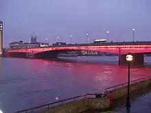
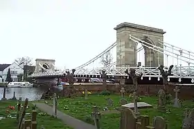
| Westminster Bridge | Road bridge, arch bridge, tram bridge (from 1909 until Jul 1952) | 🌍[26][27] | 24 May 1862, 18 Nov 1750 | .jpg.webp) | |
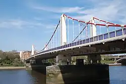
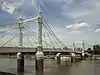
| Lambeth Bridge | Road bridge, arch bridge | 🌍[28] | 12 May 1932 |  | |
| Vauxhall Bridge | Deck arch bridge, steel bridge, road bridge, tram bridge (from 1906 until Jan 1952) | 🌍 | 1816 | 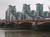 | |
| Victoria line tunnels | Railway tunnel | 🌍 | 1971 | Between Vauxhall and Pimlico | |
| Wimbledon – Pimlico cable tunnel | Utility tunnel | 🌍 | 1996 | Electricity cables[29] | |
| Battersea steam tunnel | Utility tunnel | 🌍 | 20th century | Between Battersea and Pimlico is a single tunnel carrying four pipes, two 30" Thames Water mains and two 11" pipes feeding the Pimlico District Heating system, originally powered by Battersea Power Station.[30] | |
| Battersea exhaust tunnels | Utility tunnel | 🌍 | 1920s | Between Battersea and either side of Victoria are two tunnels. Tunnels are labelled 'A' and 'B'; A splits further to become 'C' under Ranelagh Gardens. | |
| Grosvenor Bridge | Steel bridge, railway bridge, arch bridge | 🌍 | 1860 | Also known as Victoria Railway Bridge |
Former
- At least two Emergency Thames Bridges were erected as a precaution against destructions during World War II. The first was built from Victoria Embankment to County Hall, London in 1942[31] before being demolished in 1948.[32] Between the same years stood another, between Millbank outside the Tate Britain and Lambeth.[33][34]
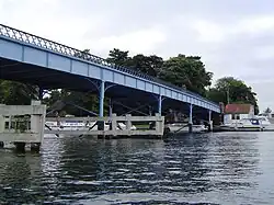
South West London


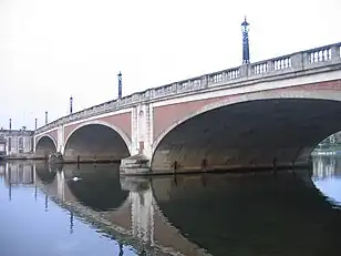
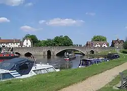
.jpg.webp)
Planned
- Diamond Jubilee Footbridge, a pedestrian bridge adjacent to Battersea Railway Bridge, granted planning permission in 2013.
London to Windsor
| Crossing | Type | Co-ordinates | Date opened | Notes | Photo |
|---|---|---|---|---|---|
| Sunbury Ferry | Ferry route | 🌍 | 2019 | April to November | |
| Walton Bridge | Road bridge | 🌍 | 2013 | 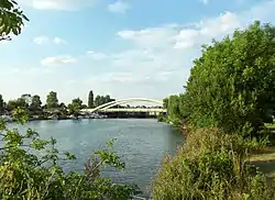 | |
| Shepperton to Weybridge Ferry | Passenger ferry | 🌍 | 16th century | The only ferry on any form of the Thames Path – and the most upstream |  |
| Chertsey Bridge | Road bridge | 🌍[50][51][52] | 1785 |  | |
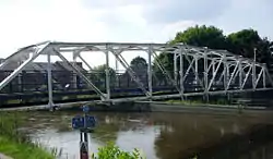
| M3 Chertsey Bridge | Highway bridge | 🌍 | 1971 | Carrying the M3 motorway | 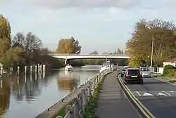 |
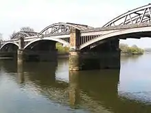
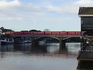
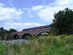
| Staines Railway Bridge | Railway bridge | 🌍 | 1856 | Built by the London and South Western Railway. Carries the Waterloo to Reading Line. | |
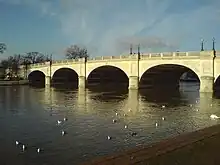
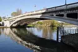
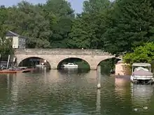
| Staines Bridge | Road bridge | 🌍 | 1832 | Bridges continuously recorded near this site since 1228. |  |
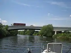
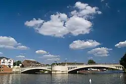
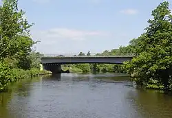
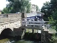
| Runnymede Bridge | Highway bridge | 🌍 | 1961 | Carrying the M25 motorway and, on the older part of the bridge, the A30; widened in 1983 and 2005. | .JPG.webp) |
| Albert Bridge | Road bridge | 🌍 | 1927 | Replaced a cast-iron bridge built in 1850–51. | .JPG.webp) |
| Victoria Bridge | Road bridge | 🌍 | 1967 | Replacing an 1851 bridge. | 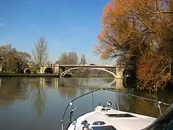 |
| Black Potts Railway Bridge | Railway bridge | 🌍 | 1850 | .JPG.webp) | |
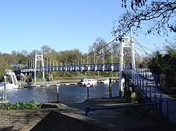
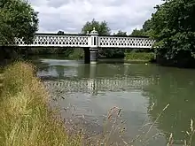
| Windsor Bridge | Footbridge (from 1970), bicycle bridge | 🌍 | 1 Jun 1824 | Bridges recorded on this site since 1172. Pedestrian/cycle bridge since 1970. | 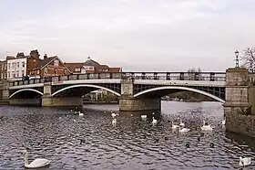 |
| Windsor Railway Bridge | Railway bridge | 🌍[53] | 1849 | 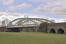 | |
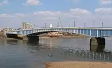
| Queen Elizabeth Bridge | Road bridge | 🌍 | 1966 | .JPG.webp) |
Former
- The Datchet Bridge, built in 1707, was demolished in 1848, and replaced by the Albert and Victoria bridges.
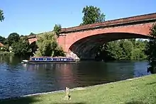
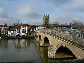
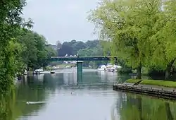
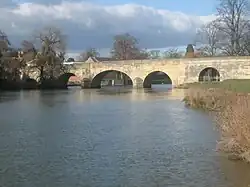
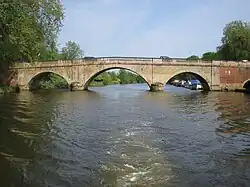
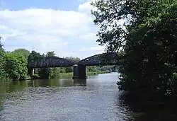
Windsor to Reading
.JPG.webp)
.jpg.webp)
.jpg.webp)

.jpg.webp)
Former
- A footbridge was built in 2012, for the London Olympics, to enable spectators of the rowing events held at Dorney Lake to gain access from Windsor Racecourse. It was removed after the Olympics.[58]
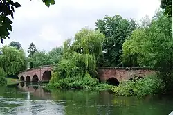
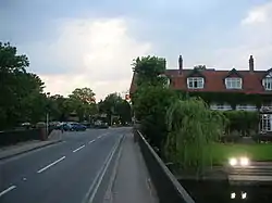
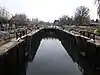
Reading to Oxford


_(Nancy).JPG.webp)
.JPG.webp)

.jpg.webp)
.jpg.webp)


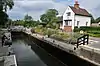
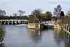
Oxford to Cricklade
| Crossing | Type | Co-ordinates | Date opened | Notes | Photo |
|---|---|---|---|---|---|
| Medley Footbridge | Footbridge | 🌍 | 1865 | Also called Rainbow footbridge. | 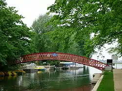 |
| Tank footbridge | Footbridge | 🌍 | Sep 1947[71] |  | |
| Godstow Bridge | Road bridge | 🌍[72] | 1792 | A previous bridge was held by the Royalists in 1645. |  |
| A34 Road Bridge | Road bridge | 🌍 | 1961 |  | |
| King's Lock | Lock, footbridge | 🌍 | 1928 |  | |
| Eynsham Lock | Lock, footbridge | 🌍 | 1928 | Permissive |  |
| Swinford Toll Bridge | Road bridge | 🌍[73][74] | 1769 |  | |
| Pinkhill Lock | Lock, footbridge | 🌍 | 1791 | 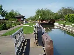 | |
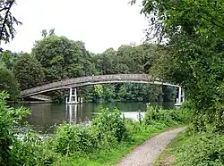
| Hart's Weir Footbridge | Footbridge | 🌍 | 1879 | 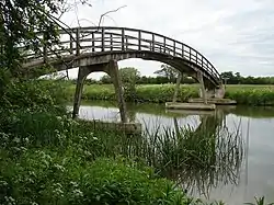 | |
| New Bridge | Road bridge | 🌍[75][76][77] | 1250[78] | | |
| Duxford ford | Ford | 🌍 | The ford crosses the original river channel to an island formed on its other side by the Shifford Lock Cut, which is crossed by a footbridge. There is no footbridge across the original river channel, which must be forded by pedestrians. |  | |
| Shifford Lock | Lock, footbridge | 🌍 |  | ||
| Tenfoot Bridge | Footbridge | 🌍 | 1869 |  | |
| Tadpole Bridge | Road bridge | 🌍[79] | 1784 | 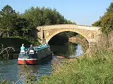 | |
| Rushey Lock | Lock, footbridge | 🌍 | 1790 |  | |
| Old Man's Bridge | Footbridge | 🌍 | 1894 | 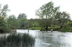 | |
| Radcot Bridge | Road bridge | 🌍[80][81][82] | 1787 |  | |
| Eaton Footbridge | Footbridge | 🌍 | 1936 | 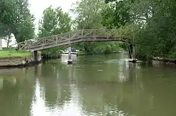 | |
| Buscot Lock | Lock, footbridge | 🌍 | 1790 |  | |
| Bloomers Hole Footbridge | Footbridge | 🌍 | 2000 | Built in 2000 for the Thames Path. |  |
| St. John's Bridge | Road bridge | 🌍 | 1886 |  | |
| Halfpenny Bridge | Road bridge | 🌍[83][84] | 1792 | The upstream limit of the navigable Thames. | 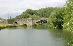 |
| Inglesham Footbridge | Footbridge | 🌍 | 1996 | The original towpath extends upstream to this point, by the connection with the now disused Thames and Severn Canal. |  |
| Hannington Bridge | Road bridge | 🌍 | 1841 | 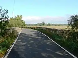 | |
| Castle Eaton Bridge | Road bridge | 🌍 | 1893 |  | |
| Water Eaton House Bridge | Footbridge | 🌍 | Described in 1896 as a small occupation bridge for pedestrians and cattle.[85] |  | |
| Eysey Footbridge | Footbridge | 🌍 | .jpg.webp) | ||
| A419 Road Bridge | Road bridge | 🌍 | 1988 | .jpg.webp) | |
| Abingdon Court Lane Bridge | Road bridge | 🌍 | 20th century | For sewage works & cricket club: accessible to authorised personnel only. | |
| Cricklade Town Bridge | Road bridge | 🌍 | 1852 | 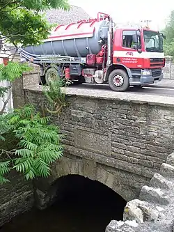 |
Cricklade to the source
Not all of the bridges above Cricklade are listed below. For example, there are a number of small agricultural bridges allowing access between fields, and bridges to properties in Ashton Keynes that are not mentioned.
| Crossing | Type | Co-ordinates | Date opened | Notes | Photo |
|---|---|---|---|---|---|
| Aqueduct footings footbridge | Footbridge, navigable aqueduct | 🌍 | Site of a former aqueduct carrying the North Wilts Canal over the Thames. |  | |
| Midland and South Western Junction Railway bridge | Railway bridge, footbridge | 🌍 | Formerly a bridge for the Midland and South Western Junction Railway. |  | |
| Stones Lane footbridge | Footbridge | 🌍 | Footbridge at Hailstone House. |  | |
| Manor Farm bridge | Road bridge | 🌍 | North of Manor Farm, Waterhay. | ||
| Brook Farm bridge | Road bridge | 🌍 | North of Brook Farm, Waterhay. | ||
| Waterhay bridge | Road bridge | 🌍 |  | ||
| Unnamed footbridge | Footbridge | 🌍 | The footbridge and a ford carry a bridlepath over the river, just outside Ashton Keynes. | .jpg.webp) | |
| Bridge on High Road | Road bridge | 🌍 | Bridge on High Road, Ashton Keynes | ||
| Bridge on The Derry | Road bridge | 🌍 | Bridge on The Derry, Ashton Keynes |  | |
| Bridge on Gosditch, Ashton Keynes | Road bridge | 51°38′42″N 1°56′7″W | |||
| Bridge on Church Walk, Ashton Keynes | Road bridge | 51°38′48″N 1°56′10″W | |||
| Bridge on Church Lane, Ashton Keynes | Road bridge | 51°38′48″N 1°56′14″W | |||
| Bridge on B4696, Ashton Keynes | Road bridge | 51°38′46″N 1°56′31″W | |||
| Bridges | Road bridge and pedestrian bridge | 51°38′46″N 1°56′56″W | |||
| Bridge | Road bridge | 51°38′43″N 1°57′38″W | |||
| Footbridge | Pedestrian bridge | 51°38′48″N 1°57′46″W | |||
| Bridge | Road bridge | 51°38′51″N 1°57′58″W | |||
| Bridge | Road bridge | 51°38′52″N 1°58′2″W | |||
| Bridge | Road bridge | 51°38′54″N 1°58′8″W | |||
| Footbridge | Pedestrian bridge | 51°38′59″N 1°58′17″W | |||
| Bridge | Road bridge | 51°39′2″N 1°58′24″W | |||
| Neigh Bridge | Road bridge | 51°39′6″N 1°58′29″W | |||
| Bridge south of Ewen | Road bridge | 51°40′27″N 1°59′44″W | |||
| Parker's Bridge, Ewen | Road bridge | 51°40′31″N 2°0′25″W | |||
| A429 Road Bridge | Road bridge | 51°40′47″N 2°0′53″W | Demolished bridge on the currently closed Cirencester Branch Line ran over the road. Part of the Beeching Axe legacy. | ||
| A433 Road Bridge, Fosse Way Roman Road | Road bridge | 51°41′24″N 2°1′21″W | At Thames Head |
The river splits as it passes through Ashton Keynes. An alternative route to that listed above crosses High Bridge at 51°38′13″N 1°55′46″W and Three Bridges at 51°38′18″N 1°56′21″W.
See also
Notes
- For example Berkshire County Council and Middlesex County Council were abolished and smaller authorities have been created in the counties adjoining the Thames, from the Borough of Swindon unitary authority to Medway Council on the Thames Estuary.
- e.g. Buckinghamshire County Cricket Club, Middlesex County Football Association and Middlesex County Cricket Club
References
- "The river environment: Fords and ferries". Thames Pilot. Retrieved 22 June 2023.
- "Parishes: Putney – British History Online". www.british-history.ac.uk.
- "HAMMERTONS FERRY". HAMMERTONS FERRY. Retrieved 4 May 2023.
- "Sunbury Ferry - Connecting Sunbury on Thames & Walton on Thames". sunburyferry.co.uk. Retrieved 4 May 2023.
- Anon (May 1970). "Cables Down Under". Electronics & Power. 16 (5): 175. doi:10.1049/ep.1970.0161.
- Haswell, C.K. (December 1969). "Thames Cable Tunnel". Proceedings of the Institution of Civil Engineers. 44 (4): 323–430. doi:10.1680/iicep.1969.7250.
- Map drawn by a one-time Portreve (Mayor) of Gravesend, William Bourne, and included in The Book of Gravesham Sydney Harker, 1979 ISBN 0 86023 091 0]
- "Lower Thames Crossing – Design and build – Highways England". Highways England. 15 June 2020. Retrieved 6 February 2021.
- "Open Infrastructure Map".
- https://historicengland.org.uk/services-skills/education/educational-images/barking-power-station-creekmouth-barking-11049
- "Open Infrastructure Map". Open Infrastructure Map. Retrieved 20 March 2020.
- http://www.crossrail.co.uk/construction/tunnelling/railway-tunnels/thames-tunnel-plumstead-to-north-woolwich
- "Thames Tunnel – Plumstead to North Woolwich". Crossrail. Archived from the original on 21 November 2019. Retrieved 21 August 2020.
- "Monitoring settlement in London Clay".
- John Witherow; Flora Shaw; Robert Barrington-Ward; Tony Gallagher (eds.), The Times, London: Times Newspapers, ISSN 0140-0460, Wikidata Q50008
- "Open Infrastructure Map". Open Infrastructure Map. Retrieved 20 March 2020.
- Historic England. "Details from listed building database (1242119)". National Heritage List for England.
- "Open Infrastructure Map". Open Infrastructure Map. Retrieved 20 March 2020.
- "Greenwich issues air quality warning as tunnel work moves ahead". News Shopper. 7 August 2020. Retrieved 10 August 2020.
- "Silvertown Tunnel". Transport for London. Retrieved 10 August 2020.
- "TfL Press Release – TfL and its partners commence further feasibility work on extending DLR into Thamesmead to support new homes and growth". tfl-newsroom.prgloo.com. Transport for London. Retrieved 21 December 2020.
- "THE NEW TOWER BRIDGE. OPENING BY THE PRINCE". Evening Standard.
- https://hemeroteca.lavanguardia.com/preview/1973/03/17/pagina-23/34246951/pdf.html
- "Open Infrastructure Map". Open Infrastructure Map. Retrieved 23 March 2020.
- https://structurae.net/structures/blackfriars-railway-bridge-1886
- Historic England. "Details from listed building database (1081058)". National Heritage List for England.
- Historic England. "Details from listed building database (1066172)". National Heritage List for England.
- Historic England. "Details from listed building database (1393007)". National Heritage List for England.
- "Open Infrastructure Map". Open Infrastructure Map. Retrieved 23 March 2020.
- "Pimlico District Heating" (PDF). Westminster Council.
- "Emergency Thames Bridge: Victoria Embankment to County Hall, construction work in progress". City of London Corporation. Archived from the original on 6 November 2015. Retrieved 28 March 2013.
- "Emergency Thames Bridge: Victoria Embankment to County Hall, demolition work in progress". City of London Corporation. Archived from the original on 6 November 2015. Retrieved 28 March 2013.
- "Emergency Thames Bridge: Millbank site, construction work in progress". City of London Corporation. Archived from the original on 6 November 2015. Retrieved 28 March 2013.
- "Emergency Thames Bridge: Millbank site, structure is dismantled". City of London Corporation. Archived from the original on 6 November 2015. Retrieved 28 March 2013.
- "London bridge designs unveiled". BBC News. 21 July 2015.
- Matthews, Peter (2008). London's Bridges. Bloomsbury Publishing. ISBN 978-0-7478-0679-0. OL 23615119M. Wikidata Q105305831.
- Historic England. "Details from listed building database (1358138)". National Heritage List for England.
- https://www.dwwindsor.com/.../in-situ-refurbishment-o...
- Historic England. "Details from listed building database (1393005)". National Heritage List for England.
- Historic England. "Details from listed building database (1393006)". National Heritage List for England.
- Historic England. "Details from listed building database (1079799)". National Heritage List for England.
- Historic England. "Details from listed building database (1357672)". National Heritage List for England.
- Walton, A. (1834). A Tour on the Banks of the Thames from London to Oxford, in the Autumn of 1829. London: T. W. Hord. Retrieved 12 June 2019 – via Where Thames Smooth Waters Glide.
- http://list.english-heritage.org.uk/resultsingle.aspx?uid=1080793
- Historic England. "Details from listed building database (1080793)". National Heritage List for England.
- Historic England. "Details from listed building database (1079819)". National Heritage List for England.
- Historic England. "Details from listed building database (1031877)". National Heritage List for England.
- Historic England. "Details from listed building database (1065378)". National Heritage List for England.
- Historic England. "Details from listed building database (1300232)". National Heritage List for England.
- Historic England. "Details from listed building database (1204646)". National Heritage List for England.
- Historic England. "Details from listed building database (1003752)". National Heritage List for England.
- Historic England. "Details from listed building database (1029204)". National Heritage List for England.
- Historic England. "Details from listed building database (1319297)". National Heritage List for England.
- Historic England. "Details from listed building database (1332381)". National Heritage List for England.
- Historic England. "Details from listed building database (1117598)". National Heritage List for England.
- Historic England. "Details from listed building database (1117436)". National Heritage List for England.
- Historic England. "Details from listed building database (1369302)". National Heritage List for England.
- "Olympic bridge in place at Dorney Lake". www.sloughexpress.co.uk.
- Historic England. "Details from listed building database (1290673)". National Heritage List for England.
- Historic England. "Details from listed building database (1285970)". National Heritage List for England.
- Historic England. "Details from listed building database (1368917)". National Heritage List for England.
- Historic England. "Details from listed building database (1006294)". National Heritage List for England.
- Historic England. "Details from listed building database (1059632)". National Heritage List for England.
- Historic England. "Details from listed building database (1180968)". National Heritage List for England.
- Historic England. "Details from listed building database (1182464)". National Heritage List for England.
- Historic England. "Details from listed building database (1194571)". National Heritage List for England.
- Historic England. "Details from listed building database (1368839)". National Heritage List for England.
- Historic England. "Details from listed building database (1048926)". National Heritage List for England.
- https://structurae.net/en/structures/nuneham-railway-bridge
- Historic England. "Details from listed building database (1319913)". National Heritage List for England.
- https://www.dailyinfo.co.uk/guide/cartoonist/binsey
- Historic England. "Details from listed building database (1369373)". National Heritage List for England.
- Historic England. "Details from listed building database (1284764)". National Heritage List for England.
- Historic England. "Details from listed building database (1006292)". National Heritage List for England.
- Historic England. "Details from listed building database (1368262)". National Heritage List for England.
- Historic England. "Details from listed building database (1048348)". National Heritage List for England.
- Historic England. "Details from listed building database (1004851)". National Heritage List for England.
- Thacker, Fred. S. (1920). The Thames Highway: A History of the Locks and Weirs. Vol. 2, Locks and Weirs. p. 77.
- Historic England. "Details from listed building database (1181619)". National Heritage List for England.
- Historic England. "Details from listed building database (1048414)". National Heritage List for England.
- Historic England. "Details from listed building database (1006361)". National Heritage List for England.
- Historic England. "Details from listed building database (1053405)". National Heritage List for England.
- Historic England. "Details from listed building database (1003424)". National Heritage List for England.
- Historic England. "Details from listed building database (1023393)". National Heritage List for England.
- Anon (24 July 1896). "Thames Bridges no. XLIII. 92.-Water Eaton Bridge". Engineering. 62: 105–6. Retrieved 27 October 2023.
Further reading
- Tucker, Joan (2012). Ferries of the Upper Thames. Amberley Publishing. ISBN 978-1-84868-967-1.
External links
 Media related to Crossings of the River Thames at Wikimedia Commons