Trùng Khánh district
Trùng Khánh is a district (huyện) of Cao Bằng province in the Northeast region of Vietnam.
Trùng Khánh district
Huyện Trùng Khánh | |
|---|---|
 | |
| Country | |
| Region | Northeast |
| Province | Cao Bằng |
| Capital | Trùng Khánh |
| Area | |
| • Total | 688.01 km2 (265.64 sq mi) |
| Population (2020)[1] | |
| • Total | 70,424 |
| • Density | 102/km2 (260/sq mi) |
| Time zone | UTC+7 (Indochina Time) |
As of 2020 the district had a population of 70,424.[1] The district covers an area of 688.01 km². The district capital lies at Trùng Khánh.[2]
The district is famous for its Chinese chestnut.
Administrative divisions
Trùng Khánh district is subdivided to 21 commune-level subdivisions, including the townships of Hùng Quốc, Trùng Khánh and the rural communes of: Cao Chương, Cao Thăng, Chí Viễn, Đàm Thủy, Đình Phong, Đoài Dương, Đức Hồng, Khâm Thành, Lăng Hiếu, Ngọc Côn, Ngọc Khê, Phong Châu, Phong Nặm, Quang Hán, Quang Trung, Quang Vinh, Tri Phương, Trung Phúc, Xuân Nội.[1]
Climate
| Climate data for Trùng Khánh | |||||||||||||
|---|---|---|---|---|---|---|---|---|---|---|---|---|---|
| Month | Jan | Feb | Mar | Apr | May | Jun | Jul | Aug | Sep | Oct | Nov | Dec | Year |
| Record high °C (°F) | 29.1 (84.4) |
32.5 (90.5) |
34.0 (93.2) |
37.0 (98.6) |
37.1 (98.8) |
37.0 (98.6) |
35.9 (96.6) |
36.5 (97.7) |
36.3 (97.3) |
32.6 (90.7) |
31.8 (89.2) |
29.4 (84.9) |
37.1 (98.8) |
| Average high °C (°F) | 15.8 (60.4) |
17.4 (63.3) |
20.8 (69.4) |
25.1 (77.2) |
28.5 (83.3) |
29.9 (85.8) |
30.3 (86.5) |
30.3 (86.5) |
29.0 (84.2) |
26.0 (78.8) |
22.2 (72.0) |
18.3 (64.9) |
24.5 (76.1) |
| Daily mean °C (°F) | 11.8 (53.2) |
13.6 (56.5) |
17.1 (62.8) |
21.2 (70.2) |
24.2 (75.6) |
25.7 (78.3) |
26.0 (78.8) |
25.6 (78.1) |
24.0 (75.2) |
21.0 (69.8) |
17.1 (62.8) |
13.2 (55.8) |
20.0 (68.0) |
| Average low °C (°F) | 9.0 (48.2) |
11.0 (51.8) |
14.5 (58.1) |
18.3 (64.9) |
21.1 (70.0) |
22.8 (73.0) |
23.3 (73.9) |
22.6 (72.7) |
20.7 (69.3) |
17.6 (63.7) |
13.5 (56.3) |
9.7 (49.5) |
17.0 (62.6) |
| Record low °C (°F) | −3.0 (26.6) |
−0.6 (30.9) |
0.8 (33.4) |
7.0 (44.6) |
11.0 (51.8) |
13.9 (57.0) |
17.4 (63.3) |
16.0 (60.8) |
12.1 (53.8) |
5.2 (41.4) |
1.0 (33.8) |
−3.4 (25.9) |
−3.4 (25.9) |
| Average precipitation mm (inches) | 40.6 (1.60) |
38.0 (1.50) |
56.6 (2.23) |
97.3 (3.83) |
215.8 (8.50) |
297.5 (11.71) |
307.5 (12.11) |
292.7 (11.52) |
149.9 (5.90) |
92.2 (3.63) |
55.0 (2.17) |
33.4 (1.31) |
1,670.2 (65.76) |
| Average rainy days | 11.7 | 12.5 | 14.5 | 14.7 | 16.2 | 18.7 | 20.2 | 18.6 | 12.3 | 9.8 | 8.5 | 7.7 | 165.2 |
| Average relative humidity (%) | 80.0 | 80.9 | 81.0 | 80.7 | 80.4 | 82.6 | 83.4 | 84.0 | 82.6 | 80.6 | 79.8 | 78.4 | 81.1 |
| Mean monthly sunshine hours | 62.2 | 67.1 | 66.5 | 100.4 | 140.3 | 131.5 | 152.3 | 174.8 | 161.3 | 139.8 | 121.2 | 109.8 | 1,426.2 |
| Source: Vietnam Institute for Building Science and Technology[3] | |||||||||||||
References
- "Nghị quyết số 897/NQ-UBTVQH14 năm 2020 về việc sắp xếp các đơn vị hành chính cấp huyện, cấp xã thuộc tỉnh Cao Bằng". 2020-01-11.
- "Districts of Vietnam". Statoids. Retrieved March 13, 2009.
- "Vietnam Institute for Building Science and Technology" (PDF). Retrieved 16 August 2023.
| Bắc Giang province | 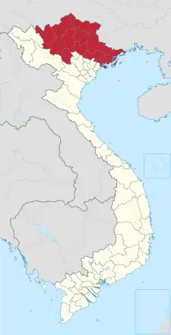 | |
|---|---|---|
| Bắc Kạn province | ||
| Cao Bằng province | ||
| Hà Giang province | ||
| Lạng Sơn province | ||
| Phú Thọ province | ||
| Quảng Ninh province |
| |
| Thái Nguyên province | ||
| Tuyên Quang province | ||
※ denotes provincial seat. | ||

This article is issued from Wikipedia. The text is licensed under Creative Commons - Attribution - Sharealike. Additional terms may apply for the media files.