Westelijke Polders
Westelijke Polders is a resort in Suriname, located in the Nickerie District. Its population at the 2012 census was 8,616.[1] Its Dutch place name (in English 'western polders') reflects Suriname's colonial past. Its western boundary is the Courantyne River, between Suriname and Guyana.
Westelijke Polders | |
|---|---|
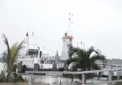
 Ferry to Guyana | |
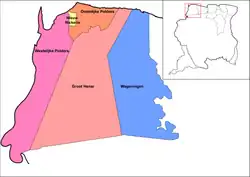
 Map showing the resorts of Nickerie District. Westelijke Polders | |
| Country | |
| District | Nickerie District |
| Area | |
| • Total | 1,168 km2 (451 sq mi) |
| Population (2012)[1] | |
| • Total | 8,616 |
| • Density | 7.4/km2 (19/sq mi) |
| Time zone | UTC-3 (AST) |
Since 1998, the Canawaina ferry connects South Drain, located in the resort Westelijke Polders, with Moleson Creek in Guyana.[2] This is the only legal connection between the two countries, but before the repavement of the road many travelers preferred to take a back-track route.[3]
The uninhabited nature reserve Papagaaieneiland is located in the Courantyne. The route of the planned bridge between Suriname and Guyana will run through the island.[4] As of 2020, the construction has not started.
References
- "2012 Census Resorts Suriname" (PDF). Spang Staging. Retrieved 18 May 2020.
- Ministerie van Transport, Communicatie en Toerisme - De Canawaima Ferry Service Incorporated
- Kaieteur News - Canawaima Ferry Service seeks to boost travel
- "Corantijnbrug zal lopen over Papagaaien Eiland". Star Nieuws (in Dutch). Retrieved 18 May 2020.
