Baoting Li and Miao Autonomous County
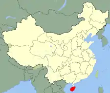
Bǎotíng Li and Miao Autonomous County (simplified Chinese: 保亭黎族苗族自治县; traditional Chinese: 保亭黎族苗族自治縣; pinyin: Bǎotíng Lí Zú Miáo Zú Zìzhì Xiàn) is an autonomous county in Hainan, China. One of the six autonomous counties on the island, its postal code is 572300. Baoting spans an area of 1,153.24 square kilometres (445.27 sq mi), and has a population of about 168,000 as of 2020.[1]
Baoting
保亭县 | |
|---|---|
| 保亭黎族苗族县 Baoting Li and Miao Autonomous County | |
 | |
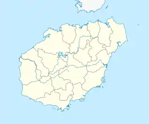
 Baoting Location in Hainan | |
| Coordinates: 18°38′28″N 109°46′30″E | |
| Country | People's Republic of China |
| Province | Hainan |
| Seat | Baocheng Town |
| Area | |
| • Total | 1,153.24 km2 (445.27 sq mi) |
| Population (2020) | |
| • Total | 168,000 |
| • Density | 150/km2 (380/sq mi) |
| Time zone | UTC+8 (China standard time) |
History
The area has been referred to as Baoting (Chinese: 保亭; pinyin: Bǎotíng) since at least the Ming dynasty.[1] Baoting was first incorporated as a county in 1935.[1]
Baoting fell under control of the People's Liberation Army in February 1948.[1]
Climate
| Climate data for Baoting (1991−2020 normals, extremes 1981–2010) | |||||||||||||
|---|---|---|---|---|---|---|---|---|---|---|---|---|---|
| Month | Jan | Feb | Mar | Apr | May | Jun | Jul | Aug | Sep | Oct | Nov | Dec | Year |
| Record high °C (°F) | 32.6 (90.7) |
34.0 (93.2) |
35.4 (95.7) |
38.0 (100.4) |
38.9 (102.0) |
37.4 (99.3) |
37.2 (99.0) |
37.3 (99.1) |
36.5 (97.7) |
35.4 (95.7) |
34.3 (93.7) |
32.9 (91.2) |
38.9 (102.0) |
| Average high °C (°F) | 26.6 (79.9) |
27.5 (81.5) |
29.5 (85.1) |
31.8 (89.2) |
33.2 (91.8) |
33.2 (91.8) |
33.0 (91.4) |
33.0 (91.4) |
32.3 (90.1) |
30.8 (87.4) |
29.2 (84.6) |
26.7 (80.1) |
30.6 (87.0) |
| Daily mean °C (°F) | 20.5 (68.9) |
21.6 (70.9) |
23.8 (74.8) |
26.2 (79.2) |
27.6 (81.7) |
28.1 (82.6) |
27.8 (82.0) |
27.5 (81.5) |
26.8 (80.2) |
25.5 (77.9) |
23.8 (74.8) |
21.3 (70.3) |
25.0 (77.1) |
| Average low °C (°F) | 16.6 (61.9) |
17.9 (64.2) |
20.3 (68.5) |
22.7 (72.9) |
24.3 (75.7) |
24.9 (76.8) |
24.7 (76.5) |
24.4 (75.9) |
23.8 (74.8) |
22.3 (72.1) |
20.4 (68.7) |
17.8 (64.0) |
21.7 (71.0) |
| Record low °C (°F) | 5.7 (42.3) |
7.4 (45.3) |
6.3 (43.3) |
16.5 (61.7) |
14.7 (58.5) |
18.8 (65.8) |
21.2 (70.2) |
21.1 (70.0) |
17.0 (62.6) |
11.9 (53.4) |
9.8 (49.6) |
4.8 (40.6) |
4.8 (40.6) |
| Average precipitation mm (inches) | 14.9 (0.59) |
25.6 (1.01) |
36.9 (1.45) |
108.6 (4.28) |
253.6 (9.98) |
268.9 (10.59) |
356.8 (14.05) |
348.2 (13.71) |
353.0 (13.90) |
274.6 (10.81) |
88.3 (3.48) |
23.7 (0.93) |
2,153.1 (84.78) |
| Average precipitation days (≥ 0.1 mm) | 5.8 | 6.2 | 6.5 | 9.9 | 16.8 | 18.4 | 20.5 | 21.9 | 21.8 | 14.7 | 8.0 | 5.4 | 155.9 |
| Average relative humidity (%) | 78 | 79 | 80 | 81 | 83 | 84 | 85 | 86 | 86 | 81 | 77 | 75 | 81 |
| Mean monthly sunshine hours | 131.7 | 111.1 | 122.6 | 144.0 | 170.2 | 159.1 | 169.7 | 158.4 | 135.5 | 154.9 | 153.0 | 137.6 | 1,747.8 |
| Percent possible sunshine | 38 | 34 | 33 | 38 | 42 | 40 | 42 | 40 | 37 | 43 | 46 | 40 | 39 |
| Source: China Meteorological Administration[2][3] | |||||||||||||
Administrative divisions
The autonomous county administers one residential community (Chinese: 社区; pinyin: shè qū), six towns (Chinese: 镇; pinyin: zhèn), and three townships (Chinese: 乡; pinyin: xiāng).[4]
Residential communities
The autonomous county directly administers one residential community, which are typically governed by township-level divisions: Xinxing Community (Chinese: 新星社区; pinyin: Xīnxīng Shèqū).[4]
Towns
The autonomous county administers the following six towns:[4]
Demographics
As of 2020, Baoting's population totaled about 168,000.[1] In 1999 the county had a population of 155,575, largely made up of the indigenous Li people and Miao people.
62.4% of the autonomous county's population is ethnically Li, 30.2% is ethnically Han, 4.5% is ethnically Miao, and 2.9% belong to other ethnic groups.[1]
Economy
The autonomous county's gross domestic product totaled 5.627 billion renminbi (RMB) as of 2020.[1] As of 2020, urban residents have an annual per capita disposable income of 33,564 RMB, a figure which totaled 14,067 RMB for rural residents; these figures grew by 3.2% and 8.8% in 2020, respectively.[1]
Baoting has a large agricultural sector, and crops grown in the autonomous county include rambutan, mangosteen, katuk, okra, and passion fruit.[1]
References
- Harvard University Committee on the Environment (1999). "China County & City Population 1999 FAQ". Archived from the original on 2016-01-09.
- 走进保亭 [Enter Baoting]. baoting.hainan.gov.cn (in Chinese). Baoting Li and Miao Autonomous County People's Government. Archived from the original on 2022-02-27. Retrieved 2022-02-26.
- 1991-2020 normals "Climate averages from 1991 to 2020". China Meteorological Administration. Archived from the original on 2023-04-17.
- 1981-2010 extremes 中国气象数据网 – WeatherBk Data (in Simplified Chinese). China Meteorological Administration. Retrieved 14 April 2023.
- 2021年统计用区划代码(保亭黎族苗族自治县) [2021 Statistical Division Codes (Baoting Li and Miao Autonomous County)] (in Chinese). National Bureau of Statistics of China. Archived from the original on 2022-02-27. Retrieved 2022-02-26.
