Xinxing, Xinjiang
Xinxing is a county-level city in the Xinjiang Uyghur Autonomous Region, China. It is actually located with enclaves in Hami.
Xinxing
| |
|---|---|
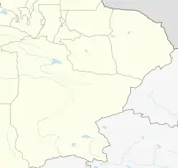
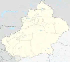
 Xinxing Location in Xinjiang  Xinxing Xinxing (Xinjiang)  Xinxing Xinxing (China) | |
| Coordinates: 42°47′43″N 93°44′47″E | |
| Country | China |
| Autonomous region | Xinjiang |
| Established | February 2021 |
| Municipal seat | Huangtian Town (Huangtian Farm) |
| Government | |
| • CCP Secretary | Yang Hongbin (Political Commissar of the 13th Division) |
| • Mayor | Iminjan Islam (Commander of the 13th Division) |
| Area | |
| • Total | 539 km2 (208 sq mi) |
| Population (2021)[1] | |
| • Total | 44,700 |
| • Density | 83/km2 (210/sq mi) |
| Time zone | UTC+8 (China Standard[lower-alpha 1]) |
| Website | www |
Xinxing is the headquarter of the 13th Division of Xinjiang Production and Construction Corps and currently administered by the 13th Division. The city implemented the "division and city integration" (师市合一, shī shì héyī) management system, it shares the same leader group with the 13th Division.
History
In September 2018, the research team of the Civil Affairs Bureau of the Xinjiang Production and Construction Corps went to the 13rd Division of the Xinjiang Production and Construction Corps to investigate the proposed Xinxing. In December 2020, a report meeting on the overall planning results of the proposed Xinxing will be held. At the meeting, experts from the Henan Provincial Urban and Rural Planning and Design Institute Co., Ltd. will report on the overall urban design and regulatory detailed planning results of the overall planning of Xinxing.[2]
On February 4, 2021, the People's Government of the Xinjiang Uygur Autonomous Region announced that with the approval of the State Council, the establishment of Xinxing City was approved, No. 57, Lanxin East Road, Huangtian Farm, 13th Division, Xinxing Municipal People's Government.[3] Xinxing consists of the original Huangtian Farm, Red Star No. 1, Red Star No. 4, Red Star No. 2 Ranch, and Hongshan Gardening No. 2, The total area is 539.76 square kilometers. The scope of the central city: East to Bingdi Integration Avenue, west to Xihuan Road, south to South Damo Road, north to China National Highway 312 The planned area is 32 square kilometers.[4]
Administrative divisions
Xinxing contains 3 towns and 1 core area:[5]
| Name | Simplified Chinese | Hanyu Pinyin | Uyghur (UEY) | Uyghur Latin (ULY) | Administrative division code | |
|---|---|---|---|---|---|---|
| Towns | ||||||
| Erdaohu Town (Red Star No. 1 Farm)* |
二道湖镇 (红星一场) |
Èrdàohú Zhèn | 659011100 | |||
| Luoyi Town (Red Star No. 4 Farm)* |
骆驿镇 (红星四场) |
Luòyì Zhèn | 659011101 | |||
| Huangtian Town (Huangtian Farm)* |
黄田镇 (黄田农场) |
Huángtián Zhèn | ساقا (خۇاڭتيەن) بازىرى | 659011102 | ||
| core area | ||||||
| Xinxing City Core Area | 新星市核心区 | Xīnxīng Shì Héxīnqū | 659011400 | |||
Notes
- Locals in Xinjiang frequently observe UTC+6 (Xinjiang Time), 2 hours behind Beijing.
References
- "新疆生产建设兵团第十三师新星市 2021年国民经济和社会发展统计公报" (in Chinese). 2022-04-20.
- "国务院批复同意设立新疆维吾尔自治区直辖县级新星市". 澎湃新闻 (in Chinese). Retrieved 2021-02-04.
- "新疆新星市获国务院批准设立". 中国新闻网 (in Chinese). Retrieved 2021-02-04.
- "《十三师拟建新星市总体规划(2020-2035)》、《拟建新星市总体城市设计》、《拟建新星市中心城区控制性详细规划》成果公示". 兵团第十三师 (in Chinese). 2020-09-15. Archived from the original on 2021-05-06. Retrieved 2021-02-11.
- "2022年统计用区划代码和城乡划分代码:新星市" (in Chinese).