Bawan
Bawan is a large[3] village and corresponding community development block in Hardoi district of Uttar Pradesh, India.[2] It is located 10 km[4] west of Hardoi, on the south side of the road to Bazpur-Naktaura and the Sai Ghat.[3] Bawan was historically the seat of a pargana since at least the time of the Mughal Emperor Akbar, and it is also the site of a mela held in honour of Darshan Debi on the first Sunday of Bhadon, at a site called the Suraj Kund.[3] The main staple crops here are wheat, rice,[5] and gram.[4] Markets are held on Mondays and Thursdays.[4][5] As of 2011, the population of Bawan is 13,524, in 2,230 households.[2]
Bawan
Bāwan | |
|---|---|
Populated place | |
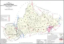 Map showing Bawan (#003) in Bawan CD block | |
 Bawan Location in Uttar Pradesh, India  Bawan Bawan (India) | |
| Coordinates: 27.395537°N 80.019089°E[1] | |
| Country | |
| State | Uttar Pradesh |
| District | Hardoi |
| Area | |
| • Total | 9.928 km2 (3.833 sq mi) |
| Population (2011)[2] | |
| • Total | 13,524 |
| • Density | 1,400/km2 (3,500/sq mi) |
| Languages | |
| • Official | Hindi |
| Time zone | UTC+5:30 (IST) |
History
According to tradition, Bawan was founded by a person named Rajpal before the reign of Rama in Ayodhya.[3] It is said that later, the 11th-century Muslim folk hero Ghazi Sayyid Salar Masud sent a force from Kannauj to conquer Bawan, and that the Muslim soldiers who died in the ensuing battle were buried near the Suraj Kund.[3] Another one of Salar Masud's companions, Makhdum Abdul Qasim, is said to have fasted here for 40 days, and his shrine is still visited on Thursday evenings by people who leave sweetmeats and light small lamps in his memory.[3]
At the turn of the 20th century, Bawan was described as a large village both in population and in physical area, with a population of 3,800 people as of the 1901 census.[3] Of these, 1,021 were Muslim, while the main Hindu caste was the Brahmins.[3] The Darshan Debi mela, which had previously been "of considerable importance", was still observed but its attendance was smaller than it had been in the past.[3] The weekly veneration of Makhdum Abdul Qasim's shrine was also noted, with an attendance of about 200 people at the time.[3] Bawan hosted a market twice per week at the time.[3]
The 1961 census recorded Bawan as comprising 6 hamlets, with a total population of 4,993 (2,704 male and 2,289 female), in 968 households and 703 physical houses.[6] The area of the village was given as 2,478 acres.[6]
The 1981 census recorded Bawan as having a population of 7,384, in 1,306 households, and covering an area of 992.32 hectares.[5]
Villages
Bawan CD block has the following 140 villages:[2]
| Village name | Total land area (hectares) | Population (in 2011) |
|---|---|---|
| Saurangpur | 81.6 | 1,053 |
| Sahijana | 128.8 | 976 |
| Chandrsipur | 158.2 | 429 |
| Mahreypur | 300.2 | 1,922 |
| Deopur | 95 | 435 |
| Virsinghpur | 178.1 | 739 |
| Gadanpur | 51 | 0 |
| Nagara | 19.6 | 0 |
| Mahimapur | 77.7 | 4 |
| Nayagaon | 148.3 | 0 |
| Auhadpur Lala Bhup | 157 | 294 |
| Jilgaon | 201.2 | 979 |
| Shekhpur | 166.4 | 1,295 |
| Sariya Paraspur | 168.8 | 522 |
| Rampur Lalji | 182.5 | 951 |
| Dharampur | 45 | 352 |
| Barsohiya | 496.2 | 4,544 |
| Sonepur | 287.4 | 1,021 |
| Pemapur | 66.7 | 414 |
| Pakari | 577 | 2,454 |
| Mattipur | 164.7 | 1,235 |
| Mitmitpur Naseb | 32.7 | 0 |
| Bajpur Naktaura Naseb | 147.6 | 2,843 |
| Bajpur Naktaura | 219.6 | 0 |
| Dularpur | 358.6 | 2,329 |
| Pakha | 108.8 | 0 |
| Poora | 98.9 | 162 |
| Poora Naseb | 60.4 | 0 |
| Barwan Ahat Mali | 41.2 | 3,996 |
| Barwan Faraj | 293.6 | 0 |
| Barwan Naseb | 121.8 | 0 |
| Ramapur Chhaiya | 185.6 | 1,569 |
| Ramapur Adhaikan | 41.3 | 303 |
| Manimau | 81.6 | 763 |
| Koliya | 160.9 | 818 |
| Mirkapur | 67.2 | 934 |
| Mirkapur Naseb | 42.5 | 0 |
| Behta Gokul | 889.7 | 6,521 |
| Kuvanarpur | 193.9 | 1,129 |
| Behta Dheera | 493.8 | 3,451 |
| Khalifapur Masti | 175.4 | 1,040 |
| Maganpur | 151.3 | 1,155 |
| Udhranpur | 141.7 | 2,071 |
| Sikandarpur | 118.4 | 888 |
| Sahijana | 207.7 | 1,248 |
| Sakaha | 525.3 | 3,964 |
| Gaidhara | 176.8 | 818 |
| Palia | 106.6 | 455 |
| Koilaha | 253.2 | 1,255 |
| Manpur | 710 | 4,880 |
| Mansoorpur | 38.4 | 439 |
| Gadaipur | 539.5 | 2,864 |
| Jatuli | 181 | 1,070 |
| Mubarakpur | 78 | 0 |
| Bheekhpur | 333.6 | 1,877 |
| Dularpur | 199.9 | 1,288 |
| Achauli | 55.2 | 152 |
| Hasnapur | 128.6 | 829 |
| Moosepur | 250.8 | 2,275 |
| Balehra | 421.9 | 2,243 |
| Dabheliya | 167.1 | 568 |
| Aeja | 625.5 | 3,385 |
| Auhadpur Sakara | 291.1 | 2,712 |
| Suherdi | 123.2 | 986 |
| Andhiyar | 78.6 | 196 |
| Baijana | 299.3 | 585 |
| Lagwahi | 131.8 | 764 |
| Lonar | 446.7 | 3,496 |
| Lakhwa | 60.8 | 564 |
| Purori | 223.6 | 1,483 |
| Chndsaura | 133.7 | 175 |
| Kadari | 143.5 | 70 |
| Rampur Jatuli | 182.4 | 481 |
| Nevada | 305.2 | 1,300 |
| Gajhathan | 96.4 | 451 |
| Sakara | 1,018.8 | 5,196 |
| Iqbalpur | 105.4 | 83 |
| Baghuri | 106 | 575 |
| Mirjapur | 101 | 16 |
| Majhigawan | 91.9 | 427 |
| Garhiya Dilla | 45.7 | 405 |
| Govindpur | 42.6 | 554 |
| Dauli | 85.1 | 802 |
| Baghouramal | 201.6 | 1,203 |
| Karanpur | 87.9 | 568 |
| Garhiya Jhabbu | 28.9 | 543 |
| Gangauli | 506.5 | 1,460 |
| Ituariya | 104.2 | 492 |
| Kallan Saryan | 68.7 | 275 |
| Dudhiya | 169.3 | 728 |
| Udaypur | 115.3 | 991 |
| Bakura | 195 | 0 |
| Etoriya | 104.8 | 764 |
| Barela | 159.5 | 828 |
| Mujahidpur | 262.2 | 2,290 |
| Kamalpur | 206.2 | 597 |
| Teriya | 164.4 | 1,564 |
| Jagdishpur | 292.7 | 1,868 |
| Savirpur | 153.7 | 758 |
| Nijampur | 239.4 | 1,225 |
| Samudahar | 103.6 | 0 |
| Bawan (block headquarters) | 992.8 | 13,524 |
| Darveshpur | 112.5 | 527 |
| Biskula | 195.5 | 1,217 |
| Bhithari | 721 | 5,301 |
| Ramapur Raholiya | 250.3 | 1,515 |
| Badruddinpur | 185.8 | 525 |
| Bajehara | 245.7 | 1,138 |
| Barkheriya | 13.2 | 0 |
| Nayagaon | 142 | 1,096 |
| Barkhara | 134.2 | 2,000 |
| Bavnapur | 262 | 1,508 |
| Airla | 45.8 | 0 |
| Husenpur Sahora | 262.8 | 2,184 |
| Sakatpur | 228.2 | 1,623 |
| Majhraeta | 547 | 3,569 |
| Allipur | 275.3 | 1,490 |
| Pusaura | 102.4 | 438 |
| Gulamau | 511.6 | 3,051 |
| Fool Behta | 201.3 | 2,376 |
| Kaurha | 1,292.3 | 9,376 |
| Kakrahi | 415.6 | 2,259 |
| Mendua | 405.5 | 1,666 |
| Mirgwan | 119.2 | 569 |
| Khumaripur | 211.3 | 1,005 |
| Amirta | 73.8 | 473 |
| Kashipur | 273.2 | 2,360 |
| Bannai | 187.9 | 1,402 |
| Sathra | 148.2 | 764 |
| Korriya | 746.7 | 5,738 |
| Behta Sadhai | 675.4 | 4,741 |
| Behti | 639.9 | 3,651 |
| Tatura | 784.8 | 6,290 |
| Mammarpur | 83.1 | 738 |
| Aneg Behta | 219.2 | 690 |
| Naya Gaon Habibpur | 446.7 | 3,470 |
| Rara | 634.3 | 4,107 |
| Maholiya Sheopar | 541.2 | 3,167 |
| Harsinghpur | 129.4 | 1,021 |
| Bharigawan | 571 | 3,441 |
References
- Search for "Bawan" here https://geonames.nga.mil/namesgaz/.
{{cite web}}: Missing or empty|title=(help) - "Census of India 2011: Uttar Pradesh District Census Handbook - Hardoi, Part A (Village and Town Directory)" (PDF). Census 2011 India. pp. 180–205. Retrieved 23 May 2021.
- Nevill, H.R. (1904). Hardoi - A Gazetteer. Allahabad: Government Press. pp. 169–72. Retrieved 23 May 2021.
- Census 1971 Uttar Pradesh: District Census Handbook Part X-A: Village & Town Directory, District Hardoi (PDF). 1972. pp. 82–3. Retrieved 23 May 2021.
- Census 1981 Uttar Pradesh: District Census Handbook Part XIII-A: Village & Town Directory, District Hardoi (PDF). 1982. pp. 114–5. Retrieved 23 May 2021.
- Census 1961: District Census Handbook, Uttar Pradesh (36 - Hardoi District) (PDF). Lucknow. 1965. pp. 158, liv-lv of section "Hardoi Tahsil". Retrieved 23 May 2021.
{{cite book}}: CS1 maint: location missing publisher (link)