Coigneux
Coigneux (pronounced [kwa.ɲø]; Picard: Cognu) is a commune in the Somme department and Hauts-de-France region of northern France.
Coigneux | |
|---|---|
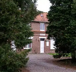 The town hall in Coigneux | |
Location of Coigneux | |
 Coigneux  Coigneux | |
| Coordinates: 50°07′50″N 2°33′09″E | |
| Country | France |
| Region | Hauts-de-France |
| Department | Somme |
| Arrondissement | Péronne |
| Canton | Albert |
| Intercommunality | Pays du Coquelicot |
| Government | |
| • Mayor (2020–2026) | Alain Laignel[1] |
| Area 1 | 2.88 km2 (1.11 sq mi) |
| Population | 49 |
| • Density | 17/km2 (44/sq mi) |
| Time zone | UTC+01:00 (CET) |
| • Summer (DST) | UTC+02:00 (CEST) |
| INSEE/Postal code | 80201 /80560 |
| Elevation | 100–150 m (330–490 ft) (avg. 107 m or 351 ft) |
| 1 French Land Register data, which excludes lakes, ponds, glaciers > 1 km2 (0.386 sq mi or 247 acres) and river estuaries. | |
Geography
Coigneux is situated on the D176 road, some 22 miles (35 km) northeast of Amiens. The source of the Authie river is found here.
Population
| Year | Pop. | ±% p.a. |
|---|---|---|
| 1968 | 86 | — |
| 1975 | 71 | −2.70% |
| 1982 | 64 | −1.47% |
| 1990 | 56 | −1.66% |
| 1999 | 50 | −1.25% |
| 2007 | 46 | −1.04% |
| 2012 | 50 | +1.68% |
| 2017 | 49 | −0.40% |
| Source: INSEE[3] | ||
See also
References
- "Répertoire national des élus: les maires". data.gouv.fr, Plateforme ouverte des données publiques françaises (in French). 9 August 2021.
- "Populations légales 2020". The National Institute of Statistics and Economic Studies. 29 December 2022.
- Population en historique depuis 1968, INSEE
Wikimedia Commons has media related to Coigneux.
This article is issued from Wikipedia. The text is licensed under Creative Commons - Attribution - Sharealike. Additional terms may apply for the media files.