Corbières-en-Provence
Corbières-en-Provence (French pronunciation: [kɔʁbjɛʁ ɑ̃ pʁɔvɑ̃s], literally Corbières in Provence; Occitan: Corbièras),[3] simply known as Corbières until 2018, is a commune in the Alpes-de-Haute-Provence department in the Provence-Alpes-Côte d'Azur region of Southeastern France. In 2018, it had a population of 1,196. Its inhabitants are called Corbiérains (masculine) and Corbiéraines (feminine).
Corbières-en-Provence
| |
|---|---|
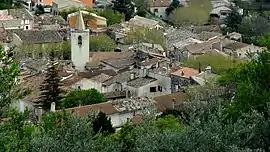 A view of Corbières-en-Provence | |
 Coat of arms | |
Location of Corbières-en-Provence | |
 Corbières-en-Provence 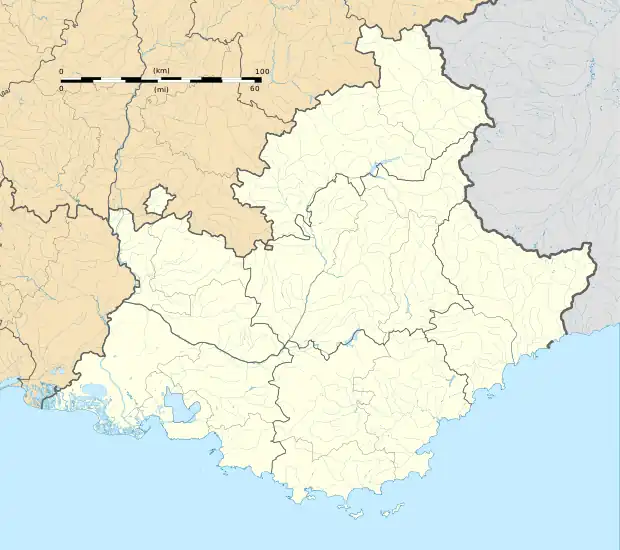 Corbières-en-Provence | |
| Coordinates: 43°45′43″N 5°45′07″E | |
| Country | France |
| Region | Provence-Alpes-Côte d'Azur |
| Department | Alpes-de-Haute-Provence |
| Arrondissement | Forcalquier |
| Canton | Manosque-3 |
| Intercommunality | Durance-Luberon-Verdon Agglomération |
| Government | |
| • Mayor (2020–2026) | Jean-Claude Castel[1] |
| Area 1 | 19.06 km2 (7.36 sq mi) |
| Population | 1,241 |
| • Density | 65/km2 (170/sq mi) |
| Time zone | UTC+01:00 (CET) |
| • Summer (DST) | UTC+02:00 (CEST) |
| INSEE/Postal code | 04063 /04220 |
| Elevation | 256–531 m (840–1,742 ft) (avg. 300 m or 980 ft) |
| 1 French Land Register data, which excludes lakes, ponds, glaciers > 1 km2 (0.386 sq mi or 247 acres) and river estuaries. | |
Corbières-en-Provence is located at the heart of the Provence historical province, on the departmental border with Vaucluse and Var, not far north from Bouches-du-Rhône, where the Verdon flows into the Durance. The commune itself is situated on the Durance, the banks of which are served by the A51 autoroute, nicknamed the "Autoroute du Val de Durance".
Demographics
|
|
References
- "Répertoire national des élus: les maires". data.gouv.fr, Plateforme ouverte des données publiques françaises (in French). 2 December 2020.
- "Populations légales 2020". The National Institute of Statistics and Economic Studies. 29 December 2022.
- Décret n° 2018-956 5 November 2018 (in French)