Elsoff
Elsoff is an Ortsgemeinde – a community belonging to a Verbandsgemeinde – in the Westerwaldkreis in Rhineland-Palatinate, Germany.
Elsoff | |
|---|---|
 Coat of arms | |
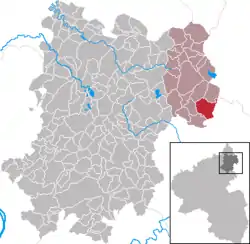
Location of Elsoff within Westerwaldkreis district  | |
 Elsoff  Elsoff | |
| Coordinates: 50°34′33″N 8°06′58″E | |
| Country | Germany |
| State | Rhineland-Palatinate |
| District | Westerwaldkreis |
| Municipal assoc. | Rennerod |
| Government | |
| • Mayor (2019–24) | Kornelia Jex[1] |
| Area | |
| • Total | 9.44 km2 (3.64 sq mi) |
| Elevation | 370 m (1,210 ft) |
| Population (2021-12-31)[2] | |
| • Total | 937 |
| • Density | 99/km2 (260/sq mi) |
| Time zone | UTC+01:00 (CET) |
| • Summer (DST) | UTC+02:00 (CEST) |
| Postal codes | 56479 |
| Dialling codes | 02664 |
| Vehicle registration | WW |
| Website | www.elsoff.de |
Geography
The community lies in the Westerwald between Siegen (35 km to the north), Wetzlar (28 km to the east) and Limburg an der Lahn (22 km to the south). Elsoff belongs to the Verbandsgemeinde of Rennerod, a kind of collective municipality.
Politics
The municipal council is made up of 6 council members who were elected in a majority vote in a municipal election on 7 June 2009.
Culture and sightseeing
Elsoff has listed cultural sites.[3] The listing is divided into Elsoff and Mittelhofen, as they were previously independent municipalities.
- Elsoff (Westerwald)
- Catholic parish church St. Peter and Paul in Kirchstrasse 19. A late historism basalt quarry stone hall with three naves, occupied in 1911. The church has a medieval tower and a grave cross (probably built in 1684), on pillars from the year 1779. Additionally a war memorial was established during 1914/18.
- A wayside shrine probably built in the 19th century, southeast of the village, on the road to Mengerskirchen.
- A Stations of the Cross, established in 1898, between two gates with a high cross built in 1990. Graveside settlements from the 20th century are situated there too.
- Elsoff (Westerwald) – Mittelhofen
- A catholic branch church with a simple hall construction from 1788.
.JPG.webp)
- A Half-timbered house, partly solid construction from the 18th century, still inhabited, with a cast iron fountain built in the 19th century at the Brunnenstrasse 11.
_und_Laufbrunnen_(KD.RLP_1_07.2015).jpg.webp)
- Wayside shrine probably built in the 19th century north of the village, along a country lane.
- The Hof Krempel, a former manor with stately buildings around rectangular courtyard and partly half-timbered barn from the 18th century. The residential building and stable have a solid construction made in the 19th century.
Economy and infrastructure
West of the community runs Bundesstraße 54, leading from Limburg an der Lahn to Siegen. The nearest Autobahn interchange is Herborn on the A 45 (Dortmund–Aschaffenburg), some 25 km away. The nearest InterCityExpress stop is the railway station at Montabaur on the Cologne-Frankfurt high-speed rail line.
References
- Direktwahlen 2019, Westerwaldkreis, Landeswahlleiter Rheinland-Pfalz, accessed 9 August 2021.
- "Bevölkerungsstand 2021, Kreise, Gemeinden, Verbandsgemeinden" (in German). Statistisches Landesamt Rheinland-Pfalz. 2022.
- Generaldirektion Kulturelles Erbe Rheinland-Pfalz (Ed.) Nachrichtliches Verzeichnis der Kulturdenkmäler – Westerwaldkreis (Memento from 07.01.2021 in Internet Archive) Bergamo 2021 pp. 10 f. (PDF; 4,8 MB)