Fitampito
Fitampito is a rural municipality in Madagascar. It belongs to the district of Ikalamavony, which is a part of Haute Matsiatra Region. The population of the commune was estimated to be approximately 9,546 in 2018.
Fitampito | |
|---|---|
 Fitampito Location in Madagascar | |
| Coordinates: 20°58′S 46°19′E | |
| Country | |
| Region | Haute Matsiatra |
| District | Ikalamavony |
| Area | |
| • Total | 2,202 km2 (850 sq mi) |
| Elevation | 652 m (2,139 ft) |
| Population (2018) | |
| • Total | 9,546 |
| Time zone | UTC3 (EAT) |
| Postal code | 314 |
Only primary schooling is available. Farming and raising livestock provides employment for 44% and 55% of the working population. The most important crop is rice, while other important products are peanuts, beans and cassava. Services provide employment for 1% of the population.[2]
Rivers
The town lies at the Matsiatra river.
References and notes
- Estimated based on DEM data from Shuttle Radar Topography Mission
- "ILO census data". Cornell University. 2002. Retrieved 2008-05-01.
Capital: Fianarantsoa | ||
| Ambalavao (17) - 303 | 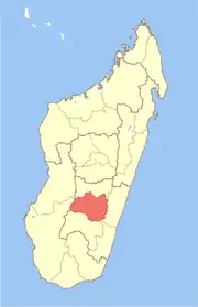 | |
| Ambohimahasoa (17) - 305 | ||
| Fianarantsoa (1) - 301 | ||
| Ikalamavony (8) - 314 | ||
| Isandra (13) - 314 | ||
| Lalangina (13) - 303 | ||
| Vohibato (15) - 305 | ||
Total: 7 districts; 84 communes | ||
This article is issued from Wikipedia. The text is licensed under Creative Commons - Attribution - Sharealike. Additional terms may apply for the media files.