Katzenthal
Katzenthal (French pronunciation: [katsəntal] ⓘ) is a commune in the Haut-Rhin department in Grand Est in north-eastern France.
Katzenthal | |
|---|---|
 A general view of Katzenthal | |
.svg.png.webp) Coat of arms | |
Location of Katzenthal | |
 Katzenthal 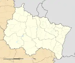 Katzenthal | |
| Coordinates: 48°06′30″N 7°16′58″E | |
| Country | France |
| Region | Grand Est |
| Department | Haut-Rhin |
| Arrondissement | Colmar-Ribeauvillé |
| Canton | Sainte-Marie-aux-Mines |
| Intercommunality | Vallée de Kaysersberg |
| Government | |
| • Mayor (2020–2026) | Nathalie Tantet-Lorang[1] |
| Area 1 | 3.5 km2 (1.4 sq mi) |
| Population | 538 |
| • Density | 150/km2 (400/sq mi) |
| Time zone | UTC+01:00 (CET) |
| • Summer (DST) | UTC+02:00 (CEST) |
| INSEE/Postal code | 68161 /68230 |
| Elevation | 210–660 m (690–2,170 ft) (avg. 280 m or 920 ft) |
| 1 French Land Register data, which excludes lakes, ponds, glaciers > 1 km2 (0.386 sq mi or 247 acres) and river estuaries. | |
Population
| Year | Pop. | ±% p.a. |
|---|---|---|
| 1968 | 483 | — |
| 1975 | 528 | +1.28% |
| 1982 | 505 | −0.63% |
| 1990 | 505 | +0.00% |
| 1999 | 497 | −0.18% |
| 2007 | 544 | +1.14% |
| 2012 | 538 | −0.22% |
| 2017 | 528 | −0.37% |
| Source: INSEE[3] | ||
References
- "Répertoire national des élus: les maires" (in French). data.gouv.fr, Plateforme ouverte des données publiques françaises. 13 September 2022.
- "Populations légales 2020". The National Institute of Statistics and Economic Studies. 29 December 2022.
- Population en historique depuis 1968, INSEE
Wikimedia Commons has media related to Katzenthal.
This article is issued from Wikipedia. The text is licensed under Creative Commons - Attribution - Sharealike. Additional terms may apply for the media files.