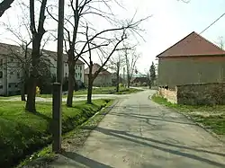
Kly (Mělník District)
Kly is a municipality and village in Mělník District in the Central Bohemian Region of the Czech Republic. It has about 1,700 inhabitants.
Kly | |
|---|---|
 Záboří, a part of Kly | |
 Flag  Coat of arms | |
 Kly Location in the Czech Republic | |
| Coordinates: 50°18′32″N 14°30′6″E | |
| Country | |
| Region | Central Bohemian |
| District | Mělník |
| First mentioned | 1323 |
| Area | |
| • Total | 10.61 km2 (4.10 sq mi) |
| Elevation | 159 m (522 ft) |
| Population (2023-01-01)[1] | |
| • Total | 1,728 |
| • Density | 160/km2 (420/sq mi) |
| Time zone | UTC+1 (CET) |
| • Summer (DST) | UTC+2 (CEST) |
| Postal code | 277 41 |
| Website | www |
Administrative parts
Villages of Dolní Vinice, Hoření Vinice, Krauzovna, Lom, Větrušice and Záboří are administrative parts of Kly.
Geography
Kly is located about 4 kilometres (2 mi) south of Mělník and 20 km (12 mi) north of Prague. It lies in a flat landscape in the Central Elbe Table. The Elbe River flows along the western municipal border. Part of the Úpor – Černínovsko Nature Reserve is located in the municipal territory.
History
The first written mention of Kly is from 1323. The municipality was heavily damaged by the 2002 European floods.[2]
Sights
The main landmark is the Church of the Nativity of the Virgin Mary in Záhoří. It is a Neorenaissance church from 1884, which replaced the old Gothic church.[3]
In the centre of Kly is the Chapel of Saint Wenceslaus. It dates from 1886.[4]
References
- "Population of Municipalities – 1 January 2023". Czech Statistical Office. 2023-05-23.
- "Historie obce" (in Czech). Obec Kly. Retrieved 2023-03-14.
- "Kostel Narození Panny Marie" (in Czech). National Heritage Institute. Retrieved 2023-03-14.
- "Kaple sv. Václava" (in Czech). National Heritage Institute. Retrieved 2023-03-14.