Kutrovice
Kutrovice (Czech pronunciation: [ˈkutrovɪtsɛ]) is a municipality and village in Kladno District in the Central Bohemian Region of the Czech Republic. It has about 100 inhabitants.
Kutrovice | |
|---|---|
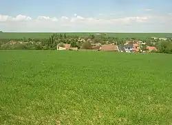 View from the south | |
 Flag  Coat of arms | |
 Kutrovice Location in the Czech Republic | |
| Coordinates: 50°15′42″N 14°1′8″E | |
| Country | |
| Region | Central Bohemian |
| District | Kladno |
| First mentioned | 1366 |
| Area | |
| • Total | 1.49 km2 (0.58 sq mi) |
| Elevation | 260 m (850 ft) |
| Population (2023-01-01)[1] | |
| • Total | 102 |
| • Density | 68/km2 (180/sq mi) |
| Time zone | UTC+1 (CET) |
| • Summer (DST) | UTC+2 (CEST) |
| Postal code | 273 75 |
| Website | www |
Geography
Kutrovice is located about 14 kilometres (9 mi) north of Kladno and 31 km (19 mi) northwest of Prague. It lies in an agricultural landscape of the Lower Eger Table. The Bakovský Stream flows through the municipality.
History
The first written mention of Kutrovice is from 1366.[2]
Transport
The I/7 road from Prague to Chomutov, which replaces the unfinished section of the D7 motorway, runs through the municipality.
Sights
Kutrovice is poor in monuments. The only protected cultural monument is a small Baroque chapel from the first half of the 19th century.[3]
Gallery
 Bakovský Stream in the centre
 Main street in the southern part
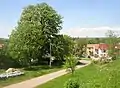 Huge horse-chestnut tree featured in coat of arms
 Baroque chapel
 Memorial to victims of the World War I
References
- "Population of Municipalities – 1 January 2023". Czech Statistical Office. 2023-05-23.
- "Úvod" (in Czech). Obec Kutrovice. Retrieved 2022-05-19.
- "Výsledky vyhledávání: Kulturní památky, obec Kutrovice". Ústřední seznam kulturních památek (in Czech). National Heritage Institute. Retrieved 2023-07-13.
This article is issued from Wikipedia. The text is licensed under Creative Commons - Attribution - Sharealike. Additional terms may apply for the media files.