La Biche River Wildland Provincial Park
La Biche River Wildland Provincial Park is a wildland provincial park in northern Alberta, Canada. The park was established on 6 June 2000 and had an area of 16,843.975 hectares (41,622.37 acres; 65.03 sq mi).[3] It was expanded on 8 August 2001 to an area of 17,545.251 hectares (43,355.26 acres; 67.74 sq mi).[4] The park is included in the Upper Athabasca Region Land Use Framework.[5]
| La Biche River Wildland Provincial Park | |
|---|---|
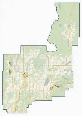
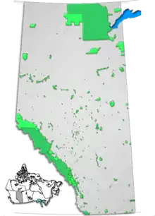
 Location of La Biche River WPP  La Biche River Wildland Provincial Park (Canada)  La Biche River Wildland Provincial Park (Athabasca County) | |
| Location | Athabasca County, Alberta |
| Nearest town | Atmore, Alberta |
| Coordinates | 55°0′0″N 112°36′30″W |
| Area | 17,313.849 ha (66.84914 sq mi)[2] |
| Established | 6 June 2000[3] |
| Governing body | Alberta Forestry, Parks and Tourism |
Location
The park is in Athabasca County in northern Alberta, approximately 75 kilometres (47 mi) northeast of Athabasca. It is west of Alberta Highway 63 between Township Road 685 in the south and Amesbury in the north. The La Biche River forms the eastern boundary of the park. The river then takes a sharp left turn and forms the northern boundary. The Athabasca River forms the western boundary. The southern boundary is Pine Creek. Other borders are completed by the Dominion Land Survey system. The park is approximately 18.5 kilometres (11.5 mi) east-to-west and the same north-to-south.[2] There is no road access to the park. There is access through Poachers Landing Provincial Recreation Area (PRA) which is approximately 55 kilometres (34 mi) east and then north of Athabasca on public roads. Poachers Landing PRA is adjacent to La Biche WPP on the west. Once inside Poachers Landing, trails for off highway vehicles, snowmobiles, and horseback riding allow access to the Wildland Provincial Park. The PRA also allows access to the Athabasca River which connects to the park in summer and winter.[6]
Ecology
The park protects an example of the Central Mixedwood subregion of the Boreal Forest natural region of Alberta.[5] In the National Ecological Framework for Canada used by Environment and Climate Change Canada, the park is in the Athabasca Plain ecodistrict of the Boreal Transition ecoregion in the Central Boreal Plains ecoprovince of the Boreal Plains Ecozone.[7][8] Under the OneEarth classification (previously World Wildlife Fund), the park is in the Mid-Canada Boreal Plains Forests ecoregion of the Mid-Canada Boreal Plains & Foothill Forests bioregion.[9]
Geography
The park is largely flat except for the valley where it meets the Athabasca. The elevation of the park is approximately 550 metres (1,800 ft). There are two low ridges in the northeastern part of the park reaching up to 596 metres (1,955 ft). The elevation drops to 495 metres (1,624 ft) at the Athabasca. There are several small lakes in the center of the park each about 1.6 kilometres (1 mi) long.[10]
Climate
The Köppen climate classification of the park is Continental, Subarctic (Dfc) characterized by long, cold winters, and short, warm to cool summers.[11] Using the data from nearby weather stations (Atmore AGCM and Wandering River Auto), average daily temperatures exceed 10 °C (50 °F) only for June, July, and August while average daily temperatures are less than 0 °C (32 °F) for November through March. The long-run average precipitation for the wettest months, June and July, is 90 to 100 millimetres (3.5 to 3.9 in) per month; conversely, it is less than 40 millimetres (1.6 in) per month from September through April.[12]
Natural history themes
The low ridges are covered by dense forests while the land between the ridges is covered in marsh. The park protects an undisturbed boreal forest of aspen, birch, black poplar, fir, and black spruce. Carnivores found in the park include American black bear and lynx. Ungulates in the park include moose, wolverine, and boreal woodland caribou. Beavers are found in the marsh.[5]
Activities
The park has a significant trail system allowing off-highway vehicle and horseback riding in summer and snowmobiling and dogsledding in winter but only on existing trails; off-trail use is prohibited. There are backcountry campgrounds on the western side of the park. On the waterways, Powerboating, canoeing, and kayaking are permitted. Wildlife viewing and backcountry hiking are allowed. Hunting and fishing are permitted when licensed.[5]
References
- UNEP-WCMC (2000). "Protected Area Profile for La Biche River Wildland Provincial Park from the World Database on Protected Areas". ProtectedPlanet.net. Retrieved 15 March 2023.
- "Plan Showing La Biche River Wildland Provincial Park" (PDF). Alberta Parks. 3 April 2012.
- "O.C. 207/2000". Orders in Council. Alberta King's Printer. 6 June 2000.
- "O.C. 326/2001". Orders in Council. Alberta King's Printer. Retrieved 18 March 2023.
- "Information & Facilities - La Biche River Wildland Provincial Park". Alberta Parks. 31 August 2022.
- "Random Backcountry Camping - La Biche River Wildland Provincial Park". Alberta Parks. 21 April 2022.
- Terrestrial Ecozones, Ecoregions, and Ecodistricts: Alberta, Saskatchewan, and Manitoba, Canada (Map). 1:2 million. Agriculture and Agri-Food Canada and Environment Canada. 1995.
- Ecological Land Classification, 2017 (PDF). Statistics Canada. 1 March 2018. pp. 4–5, 28. ISBN 978-0-660-24501-0. Catalogue no. 12-607-X.
- "Alberta-British Columbia Foothills Forests". OneEarth.org.
- "Alberta topographic map". Topographic-Map.com. Retrieved 15 March 2023.
- "Climate Zones of North America". CEC.org. Commission for Environmental Cooperation. Retrieved 25 January 2023.
- "Climate Normals for Alberta: (Atmore AGCM and Wandering River Auto)". Government of Alberta. 2020.
