Whitehorse Wildland Provincial Park
Whitehorse Wildland Provincial Park is a wildland provincial park in west-central Alberta, Canada. The park was established on 26 August 1998 and had an area of 17,439.886 hectares (43,094.90 acres; 67.34 sq mi).[4] On 23 July 2002, the area was changed slightly to 17,325.54 ha (42,812.34 acres; 66.89 sq mi).[3] The park is included in the Upper Athabasca Region Land Use Framework. The park is named for the creek within the boundaries of the park.
| Whitehorse Wildland Provincial Park | |
|---|---|
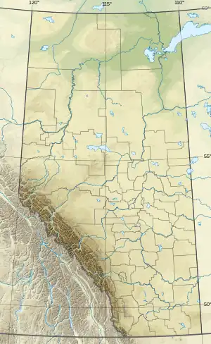
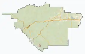
 Location of Whitehorse WPP  Whitehorse Wildland Provincial Park (Canada)  Whitehorse Wildland Provincial Park (Yellowhead County) | |
| Location | Yellowhead County, Alberta |
| Nearest town | Cadomin, Alberta |
| Coordinates | 52°59′42″N 117°27′18″W[2] |
| Area | 17,325.54 ha (66.8943 sq mi)[3] |
| Established | 26 August 1998[4] |
| Governing body | Alberta Parks[5] |
Location
The park is in Yellowhead County in western Alberta, approximately 38 km (24 mi) southwest of Robb and 6 km (3.7 mi) south of Cadomin, Alberta. Jasper National Park borders the park to the west. Whitehorse Wildland is adjacent to Whitehorse Creek Provincial Recreation Area.[3][5][6]
Ecology
In the National Ecological Framework for Canada used by Environment and Climate Change Canada, the park is in the Luscar and Ram River Foothills ecodistricts of the Western Alberta Upland ecoregion in the Boreal Foothills ecoprovince of the Boreal Plains ecozone.[7][8] Under the OneEarth classification (previously World Wildlife Fund), the park is in the Northern Rockies Conifer Forests ecoregion of the Greater Rockies & Mountain Forests bioregion.[9]
Geography
The northern part of the park contains the watershed of the Whitehorse Creek and the ridges of foothills forming the valley for the creek. The northern ridge is the Nikanassin Range while the southern is the Miette Range. Within the park, in the Nikanassen Range are four mountains: Luscar Mountain at 2,606 m (8,550 ft) elevation, Leyland Mountain (2,545 m (8,350 ft)), Mount Gregg (2,530 m (8,300 ft)). and Mount Sir Harold Mitchell (2,514 m (8,248 ft)). The Miette Ranges contains several unnamed mountains 2,100 to 2,300 m (6,900 to 7,500 ft) in elevation.[10] The southern arm of the park follows the Cardinal Divide Ridge. The Cardinal Divide, with an elevation of 2,025 m (6,644 ft), is the continental divide between two major watersheds: the McLeod and Athabasca Rivers, which eventually drain into the Arctic Ocean; and the Cardinal, Brazeau, and North Saskatchewan Rivers, which eventually drain into Hudson Bay.[6] In the southern arm contains several named mountains: Prospect Mountain (2,819 m (9,249 ft)), Cheviot Mountain (2,720 m (8,920 ft)), and Tripoli Mountain (2,620 m (8,600 ft)). In addition, two mountains form the border with Jasper National Park and are thus partially in Whitehorse Wildland park: Blackface Mountain (2,867 m (9,406 ft)) and Climax Mountain (2,823 m (9,262 ft)).[11] The elevation of Whitehorse Creek when it leaves to park is 1,600 m (5,200 ft). There is an extensive trail network in the park for hiking and horseback trail riding.[6]
Climate
The Köppen climate classification of the park is Continental, Subarctic (Dfc) characterized by long, cold winters, and short, warm to cool summers.[12] Using the data from a nearby weather stations (Luscar Creek), average daily temperatures for 1991 to 2020 exceeds 10 °C (50 °F) only for June, July, and August while average daily temperatures are less than 0 °C (32 °F) for November through March. At Luscar Creek, the long-run average precipitation from 1991 to 2020 for the wettest months, June and July, is 100 to 110 mm (3.9 to 4.3 in) per month; conversely, the station receive less than 40 mm (1.6 in) per month from October through March.[13]
Natural history
The park is home to many wildlife species. Ungulates include bighorn sheep, elk, moose, and mule deer. Carnivores include grizzly bears, wolves, and cougars. Among the small mammals are hoary marmots and American pikas. The park also provides breeding habitat for harlequin ducks which are dependent on the fast-flowing mountain streams for nesting and rearing their young.[6]
Cadomin Cave, located just south of Cadomin, is an extensive limestone cave system providing important bat habitat and is one of only four major bat hibernacula in Alberta.[6]
Activities
Front country camping is available at the adjacent Whitehorse Creek Provincial Recreation Area. Whitehorse Wildland has four designated backcountry campgrounds, as well as random backcountry camping. The extensive trail system allows for hiking, horesback trail riding, and mountain biking. Also found are geocaching and wildlife viewing. Hunting is permitted when licensed.[5]
References
- UNEP-WCMC (1998). "Protected Area Profile for Whitehorse Wildland Provincial Park from the World Database on Protected Areas". ProtectedPlanet.net. Archived from the original on 23 March 2023. Retrieved 18 March 2023.
- Sheet No. 83-C-14 (Map). 1:50,000. Alberta Sustainable Resource Development. April 2008. Archived from the original on 20 November 2019. Retrieved 21 March 2023.
- "O.C. 364/2002". Orders in Council. Alberta King's Printer. 23 July 2002. Archived from the original on 23 March 2023. Retrieved 21 March 2023.
- "O.C. 354/98". Orders in Council. Alberta King's Printer. 26 August 1998. Archived from the original on 23 March 2023. Retrieved 22 March 2023.
- "Information & Facilities - Whitehorse Wildland Provincial Park". Alberta Parks. Archived from the original on 18 January 2023. Retrieved 21 March 2023.
- "Whitehorse Wildland Provincial Park: Park Guide" (PDF). Alberta Parks. December 2022.
- Terrestrial Ecozones, Ecoregions, and Ecodistricts: Alberta, Saskatchewan, and Manitoba, Canada (Map). 1:2 million. Agriculture and Agri-Food Canada and Environment Canada. 1995. Archived from the original on 15 September 2022. Retrieved 21 March 2023.
- Ecological Land Classification, 2017 (PDF). Statistics Canada. 1 March 2018. pp. 4–5, 26. ISBN 978-0-660-24501-0. Catalogue no. 12-607-X. Archived (PDF) from the original on 14 December 2018. Retrieved 21 March 2023.
- Noss, Reed. "Northern Rockies Conifer Forests". OneEarth.org. Archived from the original on 26 September 2022. Retrieved 21 March 2023.
- "Alberta topographic map". Topographic-Map.com. Archived from the original on 23 March 2023. Retrieved 21 March 2023.
- "Alberta topographic map". Topographic-Map.com. Archived from the original on 23 March 2023. Retrieved 21 March 2023.
- Atlas of Canada: Climatic Regions (PDF) (Map). Government of Canada. Archived (PDF) from the original on 15 March 2023. Retrieved 20 March 2023.
- "Climate Normals for Alberta: (Luscar Creek)". Government of Alberta. 2020. Archived from the original on 25 January 2023. Retrieved 21 March 2023.
