Miette Range
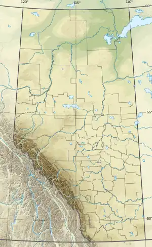
The Miette Range is a mountain range of the Canadian Rockies located south of Highway 16 near the east border of Jasper National Park, Alberta, Canada.
| Miette Range | |
|---|---|
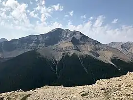 Utopia Mountain from the Sulphur Skyline | |
| Highest point | |
| Peak | Utopia Mountain |
| Elevation | 2,602 m (8,537 ft)[1] |
| Listing | Mountains of Alberta |
| Coordinates | 53°05′50″N 117°46′08″W[2] |
| Geography | |
 | |
| Country | Canada |
| Province | Alberta |
| Range coordinates | 53°08′N 117°51′W[3] |
| Parent range | Canadian Rockies |
| Topo map | NTS 83F4 Miette[3] |
This range includes the following mountains and peaks:
| Mountain/peak | Elevation | Location | |
|---|---|---|---|
| metres | feet | ||
| Utopia Mountain | 2,602 | 8,537 | 53°05′46″N 117°46′01″W |
| Mount O'Hagan | 2,445 | 8,022 | 53°06′46″N 117°48′41″W |
| Capitol Mountain | 2,438 | 7,999 | 53°07′54″N 117°51′45″W |
| Roche Miette | 2,316 | 7,598 | 53°09′46″N 117°55′08″W |
| Syncline Ridge | 1,905 | 6,250 | 53°09′40″N 117°56′10″W |
See also
References
- "Topographic map of Utopia Mountain". opentopomap.org. Retrieved 2023-07-10.
- "Utopia Mountain". Geographical Names Data Base. Natural Resources Canada. Retrieved 2023-07-10.
- "Miette Range". Geographical Names Data Base. Natural Resources Canada. Retrieved 2023-07-10.
This article is issued from Wikipedia. The text is licensed under Creative Commons - Attribution - Sharealike. Additional terms may apply for the media files.