High Rock Range
The High Rock Range is a mountain range of the Canadian Rockies in southwestern Alberta and southeastern British Columbia, Canada.
| High Rock Range | |
|---|---|
 Mount Rae from the north, Sept. 2006 | |
| Highest point | |
| Peak | Mount Rae |
| Elevation | 3,218 m (10,558 ft) |
| Coordinates | 50°37′22″N 114°58′29″W[1] |
| Dimensions | |
| Length | 117 km (73 mi) N-S[2] |
| Width | 37 km (23 mi) E-W[2] |
| Area | 2,172 km2 (839 sq mi)[2] |
| Geography | |
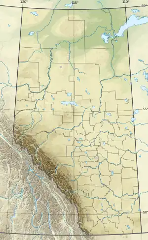 Location of High Rock Range on the Continental Divide 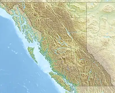 High Rock Range (British Columbia) | |
| Country | Canada |
| Provinces | Alberta and British Columbia |
| Range coordinates | 50°08′56″N 114°42′21″W[3] |
| Parent range | Canadian Rockies |
| Topo map | NTS 82J2 Fording River[3] |
It is a part of the Southern Continental Ranges and is located on the Continental Divide, north of the Crowsnest Pass and south of the Highwood Pass.[4] It lies partly within Kananaskis Country.
The Misty Range and the Greenhills Range are subdivisions of the High Rock.
The High Rock Range covers a surface area of 2,172 km2 (838 mi2), has a length of 117 km (73 mi) (from north to south) and a width of 37 km (23 mi).[2]
List of mountains
| Name | Elevation | Prominence | Coordinates | ||
|---|---|---|---|---|---|
| m | ft | m | ft | ||
| Mount Rae | 10,558
style="text-align:right;" data-sort-value="7003133000000000000"|1,330 |
4,360 | 50°37′22″N 114°58′29″W | ||
| Mist Mountain | 10,300
style="text-align:right;" data-sort-value="7002487000000000000"|487 |
1,598 | 50°33′15″N 114°54′36″W | ||
| Tornado Mountain | 10,167
style="text-align:right;" data-sort-value="7002959000000000000"|959 |
3,146 | 49°58′1″N 114°39′16″W | ||
| Courcelette Peak | 9,987
style="text-align:right;" data-sort-value="7002775000000000000"|775 |
2,543 | 50°17′27″N 114°48′21″W | ||
| Mount Lyall | 9,680
style="text-align:right;" data-sort-value="7002529000000000000"|529 |
1,736 | 50°5′23″N 114°42′17″W | ||
| Beehive Mountain | 9,498
style="text-align:right;" data-sort-value="7002245000000000000"|245 |
804 | 50°3′54″N 114°39′47″W | ||
| Mount Armstrong | 9,262
style="text-align:right;" data-sort-value="7002250000000000000"|250 |
820 | 50°21′1″N 114°45′59″W | ||
| Crowsnest Mountain | 9,137
style="text-align:right;" data-sort-value="7002925000000000000"|925 |
3,035 | 49°42′13″N 114°34′26″W | ||
| Mount Muir | 9,049
style="text-align:right;" data-sort-value="7002518000000000000"|518 |
1,699 | 50°23′28″N 114°49′35″W | ||
| Allison Peak | 8,681
style="text-align:right;" data-sort-value="7002541000000000000"|541 |
1,775 | 49°44′36″N 114°38′47″W | ||
| Mount Tecumseh | 8,356
style="text-align:right;" data-sort-value="7002518000000000000"|518 |
1,699 | 49°39′55″N 114°38′46″W | ||
See also
References
- "Mount Rae". Geographical Names Data Base. Natural Resources Canada. Retrieved 2021-11-17.
- "High Rock Range". Peakbagger.com. Retrieved 2006-09-20.
- "High Rock Range (Alberta)". Geographical Names Data Base. Natural Resources Canada. Retrieved 2021-11-17.
- "High Rock Range". cdnrockiesdatabases.ca. Retrieved 2006-09-20.
This article is issued from Wikipedia. The text is licensed under Creative Commons - Attribution - Sharealike. Additional terms may apply for the media files.