Vermilion Range (Alberta)
The Vermilion Range is a mountain range of the Canadian Rockies, in Banff National Park, Canada. The range is east of the Sawback Range and west of the Bare and Palliser Ranges.
| Vermilion Range | |
|---|---|
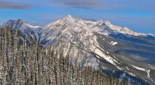 Mount Brewster as seen from Sulphur Mountain in 2010 | |
| Highest point | |
| Peak | Cascade Mountain |
| Elevation | 2,998 m (9,836 ft)[1] |
| Listing | Mountains of Alberta |
| Coordinates | 51°16′05″N 115°34′56″W[2] |
| Dimensions | |
| Length | 56 km (35 mi) N-S[3] |
| Width | 35 km (22 mi) E-W[3] |
| Area | 551 km2 (213 sq mi)[3] |
| Geography | |
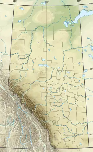 Location in SW Alberta | |
| Country | Canada |
| Province | Alberta |
| Protected area | Banff National Park |
| Range coordinates | 51°22′N 115°43′W[4] |
| Parent range | Canadian Rockies |
| Borders on | Sawback Range, Bare Range, Palliser Range and Fairholme Range |
| Topo map | NTS 82O5 Castle Mountain[4] |
This range includes the following mountains and peaks:
| Name | Elevation | |
|---|---|---|
| m | ft | |
| Cascade Mountain | 2,998 | 9,836 |
| Flints Peak | 2,950 | 9,680 |
| Mount Brewster | 2,859 | 9,380 |
| Prow Mountain | 2,858 | 9,377 |
| Mount Norquay | 2,522 | 8,274 |
Geology
The mountains in Banff Park are composed of sedimentary rock laid down during the Precambrian to Jurassic periods.[5] Formed in shallow seas, this sedimentary rock was pushed east and over the top of younger rock during the Laramide orogeny.[6]
Climate
Based on the Köppen climate classification, the range experiences a subarctic climate with cold, snowy winters, and mild summers.[7] Temperatures in winter can drop below −20 °C (−4 °F) with wind chill factors below −30 °C (−22 °F).
References
- "Cascade Mountain". cdnrockiesdatabases.ca. Retrieved 2019-09-17.
- "Cascade Mountain". Geographical Names Data Base. Natural Resources Canada. Retrieved 2019-09-17.
- "Vermillion Range". Peakbagger.com. Retrieved 2021-07-30.
- "Vermilion Range". Geographical Names Data Base. Natural Resources Canada. Retrieved 2014-11-09.
- Belyea, Helen R. (1960). The Story of the Mountains in Banff National Park (PDF). parkscanadahistory.com (Report). Ottawa: Geological Survey of Canada. Archived (PDF) from the original on 2015-10-02. Retrieved 2019-09-13.
- Gadd, Ben (2008), Geology of the Rocky Mountains and Columbias
- Peel, M. C.; Finlayson, B. L. & McMahon, T. A. (2007). "Updated world map of the Köppen−Geiger climate classification". Hydrol. Earth Syst. Sci. 11: 1633–1644. doi:10.5194/hess-11-1633-2007. ISSN 1027-5606.
This article is issued from Wikipedia. The text is licensed under Creative Commons - Attribution - Sharealike. Additional terms may apply for the media files.