Lalitpur District, Nepal
Lalitpur District (Nepali: ललितपुर जिल्लाⓘ, a part of Bagmati Province, is one of the seventy-seven districts of Nepal. The district, with Lalitpur as its district headquarters, covers an area of 396.92 km2 (153.25 sq mi) and has a population (2001) of 337,785. It is one of the three districts in the Kathmandu Valley, along with Kathmandu and Bhaktapur. Its population was 466,784 in the initial 2011 census tabulation.[3] It is surrounded by Makwanpur, Bhaktapur, Kathmandu and Kavre.
Lalitpur District
ललितपुर जिल्ला | |
|---|---|
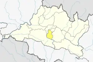 Location of district in province | |
| Country | |
| Admin HQ. | Lalitpur |
| Government | |
| • Type | Coordination committee |
| • Body | DCC, Lalitpur |
| Area | |
| • Total | 396.92 km2 (153.25 sq mi) |
| Population | |
| • Total | 468,132 |
| • Density | 1,200/km2 (3,100/sq mi) |
| 2001 pop.: 337,785 1991 pop.: 257,086 1991 pop.: 184,341 | |
| Time zone | UTC+05:45 (NPT) |
| Website | www |
Geography and climate
| Climate Zone[4] | Elevation Range | % of Area |
|---|---|---|
| Upper Tropical | 300 to 1,000 meters 1,000 to 3,300 ft. |
9.9% |
| Subtropical | 1,000 to 2,000 meters 3,300 to 6,600 ft. |
79.3% |
| Temperate | 2,000 to 3,000 meters 6,400 to 9,800 ft. |
10.8% |
Demographics
| Census year | Pop. | ±% p.a. |
|---|---|---|
| 1981 | 184,341 | — |
| 1991 | 257,086 | +3.38% |
| 2001 | 337,785 | +2.77% |
| 2011 | 468,132 | +3.32% |
| 2021 | 548,401 | +1.60% |
| Source: Citypopulation[5] | ||
At the time of the 2011 Nepal census, Lalitpur District had a population of 468,132.
language in Lalitpur District
As their first language, 47.3% spoke Nepali, 30.3% Newar, 11.4% Tamang, 2.5% Maithili, 1.4% Magar, 1.1% Rai, 1.0% Bhojpuri, 0.7% Tharu, 0.6% Gurung, 0.6% Limbu, 0.5% Hindi, 0.4% Pahari, 0.2% Danuwar, 0.2% Sunuwar, 0.2% Urdu, 0.1% Bengali, 0.1% Bantawa, 0.1% Chamling, 0.1% Doteli, 0.1% English, 0.1% Rajasthani, 0.1% Sherpa, 0.1% Tibetan and 0.3% other languages.[6]
Ethnicity/caste: 33.8% were Newar, 18.8% Chhetri, 13.1% Tamang, 13.0% Hill Brahmin, 4.6% Magar, 2.7% Rai, 1.2% Gurung, 1.2% Tharu, 1.1% Kami, 0.9% Limbu, 0.8% Pahari, 0.7% Sarki, 0.7% Thakuri, 0.6% Musalman, 0.5% Damai/Dholi, 0.5% Yadav, 0.4% Sanyasi/Dasnami, 0.3% other Dalit, 0.3% Danuwar, 0.3% Kalwar, 0.3% Majhi, 0.3% Sunuwar, 0.3% Teli, 0.2% Terai Brahmin, 0.2% Gharti/Bhujel, 0.2% Hajam/Thakur, 0.2% Kayastha, 0.2% Koiri/Kushwaha, 0.2% Marwadi, 0.2% Sherpa, 0.2% other Terai, 0.1% Badi, 0.1% Bengali, 0.1% Chamar/Harijan/Ram, 0.1% Dhanuk, 0.1% foreigners, 0.1% Ghale, 0.1% Halwai, 0.1% Kathabaniyan, 0.1% Kumal, 0.1% Kurmi, 0.1% Lohar, 0.1% Punjabi/Sikh, 0.1% Rajput, 0.1% Sudhi, 0.1% Thakali and 0.1% others.[7]
Religion: 73.5% were Hindu, 19.3% Buddhist, 5.0% Christian, 1.2% Kirati, 0.7% Muslim and 0.2% others.[9]
Literacy: 82.2% could read and write, 1.7% could only read and 15.9% could neither read nor write.[10]
Administrative division
There are six municipalities in Lalitpur District, including three Rural Municipalities and one Metropolitan city:
- Lalitpur Metropolitan City
- Mahalaxmi Municipality
- Godawari Municipality
- Konjyoson Rural Municipality
- Bagmati Rural Municipality
- Mahankal Rural Municipality
Former Village Development Committees
Prior to federal restructuring, the following Village development committees were also part of the district. By 2017, they were all merged into municipalities or rural municipalities or were included into Lalitpur Metropolitan City.
- Ashrang
- Badikhel, now Godawari Municipality
- Bhardev
- Bhattedanda
- Bisankhunarayan, now Godawari Municipality
- Bungamati (Bunga), now at Lalitpur Metropolitan city 22
- Bukhel
- Bhainsapti, now Karyabinayak Municipality
- Chandanpur
- Chapagaun, now Godawari Municipality
- Chaughare
- Chhampi, now Karyabinayak Municipality
- Dalchoki
- Devichaur
- Dhapakhel, now Lalitpur Municipality
- Dukuchhap, now Karyabinayak Municipality
- Ghusel
- Gimdi
- Godamchaur, now Godawari Municipality
- Godawari, now Godawari Municipality
- Gotikhel
- Harisiddhi, now Lalitpur Municipality
- Ikudol
- Imadol, now Mahalakshmi Municipality
- Jharuwarasi, now Godawari Municipality
- Kaleshwar
- Khokana, now Karyabinayak Municipality
- Lamatar, now Mahalakshmi Municipality
- Lele, now Godawari Municipality
- Lubhu, now Mahalakshmi Municipality
- Malta
- Manikhel
- Nallu
- Pyutar
- Sainbu, now Karyabinayak Municipality
- Sankhu
- Siddhipur, now Mahalakshmi Municipality
- Sunakothi, now Lalitpur Municipality
- Thaiba, now Godawari Municipality
- Thecho, now Godawari Municipality
- Thuladurlung
- Tikathali, now Mahalakshmi Municipality
Other places
- Jharuwarasi
- Chyasal
- Jawalakhel
- Pyan Gaun
- Lagankhel
- Jhamsikhel
- Kumaripati
- Kupondole
- Kusunti
- माल्टा
Education
Lalitpur District has adequate education facilities in comparison to other districts, including:
- Adarsha Vidya Mandir (AVM)
- Adarsha Saula Yubak Higher Secondary School
- AIMS Academy
- Graded English Medium School (GEMS)
- Annal Jyoti Boarding School (AJS)
- United Universal School
- Ideal Model School
- Institute of Engineering (Pulchok)
- I.J. Pioneer High School
- Little Angels' School
- Little Learners Fun School (Saibu Bhaisepati)
- Rato Bangala school
- United school (Imadol)
- St. Mary's School
- St. Xavier's School
- Nepal Don Bosco School, Siddhipur
- Shuvatara School
- Vajra Academy (Jharuwarashi)
- Milestone School
- Anant English School, Siddhipur
- The Sudesha School (Nakhkhu)
- Pawan Prakriti English Secondary school (Tikathali)
- Pathshala Nepal Foundation (Bagdol)
- Prasadi Academy, Manbhawan
- Nalanda Secondary Boarding School (Satdobato)
- Kshitiz Secondary Boarding School (Harisiddhi)
- Nawa Bihani School, Imadole
- Oracle English Medium School
- Royal Yala World School
- Unique Academy/College, Kumaripati
- United Academy (Kumaripati)
- Kitini secondary higher school (thaukhel)
- Radiant Readers Academy (Sanepa)
Sports
Lalitpur is also home to several notable sporting organisations and grounds such as:
- ANFA Complex, Satdobato
- Tennis Complex, Satdobato
- Army Physical Training Centre, Lagankhel
- Chyasal Technical Centre, Chyasal
- Thecho Badminton Club
- Pragaypokhari Badminton Circle,Prayagpokhari
References
- "National Planning Commission Secretariat, Central Bureau of Statistics. Nepal". Archived from the original on 2016-08-16.
- "STATISTICAL YEAR BOOK OF NEPAL - 2011" (PDF). Archived from the original (PDF) on 2016-03-26. Retrieved 2016-09-06.
- http://census.gov.np/images/pdf/Preliminary%20Leaflet%202011.pdf%5B%5D
- The Map of Potential Vegetation of Nepal - a forestry/agroecological/biodiversity classification system (PDF), . Forest & Landscape Development and Environment Series 2-2005 and CFC-TIS Document Series No.110., 2005, ISBN 87-7903-210-9, retrieved Nov 22, 2013
- "NEPAL: Administrative Division". www.citypopulation.de.
- NepalMap Language
- NepalMap Caste
- "NepalMap profile: Lalitpur". NepalMap. Retrieved 16 July 2022.
- NepalMap Religion
- NepalMap Literacy
- "Districts of Nepal". Statoids.