List of listed buildings in Jedburgh, Scottish Borders
List
| Name | Location | Date Listed | Grid Ref. [note 1] | Geo-coordinates | Notes | LB Number [note 2] | Image |
|---|---|---|---|---|---|---|---|
| 1 High Street | High Street | 1993 | 55°28′40″N 2°33′18″W | Category C(S) | 35541 | 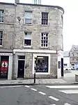
| |
| 5-7 (Odd Nos) High Street | High Street | 1993 | 55°28′40″N 2°33′18″W | Category C(S) | 35543 | 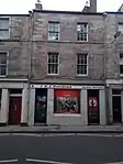
| |
| 19 High Street | High Street | 1993 | 55°28′41″N 2°33′17″W | Category B | 35548 | 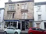
| |
| 49 High Street And 1 Smith's Wynd | High Street | 1993 | 55°28′44″N 2°33′12″W | Category C(S) | 35557 | 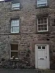
| |
| 20 High Street, Spread Eagle Hotel, With Stables To Rear | High Street | 1971 | 55°28′42″N 2°33′17″W | with stables to rear | 35565 | 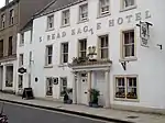
| |
| 24 High Street | High Street | 55°28′43″N 2°33′16″W | Category B | 35567 | 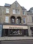
| ||
| 32-34 (Even Nos) High Street | High Street | 55°28′44″N 2°33′15″W | Category B | 35570 | 
| ||
| 36 High Street | High Street | 55°28′44″N 2°33′14″W | Category B | 35571 | 
| ||
| 5-6 Market Place And 4-7 (Inclusive Nos) Burn Wynd | Market Place | 55°28′39″N 2°33′21″W | Category B | 35576 | 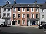
| ||
| Newcastle Road (And Oxnam Road), Old Parish Church With Gatepiers And Boundary Wall, (Church Of Scotland) | Newcastle Road | 1993 | 55°28′29″N 2°33′14″W | Category A | 35581 | .jpg.webp)
| |
| 1A And 1B Old Bridge End | Bridge End | 55°28′40″N 2°33′03″W | Category B | 35585 | 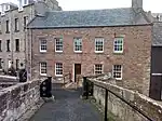
| ||
| 5 Abbey Place, Abbots Lea | Abbey Place | 55°28′38″N 2°33′17″W | Category C(S) | 35460 | 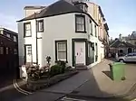
| ||
| 6 And 7C Abbey Place | Abbey Place | 55°28′38″N 2°33′17″W | Category B | 35461 | 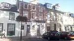
| ||
| Bridge Street, Bridge House | Bridge Street | 55°28′49″N 2°33′06″W | Category C(S) | 35466 | 
| ||
| 1 Bridge Street, Maitland House | Bridge Street | 55°28′49″N 2°33′08″W | Category C(S) | 35468 | 
| ||
| 14A And B And 16 Canongate | Canongate | 55°28′40″N 2°33′15″W | Category C(S) | 35480 | 
| ||
| 71 Castlegate | Castlegate | 55°28′32″N 2°33′29″W | Category C(S) | 35492 |  Upload Photo | ||
| 83 Castlegate | Castlegate | 55°28′31″N 2°33′30″W | Category C(S) | 35497 | .jpg.webp)
| ||
| 91 Castlegate With Garden Wall To Front | Castlegate | 55°28′30″N 2°33′32″W | Category C(S) | 35502 | 
| ||
| Castlegate, Sheriff Court (Old County Buildings) With Front Wall And Railings | Castlegate | 55°28′39″N 2°33′20″W | Category A | 35503 | 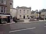
| ||
| 74 Castlegate | Castlegate | 55°28′30″N 2°33′29″W | Category C(S) | 35513 | Upload Photo | ||
| 1,2,3 Duck Row | Duck Row | 55°28′41″N 2°33′05″W | Category C(S) | 35519 | 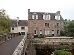
| ||
| 11 Exchange Street | Exchange Street | 1993 | 55°28′41″N 2°33′21″W | Category A | 35522 | 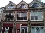
| |
| Friars, Normanie With Cast-Iron Verandah, Terrace And Steps | 55°28′47″N 2°33′23″W | Category C(S) | 35526 | Upload Photo | |||
| Friarsgate, Friars Yard With Boundary Walls, Gatepiers And Railings | 55°28′50″N 2°33′15″W | Category C(S) | 35531 | 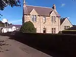
| |||
| Edgerston Church With Graveyard, Gatepiers, Graveyard Wall And Railings | Edgerston | 55°23′54″N 2°29′58″W | Category B | 13355 | 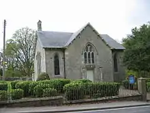
| ||
| Ferniehirst Castle With Arched Gateway, Garden Walls And Outbuildings | 55°27′16″N 2°33′04″W | Category A | 13369 | 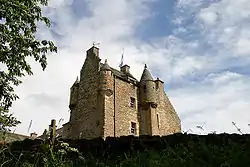
| |||
| Glenburn Hall Stables | 55°28′22″N 2°34′16″W | Category C(S) | 13373 | 
| |||
| Hundalee | 55°27′41″N 2°33′37″W | Category B | 13375 | Upload Photo | |||
| Hunthill With Forecourt And Garden Walls, Forecourt Gatepiers And Gates, And Entrance Gatepiers | 55°27′52″N 2°31′45″W | Category B | 13377 | Upload Photo | |||
| Jedfoot Lodge With Gates And Boundary Wall | 55°30′34″N 2°32′21″W | Category C(S) | 13380 | 
| |||
| Jedwater House, With Stables, Outbuilding, And Retaining Wall | 55°28′04″N 2°33′10″W | Category B | 13381 | Upload Photo | |||
| Lintalee And Walled Garden | 55°27′23″N 2°33′36″W | Category B | 13388 | Upload Photo | |||
| 1-5 (Inclusive Nos) Mossburnford Cottages | 55°26′19″N 2°31′43″W | Category C(S) | 13390 | 
| |||
| Newcastle Road, Linthaugh | Newcastle Road | 55°27′25″N 2°33′25″W | Category B | 13395 | Upload Photo | ||
| Bonjedward House And Walled Garden | 55°29′44″N 2°32′48″W | Category B | 8400 | 
| |||
| 1-4 (Inclusive Nos) Easter Ulston Cottages | 55°29′26″N 2°31′22″W | Category C(S) | 8409 | 
| |||
| 25-27 (Odd Nos) High Street | High Street | 55°28′42″N 2°33′15″W | Category C(S) | 35550 | 
| ||
| 4-6 (Even Nos) High Street | High Street | 55°28′41″N 2°33′19″W | Category C(S) | 35559 | 
| ||
| 8 High Street And Grahamslaw Close | High Street | 55°28′41″N 2°33′19″W | Category C(S) | 35560 | 
| ||
| 18 High Street | High Street | 55°28′42″N 2°33′18″W | Category C(S) | 35564 | 
| ||
| 7-8 Market Place And 4-7 (Inclusive Nos) Burn Wynd | Market Place | 55°28′40″N 2°33′21″W | Category B | 35577 | 
| ||
| Newcastle Road, Allerley Well Park, Gatepiers, Drinking Fountain, Boundary Walls And Marker Stone | Newcastle Road | 55°28′24″N 2°33′15″W | Category C(S) | 35579 | 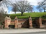
| ||
| Newcastle Road (And Oxnam Road), Kirkland House, (Former Manse), Coach House And Boundary Wall | Newcastle Road | 55°28′27″N 2°33′14″W | Category B | 35582 | 
| ||
| Oxnam Road, Allerley Brae, W Cottage | Oxnam Road | 55°28′30″N 2°33′08″W | Category C(S) | 35587 | 
| ||
| 1A Smith's Wynd | Smith's Wynd | 55°28′44″N 2°33′12″W | Category C(S) | 35596 | 
| ||
| 1-3 (Inclusive Nos) Under Nags Head Close And Blackhills Close | 55°28′39″N 2°33′23″W | Category C(S) | 35599 | 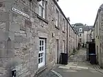
| |||
| 91 Bongate With Gatepiers, Gates And Railings | Bongate | 55°29′02″N 2°32′52″W | Category C(S) | 35463 | _in_Jedburgh.jpg.webp)
| ||
| 2 Bridge Street | Bridge Street | 55°28′49″N 2°33′07″W | Category C(S) | 35469 | Upload Photo | ||
| 2 Canongate, Including Jedvale | Canongate | 55°28′40″N 2°33′18″W | Category C(S) | 35475 | .jpg.webp)
| ||
| Castlegate, Jedburgh Castle Old Jail With Exercise Yard Walls, Fortifications, Portcullis Gates, Entrance Gates And Outer Embankment Wall | Castlegate | 55°28′27″N 2°33′32″W | Category A | 35482 | 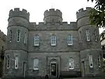
| ||
| 1 And 2 Castlegate | Castlegate | 55°28′39″N 2°33′21″W | Category B | 35483 | 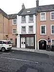
| ||
| 15 Castlegate, Carnegie Library | Castlegate | 55°28′38″N 2°33′22″W | Category B | 35486 | 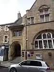
| ||
| 89 Castlegate With Garden Walls | Castlegate | 55°28′30″N 2°33′31″W | Category C(S) | 35501 | 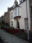
| ||
| 18 - 20 (Even Nos) Castlegate | Castlegate | 55°28′37″N 2°33′22″W | Category C(S) | 35506 | 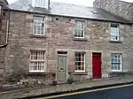
| ||
| 46 Castlegate | Castlegate | 55°28′34″N 2°33′25″W | Category B | 35509 | 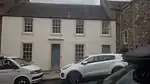
| ||
| 48 Castlegate | Castlegate | 55°28′34″N 2°33′25″W | Category C(S) | 35510 | 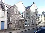
| ||
| 15 Exchange Street | Exchange Street | 55°28′41″N 2°33′22″W | Category C(S) | 35524 | 
| ||
| Edgerston Estate, Stotfield Steading | Edgerston | 55°24′10″N 2°29′05″W | Category C(S) | 13356 | Upload Photo | ||
| Edgerston House Walled Garden Incorporating Summerhouse, Fountain With Cascase Beyond, Two Attached Outbuildings And Two Detached Summerhouses | Edgerston | 55°23′42″N 2°29′20″W | Category B | 13364 | Upload Photo | ||
| Ferniehurst Castle Visitor Centre (Former Chapel) | 55°27′17″N 2°33′03″W | Category A | 13370 | 
| |||
| Glenburn Hall With Walled Garden, Outbuildings, Gatepiers And Railings | 55°28′23″N 2°34′05″W | Category A | 13371 | Upload Photo | |||
| Hundalee Cottage With Gates And Gatepiers | 55°27′37″N 2°33′47″W | Category C(S) | 13376 | 
| |||
| Jedfoot Cottage With Boundary Wall | 55°30′33″N 2°32′24″W | Category C(S) | 13379 | 
| |||
| Kersheugh | 55°26′44″N 2°32′31″W | Category C(S) | f13382 | Upload Photo | |||
| Lanton Tower With Service Wing, Stables, Boundary And_Garden Walls | 55°29′09″N 2°36′22″W | Category B | 13387 | .jpg.webp)
| |||
| Mount Ulston With Gatepiers And Boundary Wall, Carriage House/Stable Range, Walled Garden And Summerhouses | 55°29′53″N 2°32′00″W | Category B | 13393 | Upload Photo | |||
| Overton Tower | 55°24′31″N 2°29′58″W | Category B | 13398 | 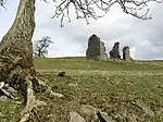
| |||
| 1-6 (Inclusive Nos) Timpendean Farm Cottages | 55°30′03″N 2°35′09″W | Category C(S) | 13400 | Upload Photo | |||
| Bonjedward House, Stable, Garage, Cottages And Barn | 55°29′42″N 2°32′51″W | Category C(S) | 8402 | 
| |||
| 3 High Street | High Street | 55°28′40″N 2°33′18″W | Category C(S) | 35542 | 
| ||
| 9 High Street | High Street | 55°28′41″N 2°33′17″W | Category C(S) | 35544 | 
| ||
| 21-23 (Odd Nos) High Street | High Street | 55°28′42″N 2°33′16″W | Category C(S) | 35549 | 
| ||
| 29-31 (Odd Nos) High Street | High Street | 55°28′42″N 2°33′15″W | Category C(S) | 35551 | 
| ||
| 45-47 (Odd Nos) High Street | High Street | 55°28′44″N 2°33′12″W | Category C(S) | 35556 | 
| ||
| 2 High Street, 1 Exchange Street And 12 Market Place | High Street | 55°28′40″N 2°33′19″W | Category C(S) | 35558 | Upload Photo | ||
| 16 High Street | High Street | 55°28′42″N 2°33′18″W | Category C(S) | 35563 | 
| ||
| 26 High Street | High Street | 55°28′43″N 2°33′16″W | Category B | 35568 | 
| ||
| Newcastle Road, Inchbonny And Garages | Newcastle Road | 55°28′12″N 2°33′12″W | Category C(S) | 35580 | Upload Photo | ||
| Queen Street, Queen Mary's House With Outbuildings, Boundary Wall And Railings | Queen Street | 55°28′43″N 2°33′10″W | Category A | 35591 | 
| ||
| 1-10 (Inclusive Nos) Queen Street, Queen Mary's Buildings | Queen Street | 55°28′44″N 2°33′09″W | Category C(S) | 35592 | 
| ||
| 19 Queen Street | Queen Street | 55°28′48″N 2°33′08″W | Category C(S) | 35593 | 
| ||
| Sharplaw Road, Birkhill With Associated Outbuildings, Including Hayloft And Coach House, And Boundary Walls | Sharplaw Road | 55°29′03″N 2°33′07″W | Category C(S) | 35594 | 
| ||
| 1 And 3 Abbey Bridge End With Boundary Walls | Abbey Bridge End | 55°28′33″N 2°33′15″W | Category B | 35453 | 
| ||
| 7-11 (Odd Nos) Castlegate (Prince Charlie's House), 1-7 (Odd Nos) Blackhills Close And 1-2 Upper Nags Head Close | Castlegate | 55°28′39″N 2°33′22″W | Category B | 35485 | 
| ||
| 27 Castlegate | Castlegate | 55°28′38″N 2°33′23″W | Category C(S) | 35488 | Upload Photo | ||
| 59 And 61 Castlegate | Castlegate | 55°28′34″N 2°33′27″W | Category C(S) | 35491 | 
| ||
| 81 Castlegate | Castlegate | 55°28′31″N 2°33′30″W | Category C(S) | 35496 | Upload Photo | ||
| Castlegate, Police Station | Castlegate | 55°28′38″N 2°33′21″W | Category C(S) | 35504 | 
| ||
| 24-26 (Even Nos And 24A) Castlegate And 1 Abbey Close | Castlegate | 55°28′37″N 2°33′22″W | Category B | 35507 | 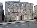
| ||
| 30 Castlegate | Castlegate | 55°28′36″N 2°33′23″W | Category B | 35508 | 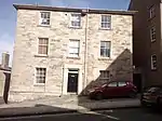
| ||
| 76 Castlegate | Castlegate | 55°28′30″N 2°33′30″W | Category C(S) | 35514 | 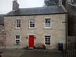
| ||
| High Street Bank Of Scotland With Boundary Wall And Railings | High Street | 55°28′46″N 2°33′13″W | Category B | 35535 | 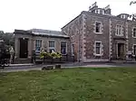
| ||
| Edgerston House South Lodge | Edgerston | 55°23′29″N 2°29′39″W | Category C(S) | 13362 | Upload Photo | ||
| Edgerston Mill Cottage | 55°23′29″N 2°29′06″W | Category C(S) | 13366 | Upload Photo | |||
| Hunthill, Stable Court | 55°27′57″N 2°31′42″W | Category C(S) | 13378 | Upload Photo | |||
| Lanton, Beeswing Cottage With Gatepiers And Garden Wall | 55°29′15″N 2°36′16″W | Category C(S) | 13384 | 
| |||
| Mossburnford House | 55°26′24″N 2°31′50″W | Category B | 13391 | Upload Photo | |||
| 1-7 (Inclusive Nos) Bonjedward Cottages | Bonjedward | 55°30′14″N 2°32′46″W | Category C(S) | 8399 | 
| ||
| Bonjedward House, Lodge | Bonjedward | 55°29′51″N 2°32′45″W | Category C(S) | 8401 | 
| ||
| Bonjedward, The Old Smiddy | Bonjedward | 55°30′13″N 2°32′43″W | Category C(S) | 8405 | 
| ||
| 17 High Street | High Street | 55°28′41″N 2°33′17″W | Category C(S) | 35547 | 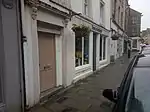
| ||
| Market Place, Jubilee Fountain | Market Place | 55°28′39″N 2°33′20″W | Category B | 35573 | 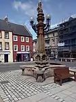
| ||
| Oxnam Road, Allerley Brae, E Cottage | Oxnam Road | 55°28′30″N 2°33′08″W | Category C(S) | 35586 | 
| ||
| Oxnam Road, Boundary Bank With Entrance Gate And Coach House | Oxnam Road | 55°28′38″N 2°32′59″W | Category C(S) | 35588 | 
| ||
| Waterside, Hartrigge Lodge With Boundary Walls And Gatepiers | Waterside | 55°28′44″N 2°33′01″W | Category C(S) | 35601 | 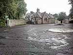
| ||
| Abbey Close, The Abbey House With Boundary Wall And Railings | Abbey Close | 55°28′36″N 2°33′20″W | Category C(S) | 35455 | Upload Photo | ||
| Bongate, Bongate Cottage And Gatepiers | Bongate | 55°29′02″N 2°32′51″W | Category B | 35462 | 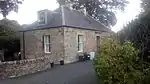
| ||
| Bridge Street, Townfoot Bridge | Bridge Street | 55°28′50″N 2°33′04″W | Category B | 35467 | 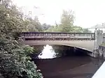
| ||
| 8 Burn Wynd And 4 And 5 Cornelius Close, Canongate Gallery | Burn Wynd | 55°28′40″N 2°33′22″W | Category C(S) | 35470 | Upload Photo | ||
| 12-14 (Even Nos) Canongate | Canongate | 55°28′40″N 2°33′15″W | Category C(S) | 35479 | Upload Photo | ||
| 75 Castlegate | Castlegate | 55°28′32″N 2°33′30″W | Category C(S) | 35494 | Upload Photo | ||
| 89A Castlegate | Castlegate | 55°28′31″N 2°33′31″W | Category C(S) | 35500 | .jpg.webp)
| ||
| Castlegate, Masonic Hall | Castlegate | 55°28′38″N 2°33′21″W | Category C(S) | 35505 | 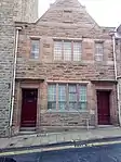
| ||
| 7-9 (Odd Nos) Exchange Street | Exchange Street | 55°28′41″N 2°33′20″W | Category C(S) | 35521 | Upload Photo | ||
| Friarsgate, Friars Glen | Friarsgate | 55°28′50″N 2°33′18″W | Category B | 35527 | Upload Photo | ||
| Friarsgate, Friarshall With Coach House Boundary Walls And Gatepiers | Friarsgate | 55°28′44″N 2°33′18″W | Category C(S) | 35528 | .jpg.webp)
| ||
| Friarsgate, Friars Mount With Gatepiers And Quadrant Walls | Friarsgate | 55°28′46″N 2°33′20″W | Category C(S) | 35530 | Upload Photo | ||
| High Street, Jedburgh Grammar School With Primary School Boundary Walls, Railings And Gatepiers | High Street | 55°28′49″N 2°33′13″W | Category B | 35537 | 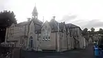
| ||
| Edgerston, Old Schoolhouse And Boundary Wall | Edgerston | 55°23′53″N 2°29′59″W | Category C(S) | 13367 | Upload Photo | ||
| Hartrigge House Stables And Walled Garden | 55°29′01″N 2°32′24″W | Category B | 13374 | 
| |||
| Lanton, The Old Manor Inn With Garden Walls | 55°29′16″N 2°36′15″W | Category B | 13386 | 
| |||
| Lintalee, Lodge | 55°27′24″N 2°33′27″W | Category C(S) | 13389 | Upload Photo | |||
| Newcastle Road, Hundaleebank | Newcastle Road | 55°27′57″N 2°33′15″W | Category C(S) | 13394 | 
| ||
| New Mill Farmhouse | 55°29′50″N 2°32′38″W | Category B | 13396 | Upload Photo | |||
| Wildcat Gate, Headkeeper's Cottage | 55°28′37″N 2°32′04″W | Category B | 13401 | 
| |||
| High Street, K6 Telephone Kiosk At Post Office | High Street | 55°28′43″N 2°33′14″W | Category B | 35540 | 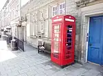
| ||
| 11-13 (Odd Nos) High Street | High Street | 55°28′41″N 2°33′17″W | Category C(S) | 35545 | 
| ||
| 15 High Street | High Street | 55°28′41″N 2°33′17″W | Category C(S) | 35546 | 
| ||
| 33 High Street | High Street | 55°28′42″N 2°33′14″W | Category C(S) | 35552 | 
| ||
| 12-14 (Even Nos) High Street | High Street | 55°28′41″N 2°33′18″W | Category C(S) | 35562 | 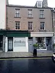
| ||
| 22 High Street | High Street | 55°28′43″N 2°33′16″W | Category C(S) | 35566 | Upload Photo | ||
| 30 High Street | High Street | 55°28′43″N 2°33′15″W | Category C(S) | 35569 | 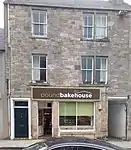
| ||
| Old Bongate St Mary's Rc Church, Presbytery, Ancillary Accommodation, Boundary Walls And Gatepiers | Bogate | 55°28′55″N 2°33′04″W | Category B | 35583 | 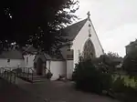
| ||
| 2 Smith's Wynd | Smith;s Wynd | 55°28′44″N 2°33′12″W | Category C(S) | 35597 | 
| ||
| Abbey Bridge End, The Rampart, War Memorial With Balustrades, Steps And Walls | Abbey Bridge End | 55°28′35″N 2°33′15″W | Category B | 35454 | 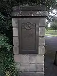
| ||
| Jedburgh Town Hall | Abbey Place | 55°28′37″N 2°33′14″W | Category B | 35458 | 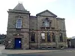
| ||
| Canongate Bridge | 55°28′41″N 2°33′04″W | or "Packhorse Bridge" | 35471 | 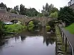
| |||
| 7 Canongate | Canongate | 55°28′39″N 2°33′18″W | Category C(S) | 35473 | Upload Photo | ||
| 3-5 (Inclusive Nos) Castlegate (To Under Nags Head Close) | Castlegate | 55°28′39″N 2°33′21″W | Category B | 35484 | 
| ||
| 57 Castlegate | Castlegate | 55°28′34″N 2°33′27″W | Category C(S) | 35490 | 
| ||
| 87 Castlegate | Castlegate | 55°28′31″N 2°33′31″W | Category C(S) | 35499 | 
| ||
| 72 Castlegate | Castlegate | 55°28′30″N 2°33′29″W | Category C(S) | 35512 | Upload Photo | ||
| Crown Lane, Crown Lane House With Boundary Wall And Railings | Crown Lane | 55°28′41″N 2°33′16″W | Category B | 35516 | 
| ||
| Duck Row, The Piper's House | Duck Row | 55°28′40″N 2°33′06″W | Category B | 35518 | 
| ||
| Galahill, The Hermitage With Gatepiers And Boundary Walls | 55°28′28″N 2°33′29″W | Category C(S) | 35534 | 
| |||
| Edgerston Farmhouse And Implement Shed | 55°23′44″N 2°29′41″W | Category C(S) | 13357 | Upload Photo | |||
| Edgerston House, Bridge | Edgerston | 55°24′07″N 2°29′18″W | Category B | 13361 | Upload Photo | ||
| Langlee | 55°27′02″N 2°33′37″W | Category B | 13383 | Upload Photo | |||
| Mossburnford House Stables, Outbuildings And Walled Gardens | 55°26′26″N 2°31′46″W | Category B | 13392 | Upload Photo | |||
| Bonjedward, Telephone Kiosk | Bonjedward | 55°30′13″N 2°32′44″W | Category B | 8406 | 
| ||
| Camphouse (Former Coaching Inn) With Stables To Rear | 55°24′36″N 2°30′28″W | Category B | 8407 | Upload Photo | |||
| Dolphinston With Outbuildings, Boundary Wall And Gatepiers | 55°25′41″N 2°30′09″W | Category B | 8408 | Upload Photo | |||
| High Street, Trinity Manse With Gatepiers And Boundary Wall | High Street | 55°28′47″N 2°33′12″W | Category C(S) | 35539 | Upload Photo | ||
| 41-43 (Odd Nos) High Street | High Street | 55°28′43″N 2°33′13″W | Category C(S) | 35555 | 
| ||
| 9 Market Place And 2 Burn Wynd | Market place | 55°28′40″N 2°33′21″W | Category B | 35578 | 
| ||
| 55 Bongate, Balmanno House | Bongate | 55°29′00″N 2°32′59″W | Category C(S) | 35584 | 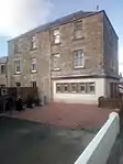
| ||
| 1 And 2 Veitch's Close And 1 And I Fairbairns's Close (Rear Of Foresters Arms) | Castlegate (behind) | 55°28′38″N 2°33′23″W | Category C(S) | 35600 | 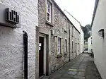
| ||
| Abbey Place, Newgate With Attached Wall, External Stair And Railings | Abbey PLace | 55°28′38″N 2°33′19″W | Category A | 35457 | 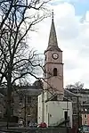
| ||
| 4 Boundaries | Boundaries | 55°28′39″N 2°33′01″W | Category B | 35464 | 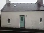
| ||
| 5 Boundaries, Boundary Villa With Wall And Railings | Boundaries | 55°28′38″N 2°33′02″W | Category C(S) | 35465 | 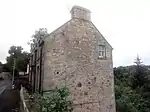
| ||
| 6 Canongate | Canogate | 55°28′40″N 2°33′17″W | Category C(S) | 35477 | 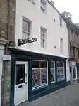
| ||
| 73A And B Castlegate | Castlegate | 55°28′32″N 2°33′29″W | Category C(S) | 35493 | Upload Photo | ||
| 3-5 (Odd Nos) Exchange Street | Exchange Street | 55°28′40″N 2°33′20″W | Category A | 35520 | 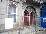
| ||
| 13 Exchange Street | Exchange Street | 55°28′41″N 2°33′22″W | Category C(S) | 35523 | 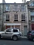
| ||
| Friars, Froylehurst With Conservatory | 55°28′45″N 2°33′24″W | Category B | 35525 | 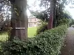
| |||
| Friarsgate, Friars House | Friarsgate | 55°28′48″N 2°33′17″W | Category C(S) | 35529 | Upload Photo | ||
| Friarsgate, Glenfriars Hotel With Boundary Wall And Gatepiers | Friarsgate | 55°28′52″N 2°33′18″W | Category C(S) | 35533 | 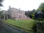
| ||
| High Street, British Legion Hall (Former Boston Church) With Boundary Walls, Piers And Railings | High Street | 55°28′45″N 2°33′10″W | Category B | 35536 | 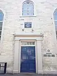
| ||
| Edgerston House Stable Court And Cottage | 55°23′46″N 2°29′21″W | Category C(S) | 13363 | Upload Photo | |||
| Lanton Placecottage | 55°29′13″N 2°36′18″W | Category C(S) | 13385 | 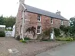
| |||
| Newcastle Road (A68), Inchbonny Bridge | Newcastle Road | 55°28′06″N 2°33′17″W | Category B | 13446 | 
| ||
| Bonjedward Mill, Farm Steading | Bonjedward | 55°29′58″N 2°32′32″W | Category B | 8404 | 
| ||
| High Street, Trinity Church (Formerly Blackfriars With Church Offices, Gates Gatepiers, Railings And Boundary Wall | High Street | 55°28′48″N 2°33′12″W | Category B | 35538 | 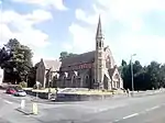
| ||
| 35 High Street | High Street | 55°28′43″N 2°33′14″W | Category C(S) | 35553 | 
| ||
| 39 High Street | High Street | 55°28′43″N 2°33′13″W | Category C(S) | 35554 | Upload Photo | ||
| 10 High Street And Grahamslaw Close Warehouse | High Street | 55°28′41″N 2°33′19″W | Category C(S) | 35561 | 
| ||
| 1 Market Place (And Abbey Place) | Market Place | 55°28′39″N 2°33′18″W | Category C(S) | 35575 | 
| ||
| Pleasance, St John's Episcopal Church With Lych Gate And Boundary Wall | The Pleasance | 55°28′52″N 2°33′15″W | Category A | 35589 | .jpg.webp)
| ||
| 2 Abbey Place | Abbey Place | 55°28′39″N 2°33′18″W | Category C(S) | 35459 | Upload Photo | ||
| 1-5 (Odd Nos) Canongate (Includes The Mercat Cafe) | Canongate | 55°28′39″N 2°33′18″W | Category C(S) | 35472 | Upload Photo | ||
| Castlegate And Galahill, Castlewood Cemetery With Steps, Gates, Gatepiers And Surrounding Wall | Castlegate | 55°28′25″N 2°33′35″W | Category C(S) | 35481 | 
| ||
| Castlegate, The Foresters Arms | Castlegate | 55°28′38″N 2°33′23″W | Category C(S) | 35487 | 
| ||
| Castlegate, Glenbank Hotel With Boundary Walls And Gatepiers | Castlegate | 55°28′35″N 2°33′28″W | Category B | 35489 | 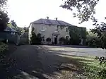
| ||
| Castlegate, Lynwell And Castle Dene | Castlegate | 55°28′29″N 2°33′30″W | Category C(S) | 35515 | 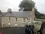
| ||
| Crown Lane, Orwell Cottage And Dentist With Flat Above | Crown Lane | 55°28′42″N 2°33′15″W | Category C(S) | 35517 | 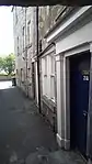
| ||
| Edgerston, Former Manse With Barn And Ice House | Edgerston | 55°24′00″N 2°30′03″W | Category B | 13358 | Upload Photo | ||
| Edgerston War Memorial And Enclosure Wall | Edgerston | 55°23′53″N 2°29′56″W | Category B | 13368 | Upload Photo | ||
| New Mill Farm, Mill And Ruined Outbuildings | 55°29′49″N 2°32′39″W | Category B | 13397 | Upload Photo | |||
| Richards Cleuch, Bridge No 780 | 55°25′14″N 2°29′49″W | Category C(S) | 13399 | Upload Photo | |||
| 38 High Street (Royal Bank Of Scotland) | High Street | 55°28′45″N 2°33′14″W | Category C(S) | 35572 | 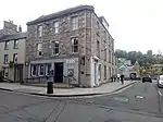
| ||
| Market Place, K6 Telephone Kiosk At Newgate | Market Place | 55°28′39″N 2°33′20″W | Category B | 35574 | 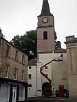
| ||
| Pleasance, St John's Church Centre | High Street | 55°28′54″N 2°33′15″W | Category B | 35590 | 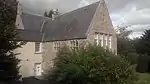
| ||
| Sharplaw Road, Brae House With Forestairs And Railings, Gatepiers And Boundary Wall | 55°28′53″N 2°33′17″W | Category B | 35595 | Upload Photo | |||
| Station Road, Station Bridge | Station Road | 55°29′08″N 2°32′43″W | Category B | 35598 | 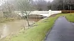
| ||
| Abbey Close, The Nest With Coach House, Boundary And Garden Walls And Railings | Abbey Close | 55°28′35″N 2°33′21″W | Category B | 35456 | Upload Photo | ||
| 21 Canongate, Royal Hotel | Canongate | 55°28′39″N 2°33′15″W | Category C(S) | 35474 | 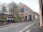
| ||
| 4 Canongate | Canongate | 55°28′40″N 2°33′17″W | Category C(S) | 35476 | 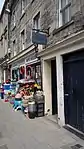
| ||
| 10 Canongate (Former Black Bull Inn) | Canongate | 55°28′40″N 2°33′17″W | Category C(S) | 35478 | 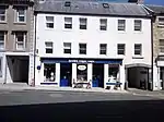
| ||
| 77 Castlegate | Castlegate | 55°28′32″N 2°33′30″W | Category C(S) | 35495 | 
| ||
| 85 Castlegate | Castlegate | 55°28′31″N 2°33′30″W | Category C(S) | 35498 | 
| ||
| 50 Castlegate | Castlegate | 55°28′34″N 2°33′26″W | Category C(S) | 35511 | 
| ||
| Friarsgate, Glenarvan (Formerly Norland) With Coach House | Friarsgate | 55°28′48″N 2°33′23″W | Category C(S) | 35532 | Upload Photo | ||
| Edgerston Home Farm, Dovecot | Edgerston | 55°23′43″N 2°29′41″W | Category B | 13359 | Upload Photo | ||
| Edgerston House With Gatepiers, Terraces And Wall Garden, Birdpool, And Entrance Gates | Edgerston | 55°23′49″N 2°29′25″W | Category A | 13360 | Upload Photo | ||
| Edgerston Mill | Edgerston | 55°23′30″N 2°29′09″W | Category B | 13365 | Upload Photo | ||
| Glenburn Hall Lodge, Entrance Gates, Gatepiers And Quadrant Walls | 55°28′19″N 2°33′55″W | Category C(S) | 13372 | 
| |||
| Newcastle Road (A68), Ferniehurst Bridge | Newcastle Road | 55°27′29″N 2°33′31″W | Category B | 13445 | 
| ||
| Bonjedward, Jedneuk With Garden Walls | Bonjedward | 55°30′11″N 2°32′39″W | Category C(S) | 8403 | Upload Photo |
Key
The scheme for classifying buildings in Scotland is:
- Category A: "buildings of national or international importance, either architectural or historic; or fine, little-altered examples of some particular period, style or building type."[1]
- Category B: "buildings of regional or more than local importance; or major examples of some particular period, style or building type, which may have been altered."[1]
- Category C: "buildings of local importance; lesser examples of any period, style, or building type, as originally constructed or moderately altered; and simple traditional buildings which group well with other listed buildings."[1]
In March 2016 there were 47,288 listed buildings in Scotland. Of these, 8% were Category A, and 50% were Category B, with the remaining 42% being Category C.[2]
Notes
- Sometimes known as OSGB36, the grid reference (where provided) is based on the British national grid reference system used by the Ordnance Survey.
• "Guide to National Grid". Ordnance Survey. Retrieved 12 December 2007.
• "Get-a-map". Ordnance Survey. Retrieved 17 December 2007. - Historic Environment Scotland assign a unique alphanumeric identifier to each designated site in Scotland, for listed buildings this always begins with "LB", for example "LB12345".
References
- All entries, addresses and coordinates are based on data from Historic Scotland. This data falls under the Open Government Licence
- "What is Listing?". Historic Environment Scotland. Retrieved 29 May 2018.
- Scotland's Historic Environment Audit 2016 (PDF). Historic Environment Scotland and the Built Environment Forum Scotland. pp. 15–16. Retrieved 29 May 2018.
This article is issued from Wikipedia. The text is licensed under Creative Commons - Attribution - Sharealike. Additional terms may apply for the media files.