Magny, Eure-et-Loir
Magny (French pronunciation: [maɲi] ⓘ) is a commune in the Eure-et-Loir department in northern France.
Magny | |
|---|---|
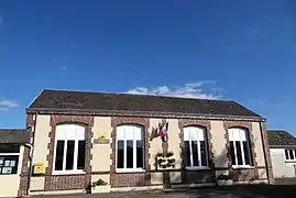 The town hall in Magny | |
.svg.png.webp) Coat of arms | |
Location of Magny | |
 Magny  Magny | |
| Coordinates: 48°21′00″N 1°15′50″E | |
| Country | France |
| Region | Centre-Val de Loire |
| Department | Eure-et-Loir |
| Arrondissement | Chartres |
| Canton | Illiers-Combray |
| Intercommunality | Entre Beauce et Perche |
| Government | |
| • Mayor (2020–2026) | Frédéric Delestre[1] |
| Area 1 | 13.03 km2 (5.03 sq mi) |
| Population | 645 |
| • Density | 50/km2 (130/sq mi) |
| Time zone | UTC+01:00 (CET) |
| • Summer (DST) | UTC+02:00 (CEST) |
| INSEE/Postal code | 28225 /28120 |
| Elevation | 159–192 m (522–630 ft) (avg. 172 m or 564 ft) |
| 1 French Land Register data, which excludes lakes, ponds, glaciers > 1 km2 (0.386 sq mi or 247 acres) and river estuaries. | |
Population
|
|
References
- "Répertoire national des élus: les maires". data.gouv.fr, Plateforme ouverte des données publiques françaises (in French). 9 August 2021.
- "Populations légales 2020". The National Institute of Statistics and Economic Studies. 29 December 2022.
Wikimedia Commons has media related to Magny (Eure-et-Loir).
This article is issued from Wikipedia. The text is licensed under Creative Commons - Attribution - Sharealike. Additional terms may apply for the media files.