Miankuh-e Moguyi Rural District
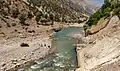
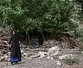
Miankuh-e Moguyi Rural District (Persian: دهستان ميان كوه موگوئي) is in the Central District of Kuhrang County, Chaharmahal and Bakhtiari province, Iran.
Miankuh-e Moguyi Rural District
Persian: دهستان ميان كوه موگوئي | |
|---|---|
 Miankuh-e Moguyi Rural District | |
| Coordinates: 32°41′47″N 49°49′02″E[1] | |
| Country | |
| Province | Chaharmahal and Bakhtiari |
| County | Kuhrang |
| District | Central |
| Population (2016)[2] | |
| • Total | 3,992 |
| Time zone | UTC+3:30 (IRST) |
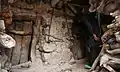
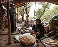
At the census of 2006, its population was 3,781 in 624 households;[3] there were 3,570 inhabitants in 754 households at the following census of 2011;[4] and in the most recent census of 2016, the population of the rural district was 3,992 in 917 households. The largest of its 16 villages was Sar Aqa Seyyed, with 1,698 people.[2]

References
- OpenStreetMap contributors (2 April 2023). "Miankuh-e Moguyi Rural District (Kuhrang County)" (Map). OpenStreetMap. Retrieved 2 April 2023.
- "Census of the Islamic Republic of Iran, 1395 (2016)". AMAR (in Persian). The Statistical Center of Iran. p. 14. Archived from the original (Excel) on 24 May 2019. Retrieved 19 December 2022.
- "Census of the Islamic Republic of Iran, 1385 (2006)". AMAR (in Persian). The Statistical Center of Iran. p. 14. Archived from the original (Excel) on 20 September 2011. Retrieved 25 September 2022.
- "Census of the Islamic Republic of Iran, 1390 (2011)" (Excel). Iran Data Portal (in Persian). The Statistical Center of Iran. p. 14. Retrieved 19 December 2022.
| Capital |  | ||||||||||||||||||||||
|---|---|---|---|---|---|---|---|---|---|---|---|---|---|---|---|---|---|---|---|---|---|---|---|
| Counties and cities |
| ||||||||||||||||||||||
| Landmarks |
| ||||||||||||||||||||||
| populated places | |||||||||||||||||||||||
This article is issued from Wikipedia. The text is licensed under Creative Commons - Attribution - Sharealike. Additional terms may apply for the media files.