National Register of Historic Places listings in Lumpkin County, Georgia
This is a list of properties and districts in Lumpkin County, Georgia that are listed on the National Register of Historic Places (NRHP).
This National Park Service list is complete through NPS recent listings posted October 20, 2023.[1]

Current listings
| [2] | Name on the Register | Image | Date listed[3] | Location | City or town | Description |
|---|---|---|---|---|---|---|
| 1 | Blood Mountain Trail Shelter | 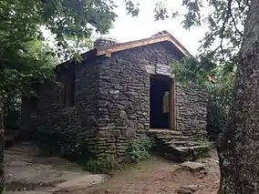 Blood Mountain Trail Shelter |
January 9, 2013 (#12001145) |
Blood Mountain Wilderness Area 34°44′25″N 83°56′15″W |
Blairsville | |
| 2 | Calhoun Mine | 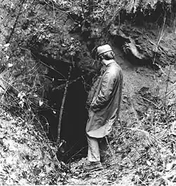 Calhoun Mine |
November 7, 1973 (#73002292) |
3 miles (4.8 km) south of Dahlonega off GA 60 34°33′43″N 83°59′09″W |
Dahlonega | National Historic Landmark |
| 3 | Dahlonega Commercial Historic District | 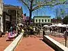 Dahlonega Commercial Historic District |
April 7, 1983 (#83000235) |
Chestates, Park, and Main Sts. 34°31′57″N 83°59′05″W |
Dahlonega | |
| 4 | Dahlonega Consolidated Gold Mine | .JPG.webp) Dahlonega Consolidated Gold Mine |
February 27, 1980 (#80001111) |
Northeast of Dahlonega 34°32′18″N 83°58′12″W |
Dahlonega | |
| 5 | Dahlonega Courthouse Gold Museum | 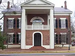 Dahlonega Courthouse Gold Museum |
August 26, 1971 (#71001100) |
U.S. 19 34°31′57″N 83°59′06″W |
Dahlonega | A Georgia state historic site |
| 6 | Daniel M. Davis House | .JPG.webp) Daniel M. Davis House |
March 12, 1998 (#98000227) |
GA 9, 1.5 miles (2.4 km) southwest of the junction with GA 52 34°30′49″N 84°03′51″W |
Dahlonega | |
| 7 | Fields Place-Vickery House | 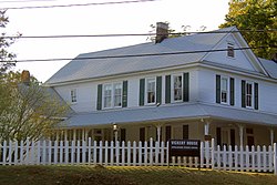 Fields Place-Vickery House |
December 14, 1978 (#78000994) |
W. Main St. and Vickery Dr. 34°31′49″N 83°59′17″W |
Dahlonega | |
| 8 | Hawkins Street Historic District | 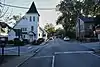 Hawkins Street Historic District |
May 12, 1995 (#95000504) |
Roughly, Hawkins St. from Church St. to N. Meaders St., including adjacent parts of Water, N. Chestatee and N. Park Sts. 34°32′00″N 83°59′11″W |
Dahlonega | |
| 9 | Holly Theatre |  Holly Theatre |
February 21, 2002 (#02000080) |
69 W. Main St. 34°31′53″N 83°59′09″W |
Dahlonega | |
| 10 | Lumpkin County Jail | 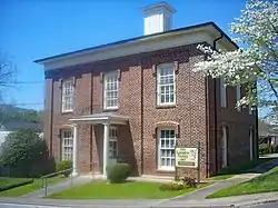 Lumpkin County Jail |
September 13, 1985 (#85002086) |
Clarksville St. 34°32′03″N 83°58′54″W |
Dahlonega | |
| 11 | Price Memorial Hall |  Price Memorial Hall |
January 20, 1972 (#72000387) |
College Ave. 34°31′47″N 83°59′13″W |
Dahlonega | |
| 12 | Seven Oaks | 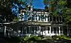 Seven Oaks |
July 15, 1982 (#82002452) |
177 S. Park St. 34°31′51″N 83°58′56″W |
Dahlonega |
References
- National Park Service, United States Department of the Interior, "National Register of Historic Places: Weekly List Actions", retrieved October 20, 2023.
- Numbers represent an alphabetical ordering by significant words. Various colorings, defined here, differentiate National Historic Landmarks and historic districts from other NRHP buildings, structures, sites or objects.
- The eight-digit number below each date is the number assigned to each location in the National Register Information System database, which can be viewed by clicking the number.
Wikimedia Commons has media related to National Register of Historic Places in Lumpkin County, Georgia.
| Topics | |
|---|---|
| Lists by state |
|
| Lists by insular areas | |
| Lists by associated state | |
| Other areas | |
| Related | |
This article is issued from Wikipedia. The text is licensed under Creative Commons - Attribution - Sharealike. Additional terms may apply for the media files.