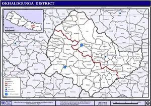
Okhaldhunga District
Okhaldhunga District (Nepali: ओखलढुङ्गा जिल्लाⓘ) is one of the fourteen districts of Koshi Province in eastern Nepal. The district, with the municipality of Okhaldhunga as its district headquarters, covers an area of 1,074.5 km2 (414.9 sq mi) and had a population of 156,702 in 2001 and 147,984 in 2011.[2]
Okhaldhunga District
ओखलढुङ्गा जिल्ला | |
|---|---|
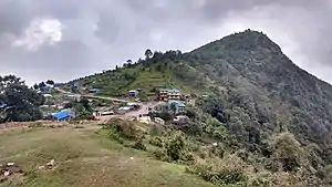 Kosh Bhanjyang, Okhaldhunga | |
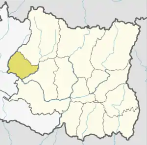 Location of Okhaldhunga in dark yellow | |
| Country | |
| Province | Koshi Province |
| Admin HQ. | Siddhicharan Municipality |
| Government | |
| • Type | Coordination committee |
| • Body | DCC, Okhaldhunga |
| • Chief District Officer | Dil Kumar Tamang [1] |
| Area | |
| • Total | 1,074 km2 (415 sq mi) |
| Population (2011) | |
| • Total | 147,984 |
| • Density | 140/km2 (360/sq mi) |
| Time zone | UTC+05:45 (NPT) |
| Main Language(s) | Nepali language (official) Rai, Sunuwar language |
| Website | ddcokhaldhunga |
Okhaldhunga is the birthplace of Siddhicharan Shrestha. Shrestha, known as the Yug Kawi of Nepal (poet of the era), is a famous Nepali poet and is primarily known for his poem and song Mero Pyāro Okhalḍhungā (My dear Okhaldhunga).
Geography and climate
| Climate Zone[3] | Elevation Range | % of Area |
|---|---|---|
| Upper Tropical | 300 to 1,000 meters
1,000 to 3,300 ft. |
22.2% |
| Subtropical | 1,000 to 2,000 meters 3,300 to 6,600 ft. |
51.1% |
| Temperate | 2,000 to 3,000 meters 6,400 to 9,800 ft. |
24.2% |
| Subalpine | 3,000 to 4,000 meters 9,800 to 13,100 ft. |
2.1% |
Demographics
| Year | Pop. | ±% p.a. |
|---|---|---|
| 1981 | 137,640 | — |
| 1991 | 139,457 | +0.13% |
| 2001 | 156,702 | +1.17% |
| 2011 | 147,984 | −0.57% |
| 2021 | 140,914 | −0.49% |
| Sources:[4] | ||
At the time of the 2011 Nepal census, Okhaldhunga District had a population of 147,984.
As their first language, 58.1% spoke Nepali, 9.2% Tamang, 9.0% Magar, 6.8% Sherpa, 4.8% Wambule, 3.8% Bahing, 2.1% Sunuwar, 1.9% Rai, 1.0% Jerung, 1.0% Newar, 0.5% Bhojpuri, 0.3% Thulung, 0.2% Gurung, 0.2% Maithili, 0.1% Bhujel, 0.1% Majhi and 0.2% others.[6]
Ethnicity/caste: 22.9% were Chhetri, 11.3% Magar, 10.6% Hill Brahmin, 10.0% Rai, 9.8% Tamang, 7.0% Sherpa, 6.6% Newar, 4.1% Kami, 3.3% Damai/Dholi, 3.0% Sunuwar, 2.9% Sarki, 2.1% Gharti/Bhujel, 1.6% Gurung, 1.5% Bahing, 0.7% Majhi, 0.7% Sanyasi/Dasnami, 0.5% Kanu, 0.3% Bin, 0.1% Badi, 0.1% Hajam/Thakur, 0.1% Thulung and 0.4% others.[7]
Religion: 70.8% were Hindu, 17.7% Buddhist, 10.2% Kirati, 0.9% Christian, 0.1% Prakriti and 0.3% others.[9]
Literacy: 64.1% could read and write, 2.8% could only read and 33.0% could neither read nor write.[10]
Village Development Committees
The district contains the following VDCs from 2017:
Andheri Narayansthan, Baksa, Balakhu, Barnalu, Baruneshwor, Betinee, Bhadaure, Bhussinga, Bigutar, Bilandu, Chyanam, Diyale, Fediguth, Fulbari, Gamnangtar, Harkapur, Jantarkhani, Jyamire, Kalikadevi, Khijikati, Katunje, Ketuke, Khiji Chandeshwori, Khijifalate, Kuibhir, Kuntadevi, Madhavpur, Mamkha, Manebhanjyang, Moli, Mulkharka, Narmedeshwor, Okhaldhunga, Palapu, Patle, Pokali, Pokhare, Prapcha, Ragadip, Ragani, Raniban, Ratmate, Rawadolu, Rumjatar, Salleri, Serna, Shreechaur, Singhadevi, Sisneri, Taluwa, Tarkerabari, Thakle, Thoksela, Thulachhap, Ubu, Yasam
Municipality
- Siddhicharan Municipality
- Champadevi Rural Municipality
- Sunkoshi Rural Municipality
- Likhu Rural Municipality
- Chisankhugadhi Rural Municipality
- Molung Rural Municipality
- Khijidemba Rural Municipality
- Manebhanjyang Rural Municipality
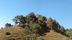
Tourist area
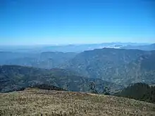
Tourists are attracted to the beauty of Khiji Okhaldhunga and Betinee Thuldhunga Okhaldhunga.
See also
References
- "CDO Profile". www.daookhaldhunga.moha.gov.np.
- Household and population by districts, Central Bureau of Statistics (CBS) Nepal Archived July 31, 2013, at the Wayback Machine
- The Map of Potential Vegetation of Nepal - a forestry/agroecological/biodiversity classification system (PDF), Forest & Landscape Development and Environment Series 2-2005 and CFC-TIS Document Series No.110., 2005, ISBN 87-7903-210-9, retrieved Nov 22, 2013
- "Nepal: Provinces and Districts". www.citypopulation.de.
- "NepalMap profile: Okhaldhunga". NepalMap. Retrieved 17 July 2022.
- NepalMap Language
- NepalMap Caste
- "NepalMap profile: Okhaldhunga". NepalMap. Retrieved 17 July 2022.
- NepalMap Religion
- NepalMap Literacy
- "Districts of Nepal". Statoids.
Places adjacent to Okhaldhunga District | ||||||||||||||||
|---|---|---|---|---|---|---|---|---|---|---|---|---|---|---|---|---|
| ||||||||||||||||
Headquarter: Okhaldhunga | ||
| Urban Municipality | | |
| Rural Municipality | ||