Rawbelle, Queensland
Rawbelle is a locality in the North Burnett Region, Queensland, Australia.[2] In the 2021 census, Rawbelle had a population of 51 people.[3]
| Rawbelle Queensland | |||||||||||||||
|---|---|---|---|---|---|---|---|---|---|---|---|---|---|---|---|
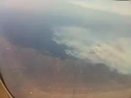 Aerial view of a bushfre at Rawbelle | |||||||||||||||
 Rawbelle | |||||||||||||||
| Coordinates | 24.9747°S 150.7316°E | ||||||||||||||
| Population | 51 (SAL 2021)[1] | ||||||||||||||
| Postcode(s) | 4630 | ||||||||||||||
| Area | 962.5 km2 (371.6 sq mi) | ||||||||||||||
| Time zone | AEST (UTC+10:00) | ||||||||||||||
| LGA(s) | North Burnett Region | ||||||||||||||
| State electorate(s) | Callide | ||||||||||||||
| Federal division(s) | Flynn | ||||||||||||||
| |||||||||||||||
Geography
Rawbelle has the following mountains:
- Mount Clairvoyant (25.0128°S 150.6333°E) 454 metres (1,490 ft)[4][5]
- Mount Runsome (25.0392°S 150.6535°E) 454 metres (1,490 ft)[4][6]
- Red Mountain (25.0184°S 150.7242°E) 447 metres (1,467 ft)[4][7]
- The Pinnacle (25.0285°S 150.6895°E) 401 metres (1,316 ft)[4][8]
History
In the 2016 census, Rawbelle had a population of 56 people.[9]
In the 2021 census, Rawbelle had a population of 51 people.[3]
Heritage listings
Rawbelle has a number of heritage-listed sites, including:
- off Old Rawbelle Road: Rawbelle Cemetery and Homestead Site[10]
References
Wikimedia Commons has media related to Rawbelle, Queensland.
- Australian Bureau of Statistics (28 June 2022). "Rawbelle (Suburb and Locality)". Australian Census 2021 QuickStats. Retrieved 28 June 2022.
- "Rawbelle – locality in North Burnett Region (entry 45411)". Queensland Place Names. Queensland Government. Retrieved 2 August 2019.
- Australian Bureau of Statistics (28 June 2022). "Rawbelle (SAL)". 2021 Census QuickStats. Retrieved 28 February 2023.
- "Mountain peaks and capes - Queensland". Queensland Open Data. Queensland Government. 12 November 2020. Archived from the original on 25 November 2020. Retrieved 25 November 2020.
- "Mount Clairvoyant – mountain in North Burnett Region (entry 7262)". Queensland Place Names. Queensland Government. Retrieved 25 November 2020.
- "Mount Runsome – mountain in North Burnett Region (entry 29333)". Queensland Place Names. Queensland Government. Retrieved 25 November 2020.
- "Red Mountain – mountain in North Burnett Region (entry 28175)". Queensland Place Names. Queensland Government. Retrieved 25 November 2020.
- "The Pinnacle – mountain in North Burnett Region (entry 34062)". Queensland Place Names. Queensland Government. Retrieved 25 November 2020.
- Australian Bureau of Statistics (27 June 2017). "Rawbelle (SSC)". 2016 Census QuickStats. Retrieved 20 October 2018.
- "North Burnett Local Heritage Register" (PDF). North Burnett Regional Council. Archived (PDF) from the original on 16 August 2019. Retrieved 16 August 2019.
This article is issued from Wikipedia. The text is licensed under Creative Commons - Attribution - Sharealike. Additional terms may apply for the media files.