Rougnat
Rougnat (French pronunciation: [ʁuɲa]; Occitan: Ronhac) is a commune in the Creuse department in the Nouvelle-Aquitaine region in central France.
Rougnat | |
|---|---|
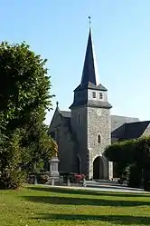 The church in Rougnat | |
 Coat of arms | |
Location of Rougnat | |
 Rougnat  Rougnat | |
| Coordinates: 46°03′17″N 2°30′07″E | |
| Country | France |
| Region | Nouvelle-Aquitaine |
| Department | Creuse |
| Arrondissement | Aubusson |
| Canton | Auzances |
| Intercommunality | CC Marche et Combraille en Aquitaine |
| Government | |
| • Mayor (2020–2026) | Pierre Désarménien[1] |
| Area 1 | 41.01 km2 (15.83 sq mi) |
| Population | 479 |
| • Density | 12/km2 (30/sq mi) |
| Time zone | UTC+01:00 (CET) |
| • Summer (DST) | UTC+02:00 (CEST) |
| INSEE/Postal code | 23164 /23700 |
| Elevation | 430–669 m (1,411–2,195 ft) (avg. 550 m or 1,800 ft) |
| 1 French Land Register data, which excludes lakes, ponds, glaciers > 1 km2 (0.386 sq mi or 247 acres) and river estuaries. | |
Geography
A large area of forestry, farming and lakes comprising the village and several hamlets situated by the banks of the river Cher, some 17 miles (27 km) northeast of Aubusson on the D996 and the D4 roads.
Population
| Year | Pop. | ±% |
|---|---|---|
| 1962 | 816 | — |
| 1968 | 856 | +4.9% |
| 1975 | 764 | −10.7% |
| 1982 | 676 | −11.5% |
| 1990 | 631 | −6.7% |
| 1999 | 541 | −14.3% |
| 2008 | 556 | +2.8% |
Sights
See also
References
- "Répertoire national des élus: les maires". data.gouv.fr, Plateforme ouverte des données publiques françaises (in French). 2 December 2020.
- "Populations légales 2020". The National Institute of Statistics and Economic Studies. 29 December 2022.
Wikimedia Commons has media related to Rougnat.
This article is issued from Wikipedia. The text is licensed under Creative Commons - Attribution - Sharealike. Additional terms may apply for the media files.