Sarasota County, Florida
Sarasota County is a county located in Southwest Florida. At the 2020 US census, the population was 434,006.[2] Its county seat is Sarasota[3] and its largest city is North Port. Sarasota County is part of the North Port–Sarasota–Bradenton, FL metropolitan statistical area.
Sarasota County | |
|---|---|
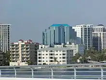
 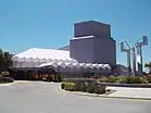 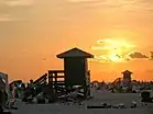 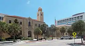 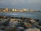 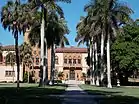 Images, from top down, left to right: Downtown Sarasota skyline; Van Wezel Performing Arts Hall on Sarasota's Bayfront; Sunset at Siesta Beach; Sarasota County Courthouse; Beachfront on Venice Beach; Front walkway of Ca' d'Zan | |
 Seal Logo | |
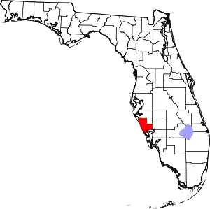 Location within the U.S. state of Florida | |
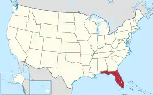 Florida's location within the U.S. | |
| Coordinates: 27°11′N 82°22′W | |
| Country | |
| State | |
| Founded | May 14, 1921 |
| Seat | Sarasota |
| Largest city | North Port |
| Area | |
| • Total | 725 sq mi (1,880 km2) |
| • Land | 556 sq mi (1,440 km2) |
| • Water | 169 sq mi (440 km2) 23.4% |
| Population | |
| • Estimate (2022) | 462,286[1] |
| • Density | 781/sq mi (302/km2) |
| Time zone | UTC−5 (Eastern) |
| • Summer (DST) | UTC−4 (EDT) |
| ZIP Codes | 34223, 34229–34278, 34284–34289, 34292-34293, 34295 |
| Area code | 941 |
| Congressional district | 17th |
| Website | www |
History
The area that is now known as Sarasota County has been inhabited by humans for some 10,000 years. Evidence of human remains as well as a burned out log at the Warm Mineral Springs, in North Port, were discovered that date to the early Archaic period.[4]
Although the name was associated with the area from the beginning of European contacts, the origin of the name "Sarasota" is unknown. In the early twentieth-century, a fanciful story was created to go hand-in-hand with a pageant held in Sarasota. The story held that the town was named after the daughter of famous explorer Hernando de Soto's daughter Sara.[5]
An early map of the area from 1763 shows the word "Zarazote" across present day Sarasota.[6]
Following exploration, the area was occupied by fishing camps, called ranchos.[7] In 1842, the Armed Occupation Act was passed, which deeded land to settlers who were willing to cultivate land in Florida. The act brought settlers to Sarasota but also led to the Second Seminole War.[8][9] During the war, the area was occupied by the U.S. army and Fort Armistead was built.[10]
Sarasota County was created in 1921 from the southern part of Manatee County. After acquisition by the United States as a territory, the area now included in Sarasota county had been part of St. Johns County (1821), Alachua County (1824), Hillsborough County (1834), and Manatee County (1855) as new counties were created from older counties to accommodate population growth and settlement in new areas.[11]
Geography

According to the U.S. Census Bureau, the county has a total area of 725 square miles (1,880 km2), of which 556 square miles (1,440 km2) is land and 169 square miles (440 km2) (23.4%) is water.[12]
Adjacent counties
- Manatee County – north
- DeSoto County – east
- Charlotte County – south
Parks and preserves
In addition to local parks there are several preserve areas including:
- Bayonne Parcel
- Circus Hammock
- Curry Creek Preserve
- Deer Prairie Creek
- Jelks Preserve
- Lemon Bay Preserve
- Legacy Trail
- Manasota Scrub Preserve
- Myakkahatchee Creek Environmental Park
- Myakka Islands Point
- Old Miakka Preserve
- Pinelands Reserve
- Pocono Trail Preserve
- Red Bug Slough
- Sleeping Turtles South
- Sleeping Turtles North
- South Lemon Bay Preserve
- T. Mabry Carlton Reserve
Climate
Sarasota County has a tropical climate with hot, humid summers and warm, drier winters. The high temperatures and high humidity in the summer regularly push the heat index over 100 °F (38 °C). There are distinct rainy and dry seasons, with the rainy season lasting from March to November and the dry season from December to February.
| Climate data for Sarasota, Florida (Sarasota–Bradenton International Airport), 1991–2020 normals, extremes 1911–present | |||||||||||||
|---|---|---|---|---|---|---|---|---|---|---|---|---|---|
| Month | Jan | Feb | Mar | Apr | May | Jun | Jul | Aug | Sep | Oct | Nov | Dec | Year |
| Record high °F (°C) | 91 (33) |
90 (32) |
91 (33) |
96 (36) |
98 (37) |
100 (38) |
101 (38) |
101 (38) |
98 (37) |
99 (37) |
92 (33) |
90 (32) |
101 (38) |
| Mean maximum °F (°C) | 82.6 (28.1) |
83.6 (28.7) |
86.1 (30.1) |
89.7 (32.1) |
93.4 (34.1) |
94.9 (34.9) |
95.2 (35.1) |
95.3 (35.2) |
94.0 (34.4) |
91.3 (32.9) |
87.2 (30.7) |
83.6 (28.7) |
96.6 (35.9) |
| Average high °F (°C) | 75.5 (24.2) |
77.9 (25.5) |
80.2 (26.8) |
84.5 (29.2) |
86.5 (30.3) |
89.0 (31.7) |
89.1 (31.7) |
89.5 (31.9) |
89.2 (31.8) |
84.3 (29.1) |
81.0 (27.2) |
77.2 (25.1) |
84.3 (29.1) |
| Daily mean °F (°C) | 64.2 (17.9) |
68.7 (20.4) |
72.1 (22.3) |
75.6 (24.2) |
79.2 (26.2) |
81.8 (27.7) |
82.1 (27.8) |
82.4 (28.0) |
82.2 (27.9) |
77.3 (25.2) |
72.6 (22.6) |
68.2 (20.1) |
76.1 (24.5) |
| Average low °F (°C) | 53.3 (11.8) |
59.6 (15.3) |
64.1 (17.8) |
66.7 (19.3) |
72.2 (22.3) |
75.6 (24.2) |
77.2 (25.1) |
78.3 (25.7) |
76.1 (24.5) |
70.3 (21.3) |
65.1 (18.4) |
59.2 (15.1) |
67.8 (19.9) |
| Mean minimum °F (°C) | 33.9 (1.1) |
37.5 (3.1) |
42.5 (5.8) |
49.2 (9.6) |
58.6 (14.8) |
68.3 (20.2) |
70.3 (21.3) |
71.7 (22.1) |
68.1 (20.1) |
55.3 (12.9) |
44.9 (7.2) |
38.9 (3.8) |
32.3 (0.2) |
| Record low °F (°C) | 23 (−5) |
21 (−6) |
30 (−1) |
37 (3) |
45 (7) |
52 (11) |
62 (17) |
60 (16) |
58 (14) |
40 (4) |
27 (−3) |
20 (−7) |
20 (−7) |
| Average precipitation inches (mm) | 2.79 (71) |
1.92 (49) |
2.85 (72) |
2.46 (62) |
2.58 (66) |
7.05 (179) |
7.39 (188) |
9.11 (231) |
6.00 (152) |
2.76 (70) |
1.81 (46) |
2.33 (59) |
49.05 (1,246) |
| Average precipitation days (≥ 0.01 in) | 8.5 | 6.8 | 6.4 | 5.1 | 6.0 | 12.8 | 15.6 | 17.5 | 13.7 | 7.0 | 5.6 | 7.6 | 112.6 |
| Source: NOAA | |||||||||||||
Government and politics
Sarasota County is one of only 20 Florida counties with its own charter, adopted in 1971. Sarasota County is governed by a five-member county commission. Each commissioner serves a four-year term and resides in and represents a single district.[13]
Like most of Southwest Florida, Sarasota County has been a stronghold for the Republican Party. It was one of the first parts of Florida to begin to favor the Republicans over the Democrats. The last Democratic presidential candidate to carry the county was Franklin D. Roosevelt in 1944. The closest any Democratic candidate has come since was Barack Obama in 2008, who lost in the county by just 211 votes.[14] The Republican edge has narrowed somewhat since the 1990s, however; Democrats have managed at least 40 percent of the vote in every election since 1996.
Republicans have historically dominated the county commission and all but two countywide elected positions. Democratic strength is concentrated in Sarasota, which has an all-Democratic city commission.
| Year | Republican | Democratic | Third party | |||
|---|---|---|---|---|---|---|
| No. | % | No. | % | No. | % | |
| 2020 | 148,370 | 54.71% | 120,110 | 44.29% | 2,689 | 0.99% |
| 2016 | 124,438 | 53.79% | 97,870 | 42.30% | 9,045 | 3.91% |
| 2012 | 110,504 | 53.14% | 95,119 | 45.74% | 2,338 | 1.12% |
| 2008 | 102,897 | 49.47% | 102,686 | 49.37% | 2,422 | 1.16% |
| 2004 | 104,692 | 53.51% | 88,442 | 45.20% | 2,518 | 1.29% |
| 2000 | 83,117 | 51.63% | 72,869 | 45.27% | 4,991 | 3.10% |
| 1996 | 69,213 | 46.46% | 63,665 | 42.73% | 16,108 | 10.81% |
| 1992 | 66,855 | 42.76% | 54,552 | 34.89% | 34,945 | 22.35% |
| 1988 | 84,602 | 66.40% | 42,099 | 33.04% | 708 | 0.56% |
| 1984 | 87,771 | 74.15% | 30,525 | 25.79% | 69 | 0.06% |
| 1980 | 68,065 | 68.57% | 25,621 | 25.81% | 5,579 | 5.62% |
| 1976 | 44,157 | 61.78% | 26,293 | 36.78% | 1,028 | 1.44% |
| 1972 | 48,939 | 79.95% | 12,235 | 19.99% | 36 | 0.06% |
| 1968 | 30,160 | 63.73% | 10,127 | 21.40% | 7,041 | 14.88% |
| 1964 | 21,917 | 61.13% | 13,937 | 38.87% | 0 | 0.00% |
| 1960 | 19,995 | 70.70% | 8,287 | 29.30% | 0 | 0.00% |
| 1956 | 13,937 | 73.40% | 5,052 | 26.60% | 0 | 0.00% |
| 1952 | 9,538 | 70.74% | 3,945 | 29.26% | 0 | 0.00% |
| 1948 | 3,559 | 49.95% | 2,302 | 32.31% | 1,264 | 17.74% |
| 1944 | 2,109 | 37.99% | 3,443 | 62.01% | 0 | 0.00% |
| 1940 | 1,672 | 30.71% | 3,773 | 69.29% | 0 | 0.00% |
| 1936 | 1,055 | 30.38% | 2,418 | 69.62% | 0 | 0.00% |
| 1932 | 667 | 25.86% | 1,912 | 74.14% | 0 | 0.00% |
| 1928 | 1,603 | 56.46% | 1,181 | 41.60% | 55 | 1.94% |
| 1924 | 187 | 40.48% | 204 | 44.16% | 71 | 15.37% |
Public safety
Aside from the typical law enforcement and fire departments, Sarasota County also utilizes an Emergency Management agency. The agency's main area of focus is disaster preparedness and response. The agency is responsible for what are called Community Emergency Response Teams as well as the county emergency evacuation shelters.[16]
Fire/EMS
The Sarasota County Fire Department (SCFD) provides fire services to the City of Sarasota and all unincorporated areas of the county with the exception of areas covered by the Nokomis and Englewood fire districts. Additionally, SCFD provides EMS service to the City of Sarasota, all unincorporated areas of the county (including areas covered by the Nokomis and Englewood fire districts) plus the city of Venice.[17]
Law enforcement
The Sarasota County Sheriff's Office (SSO) is the county's primary law enforcement agency. It is responsible for patrolling the unincorporated areas of the county along with operating the county's jail and providing courtroom security. SSO also operates the county's primary 911 center. The cities of Sarasota, North Port, and Venice along with the Town of Longboat Key each have their own police departments. The Florida Highway Patrol is responsible for patrolling FDOT maintained roads in the county (Florida State Highway System) and investigating motor vehicle accidents that occur in unincorporated areas.[18]
Three specialist law enforcement agencies have jurisdiction in the county: the Sarasota-Bradenton International Airport Police Department,[19] the New College/USF Sarasota-Manatee Campus Police Department[20], the Seminole Gulf Railway (SGLR) Police Department[21] and the Sarasota County Schools Police Department[22]. Each agency, except for the SCS Police Department, has jurisdiction in neighboring Manatee County as well, as each agency's properties extend into that county.
Voter registration
All voter information is since July 14, 2023 and provided by Florida Department of Elections:[23]
Party statistics
| Party | Registered Voters | Percentage | |
|---|---|---|---|
| Republican | 156,746 | 44.01% | |
| Democratic | 99,398 | 27.91% | |
| No party affiliation | 92,723 | 26.03% | |
| Minor parties | 7,299 | 2.05% | |
| Total Voters | 356,166 | 100.00% |
United States Senate
| Office | Senator | Party |
|---|---|---|
| Class 3 Senator | Marco Rubio | Republican |
| Class 1 Senator | Rick Scott | Republican |
United States House of Representatives
| District | Representative | Party |
|---|---|---|
| Florida's 17th Congressional District | Greg Steube | Republican |
Florida State Senate
| District | Senator | Party |
|---|---|---|
| 23 | Joe Gruters | Republican |
Florida House of Representatives
| District | Representative | Party |
|---|---|---|
| 73 | Fiona McFarland | Republican |
| 74 | James Buchanan | Republican |
| 75 | Michael Grant | Republican |
Sarasota County Commission
The Board of County Commissioners include the following:[24]
| Position | Incumbent |
|---|---|
| District 1 | Michael Moran |
| District 2 | Mark Smith |
| District 3 | Neil Rainford |
| District 4 | Joe Neunder |
| District 5 | Ron Cutsinger |
Sarasota County School Board
The School Board members include the following:<[25]
| Position | Incumbent |
|---|---|
| District 1 | Bridget Ziegler |
| District 2 | Karen Rose |
| District 3 | Tom Edwards |
| District 4 | Robyn A. Marinelli |
| District 5 | Tim Enos |
Transportation
Airports
- Sarasota-Bradenton International Airport, in Manatee County (runway), Sarasota County (terminal), and Sarasota.
- Venice Municipal Airport, a general aviation airport in Venice.
- Hidden River Airport, a private airport in the eastern part of the county.
- Buchan Airport, in Englewood.
Major highways and state roads
 Interstate 75 – north–south limited-access freeway, and has ten interchanges within Sarasota County. A major north–south highway in Sarasota County. It is a high-speed connection with other cities such as Tampa, Florida and Fort Myers, Florida. In Venice, Interstate 75 turns east, passing through North Port, before again turning south to cross Charlotte Harbor.
 U.S. Highway 41 – The main north–south road through the county is known as Tamiami Trail. It was created in the 1920s to connect Tampa with Miami, hence the contracted name.
 U.S. Highway 301 – This highway begins in the city of Sarasota with an intersection at US-41 just south of Downtown Sarasota, and runs north–south through the county.
 State Road 72 – Stickney Point Road and Clark Road
 State Road 681 – Venice Connector, this road was formerly the southern terminus of Interstate 75 in the early 1980s
 State Road 758 – Midnight Pass Road, Higel Avenue, Siesta Drive, South Osprey Avenue, Bee Ridge Road
 State Road 776 – Englewood Road/North Indiana Avenue
 State Road 777 – River Road from US-41 to I-75
 State Road 789 – Begins at an intersection with US-41 at the Sarasota Bayfront, going west across the Ringling Bridge, connecting to St. Armands Key, before turning north and becoming Gulf of Mexico Drive on Longboat Key, Florida
 State Road 780 – Fruitville Road
Public transportation
- Sarasota County Area Transit (SCAT) provides public transportation for Sarasota County, Florida. SCAT is operated by Sarasota County. It maintains 19 fixed-line bus routes plus a dial-a-ride paratransit service (SCAT Plus).[26]
Demographics
| Census | Pop. | Note | %± |
|---|---|---|---|
| 1930 | 12,440 | — | |
| 1940 | 16,106 | 29.5% | |
| 1950 | 28,827 | 79.0% | |
| 1960 | 76,895 | 166.7% | |
| 1970 | 120,413 | 56.6% | |
| 1980 | 202,251 | 68.0% | |
| 1990 | 277,776 | 37.3% | |
| 2000 | 325,957 | 17.3% | |
| 2010 | 379,448 | 16.4% | |
| 2020 | 434,006 | 14.4% | |
| U.S. Decennial Census[27] 1790–1960[28] 1900–1990[29] 1990–2000[30] 2010-2020[2] | |||
| Race | Pop 2010[33] | Pop 2020[34] | % 2010 | % 2020 |
|---|---|---|---|---|
| White (NH) | 321,978 | 349,700 | 84.85% | 80.57% |
| Black or African American (NH) | 17,036 | 16,165 | 4.49% | 3.72% |
| Native American or Alaska Native (NH) | 667 | 695 | 0.18% | 0.16% |
| Asian (NH) | 4,818 | 8,407 | 1.27% | 1.94% |
| Pacific Islander (NH) | 102 | 168 | 0.03% | 0.04% |
| Some Other Race (NH) | 545 | 1,902 | 0.14% | 0.44% |
| Mixed/Multi-Racial (NH) | 4,269 | 13,733 | 1.13% | 3.16% |
| Hispanic or Latino | 30,033 | 43,236 | 7.91% | 9.96% |
| Total | 379,448 | 434,006 |
As of the 2020 United States census, there were 434,006 people, 189,228 households, and 117,532 families residing in the county. 3.5% of that population was under the age of 5 years old, 14.0% was under 18 years old, and 37.4% was 65 years or older. 52.4% was female.
The median household income was $64,644 with a per capita income of $44,402. 8.7% of population below the poverty threshold. The median value of owner-occupied housing-units between 2016 and 2020 was $269,300 and the median gross rent was $1,342.
There were 41,215 veterans living in the county. 12.2% of the population was foreign born. 93.2% of the population that was 25 years or older had completed a high school education, and 36.4% of those 25 years or older had a bachelor's degree or higher.
As of 2020, according to the Association of Religion Data Archives (ARDA), the percentage of religious affiliations in Sarasota County were:[35]
| Religion or denomination |
Percentage of adherents |
|---|---|
| Catholic | 27.1% |
| Evangelical Protestant | 18% |
| Mainline Protestant | 5.3% |
| Other | 1.6% |
| Judaism | 1.1% |
| Black Protestant | 0.7% |
| Buddhism | 0.2% |
| Hinduism | 0.2% |
| Orthodox | 0.2% |
| Islam | 0.1% |
Economy
Top private employers
As of January 2018, the top private employers for Sarasota County are as follows:[36]
- Sarasota Memorial Health Care System (4,563)
- PGT Innovations (2,000)
- Publix (1,733)
- Venice Regional Medical Center (812)
- Sun Hydraulics (632)
- Tervis Tumbler (570)
- Shared Services Center Sarasota (455)
- FCCI Insurance (426)
- Doctors Hospital (415)
- Jackson Hewitt, Inc. (337)
Top public and private employers
As of October 2018, the top employees for Sarasota County, including public sector jobs, are as follows:[37]
- School Board of Sarasota County (4,563)
- Sarasota Memorial Hospital (4,244)
- Sarasota County Government (3,533)
- Publix Supermarkets (2,793)
- PGT Industries (2,079)
Sports and recreation
Sarasota County is home to Ed Smith Stadium, where the Baltimore Orioles currently have spring training. The Orioles also have minor league facilities at Twin Lakes Park. In January 2017, the Braves announced a formal agreement to move their Spring Training home to North Port.[38] CoolToday Park opened on March 24, 2019.[39][40]
Sarasota County is also home to Nathan Benderson Park. The facility has played host to the 2017 World Rowing Championships and subsequent World Rowing events in 2018 and 2019. It has also been the host of the 2016 Olympic Time Trials - Rowing and will host the delayed 2020 Olympic rowing time trials. NBP has also been the site of multiple NCAA national rowing championship regattas, the USRowing Youth National Championships, and other rowing regattas and dragon boat festivals since 2011. The park will host the 2021 U.S. Dragon Boat Federation National Championships and the 2022 International Dragon Boat Federation Club Crew World Championships, after holding the 2014 International Breast Cancer Paddlers Commission world regatta.[41][42]
Nathan Benderson Park is also the site of Olympic qualifying events in triathlon and paratriathlon, with several ITU Triathlon World Cup and Americas Triathlon Cup events over the years. Numerous community running and walking events, music and food festivals and other community events are held in the park, including the annual NBP Fireworks On The Lake, held every July 3, and NBP Trick Or Treat On The Lake, held the last week of October.
Education
Primary and secondary education
- Sarasota County Public Schools – public K–12 School district serving all of Sarasota County
Higher education
- New College of Florida – public liberal arts college. Honors college of the state of Florida
- Ringling College of Art and Design – private, 4-year, not-for-profit, fully accredited college with concentrations in art and design
- State College of Florida, Manatee–Sarasota – South Venice Campus of SCF
- University of South Florida Sarasota-Manatee – branch campus of USF
- Florida State University College of Medicine – branch campus for 3rd/4th Year Medical Students and PA Students in Clinical Years
Museums and libraries
Library branches:[43]
- Betty J. Johnson North Sarasota Public Library
- Elsie Quirk Public Library
- Frances T. Bourne Jacaranda Public Library
- Fruitville Public Library
- Gulf Gate Public Library
- North Port Public Library
- The Osprey Public Library at the Historic Spanish Point
- Selby Public Library
- Shannon Staub Library
- William H. Jervey, Jr. Venice Public Library
Sarasota County residents may obtain library cards for free and valid library cards may be used to check out materials at all ten Sarasota County libraries. Manatee and Charlotte County residents, as well as library users from any of the Tampa Bay Library Consortium libraries may register as reciprocal borrowers and check out materials in Sarasota County. Non-resident cards are available for purchase and offer the same privileges as resident cards.
The library system provides a variety of services which include adult, teen and children's materials. Computers for public use are available at all nine Sarasota County Libraries and free wireless access in the libraries is provided by the Sarasota County Government. The library system has licensing to the Cloud Library, OverDrive, Inc. and Freegal Music. Ask a Librarian, the on-line Florida librarian reference system is available through the Sarasota County Public Library System. Sarasota County residents have access to the Pinellas Talking Book Library as well as a Books-by-Mail service.[44] The Selby Public Library has been a selective depository in the Federal Depository Library Program and receives almost 50% of the government publications distributed through the program.[44] Additionally, the Sarasota County Library System is an organization member of the Florida Library Association.
The Little Free Library program was introduced to Sarasota County in 2014 as the result of a collaborative effort between the Libraries and Historical Resources department, the Parks, Recreation and Natural Resources department and the UF/IFAS Sarasota County Extension and Sustainability department. The Sarasota County Little Free Libraries have been placed at thirteen different county parks and recreation centers.[45]
History
The first library, which was established in 1907 by the Sarasota Town Improvement Society. County libraries have been established in response to community demands and needs.
The first libraries were autonomous with the Head Librarians reporting directly to the County Administrator. Sarasota Public Library was managed by Betty Service, the Englewood library by Harriet Ives, and Venice by Jean McGuire. Joan Hopkins directed and coordinated library services for the rapidly growing population. She directed the establishment of Gulf Gate Public Library, North Port Public Library, Frances T. Bourne Jacaranda Public Library and the new downtown Sarasota library, and laid the groundwork for building future libraries in the county.[46]
Local media
Newspapers
- North Port Sun – an edition of the Charlotte Sun newspapers
- Sarasota Herald Tribune – primarily serves Sarasota County for news, but also serves Manatee, Charlotte and DeSoto counties. Circulation is 110,817 daily and 132,185 on Sunday (2005 averages)[47] Also operates an online news portal, HeraldTribune.com
- Scene Magazine, a civic, business and social publication serving Sarasota and Manatee counties.[48]
- Observer Media Group newspapers: East County Observer, Longboat Observer, Sarasota Observer, Siesta Key Observer[49]
- The Sarasota News Leader – online weekly news
- Venice Gondolier Sun
Television
Sarasota County is part of the Tampa/St. Petersburg/Sarasota DMA, however the following stations have facilities located in the county:
- WWSB – a local ABC affiliate based in Sarasota, which serves as the primary ABC affiliate for Sarasota County and a Secondary ABC affiliate for the rest of the Tampa/St. Petersburg/Sarasota DMA
- WSNN-LD – local twenty-four-hour news station based in Sarasota
- Various government and local access channels. Access 19 (Local Government channel), Education Channel (School Board) and BLAB TV (local programming)
Television stations serving all or part of Sarasota County but located in Saint Petersburg or Tampa include:
Communities
Cities
Town
Census-designated places
- Bee Ridge
- Desoto Lakes
- Englewood
- Fruitville
- Gulf Gate Estates
- Kensington Park
- Lake Sarasota
- Lakewood Ranch (part)
- Laurel
- Nokomis
- North Sarasota
- Osprey
- Palmer Ranch
- Plantation
- Ridge Wood Heights
- Sarasota Springs
- Siesta Key
- South Gate Ridge
- South Sarasota
- South Venice
- Southgate
- The Meadows
- Vamo
- Venice Gardens
- Warm Mineral Springs
Other unincorporated communities
See also
Notes
References
- "U.S. Census Bureau QuickFacts: Sarasota County, Florida; United States". www.census.gov. Retrieved July 17, 2023.
- "QuickFacts for Sarasota County, Florida". U.S. Census Bureau. August 2021. Retrieved August 24, 2021.
- "Find a County". National Association of Counties. Retrieved September 13, 2018.
- Royal, William; Clark, Eugenie (October 1960). "Natural Preservation of Human Brain, Warm Mineral Springs, Florida". American Antiquity. 26 (2): 285–287. doi:10.2307/276213. JSTOR 276213. S2CID 162336066. Retrieved April 4, 2022.
- Chapline, George F. "The Legend of Sara DeSoto". Sarasota History Alive. Retrieved January 3, 2023.
- Barth, John Jr. "The Origin of the Name, Sarasota". Sarasota History Alive. Sarasota County Historical Resources. Retrieved April 5, 2022.
- Stack, Margaret (2011). "Chapter 2: Background History". An Archaeological and Archival Appraisal of "Spanish Indians" on the West Coast of Florida in the Eighteenth and Nineteenth Centuries. pp. 10–13.
- Sarasota County Public Records. "Harrison and Laura Watson Residence". Sarasota History Alive. Retrieved April 7, 2022.
- "Armed Occupation Act". My Florida History. The Florida Historical Society. Retrieved April 7, 2022.
- Burger, Bill. "A Military Post on Sarasota Bay". Sarasota History Alive. Retrieved April 5, 2022.
- "History of Florida Counties". Tenth Judicial Circuit of Florida Historical Society. Retrieved April 18, 2021.
- "US Gazetteer files: 2010, 2000, and 1990". United States Census Bureau. February 12, 2011. Retrieved April 23, 2011.
- "Sarasota County Charter" (PDF). July 2012. p. 6. Archived from the original (PDF) on January 28, 2016. Retrieved May 19, 2019.
- "Sarasota and Manatee wallets open for president's campaign". Sarasota Herald-Tribune. Archived from the original on December 22, 2014. Retrieved November 27, 2014.
- "Dave Leip's Atlas of U.S. Presidential Elections". Archived from the original on April 14, 2012. Retrieved April 14, 2012.
- "Emergency Management". www.scgov.net. Sarasota County Government. Retrieved July 28, 2023.
- "Fire Department". Sarasota County government. Archived from the original on December 4, 2014. Retrieved November 27, 2014.
- "Jurisdiction of the Florida Highway Patrol" (PDF). flhsmv.gov. Archived (PDF) from the original on December 28, 2016. Retrieved March 18, 2018.
- "Airport Police". Sarasota-Bradenton International Airport. Archived from the original on December 5, 2014. Retrieved November 27, 2014.
- "Campus Police". New College of Florida. Archived from the original on November 23, 2014. Retrieved November 27, 2014.
- "41426 - Decision". Surface Transportation Board. Archived from the original on December 4, 2014. Retrieved November 27, 2014.
- Florida, Sarasota County Schools. "Sarasota County Schools Police Department / SCS Police Department". www.sarasotacountyschools.net. Retrieved October 18, 2023.
- "Voter Registration - By County and Party". Florida Department of State. July 14, 2023. Retrieved July 19, 2023.
- "Sarasota County Commission (BCC)". Sarasota County. Retrieved November 30, 2022.
- "Sarasota County Election Results for August 23, 2022 | Sarasota Herald-Tribune". www.heraldtribune.com. Retrieved September 15, 2022.
- "Pages - SCAT Home". Archived from the original on December 3, 2013. Retrieved November 26, 2013.
- "U.S. Decennial Census". United States Census Bureau. Retrieved June 16, 2014.
- "Historical Census Browser". University of Virginia Library. Archived from the original on August 11, 2012. Retrieved June 16, 2014.
- "Population of Counties by Decennial Census: 1900 to 1990". United States Census Bureau. Archived from the original on February 20, 2014. Retrieved June 16, 2014.
- "Census 2000 PHC-T-4. Ranking Tables for Counties: 1990 and 2000" (PDF). United States Census Bureau. Archived (PDF) from the original on December 18, 2014. Retrieved June 16, 2014.
- https://www.census.gov/
- "About the Hispanic Population and its Origin". www.census.gov. Retrieved May 18, 2022.
- "Explore Census Data". data.census.gov. Retrieved May 27, 2022.
- "Explore Census Data". data.census.gov. Retrieved May 27, 2022.
- "Sarasota County, Florida - County Membership Report (2020)". Association of Religion Data Archives. Retrieved May 31, 2023.
- "Top Employers". EDC Sarasota. January 2018. Archived from the original on April 10, 2018. Retrieved April 9, 2018.
- "Fiscal Year 2019 Adopted Budget". Sarasota County Government. October 1, 2018. p. 40. Retrieved December 19, 2018.
- Murdock, Zack (January 17, 2017). "Atlanta Braves pick Sarasota County for spring training". Sarasota Herald-Tribune. Archived from the original on February 28, 2017. Retrieved February 27, 2017.
- "Atlanta Braves Extend Spring Training Agreement with ESPN Wide World of Sports Complex through April, 2019" (Press release). Atlanta, Georgia: Atlanta Braves Baseball Club. January 31, 2018. Retrieved December 4, 2018.
- Tucker, Tim (March 24, 2019). "Braves' Gausman takes 'another step' toward 'being ready'". The Atlanta Journal-Constitution. Retrieved March 24, 2019.
- "From pasture to sandpit to a world-class venue: Nathan Benderson Park history". Sarasota Herald-Tribune. August 16, 2017. Retrieved September 30, 2017.
- Sullivan, Robert (October 1, 2016). "Nathan Benderson Park: A Classic Reclamation Project". National Recreation and Park Association. Retrieved September 30, 2017.
- "Locations and Hours". Sarasota County. Retrieved January 3, 2020.
- "Services and Policies". Sarasota County Government. Archived from the original on April 10, 2018. Retrieved April 9, 2018.
- "Little Free Libraries". Sarasota County Government. Archived from the original on April 10, 2018. Retrieved April 9, 2018.
- "Sarasota County Library System". Florida Studies Center Publications. University of South Florida Tampa Library. January 1990. Retrieved December 19, 2018.
- "HeraldTribune.com - About Us: Fact Sheet - About Us: Fact Sheet - HeraldTribune.com". heraldtribune.com. Archived from the original on March 4, 2016. Retrieved March 18, 2018.
- "About Scene". Scene Magazine. Archived from the original on April 18, 2016. Retrieved April 17, 2016.
- Observer Media Group. "About Us". Archived from the original on December 22, 2017. Retrieved December 18, 2017.
